timistravels

My job allows me to visit a lot of Alaska on a yearly basis. I wanted to capture the trips in one location!

Driving the Hana Highway

11/21/13

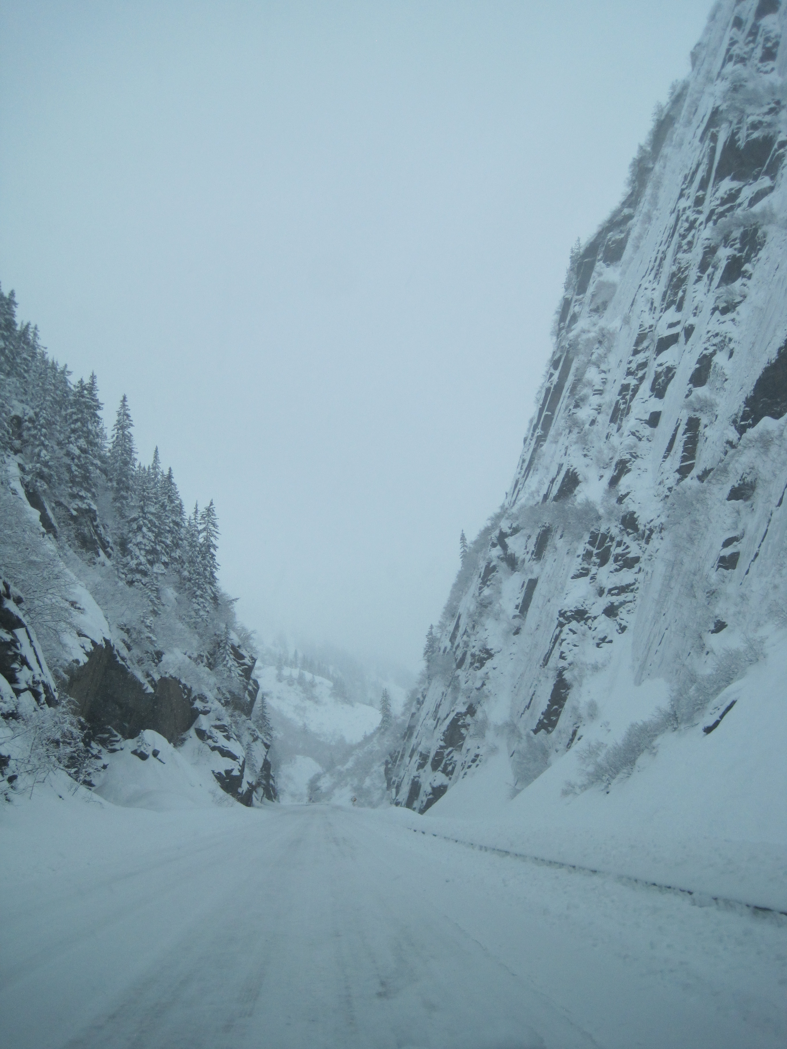
Some people say this drive is not worth it, we could not DISAGREE more, we LOVE this drive.  I do say however, if you are prone to car sickness simply offer to drive.  I have driven it 2 x’s and would recommend it to anyone visiting Maui.  I am sure this won’t be the last time we drive it.

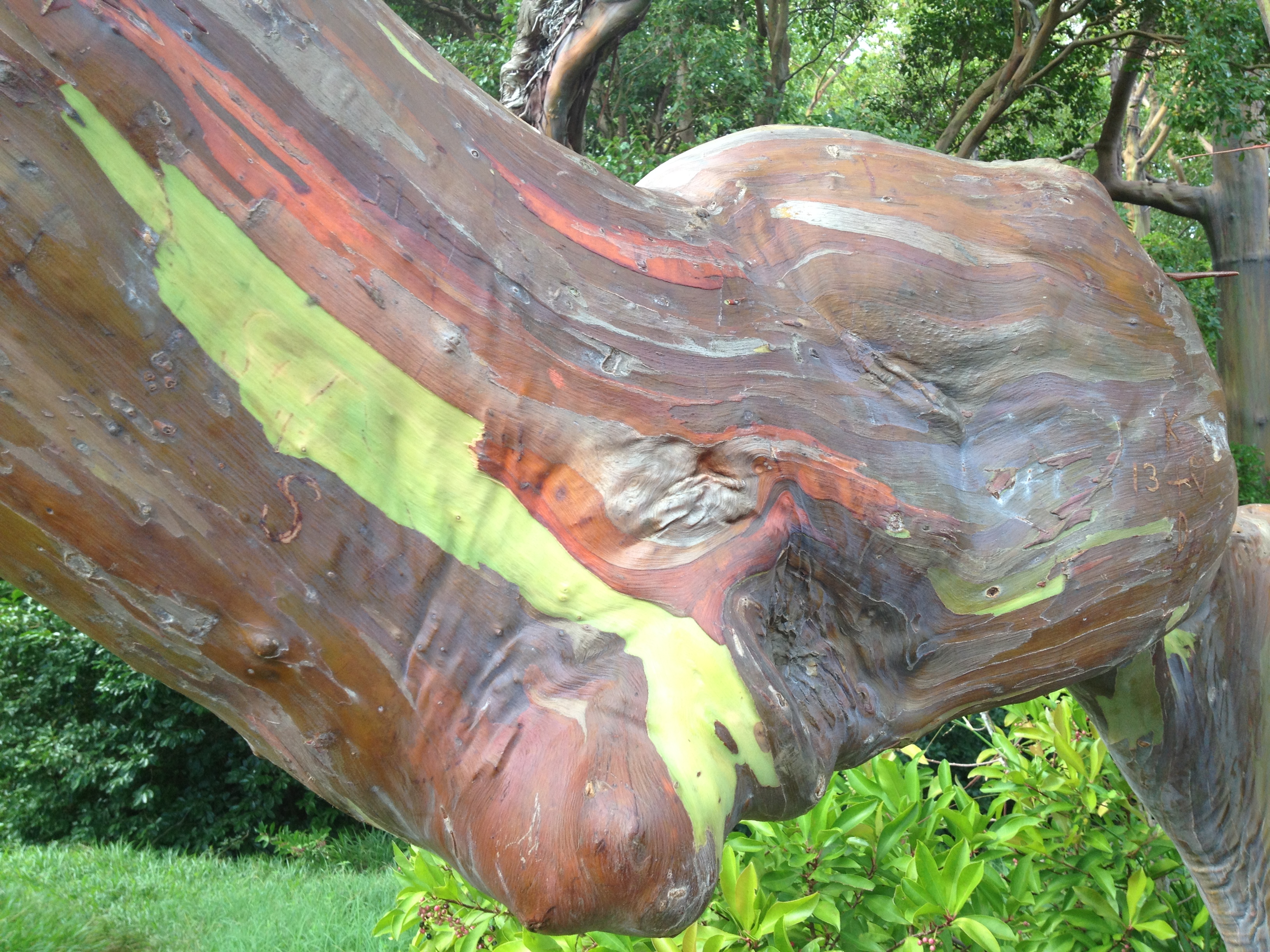
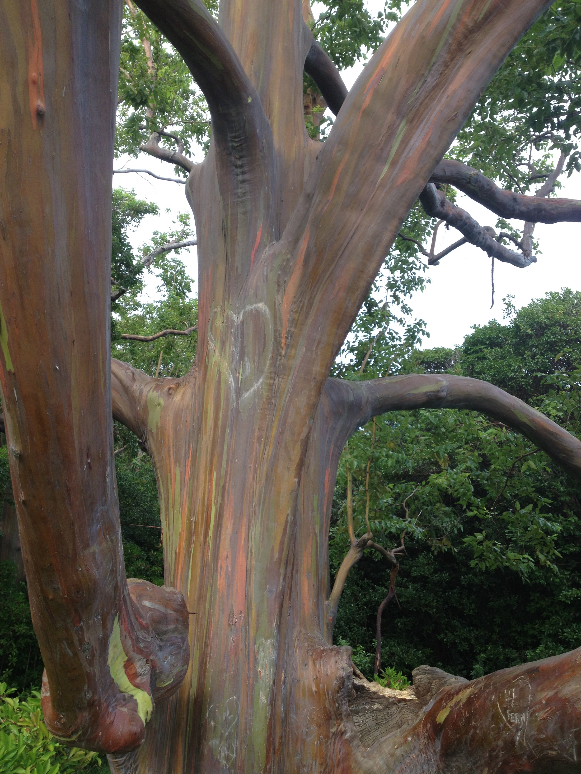
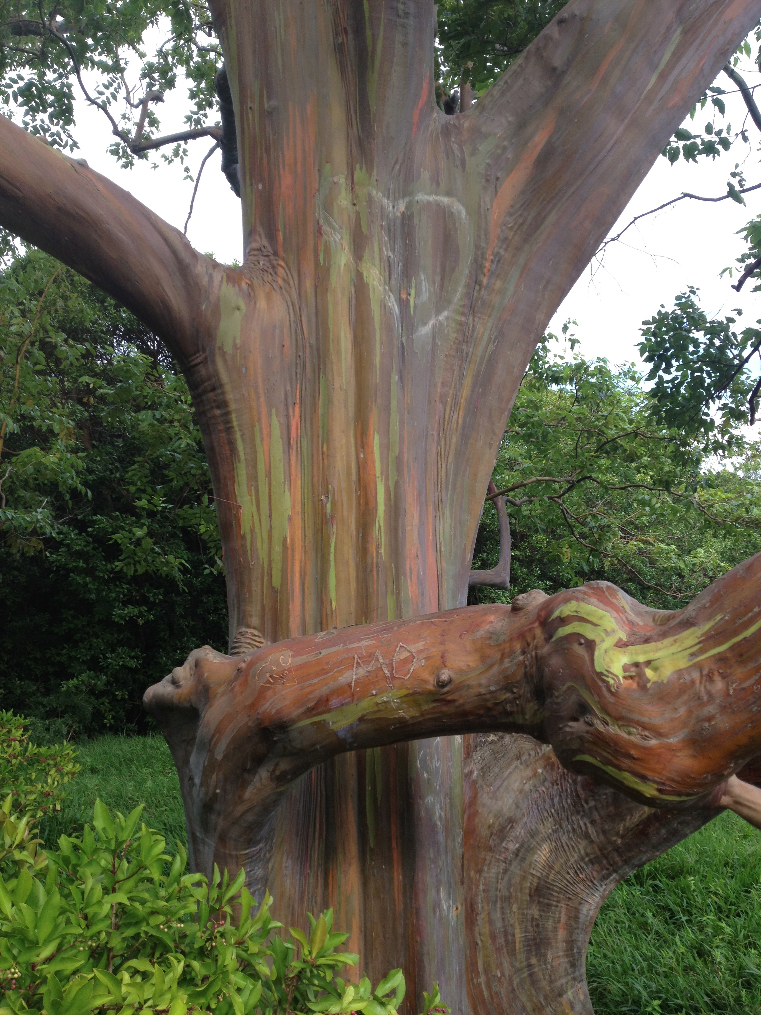
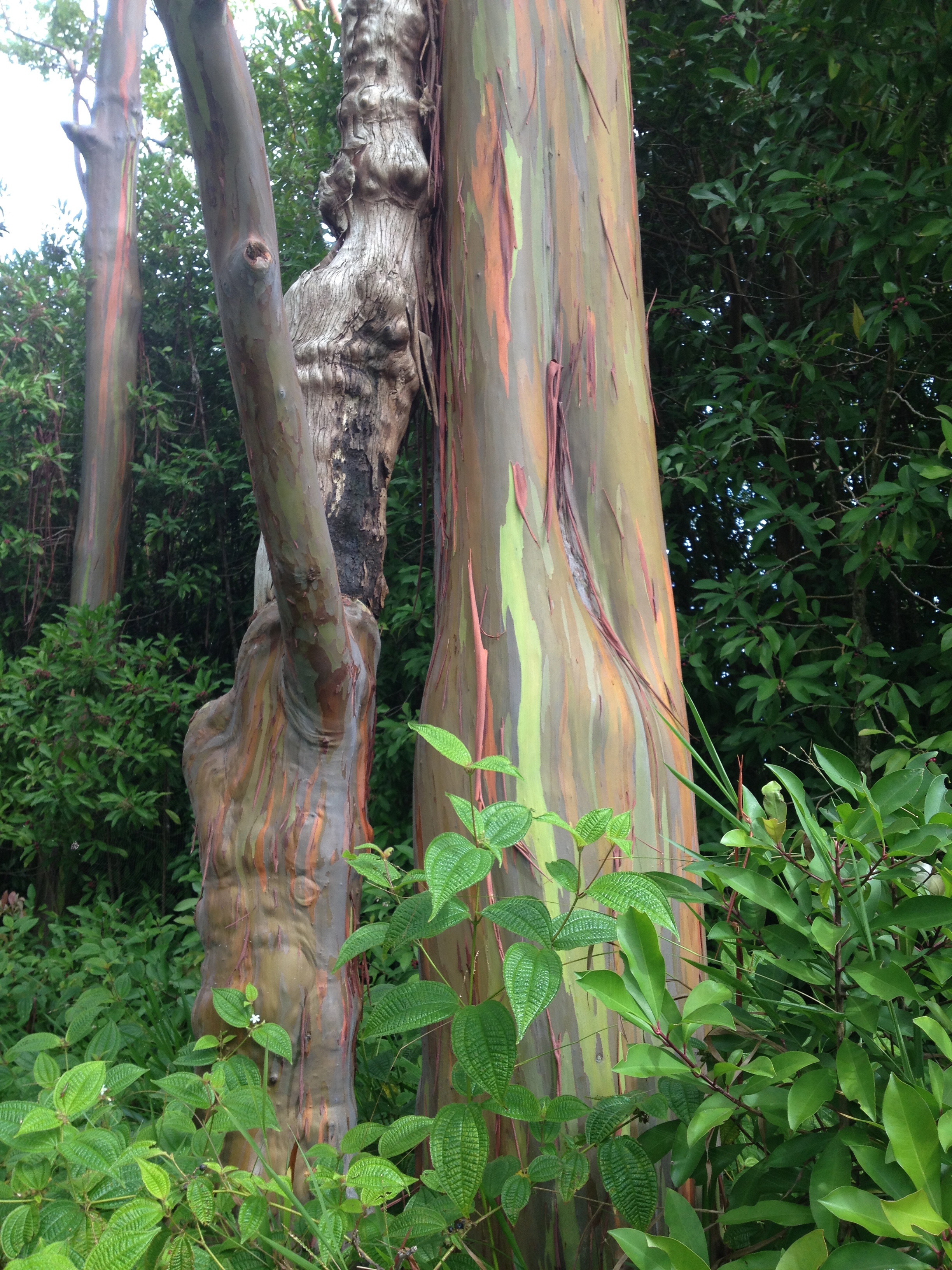
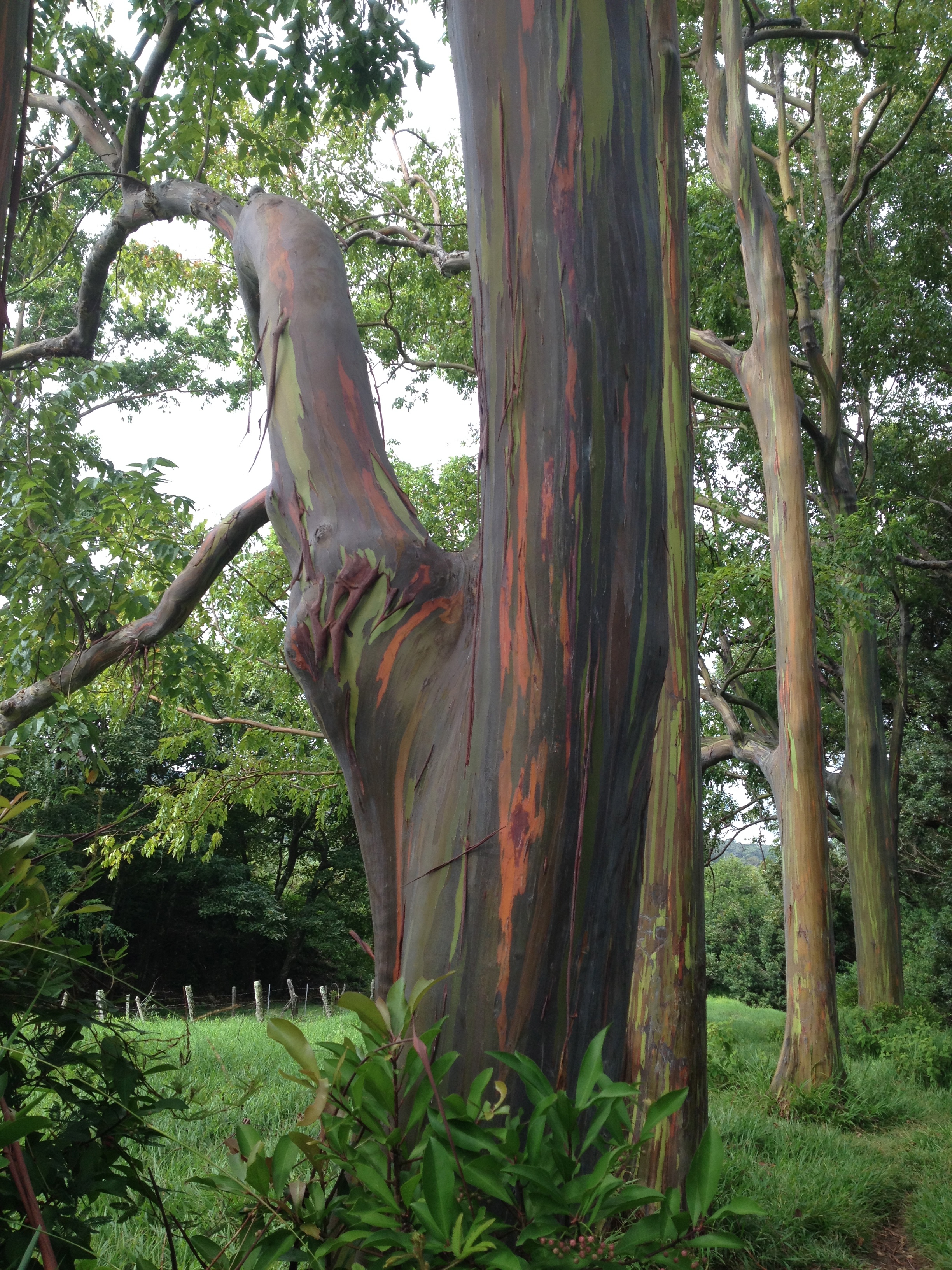
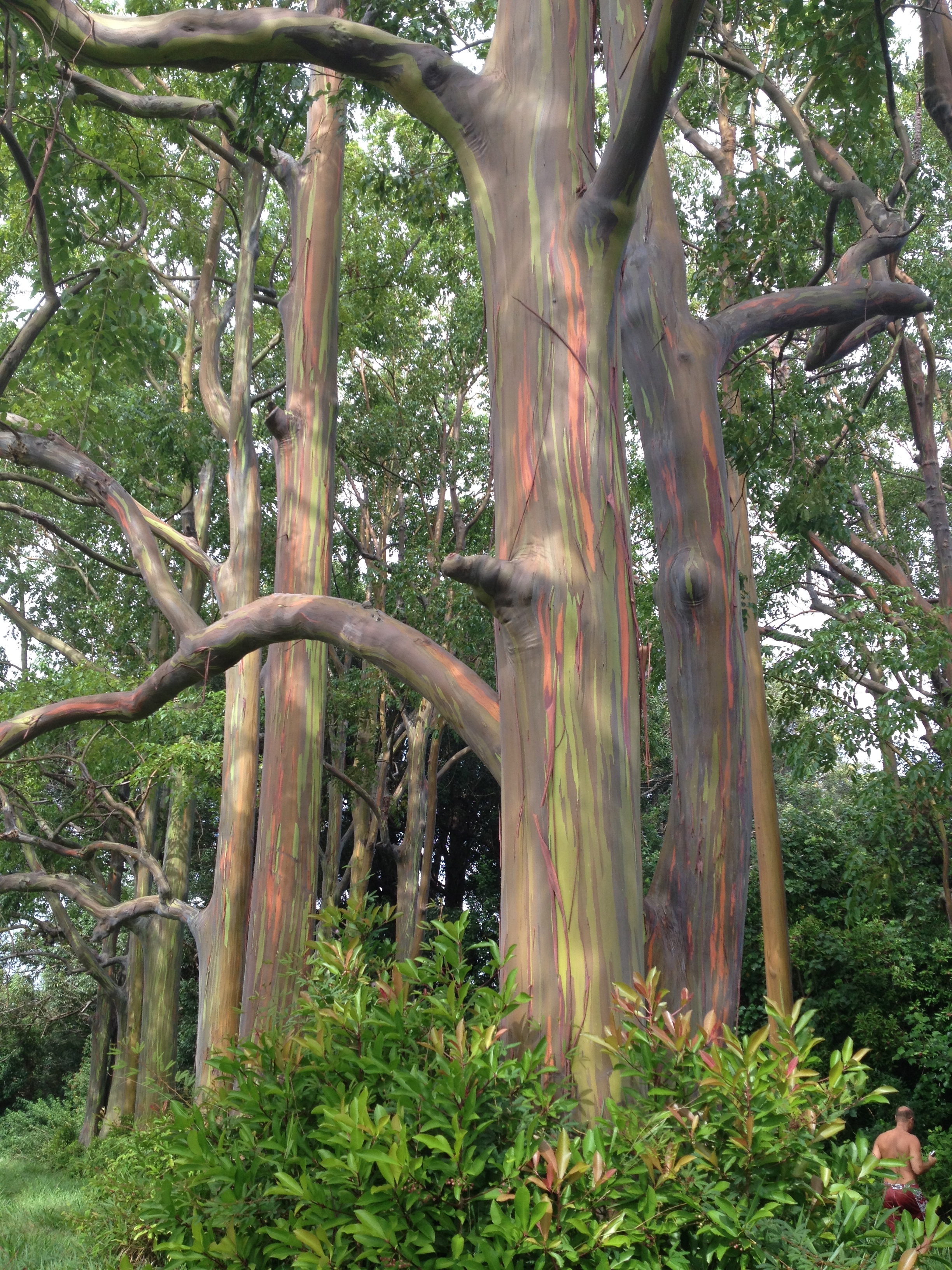
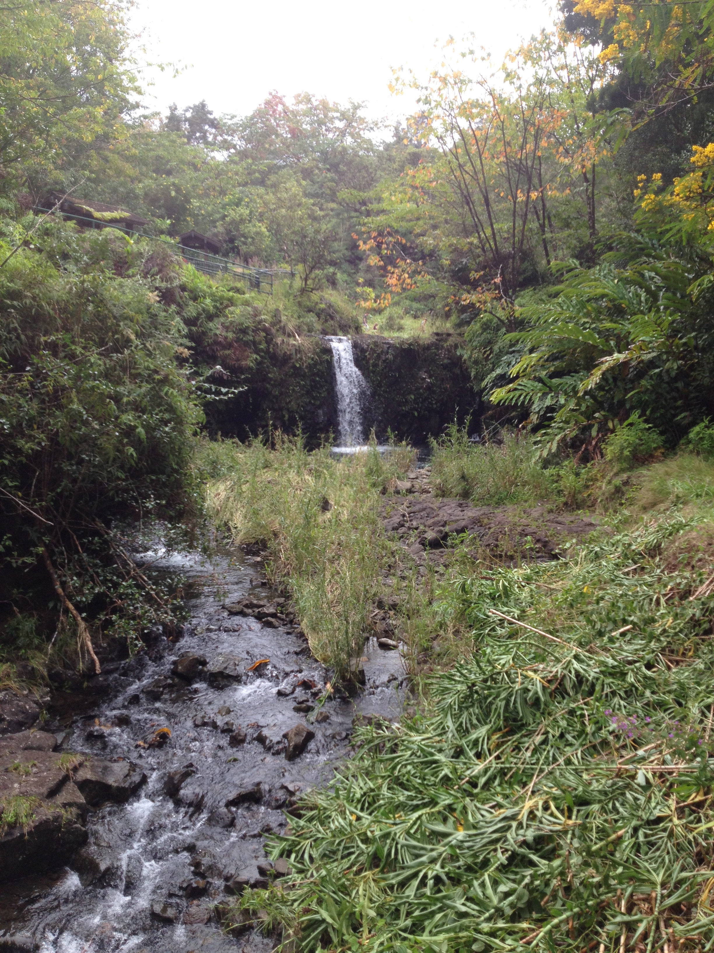
The beauty starts off almost immediately.  At the 2 mile mark there is the busiest hike of the road, and is certainly a fun easy hike into a waterfall and pool.   At about the 6 mile mark when you see the Rainbow Eucalyptus Forest on your left. IMG_1816 IMG_1825 IMG_1822 IMG_1821 IMG_1820 IMG_1819 IMG_1818 
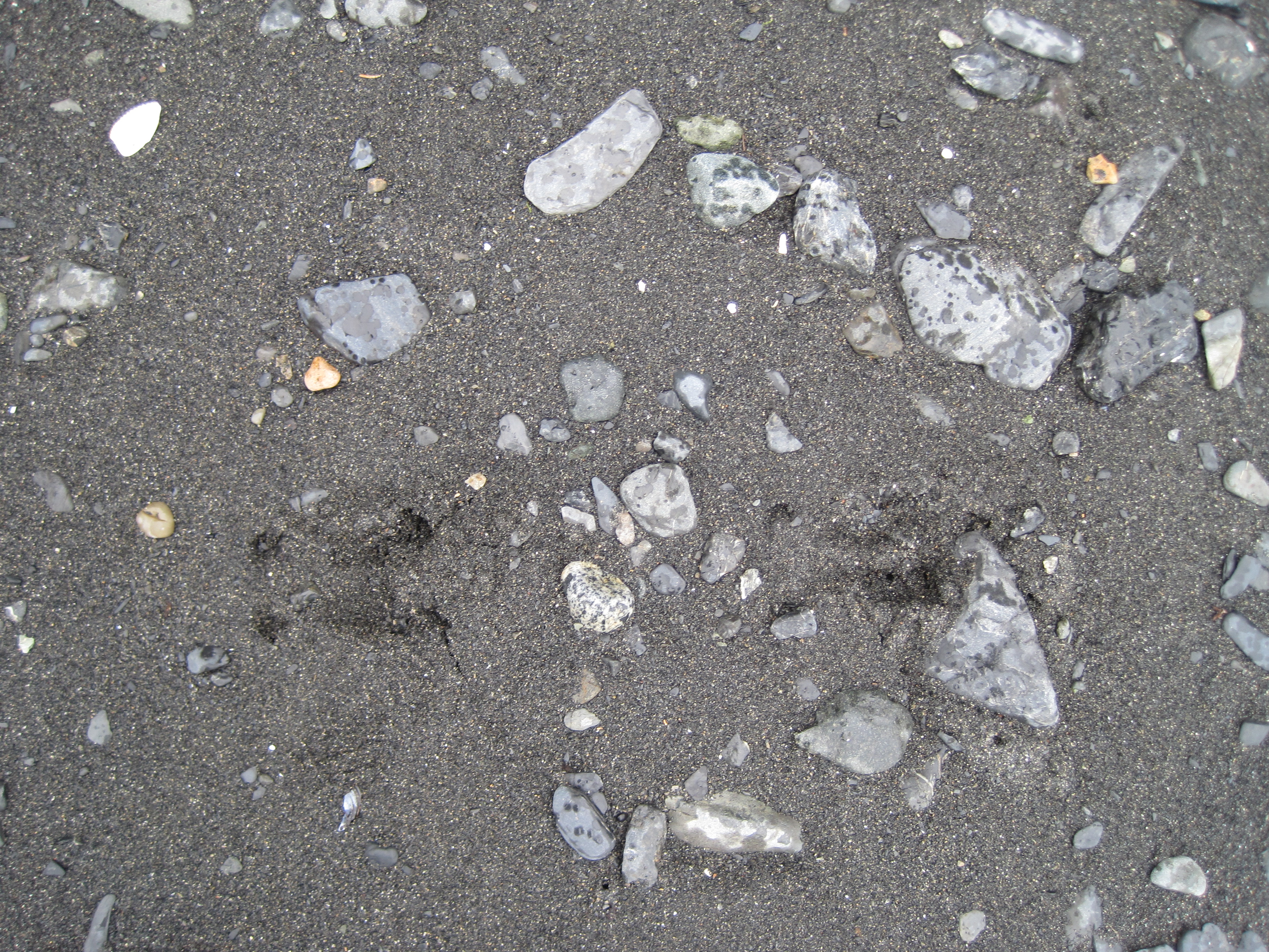
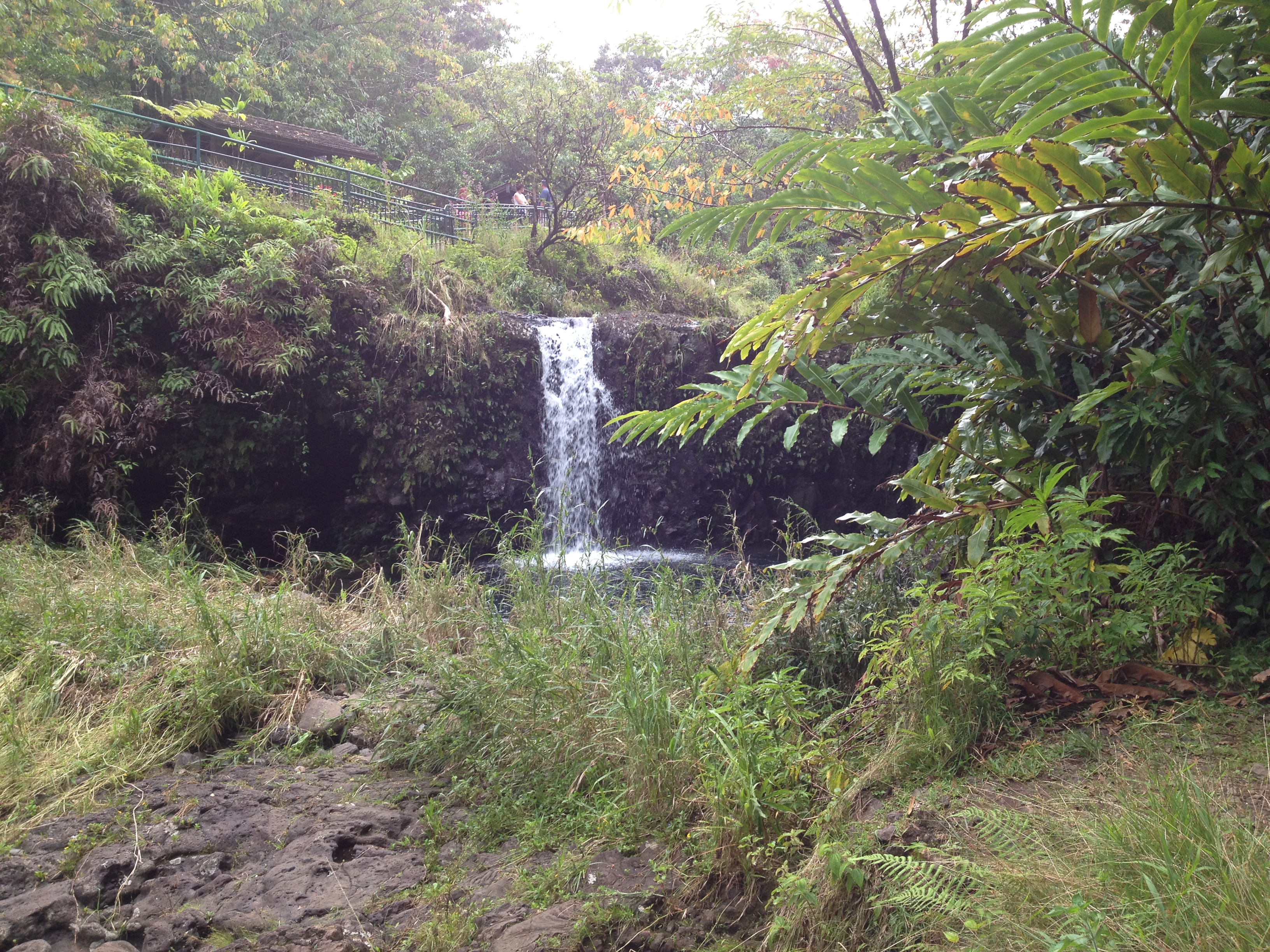
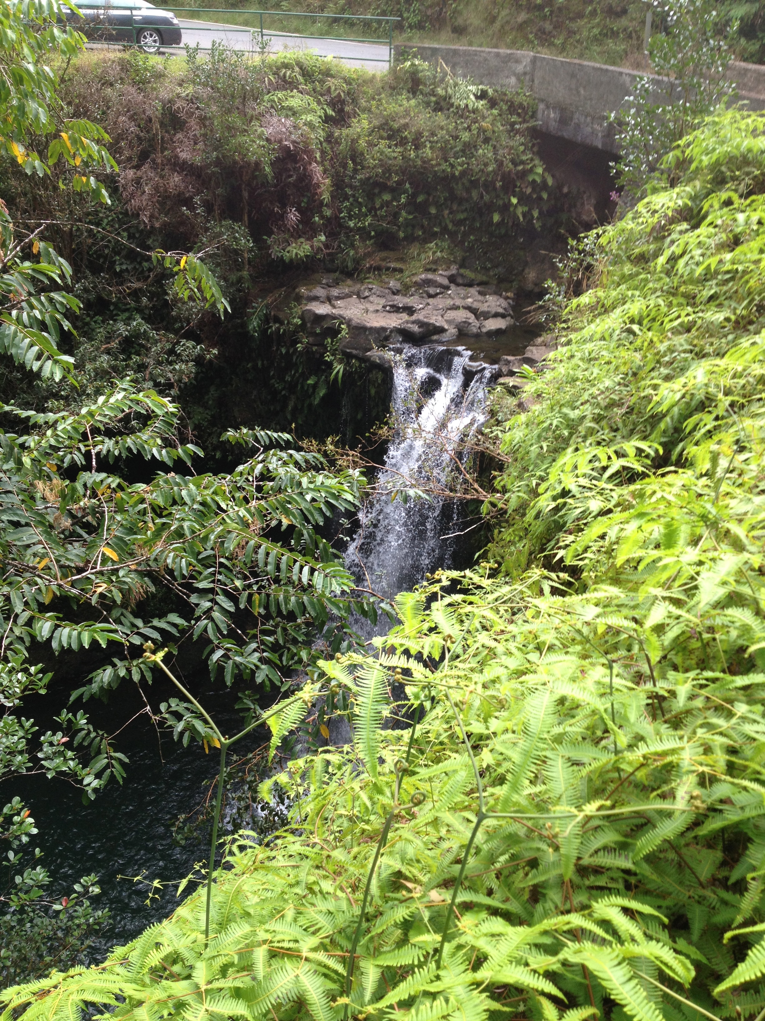
After leaving there, continue along the highway slowing at each bridge to #1 make sure no one is coming the other way and #2 (an most important) to see if there are any waterfalls in these valleys.  Sadly during this trip there had not been much rain in recent history, so a lot of the river beds were dry.IMG_1827

At 19 mile you will see the Three Bear Falls, though again, if there has not been much rain they will not be flowing as much as they will during the wet season.IMG_1826 IMG_1830  
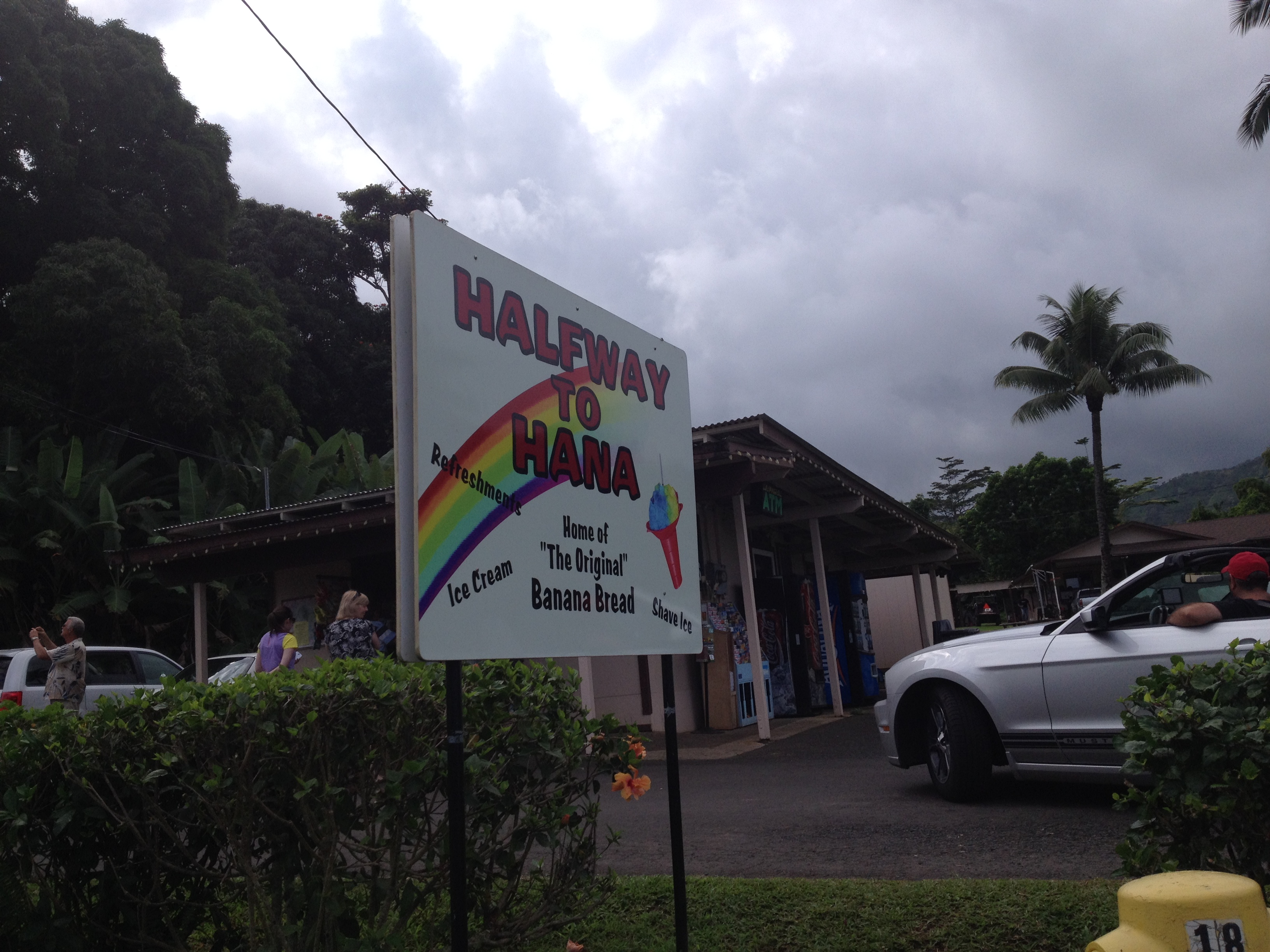
Wailuaiki Falls is located near the 21 mile marker, but it can be very hard to find a place to park around here, though we parked up hill and walked back down to view them.  Some of the best falls are up near mile markers 43 an 45.IMG_1832 IMG_1834 IMG_1835 IMG_1836 IMG_1839  
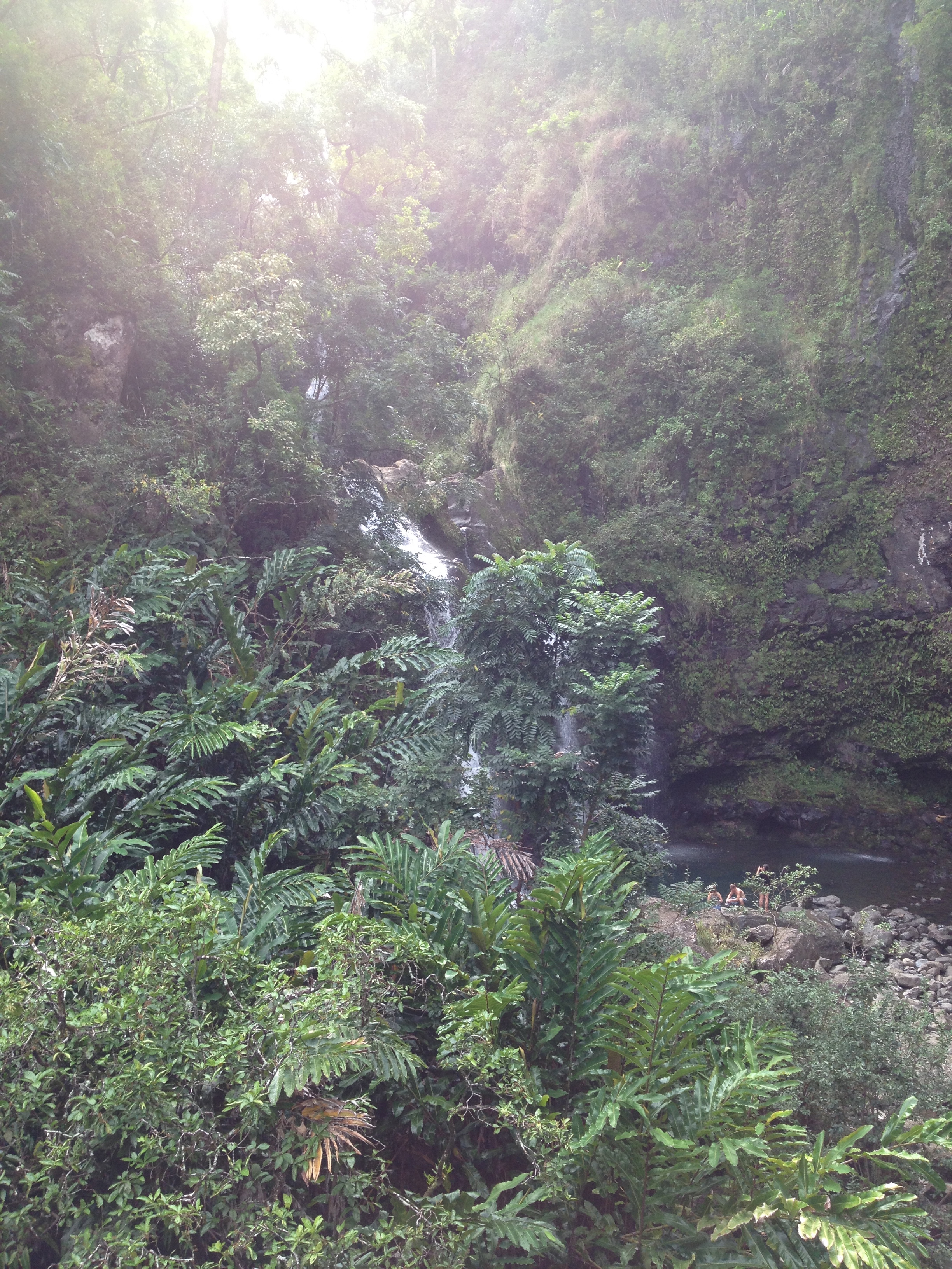
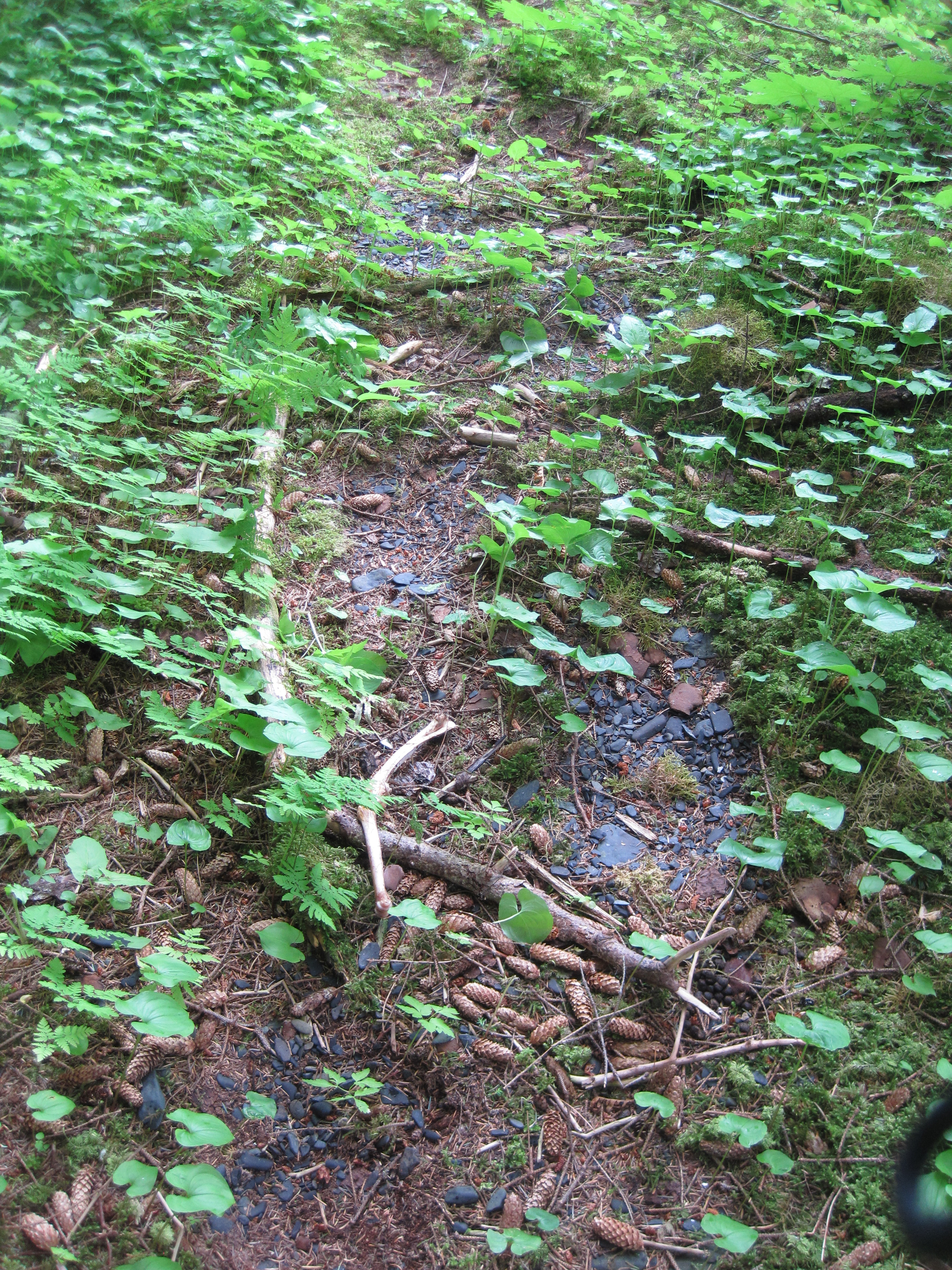
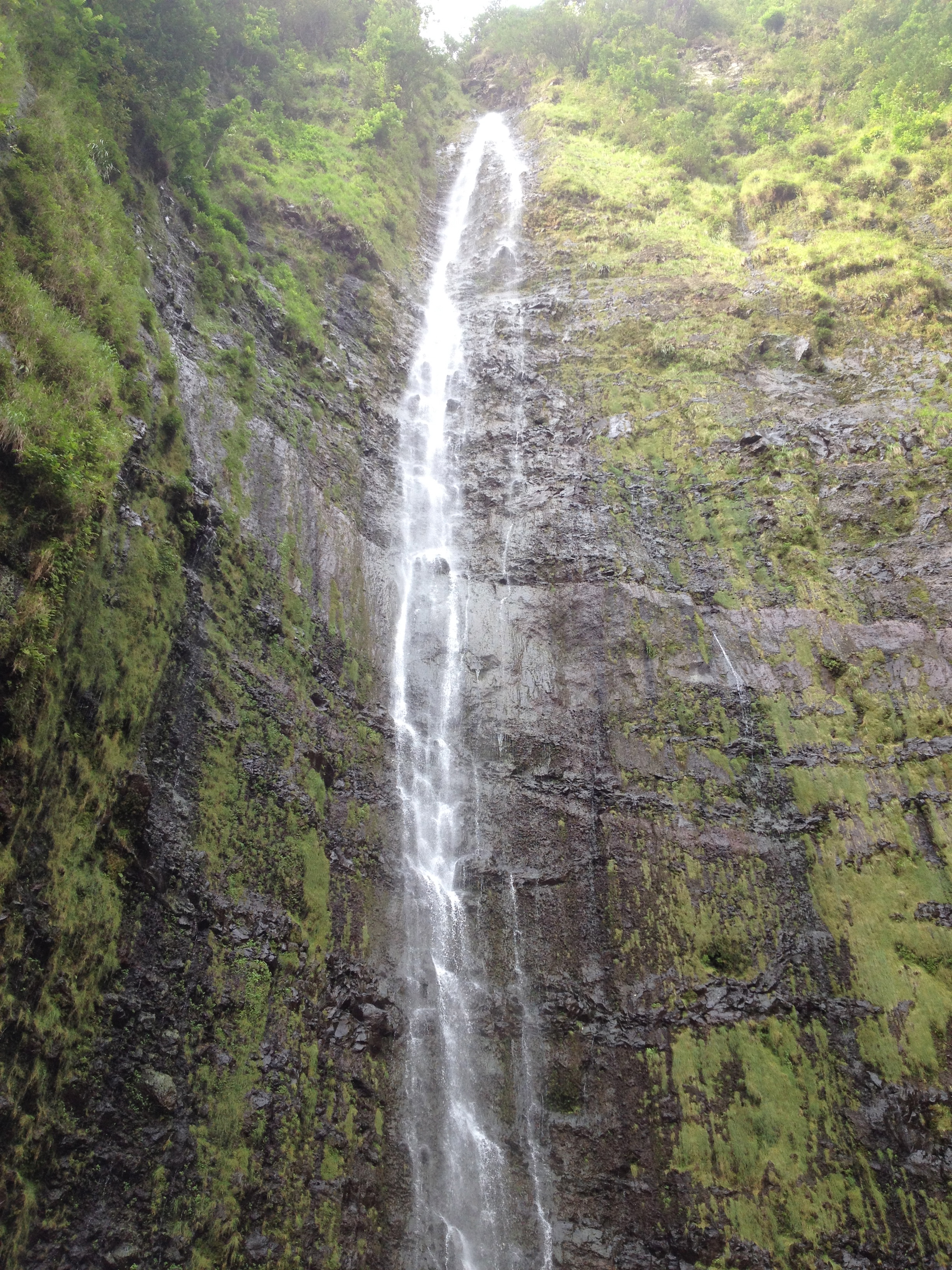
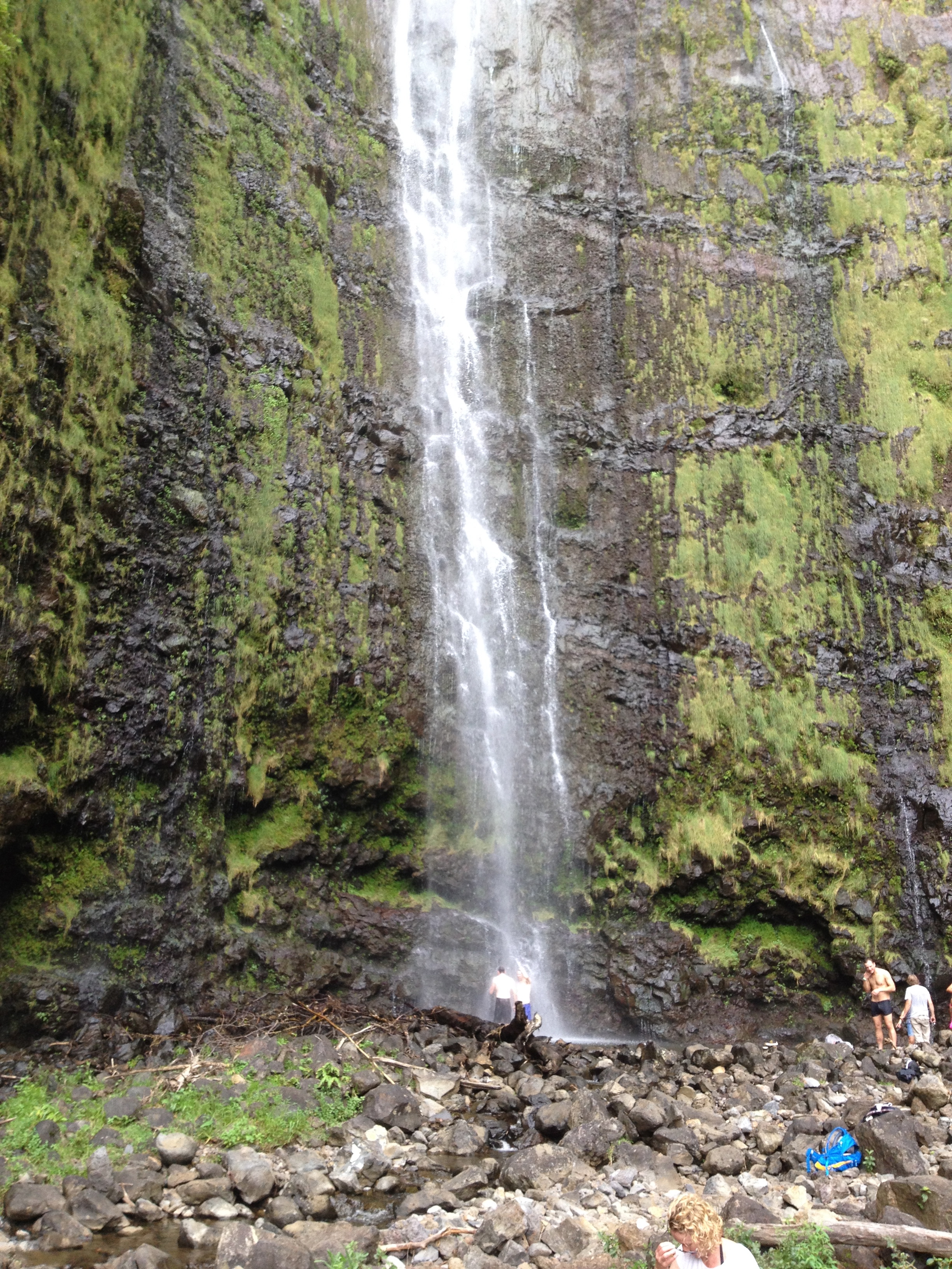
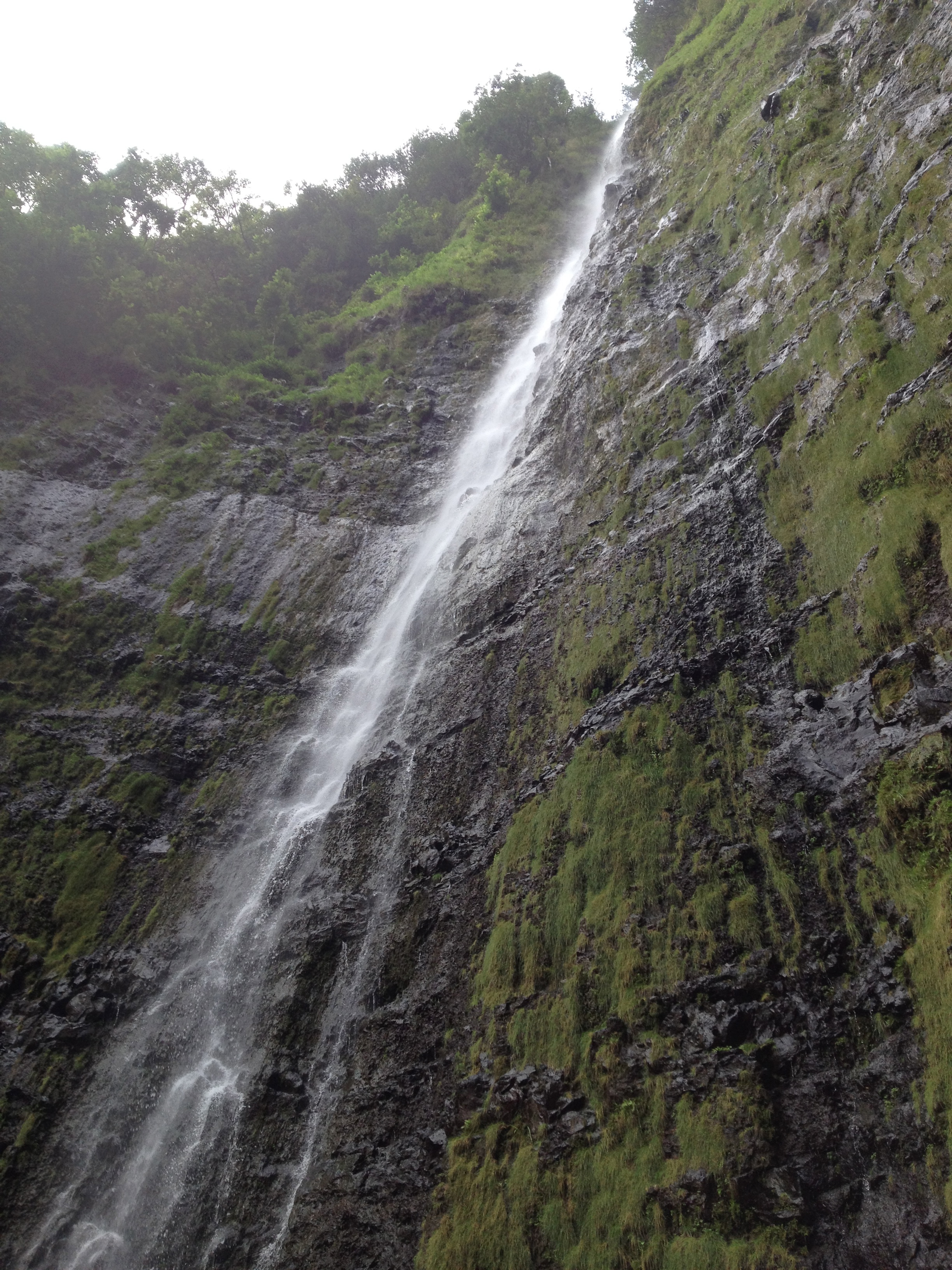
However, the highlight of our day was once we arrived to the National Park and decided to hike the 2 miles up and through the Oheo Gulch to the Waimoku Falls.  The 2nd mile of the trail is mostly going through bamboo forests which in itself is interesting.  It is 400 feet tall and the tallest falls on Maui.  We took a dip in the pool in front of it.  IMG_1867 IMG_1868 IMG_1869 IMG_1871 IMG_1873 IMG_1874

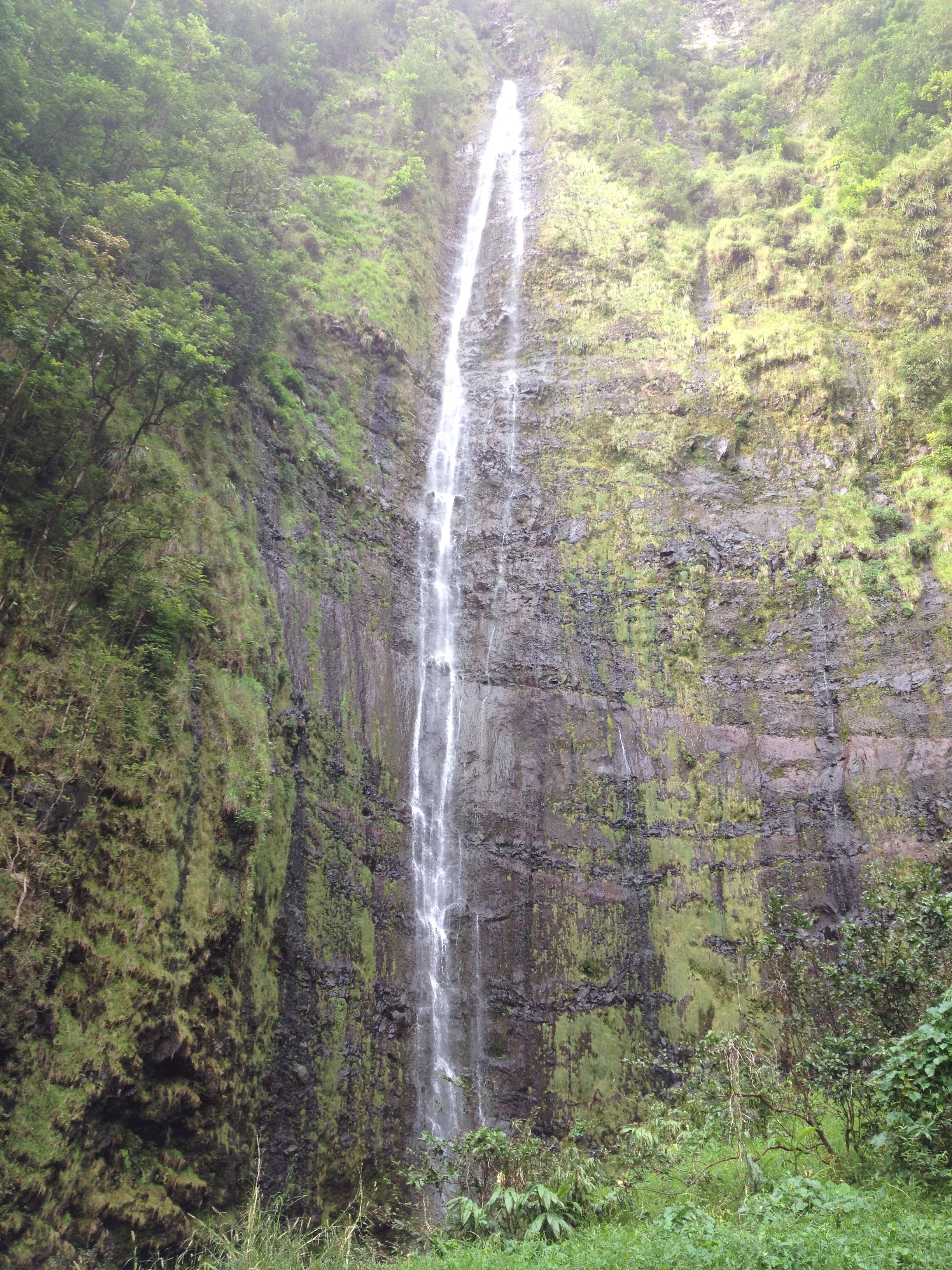
Once we were back at the Park Service area we decided to walk towards the ocean (below the main road) to view the  Seven Sacred Pools.  There are many falls along this short walk and of course pools that you can swim in and cool down after hot hikes!

During our day we also did 2 other highlights that are noteworthy.  We stopped at the Lava Tube (caves) which were worth the $12.50 entry fee.  There are a lot of interpretive signs and I feel I learned a lot while walking through the cave.  It is fascinating how it was formed.

Lastly as a highlight to the day we stopped at Nutcharee’s Thai Food in Hana.thai  We have had a lot of Thai food and traveled in Thailand for a month, so we can be a bit picky, let me tell you this was authentic and so worth stopping by to eat.  We had the 2 specials of the day, red curry with chicken and an extra special treat, fresh ahi and green curry.  No words can describe how good the green curry ahi was.  The ahi melted in my mouth.

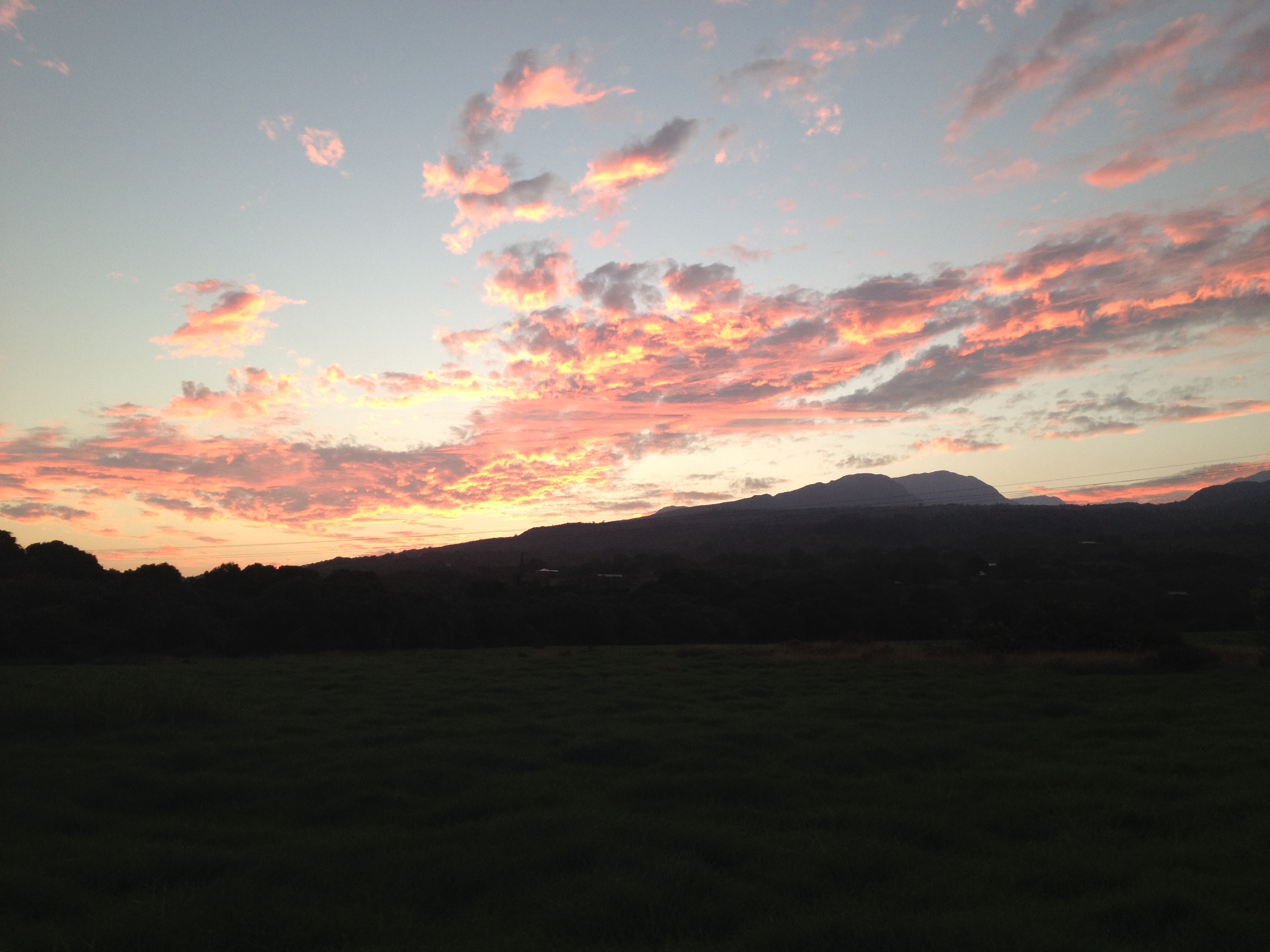
The only bummer of the day is that we ran out of time.  We ended up driving back on the Hana Highway in the dark missing so much of the beauty that we viewed on the way down to Hana.IMG_1892

1 Comment »

The most southern community in Alaska, Metlakatla on Annette Island!

Oct. 16-18, 2013

As I prepared for my trip to Metlakatla (matt-la-Cat-la) I was trying to remember a past visit(s) there, and recalled that my first trip ever for my job with AASB was to Metlakatla in the spring of 2002.  It had been a quick visit but non the less I was able to notice some big changes while at the same time, noting that some things never change.  Once in Metlakatla I also was reminded that in the late 1990’s, as I was in charge of Elderhostel trips, a small cruise ship I was on had stopped here for a day, so indeed I had been there twice before!Image

Metlakatla moved to its current location sometime in the 1890’s  before that Metlakatla was in British Columbia near Prince Rupert.   The word Metlakatla comes from the traditional Native Tsimshian (sim-See-in) word meaning “Salt Water Passage”.  A lay minister in 1886 went to Washington DC and asked the US government to give a group of Natives land in the United State.  The then US President Grover Cleveland selected Annette Island for its calm bays, water sources, and seafood accesiblity.  

One of the most interesting things that makes it different from the rest of Alaska Native communities is that it is a Reservatin.  In 1888 the same lay minister that had asked for it to be moved to the US asked if Metlakatla could be come an Indian Reservation and in 1891 it became one.

I flew to Ketchikan on Alaska Airlines then grabbed a quick flight to Annette Island on Pacific Airways, on a small float plane.  It took less than 15 minutes to fly the 16 miles. 

Typically you hear on the nightly news that Metlakatla was the warm spot in the state.  It is one of the warmest communities in Alaska with only about 3 feet of snow falling in the winters.  Image

Another thing that is unique about Melakatla is that it is a growing rural, Native community in Alaska.  With many other communities losing people to more ‘hub’ communities, Metlakala is not losing but rather gaining individual. 

IMG_0713

Tsimshian dolls by Vivian Benson (sister of one of my friends in this community) they are made of red cedar, yellow cedar, sea otter fur, hide, abalone buttons, mother of pearl buttons and human hair.

IMG_0710

in 2001 the AISU established the Healing Arts Project in order to promote relationship between health, community and culture by supporting the creativity of local Native Artists.

IMG_0708

Chikat and Raven Tail Leggings with the Tsimshain Lightning design, made of wool, yellow cedar, leather , copper, bone feathers, glass beads and sea otter fur.

IMG_0705

The designs on the sides of this bentwood box refer to two important aspects of Metlakatla’s history. One side is the symbol of ancestors conversation to Christianity and the other show the migration from Metakatla, BC to the current community in 1887.

IMG_0701

the Moon Mask by Aaron Horne, red cedar, abalone, and acrylic paint

IMG_0702

Killer Whale Mask made by Wayne Hewson, red cedar, abalone, and acrylic paint

I had a great time working with the community and enjoyed visiting the Annette Island Service Unit, a local medical facility for the community.  The artwork inside the building was amazing, and I have attached many photos of the traditional Native Artwork.  ImageImageImageImageImageImageImageImageImageImageIMG_0719 IMG_0718 IMG_0717 IMG_0716 IMG_0715 IMG_0711 IMG_0707 IMG_0700 IMG_0699 IMG_0698 IMG_0697 IMG_0696 IMG_0695 IMG_0694 IMG_0693 IMG_0692

Leave a comment »

Sitka, Home to Mt. Edgecumbe High School; Alaska’s Largest Boarding HS

Sept. 6/7, 2013

Sitka by the sea is a beautiful community in SE, Alaska and I know I have written about it before.  This trip I thought I would highlight Mt. Edgecumbe High School (hereafter, MEHS) which is a boarding high school in AK. What makes it unique is that it is run by the state and is public for anyone that applies and is accepted.  Currently there are 400 + students from over 100 Alaska communities are in attendance there.  Image

The name comes from the beautiful mountain, Mount Edgecumbe that is located on Kruzof Island, within eye site of Sitka.   It was a volcano that lies dormant now, but on most days you can see it from the school.   Historically MEHS is one of the oldest schools in the state.  In 1947 the Bureau of Indian Affairs (BIA) established this and other boarding schools to offer opportunities to Native Alaskans.  Many great Alaska Native leaders are graduates of MEHS including several Senators and Legislators.  Image

In the 1980’s the doors were closed on the school after a 16 year old, Molly Hootch, sued the state of Alaska, stating that all Alaskans should be giving the chance to go to school in their home villages and NOT have to go to a boarding high school to be educated.  She won and in the 1980’s all boarding schools in the state were closed.   Over the next few years, over 100 schools were built and opened in rural Alaska.  http://right2education.wikispaces.com/Molly+Hootch

Why, you ask, do students choose to go to a school 100’s of miles from their home in an area of the state that is only accessible by boat or plane?  Well, there are several reasons including a top notched education, and opportunities to play many sports, join a variety of clubs as well as the fact that over 90% of graduates from MEHS go on for more education after they graduate.   Since 90% of the students are Alaska Native and come from rural “Bush” communities, Sitka is a huge community and 400 students is much bigger than some of their villages.   Image

For 6 years I worked closely with the residential staff at MEHS and the feel in the residence halls is much a family feel.  Many students are ‘adopted’ by local families and have places to go for holidays and on weekends or evenings.  There is a lot of effort put into the living environment and an attempt to make the place feel like home.  Students often walk over the bridge from MEHS which sits on  Japonski Island (along with the airport and the Coast Guard Base), to the main town of Sitka which sits on Baranof Island (one of the 3 ABC islands, Admiralty, Baranof and  Chichagof).  Image

One last funny, I’ve heard a story that on April Fools Day some years ago, some individuals took a boat ride over to mountain and climbed it, tossed in a bunch of old tires and started them on fire, making individuals back in town think the volcano was erupting again!

Leave a comment »

Cordova again! I love this town!!!

Aug. 20-24, 2013

this was my 5th trip to Cordova in the last 18 months. Image

I have been there with a LOT of snow.https://timistravels.wordpress.com/2012/01/16/cordova-alaska-during-snowpocyolypse-2012/, as well as last Aug.  The weather changes often.  While we were there this trip it was quite rainy, which helped for #1 sitting inside at meetings and #2 the sales at Copper River Fleece, a business that makes beautiful rain resistant jackets/vests.  Many of us on the committee spent lots of $ at that store!  It is hard to see the designs on the trims from these photo’s but they are what ‘make’ the jacket in my opinion.

ImageImage

Another favorite of Cordova are Pete’s Treats.  Pete is a fisherman, active community member, dad, husband and most amazingly, a truffle maker!  We got a behind the scenes tour of his shop and how he makes his truffles.

Many are berry flavor based, and he spends a lot of time out picking these berries.  It takes almost 4 gallons of berries to make these condensed containers of the berry flavor.  Image                     From these, about 1/4 C of these flavors go into each batch (4 dozen) of the truffles.  We had the opportunity to sample 4 berry flavors.  In these condensed versions they are a bit different tasting than you might think.  ImageImageImage

Pete then showed us the different chocolates that he uses for mixing with the berry’s and the outside of the truffles.  The higher the # on the chocolate= the higher the cocoa mass.  He said that many don’t feel that white chocolate is chocolate, but I sure think it tastes good!ImageImage

Pete then gave us the REAL TREAT, we each got a box to fill to take home.  The ones he had to share were not his typical sized one (bigger than a golf ball) but rather smaller ones, more bite size if you will.  He offered, blueberry, nangoon (a berry) and caramel/seasalt/jalapeno!  Here we are filling our boxes.ImageImageImage

Each truffle has a distinct marking on top that correlates with a flavor. That is how you can tell what kind you are buying/eating.  This list shows what the symbols are and what flavors Pete offers.  I personally love the blueberry and caramel/sea salt/jalapeno so I had a hard time choosing what to put into my box.  Image

Cordova is also known for a few other things including fishing!  Some of our group went up river one night and caught a few salmon!  Others opted to go eat dinner at Baja Taco’s a wonderful, eclectic food joint down by the harbor.   Yes, they prepare your food in the bus 🙂

ImageImage

All in all, I continue to find something exciting about Cordova each time I visit.

Leave a comment »

Camping and Family~ Idaho adventures! (Boise, Stanly, Wildhorse Basin, McCall)

Aug. 3-11, 2013

When we heard the Tullis Family Reunion was going to be in McCall, Idaho we decided we needed to take the opportunity to explore a bit of Idaho that we had never been to before.

We spent the first night in Boise, tackling a few of the local breweries, I even found a beer that I enjoyed, called SWILL, the summer seasonal for the 10 Barrel Brewery.

On Sunday we headed up the Bogus Ski Area and went past the ski area up to the trailhead for Mt. Mores.  We hiked about 3.5-4 miles around the rim of the mountain.  It was quite warm, in the high 80’s low 90’s.  Too hot for this Alaskan, but not for Harry.

Hot hike up Bogus Basin outside of Boise

Hot hike up Bogus Basin outside of Boise

IMG_0217

highest point on Morse Mountain

We were then able to hit the brewfest in Nampa before heading to some other friends for the evening in Eagle.

However, the real adventure began on Monday morning when we headed eastward then N up to Haley, Sun Valley and eventually into the Copper Canyon and Wildhorse Basin.

IMG_0247

beautiful wildflowers

  Once we arrived to the Wildhorse Basin we knew we’d hit the jackpot of Idaho, and the fact that we’d been given an upgrade at our car rental to a Jeep, helped us quickly decide to take the remote road as far as we could.IMG_0229

IMG_0245

beautiful flowing falls

IMG_0249

need to look up what these were but they were beautiful

In the end it took us over  an hour to travel 3.5 miles.   The logging road we took seemed to be mostly traveled by ATV’s these days, but we made it in the Jeep!  At the end we hiked in about another mile or so and the valley was just spectacular.    On the way out we stopped and took some photos of the old mine.

IMG_0250IMG_0253IMG_0252IMG_0251

IMG_0238

the peak at the end of the trail. Must have been at about 11,500-12,000 feet

However, what both of us agreed to be the highlight of the trip was where we camped that night.  After coming back off the ATV road we decided to not camp at the campground, (there were only 2 spaces full, but they were the only 2 on the river) but rather to set up our tent on the riverbed.  There were so many “almost heart rocks” that we

heart

almost heart rock beach

decided to call our campsite the ‘almost heart’ site. IMG_0231

The sky was so clear that we saw more stars that night than we’ve ever seen, even more than on Mauna Kea (13,803 feet) in Hawaii.  It was spectacular.  We saw the Milky Way and many constellations as well satellites passing in the sky.  We could tell that with such a clear sky that it was going to be a cold night, but we never imagined it would get down to freezing but it did.

IMG_0263

the view from our tent

As we awoke in the morning we saw the sun rise over the mountain peak and knew we’d already had THE highlight of the trip.  But we continued onward.  We drove the loop through Copper River Basin, which was also worth the time.  Eventually we made it back to Sun Valley by noon and continued our adventure toward Stanley.  Everyone had told us we’d love it there but neither of us know what to expect.IMG_0256

It was a quaint little town, almost like one of the ghost towns in N Arizona.  It also reminded me of Nenana, AK or any smallllll town USA.  There was the main road through town and about 3 turn offs, making it easy to see all of town.  We ate pizza for lunch, filled up with gas and stopped at the visitor center.  The woman told us that the area we wanted to visit had a recent fire and that the ‘scenery’ wasn’t what it used to be.  Hence we continued to another location.IMG_0294 IMG_0305 IMG_0306 IMG_0308 IMG_0309 IMG_0310

heart2

the heart rocks at the hot springs camp site

hot sp

harry enjoying the hot springs.

Eventually we ended up in Bonneville Campgrounds, established in the location most likely because of the natural hot springs that were about ¼ mile from our tent.  We enjoyed them both in the evening and again the next morning.  It was perfect for both of us because Harry could sit in the HOT area and I could lounge where the hot water met the cold river water creating just the right temperature for me!

That day we drove a scenic route through a gorge headed towards McCall.  It again was magnificent.  We kept commenting on how nice it would have been to have our motorcycles for this trip.  We followed a river towards the west and then another one North.  The one that was flowing south as we drove north had amazing rapids and turbulent waters, very pretty.

We arrived into McCall right around the time we could check into our condo.  We quickly found the brewery before Marcia came to take us to their house on the lake, the gathering spot for the reunion.

hike mc2

there had been a fire about 18-20 years ago

The next few days were full of family, fun, laughs and memories. hikemc

Harry and I hiked up to Canyon Lake, it was steep and it was hot, and combining those elements with the high elevation, I was pooped!  We also canoed with John/Liz and Michael /Debbie down the river for a few hours, another fun adventure.    Sharing the condo with April, Carol and the twins Jason and Morgan was also a blast.

IMG_0339

the Tullis kids, Tom, Marcia, John, Harry and Karen, we missed Jim, Kathy and Jack

Thursday night the family had dinner at the pizza place, Friday night everyone brought things to BBQ and we ate at the house on the lake and Saturday night most everyone gathered at Tom and Ann’s (+family_) campsites for more BBQ fun. IMG_0419 IMG_0431

We missed those not there, but hope to see them all at the next gathering.

4 Comments »

Volunteering for a week in Seymour Canal~ Near Juneau, Alaska

June 24-29, 2013 When my husband asked me if I would be
willing to come and volunteer with him for a week out in the field
I was thrilled to take the offer. I actually met him 18 years
earlier as I was on a volunteer trip in the same area. This time we
would be boating around the area and checking in on remote cabins.
It was an great week that even rain could not ruin!

IMG_10215fly slide

Slide Lake


IMG_10210fly pC:windfall

Pack Creek is the creek
flowing out the mud flats in the photo and we stayed on Windfall
Island where we stay.

On the day we landed it was
80+degrees outside… In Alaska 80 feels like 100 anyplace else, it
was hot and the horse flies were terrible. But we loaded the float
plane and took off for a 30 minute flight.

We unloaded
and got ourselves set up at camp
https://timistravels.wordpress.com/2013/07/03/camp-life-windfall-island/
then we got in the skiff and visited Windfall Harbor, what a
beautiful area.

IMG_9823crabbers

you can see all the crab
pots here.

The only sad part were the areas that were
damaged or trashed by the crabbers (professional fisherman that
collect/sell crabs). They toss their extra crab pots in the woods
along with other junk and just leave it. They often trash the
campsite with their garbage and don’t clean up after themselves. It
is just a bit sad.
IMG_9921

sun setting on
Windfall

IMG_9948

sea anemone in the
water

IMG_9966SA

sea anemone in the
water

IMG_9969sa

sea anemone out of water
on high tide

IMG_10062*

star fish

On the
next day we set out to do the work that Harry needed to complete.
But before we did we stopped to take advantage of the low tide and
view the sea anemone’s at low tide, such interesting looking
creatures. We also got a good view of many, many, many starfish.
IMG_10063* IMG_10065* IMG_10064* IMG_10066*
IMG_9965mink

do you see the
mink?

IMG_10031loon

wish you could hear the
loon

We then went
exploring around the area, up and down Seymour Canal. We started up
in Pleasant Bay, then past the Bug Islands, into Fools Inlet and up
to Olivers Inlet. Along the way I saw a mom deer nursing her fawn,
found gumboots both eaten and uneaten at low tide, we saw and heard
loons and 100’s of bald eagles. I learned that Seymour Canal has
more bald eagles per square mile than anyplace else in the world
(according to Fish and Wildlife). We saw wildflowers, beaver
activity and even a skeleton of a deer that had not made it through
winter. We came across beautiful meadows and a salt chuck that was
amazing. Each time you turned a corner there was a breathtaking
view.We heard and saw loons throughout the trip, as well as a mink
or two on shore occasionally. The trip was just full of
nature.

IMG_9993momfawnnursing

mama deer nursing her
fawn

IMG_9970gumboot eaten

gumboot

IMG_9954us saltchuck

the salt chuck behind
us

IMG_9952beaver work

busy beavers


IMG_9956deer carcuss

deer skeleton


IMG_9916blue ger

wild blue
geranium

IMG_9859deer tracks

deer tracks on many of the
beaches

safe_image.php

eagles were everywhere in
the area.

IMG_9865hotspots

brown bear follow the same
path over and over and over and over again, and you begin to see
these pad marks in the ground.

Last but not least were the brown
bears. We saw many of them on this adventure, but you will have to
visit this blog to read more about them:
https://timistravels.wordpress.com/wp-admin/post.php?post=2536&action=edit&message=6&postpost=v2

1 Comment »

Pack Creek Brown Bear Viewing Area

After meeting my husband I have become more and more interested in brown bears and less and less frightened of them.  Pack Creek is on Admiralty Island about 30 miles south of Juneau.   Also called “Kootznoowoo,” (hence our chocolate lab was named Kootz) or “Fortress of the Bears,” by the native Tlingit people, Admiralty has more brown bears per square mile than any where else in the world, about 1,500 in total, more than all the lower 48 states combined. IMG_10081bear clam look

This area was first homesteaded by Stan Price and because of his interaction with the brown bear the bear are much more habituated to humans  and the area provides a protected space for the brown bears. IMG_10059homestead

Both the US Forest Service and Alaska Department of Fish & Game work to insure that visitors can come to the area and yet have  minimal impact to brown bears.

IMG_0895 IMG_0888 IMG_10179cubs

IMG_9779fly us

our flight out, note the ear plugs, a must on small planes

IMG_9775fly

essential items flying with us to camp, including all our food and some fresh water.

IMG_9770fly

our plane at the float pond in Juneau

IMG_9768fly

loading the plane

IMG_0947

off we go

You must have a permit to visit Pack Creek between June 1 and Sept. 10 and you can get them by visiting Recreation.gov or calling their toll free number 1-877-444-6777.   People can also sign up with a tour guide in Juneau.  Individual then must figure out how they will get to Pack Creek, most come by plane but many also arrive via boats of some kind.

IMG_10208fly packcreek

a view of Pack Creek and mud flats from the air

Pack Creek is formed from the snow that starts about 4000 feet above and descends into Seymour Canal. At the base is about a 400-acre mud flat that is especially visible at low tide.  The bear spend a lot of time in flats clamming and looking for other food sources UNTIL the fish arrive.  Typically the BEST  bear viewing on Pack Creek is when the pink and chum salmon begin heading back up the river in early July.  My husband had seen a fish in the river as early as June 30, his colleague, June 28th but as the 3 of use were out at the viewing tower, we saw one on June 26th.  The summer of 2013 is off to a good start for the bears.

IMG_10055sign trailhead

the bears all but destroyed the sign placed here in the 90’s

IMG_10056sign 'pack'

what’s left of the Pack Creek Trail sign

IMG_10054bear scratch tree

signage of bear everywhere, this tree has bear claw marks in it

IMG_10043fresh poo

yep bears do poop in the woods and on the walking trail

IMG_0941

paw print in the sand

Upon arrival a staff member will meet you and make sure you are aware of all the rules that you must follow to visit this area.  No food can be on you, you are only allowed to walk in certain areas, etc.  The rangers fill you in on what has been recent activity and will lead you to the viewing spit, or direct you to the 1 mile trail to the viewing tower.  The trail to the tower is a MUST do regardless if you see bear or not, walking through the old growth rain forest is something pretty special. IMG_10008bear hair tree IMG_10007bear scratch tree IMG_9924Pcubs

IMG_10077bear clam

clamming!

We saw a lot of activity, including a bear clamming, 2 sub adults playing with each other, and a mom and her 2 cubs.  The 2 sub adults have been friends since they were with their moms.  It is really unusual that the mom allowed their cubs to play together, but they did and after the moms ‘kicked the out’ these two have remained friends.  The mom with her 2 female cubs was the most visible.  She seems to feel quite safe at the south spit and spends a lot of time there.  We saw the cubs playing with the out haul lines, rousting with each other and simply exploring.IMG_10173cub IMG_10167pokey cubs IMG_0969 IMG_10160popkey cubsIMG_10179cubs

We got quite close to the mom and her cubs as we were returning to our boat on the night of our visit.  They were not on the spit when we walked the trail, but they were upon our arrival back.  Mom checked us out quite a bit, but in the end they just laid down and we continued on our route.  We did NOT displace them or stress her out and she was not worried about us at all.

IMG_9816windfall

tip of windfall as we paddled back from our night at Pack Creek

IMG_10218fly bear alpine

as we flew home we saw 7 brownies in the alpine. In late June they follow the snow line up and eat along the way. Plus with the heat we were having that day (high 70”s) they were climbing to cool off as well as find food.

I hope you someday consider a visit to Pack Creek, it is a magical place. IMG_9797IMG_0939 IMG_0937 IMG_0936

1 Comment »

Unalaska~ beauty on the Aleutian Chain of Alaska

July 2010

Work has its perks and traveling to the beautiful community of Unalaska / Dutch Harbor in July of 2010. This is a ‘retro’ blog to add some of my experiences pre setting up the blog.  I took great notes on our tour there and want to capture them here and now!

  • the average winter temperature in Unalaska is 36 degrees, winter average 55 degrees.IMG_2471
  • the islands were formed by volcanosIMG_2388 IMG_2391 IMG_2392
  • artifacts have been found that are over 9000 years old
  •  in the old days there was thought that the decedents were from the tip of Russia and that they came across the ice, however, Through DNA it is known that there is a direct decent from the Aleuts.IMG_2411
  • During WWII there was an Army Base here called Fort Mears.
  • On June 3/4, 1942 the Japanese bombed the area with upwards of 10,000 military troops.  This was six months after the attack on Pearl Harbor, and the Japanese aircraft struck at U.S. Army and Navy bases on Amaknak Island.  The Japanese were surprised as the air was filled with anti-aircraft fire due to the fact that  3 weeks before the US had ‘broken the code’ and the bases were on high alert expecting something like this.  The Japanese did not find an airfield nor a carrier fleet at Dutch (as they had expected) the Japanese pilots turned to secondary targets, dropped their stuff on Margaret Bay Naval barracks, killing 25 servicemen.  In total there  were 42 military deaths and 1 civilian death.
    IMG_2418

    from the museum

    IMG_2445

    bunkers

    IMG_2449

    bunkers

    IMG_2451

    during our nightly hike

  • Along the mountain sides were jagged lines which were trenches dug by all troops “Umnak” Airstrip was laid in 9 days so that fighter planes could continue to come in and land there.
  • Hog Island was named this because in the mid 1700’s pigs were brought there during the fur trade times simply to eat.
  • there were no road before WWII
  • 40-50,000 troops were on the island before 1947
  • in 1805 a Russian Orthodox minister planed 3 Sitka Spruce on the island
  • 120 types of wildflowers bloom here annually.
IMG_2477

crabbing gear

Now this area is known for it’s fish/crab processing.  It has the largest plant in Alaska as well as being the largest seafood plant in North America.  The Akutan facility sustains a year-round operations and on busy days processes over 3 million pounds of many species. Akutan’s precise daily production varies depending upon the season. There are a number of different seafoods that come from here: Alaska pollock, including frozen fillets, blocks, and surimi, as well as fishmeal and oil and halibut. The plant has  filleting capabilities and also produces both bulk and custom packs of Alaska king and snow crab. We got to have dinner at the plant, that is self-sufficient.  It has an amazing dining hall and dormitories for it’s 825 employees.   It was like college life all over again, except for the smell.

IMG_2460

after the hike to the top

IMG_2482

Eagle’s Nest, they will build anywhere!

IMG_2429

Eagle talking to us!

IMG_2408

Russian Orthodox Church

IMG_2462 IMG_2398

1 Comment »

Valdez, Alaska, 3 trips over 2 months~ both flying and driving there with views of Wrangell~St. Elias National Park

March 6-9; April 8-9; April 16-19

Well, I have learned a lot about getting to and from Valdez.  On trip 1, I was able to fly from Juneau to Anchorage then catch the ERA Airline flight to Valdez.  However, once there the snow got heavy and on the afternoon I was to fly out, the flights could not make it into Valdez and hence there was no plane to fly home on!  I tried to book for Saturday, but because it was the first day of spring break, all the seats were full and I could not get on a plane until Monday.  I  have to say I was a bit bummed, mostly because I wanted to get home and prepare to fly back to ANC on Monday.

Thankfully a school board member was stuck in ANC and her husband/2 daughters and dog were driving up to ANC on Saturday and offered me to ride with them!  What a nice offer.  So, at 6 a.m. I was in a suburban with Chris (dad) Kate ( who drove part of the way with her learning permit) and Grace my new friend who is in 5th grade.  “Bean” the dog was also a delight during the ride.

It is 300 miles though some beautiful terrain, AND some curvy tight roads.  I tried to enjoy it as much as I could and again felt blessed to be dropped off at the airport in plenty of time to catch the flight home to JNU, arriving home about 7 pm.

IMG_0435

entering the facility

IMG_9506

if I had toured the plant I would have worn this, but it was a quick visit

IMG_0434

inside the front door

While I was in Valdez I did get to go the Valdez Alyeska Marine Terminal where the southern end of the pipeline ends.  You have to show ID and be pre approved to visit, much like going on a base.  I did a meeting there with staff, and it was fun to visit the end of the pipeline! IMG_0433 IMG_9507

TRIP 2

After spending the weekend in ANC so that I could attend the inspirational Spirit of Youth http://www.spiritofyouth.org/ banquet on Saturday night, I was scheduled to fly on ERA air leaving ANC at 7:15 a.m.  Though the weather in ANC was beautiful, Valdez was not as lucky.  It was socked in and by 8:05 a.m. the flight was canceled.  Since I HAD to get there, I announced to 3 women who were also trying to get there, that I was going to rent a car and leaving; if they wanted to ride w/ me they were welcome to… all 3 joined me for the 6 hour adventure.

There we times I could barely see the road in front of me.  From Palmer to Glenallen there were whiteouts most of the way.  However, once we headed S, through Thompson Pass it was beautiful. We rolled into Valdez about 2:30 and my meeting started at 2:45 and I finished at 12:20 a.m.!!! LONG DAY.

IMG_9555

yep gas is expensive but it was worth it!

I then had to turn around and drive back to ANC on Tuesday… the roads through Thompson Pass were terrible, but unlike the day before, from Glenallen to Anchorage were perfect, just narrow and curvy!  The roads were crowded because the Arctic Man event was that weekend.  http://www.arcticman.com/

IMG_9559

leaving Valdez headed N towards the pass

IMG_9556

Bridal Falls

IMG_9558

Bridal Falls, you can see how cloudy and dingy of a day it was.

IMG_9557

IMG_9576 Headed towards Thompson Pass

IMG_9562

this is as I am getting to the summit, it continued to get worse.

IMG_9563

visibility at the summit was almost NONE

IMG_9567

visitor center in Glenallen

IMG_9564

I am not joking, it was almost a total white out.

IMG_9566IMG_9565IMG_9561Highlights of the drive include views of the Largest National Park, Wrangell-St. Elias.  This connects with Canada’s Kluani National Park and together are designated by the United Nations as a World Heritage Site due to its unique beauty and natural splendor.  Wrangell-St. Elias is 13.2 Million acres and the size of 6 Yellowstones.  It is full of rugged mountains, glaciers, rivers and valleys.  There are all kinds of wildlife including moose, bear, Dall sheep, and mountain goats.   IMG_9594 IMG_9592 IMG_9591 IMG_9590 IMG_9588 IMG_9587 IMG_9585 IMG_9584 IMG_9583 IMG_9582 IMG_9579 IMG_9578          IMG_9591

Trip 3

FINALLY I was able to fly both ways!  The weather in Valdez was beautiful, as the pictures show.  It was just breathtaking.  The sun was out, the sky was blue and the days were packed full of work!IMG_9608 IMG_9643 IMG_9641 IMG_9640 IMG_9632 IMG_9630 IMG_9622 IMG_9621 IMG_9620 IMG_9619 IMG_9618 IMG_9617 IMG_9615 IMG_9614 IMG_9613 IMG_9611 IMG_9610 IMG_9609 IMG_9650 IMG_9646

1 Comment »

Hagia (Aya) Sophia

IMG_2470

entry hallway

IMG_2473

dome

Jan. 1, 2013

Hagia (Aya) Sophia was originally built as an Orthodox basilica, then a Roman Catholic cathedral and later a mosque.  It has been a museum since 1935.IMG_2479IMG_2476

Visiting here is a must while in Istanbul.  There is so much beauty in the structure and the mosaic pieces of artwork that are masterful. At one time they were covered by plaster but have been uncovered for visitors to see.  IMG_2515 IMG_2527 IMG_2518 IMG_2517

It was built from 532 to 537 and has a very large dome at the front.   At the time it was the largest dome ever to be built and it is still studied today as it is considered such an architectural masterpiece.

It was the largest cathedral for 1000’s of years.  In 1453 it was converted to a mosque with the alter being removed and many of the mosaic decor  plastered over. Minarets were added as well as the minbar where prayers are delivered and mihrab an arch in the walls where Muslims face during prayer. IMG_2511 IMG_2509 IMG_2508 IMG_2506 IMG_2505 IMG_2503 IMG_2501 IMG_2499 IMG_2498  IMG_2496IMG_2497 IMG_2493  IMG_2491 IMG_2487IMG_2492

There was a huge earthquake    in 989 that caused one of the domes to crumble.   The repair took over 6 years but there was a lot of additional interior paintings and mosaics; Christ on the dome, the Virgin Mary holding Jesus with Peter and Paul on either side of her.


Hagia Sophia is closed on Monday!

IMG_9211 IMG_9220 IMG_2515 IMG_2535 IMG_2531 IMG_2525 IMG_2523

1 Comment »