Hoonah is on Chichagof Island, one of the ABC Islands near Juneau, (Admiralty, Baranof, Chichagof). It is the third largest island in Alaska and the 5th largest in the U.S. Almost 900 residents live here. Hoonah is also the largest Tlingit (pronounced “KLIN-kit”) village in Alaska. The Huna tribe has lived in this area since prehistoric times. Legend says that the first inhabitants were in Glacier Bay but were destroyed as the glaciers advanced. Hoonah translates in Tlingit to “where the north wind doesn’t blow.”
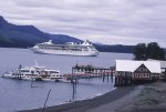
Hoonah is a great fishing port and there is the Hoonah Packing Co. in town. However, in the past few years the town has become a bit more of a tourist destination as Icy Strait Point opened and highlights the culture of the area to cruise ship visitors.
I knew the school board would not be too excited to work inside all day, but they were all good sports and got to work. At one point we had to take a break to allow them to go to City Hall as both their State Senator and Legislator were in town to talk about a proposed new dock in town. It allowed me to take a nice walk through town and take some pictures! What fun as it was a beautiful day.
We finished the workshop and the board was really happy with their accomplishment that day, and I was happy to get them moving along on their goals for improving their school for their students.
-

- me during my walk of town
-
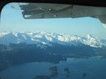
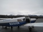
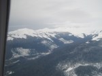
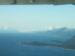
- flying
-
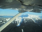
- flying, I actually got a Text while flying home from my cousin! I forgot to put phone on airplane mode
-

- me near the harbor
-
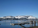
- waterfront
-
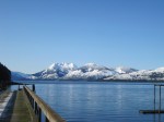
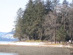
- view from their dock
-
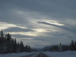
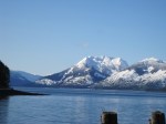
- so pretty on that day!
-

- flying
-
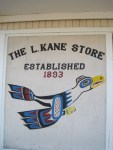
- store in town; very typical of Tlingit artwork
-
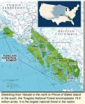
- I love maps like this that not only show you were in AK the place is BUT how big AK is compared to the rest of the US
-

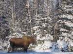
- one of my board members dogs!
-

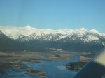
- flying into JNU, the Mendenhall Glacier in the distance
-

- the other church
-
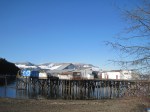
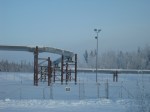
- cannery
-
- this is Lena Point and we live on this point! (not a water view)
-

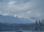
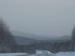
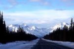
- these are the Juneau peaks as I drove to the airport in the morn… so beautiful
-

- flying
-
- cemetary
-

- totem in town
-
- flying home into Juneau
-
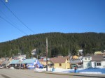
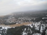
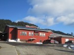
- looking into the town of Hoonah from the main street
-
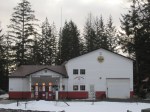
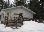
- Hoonah School
-
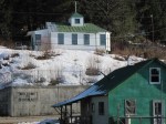
- one of the churches in town, this did not burn down in the 1944 fire!
-
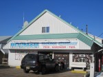
- busy store in town
-
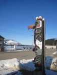
- totem looking out to harbor
-

- the town had a terrible fire on June 14, 1944 where they lost a majority of the townfront.
Flying home was almost better than flying there… and I have posted a lot of pictures from that trip. Enjoy and watch for my next trip to the Pribilof Islands, St. Paul and St. George, out in the Bering Sea!