timistravels

My job allows me to visit a lot of Alaska on a yearly basis. I wanted to capture the trips in one location!

Guided Trek on Mendenhall Icefield with local company, Northstar Trekking

July 22, 2014

What better way to celebrate our 14th anniversary than to go on a helicopter ride and trek on Mendenhall Glacier Harry and I once again took advantage of a certificate we had gotten during a fundraiser earlier this year. We have gone with Northstar Trekking 3 other times and each time it is a new adventure.

After realizing we were locals AND had gone with NST before our pilot Tracey wanted to know ‘what we wanted to see’, after telling her where we’d been before she headed N almost directly over our house then curved over towards the icefield.

IMG_1232

flying over Herbert Glacier. We ride our bicycles to the face of this a few times a year

IMG_1234

Eagle Glacier is receding quite rapidly.

IMG_1245

looking into Canada, this is probably Camp Peak

IMG_1241

some of the smaller glaciers in the icefield

IMG_1242

the pointed tips were never covered by glaciers, but the more rounded peaks were made rounded by glacier ice smoothing them out.

IMG_1250

other than being on the glacier this is my favorite picture of the day. This is Snow Tower Peaks

First we flew over Mt. Stroller White towards Herbert Glacier and continued N to Eagle Glacier. The amazing part of the flight was that we could begin to see Canadian Peeks. Along the way we also saw so many peaks that it is hard to describe let alone name them all, though Snow Tower Peaks were stunning.

IMG_1256

swinging around to head down to our trekking spot

IMG_1267

we’ve landed and I want to point out the people in this picture, it gives perspective of how large the glacier is.

The Juneau Icefield is the 5th largest icefield in America covering 1500 square miles. It is about 100 miles deep and 50 miles east to west. This icefield is about 3000 years old, so indeed there are pyramids older than this ice! Think about the icefield as one big lake with many rivers flowing out of the lake, these rivers are the glaciers. There are approximately 40 significant glaciers flowing off this field and about 100 smaller ones.

IMG_1278

in front of a ‘cave’ that was not here last week and will probably be gone in a week..

Yes Mendenhall melting and yes it is moving. It takes about 10 feet of snow to create one foot of ice, so each winter a layer is established on the icefield, but it is not growing as fast as it is melting. I have seen significant movement in the glacier in the 19 years I have lived here, it is the sad truth.

IMG_1293

filling water bottle to drink some of the clear, cold water flowing through the glacier.

IMG_1326

just as we were to depart, the tent is there for staff to store things in or to get out of the elements on not so nice days.

IMG_1318

These crevasses are about 150 feed down, you don’t want to fall.

IMG_1306

again for perceptive, this has tent and helicopter as well as people.

This is the same glacier that we were able to hike in the ice caves earlier this year, sadly they have started to collapse and it is very unsafe to return now.  http//timistravels.wordpress.com/2014/03/08/mendenhall-glacier-ice-caves-and-some-northern-lights/


Leave a comment »

Homer, Alaska; The End of the Road (or at least Highway 1)

July 17-20, 2014

IMG_1048

we flew in from Anchorage about a 30 minute flight on RAVN Air

IMG_1047

local airport

Homer, Alaska is one of the places in Alaska that gets the title of “end of the road” as it is the end of Alaska Highway 1. It’s about a 5 hour, 225 mile drive south of Anchorage so driving is an option as well as a quick 30 minute flight.   During the summer is a very popular destination for those visiting Alaska from outside, but we saw just as many, if not more, visitors that were from Alaska. Many people were visiting from as far north as Fairbanks, the Mat Su and Anchorage. People head to Homer for a number of reasons but fishing is the biggest!

IMG_1210

This is a view of the 4.5 mile spit from the air. As you can it feeds right into the bay.

IMG_1197

the change in water color is due to the fact that much of the water comes from the glaciers across the bay and glacial water is full of silt which leaves the water greyish in color and ‘thicker’ looking!

IMG_1196

Homer is known for the surf and individuals travel here so enjoy the waves.

The Spit is where a lot of the ‘tourist’ things occur. This Spit is a 4.5 mile strip of gravel, rock and sand that stretched out into the ocean. The spit was developed by glaciers in the past and most likely is the moraine from that glacier. Since it is surrounded by water on both sides, it is reshaped often. Historically there was a community on the spit from 1896 to 1902 but it was deserted after that. When a road connected Homer to Anchorage in the 1950’s the town grew quickly up into the hills surrounding the water.

IMG_1177

probably the most known establishment on the spit, though it’s menu has shrunk over the years.

IMG_1081

view out of my hotel room at Land’s End Hotel; view rooms are worth it.

IMG_1057

arts and gardening combined.

IMG_1056

11:30 at night, not bad!


IMG_1213

as we were flying out I captured this view of the bay with the Grewingk Glacier flowing into Katcemak Bay

Across from the spit is Kachemak (Catch-a-mack) you can view many glaciers flowing from the Harding Ice Field, named after President Harding. 30 glaciers flow out of this ice field which is about 3oo square miles. The 3 that can be seen from Homer are Grewingk, Portlock and Dixon Glaciers.


IMG_1176

creativity on the spit

IMG_1209

these floats pouring off a businesses porch in Old Town

Homer is an artistic, farming community. There were fresh, local vegetables on every menu in town and each store highlighted local artists. This farming in this area has grown significantly in the past few years. Homer has aspired to be known as THE ART community in Alaska. Many shops carry local art, but the fun place to visit is the Farmer’s Market on Wed and Sat mornings. You can buy not only fresh veggies but a lot of art work.


If you have a change be sure to take the ferry and visit Seldovia while in Homer. It is a quaint town that depicts off the road communities here in Alaska. The Island and Ocean Visitor Center is also a nice stop. It offers a great overview of wildlife in the area and showcases history of the region. s://timistravels.wordpress.com/wp-admin/post.php?post=3478&action=edit&message=6&postpost=v2


IMG_3141

yeppers, Moose running down the road, captured on the iphone of colleague J.Reeves

The thing that was most challenging for me was to view the 100’s and I am not exaggerating when I was 100’s of RV’s that were parked in the RV parks. When a community is on the road system this is an outcome one might expect. It was also odd to see tents set up on the spit as there is NOT one tree on the spit so it is wide open camping, I suppose I prefer camping in the woods !

IMG_1187

this fellow sat outside our meeting room for an hour on Sunday morning.

Alaskamagif300

255 miles South of Anchorage


Leave a comment »

Small town Charm in Seldovia, Alaska

IMG_1172

do you see the face of a bear in these rocks? I do and I love it!!! taken from ferry ride.

IMG_1161

wish I would have caught this, but I just decided to stand by it! It’s about a 90# Halibut.

IMG_1144

locals call this camel rock, I can see why!


July 18, 2014

A day in Seldovia, Alaska

I, for one love quaint little towns that embrace what Alaska is all about and Seldovia is just that kind of town. We were in Homer for work but had the opportunity to take the ferry ride over to Seldovia and spend the afternoon there.

IMG_1087

view from the ferry as we left Homer


IMG_1106

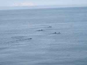
we saw whales breaching during the ferry ride. I almost caught the ‘fluke’ (whales tail)

IMG_1095

sea otters are everywhere in the waters in this area

IMG_1125

little sea otter playing in the harbor


IMG_1120

arriving to Seldovia, can you tell it’s a fishing community


IMG_1132

such beautiful flowers welcoming the ferry


It is a quieter community, as it is not on the road system; you have to try to get there! The community is far removed from the hustle and bustle of life in bigger communities in Alaska. It’s a town full of small town charm including Christmas Light contest, an annual chainsaw competition (with many of the carvings decorating town), and a solstice music festival just to name a few.IMG_1124IMG_1133

berries

a bowl of salmon berries is a summer treat!

We were hosted by a local for lunch and had yummy fresh salmon and halibut! What a treat. We then visited the Susan Early School on our way to the Otterbahn Hike and visit to the beach. I collected a lot of beach glass, (which I love) as well as filling 2 bags with salmon berries!IMG_1138IMG_1134

seldovia map

just in case you were wondering where it is on the map of Alaska

I’ve read a trip advisor reviews where people complained that there was “nothing to do” but I disagree, it is a delightful step into a beautiful community that isn’t full of tourist shops and billboards, it is a quaint Alaska community full of kindness and great old-fashioned hospitality.

Leave a comment »