timistravels

My job allows me to visit a lot of Alaska on a yearly basis. I wanted to capture the trips in one location!

Mendenhall Glacier Ice Caves (and some Northern Lights)

March 1, 2014

Almost every Feb. or March Juneau has a cold snap where Mendenhall Lake freezes enough that individuals can get out on the lake to cross country ski, or hike etc.  Typically during that time it is also quite sunny and the rain or snow subsides for a few weeks.

These explorations around Mendenhall Glacier are typically astounding, and the photos that come out of the visits make our Christmas Card each year, it is truly part of what makes Juneau such an incredible place to live, these things are in our back yard.

This year the glacial caves are getting a lot of attention from National news outlets but here are a few of my photos from the weekend of March 1 and 2, 2014.  I went on my own Sat. but did not enter the caves.  I made Harry get up early with me on Sunday and get out there when 1) there were not many people there at all and 2) I felt a little more safe with it being colder in the morning.  There is danger doing this but it was worth the risk!

The few Northern Light pictures are NOT taken by me, rather a friend of a friend.  Thought you may enjoy seeing them!

IMG_2496

out near the face of glacier

IMG_0735

harry inside the cave, yes, real colors, not altered at all

IMG_0737

me enjoying being silly

IMG_0761

over my right shoulder is a ice column in the cave, facinating

IMG_0768

just outside the cave with the peaks above my head being higher up on glacier.

IMG_0789

harry at the face being silly himself

IMG_0743

while in the cave we are looking up out of these holes…

IMG_0804

this ice cave I would not venture into, there were sounds coming out of it and that triangular piece above Harry’s left arm looks to scary to me.

IMG_0690

I hiked out to face on Sat. by myself, but did not venture into the caves

IMG_0719

just as you enter the cave

IMG_0732

that ice column that is in the middle of the cave, not quite sure how it formed, possibly a water drip that grew???

IMG_0782

the natural heart cut out I found hiking around the face of glacier

IMG_0785

out near face so much BLUE

IMG_0764

not touched up at all, the colors were simply incredible, almost looks fake doesn’t it?

Dylans house aurora 1

during this same time period we also get great Northern Lights. I did NOT take this photo rather it was taken by David Reed, a friend of a friend of a friend.

North Douglas

again by David Reed, this is taken out on North Douglas. the lights along the bottom are car lights. the light over the hilltop to the right is near our home!

2 Comments »

Kodiak Island ~ Fossil Beach and more

Kodiak, Alaska Nov. 25/26, 2012 and Dec. 9/10, 2013

Kodiak Island is known for its brown bears and remoteness.  I have gotten there a few times in the last few years, and didn’t do a blog last year (as we were taking off for another trip once I landed at home.)

Kodiak is the 2nd largest island in the United States (earlier this year I visited Admiralty Island which is the 7th largest in the US),  and #80 in the world. The island is 100 miles long from tip to tip and ranges from 10-60 miles wide.  The city of Kodiak is the largest on the island, though there are 7 communities/villages as part of Kodiak and part of why I was there was to do training with their advisory boards.  These villages are Akhiok, Karluk, Larsen Bay, Old Harbor, Ouzinkie, Port Lions and then Afognak Island (a smaller island near Kodiak).    Some of these villages have been in existence much longer than Alaska was part of the United States and remain subsistence villages as much as possible.

Kodiak reminds me a lot of Southeast, (SE) AK where I live, as it has mountains, and yet has a lot of forest on most of the island.   As in SE the only way in/out is on a boat or plane.  The great part of Kodiak is there is quite an extensive road system and I was lucky enough to have my good friend and colleague, Norm take me on a tour of the island.

We headed out early and drove to Fossil Beach.  Along the way we saw Bison, eagles, surfers and a lot of other amazing sites.  Though the road is only about 46 miles it take about 1.5 hours to get there.  The roads are curvy, and slow going, but again worth it.  And in the morning there was a lot of fog, buy by the time we headed back towards town it had lifted a bit.

Kodiak offers so much to see and do, there is not a ‘best time of year” to visit, you simply should just add it to your MUST VISIT list.  Alaska Air and ERA Airlines fly there daily and it is a place to be seen!

IMG_2021 IMG_2024 IMG_2023 IMG_2028 IMG_2027 IMG_2031 IMG_2030 IMG_2029 IMG_2034 IMG_2033 IMG_2032 IMG_2040 IMG_2039 IMG_2035 IMG_2042 IMG_2047 IMG_2043 IMG_2049 IMG_2046 IMG_2051 IMG_2050 IMG_2061 IMG_2055 IMG_2053 IMG_2045 IMG_2004 IMG_2005 IMG_2008 IMG_2010 IMG_2014 IMG_2016 IMG_2026 IMG_2038 IMG_2058 IMG_2062 IMG_2063 IMG_2065 IMG_2010 IMG_2016 IMG_2019 IMG_2020 IMG_2026 IMG_2036 IMG_2038 IMG_2052 IMG_2058 IMG_2062 IMG_2063 IMG_2065 IMG_1999

5 Comments »

Not the Iditarod, but a “pre race” in Galena

Galena, Alaska 2003 or 2005

As the Iditarod race is running this year, on VERY LITTLE snow, I am reminded of a trip I took to Galena, Alaska about 10 years ago.  I was in town for work and picked a great weekend to be there for the Spring Festival.

Every other year, the Iditarod Race stops in Galena, this was the off year, so this race was the highlight.  It was cold that day, I’m remembering about -30 to -40 below, though a few days later it was up in the 20’s.  It was a dry cold which makes it better than the wet cold of Southeast, Alaska.

I don’t remember a lot of ‘facts’ from this day, but what I do remember is that those dogs were so pampered and loved by their owners (contrary to what others might think), and those dogs LOVE to run.  The other surprising part is how small the dogs are.I had always thought they were larger dogs but once I saw in person they are much smaller.

All and all a fun time and one of these years I will get to see the actual Iditarod!      Enjoy the pics!

OLYMPUS DIGITAL CAMERA OLYMPUS DIGITAL CAMERA OLYMPUS DIGITAL CAMERA OLYMPUS DIGITAL CAMERA OLYMPUS DIGITAL CAMERA OLYMPUS DIGITAL CAMERA OLYMPUS DIGITAL CAMERA OLYMPUS DIGITAL CAMERA OLYMPUS DIGITAL CAMERA OLYMPUS DIGITAL CAMERA OLYMPUS DIGITAL CAMERA OLYMPUS DIGITAL CAMERA OLYMPUS DIGITAL CAMERA OLYMPUS DIGITAL CAMERA

2 Comments »

Driving the Hana Highway

11/21/13

Some people say this drive is not worth it, we could not DISAGREE more, we LOVE this drive.  I do say however, if you are prone to car sickness simply offer to drive.  I have driven it 2 x’s and would recommend it to anyone visiting Maui.  I am sure this won’t be the last time we drive it.

The beauty starts off almost immediately.  At the 2 mile mark there is the busiest hike of the road, and is certainly a fun easy hike into a waterfall and pool.   At about the 6 mile mark when you see the Rainbow Eucalyptus Forest on your left. IMG_1816 IMG_1825 IMG_1822 IMG_1821 IMG_1820 IMG_1819 IMG_1818 After leaving there, continue along the highway slowing at each bridge to #1 make sure no one is coming the other way and #2 (an most important) to see if there are any waterfalls in these valleys.  Sadly during this trip there had not been much rain in recent history, so a lot of the river beds were dry.IMG_1827

At 19 mile you will see the Three Bear Falls, though again, if there has not been much rain they will not be flowing as much as they will during the wet season.IMG_1826 IMG_1830  Wailuaiki Falls is located near the 21 mile marker, but it can be very hard to find a place to park around here, though we parked up hill and walked back down to view them.  Some of the best falls are up near mile markers 43 an 45.IMG_1832 IMG_1834 IMG_1835 IMG_1836 IMG_1839  However, the highlight of our day was once we arrived to the National Park and decided to hike the 2 miles up and through the Oheo Gulch to the Waimoku Falls.  The 2nd mile of the trail is mostly going through bamboo forests which in itself is interesting.  It is 400 feet tall and the tallest falls on Maui.  We took a dip in the pool in front of it.  IMG_1867 IMG_1868 IMG_1869 IMG_1871 IMG_1873 IMG_1874

Once we were back at the Park Service area we decided to walk towards the ocean (below the main road) to view the  Seven Sacred Pools.  There are many falls along this short walk and of course pools that you can swim in and cool down after hot hikes!

During our day we also did 2 other highlights that are noteworthy.  We stopped at the Lava Tube (caves) which were worth the $12.50 entry fee.  There are a lot of interpretive signs and I feel I learned a lot while walking through the cave.  It is fascinating how it was formed.

Lastly as a highlight to the day we stopped at Nutcharee’s Thai Food in Hana.thai  We have had a lot of Thai food and traveled in Thailand for a month, so we can be a bit picky, let me tell you this was authentic and so worth stopping by to eat.  We had the 2 specials of the day, red curry with chicken and an extra special treat, fresh ahi and green curry.  No words can describe how good the green curry ahi was.  The ahi melted in my mouth.

The only bummer of the day is that we ran out of time.  We ended up driving back on the Hana Highway in the dark missing so much of the beauty that we viewed on the way down to Hana.IMG_1892

1 Comment »

Drive around North end of Maui

11/19/13

1valley

there are a few valley’s like this on the N end

We have driven this before but wanted to highlight a few standouts this time.Though many people go from Lahaina around, we start the other way so that we can end in Lahaina for dinner and drinks at the Maui Brewery.  For all purposes the drive starts in Kahului.  Turn as if you were headed to the college (where the Saturday flea market is held, another must!).  Heard North along the highway 340.  As the road begins to elevate and get curvy be sure to stop at a pull out and look back at Haleakala which towers just over 10,000 feet.

3plumeriaphoto

yellow plumeria, so pretty

2flower

Hibiscus are so dang pretty

Last year we did a great hike along this route that took us a few miles into the rain forest, but this year we had other plans.  If you want to do that hike watch for the telephone pole that has #174 on it and remember that that trail head is at the bottom of that hill.  Hence if you are going the direction we are, you’d have to turn around after you see #174 and go about 1/4 miles back down the hill.  This pull out near pole 174 is also a great one to view back towards the rest of the island.

5 1st blowphoto

this is at the 2nd Mile marker 38 AFTER the blow hole if you come the way we came OR the 1st marker if you come from Lahaina. Don’t start your hike to hole from here.

4churchphoto

the quaint church in Kapalua

We continued around the point stopping for construction near the small town of Kapalua.  Near the town the road is VERY narrow and it is one lane most of the way.  Each time we drive this there seems to be a hold up b/c someone freaks out as they drive this road and stops traffic until a nice Samaritan helps the scared driver pull over far enough so others can pass.  DON”T drive this drive if you are not comfortable with tight spaces.

6 heart rockphoto

found this heart shape in a lava rock as we were climbing down to the blow hole

7 heart cut outphoto

so happy to find the natural formation of this heart in the lava rocks near the blow hole

We got to the mile marker 38  (there are 2, one at each parking lot for the blow hole), and headed out to find the natural heart cut out in the rock formations.  We hiked down the steep, rocky area towards the blow hole, but then veered to our right to find the rock!  Score!

11 snorkelphoto

we snorkeled in this cove and it was so beautiful. You can see people in the water if you look close.

After this hike we headed to our favorite snorkeling area, DT Fleming Beach Park.  After a short walk into the beach we were quick to get on our gear and into the water.  Amazing fish that I will blog about next.

After an hour or so of snorkeling, it was off to Maui Brewery for some IPA’s.  But the real treat of the night was trying a new eatery, Star Noodles.  A new ‘dont miss’ on Maui.

All and all a great day and well worth the trip around the tip!

1 Comment »

The most southern community in Alaska, Metlakatla on Annette Island!

Oct. 16-18, 2013

As I prepared for my trip to Metlakatla (matt-la-Cat-la) I was trying to remember a past visit(s) there, and recalled that my first trip ever for my job with AASB was to Metlakatla in the spring of 2002.  It had been a quick visit but non the less I was able to notice some big changes while at the same time, noting that some things never change.  Once in Metlakatla I also was reminded that in the late 1990’s, as I was in charge of Elderhostel trips, a small cruise ship I was on had stopped here for a day, so indeed I had been there twice before!Image

Metlakatla moved to its current location sometime in the 1890’s  before that Metlakatla was in British Columbia near Prince Rupert.   The word Metlakatla comes from the traditional Native Tsimshian (sim-See-in) word meaning “Salt Water Passage”.  A lay minister in 1886 went to Washington DC and asked the US government to give a group of Natives land in the United State.  The then US President Grover Cleveland selected Annette Island for its calm bays, water sources, and seafood accesiblity.  

One of the most interesting things that makes it different from the rest of Alaska Native communities is that it is a Reservatin.  In 1888 the same lay minister that had asked for it to be moved to the US asked if Metlakatla could be come an Indian Reservation and in 1891 it became one.

I flew to Ketchikan on Alaska Airlines then grabbed a quick flight to Annette Island on Pacific Airways, on a small float plane.  It took less than 15 minutes to fly the 16 miles. 

Typically you hear on the nightly news that Metlakatla was the warm spot in the state.  It is one of the warmest communities in Alaska with only about 3 feet of snow falling in the winters.  Image

Another thing that is unique about Melakatla is that it is a growing rural, Native community in Alaska.  With many other communities losing people to more ‘hub’ communities, Metlakala is not losing but rather gaining individual. 

IMG_0713

Tsimshian dolls by Vivian Benson (sister of one of my friends in this community) they are made of red cedar, yellow cedar, sea otter fur, hide, abalone buttons, mother of pearl buttons and human hair.

IMG_0710

in 2001 the AISU established the Healing Arts Project in order to promote relationship between health, community and culture by supporting the creativity of local Native Artists.

IMG_0708

Chikat and Raven Tail Leggings with the Tsimshain Lightning design, made of wool, yellow cedar, leather , copper, bone feathers, glass beads and sea otter fur.

IMG_0705

The designs on the sides of this bentwood box refer to two important aspects of Metlakatla’s history. One side is the symbol of ancestors conversation to Christianity and the other show the migration from Metakatla, BC to the current community in 1887.

IMG_0701

the Moon Mask by Aaron Horne, red cedar, abalone, and acrylic paint

IMG_0702

Killer Whale Mask made by Wayne Hewson, red cedar, abalone, and acrylic paint

I had a great time working with the community and enjoyed visiting the Annette Island Service Unit, a local medical facility for the community.  The artwork inside the building was amazing, and I have attached many photos of the traditional Native Artwork.  ImageImageImageImageImageImageImageImageImageImageIMG_0719 IMG_0718 IMG_0717 IMG_0716 IMG_0715 IMG_0711 IMG_0707 IMG_0700 IMG_0699 IMG_0698 IMG_0697 IMG_0696 IMG_0695 IMG_0694 IMG_0693 IMG_0692

Leave a comment »

Sitka, Home to Mt. Edgecumbe High School; Alaska’s Largest Boarding HS

Sept. 6/7, 2013

Sitka by the sea is a beautiful community in SE, Alaska and I know I have written about it before.  This trip I thought I would highlight Mt. Edgecumbe High School (hereafter, MEHS) which is a boarding high school in AK. What makes it unique is that it is run by the state and is public for anyone that applies and is accepted.  Currently there are 400 + students from over 100 Alaska communities are in attendance there.  Image

The name comes from the beautiful mountain, Mount Edgecumbe that is located on Kruzof Island, within eye site of Sitka.   It was a volcano that lies dormant now, but on most days you can see it from the school.   Historically MEHS is one of the oldest schools in the state.  In 1947 the Bureau of Indian Affairs (BIA) established this and other boarding schools to offer opportunities to Native Alaskans.  Many great Alaska Native leaders are graduates of MEHS including several Senators and Legislators.  Image

In the 1980’s the doors were closed on the school after a 16 year old, Molly Hootch, sued the state of Alaska, stating that all Alaskans should be giving the chance to go to school in their home villages and NOT have to go to a boarding high school to be educated.  She won and in the 1980’s all boarding schools in the state were closed.   Over the next few years, over 100 schools were built and opened in rural Alaska.  http://right2education.wikispaces.com/Molly+Hootch

Why, you ask, do students choose to go to a school 100’s of miles from their home in an area of the state that is only accessible by boat or plane?  Well, there are several reasons including a top notched education, and opportunities to play many sports, join a variety of clubs as well as the fact that over 90% of graduates from MEHS go on for more education after they graduate.   Since 90% of the students are Alaska Native and come from rural “Bush” communities, Sitka is a huge community and 400 students is much bigger than some of their villages.   Image

For 6 years I worked closely with the residential staff at MEHS and the feel in the residence halls is much a family feel.  Many students are ‘adopted’ by local families and have places to go for holidays and on weekends or evenings.  There is a lot of effort put into the living environment and an attempt to make the place feel like home.  Students often walk over the bridge from MEHS which sits on  Japonski Island (along with the airport and the Coast Guard Base), to the main town of Sitka which sits on Baranof Island (one of the 3 ABC islands, Admiralty, Baranof and  Chichagof).  Image

One last funny, I’ve heard a story that on April Fools Day some years ago, some individuals took a boat ride over to mountain and climbed it, tossed in a bunch of old tires and started them on fire, making individuals back in town think the volcano was erupting again!

Leave a comment »

Cordova again! I love this town!!!

Aug. 20-24, 2013

this was my 5th trip to Cordova in the last 18 months. Image

I have been there with a LOT of snow.https://timistravels.wordpress.com/2012/01/16/cordova-alaska-during-snowpocyolypse-2012/, as well as last Aug.  The weather changes often.  While we were there this trip it was quite rainy, which helped for #1 sitting inside at meetings and #2 the sales at Copper River Fleece, a business that makes beautiful rain resistant jackets/vests.  Many of us on the committee spent lots of $ at that store!  It is hard to see the designs on the trims from these photo’s but they are what ‘make’ the jacket in my opinion.

ImageImage

Another favorite of Cordova are Pete’s Treats.  Pete is a fisherman, active community member, dad, husband and most amazingly, a truffle maker!  We got a behind the scenes tour of his shop and how he makes his truffles.

Many are berry flavor based, and he spends a lot of time out picking these berries.  It takes almost 4 gallons of berries to make these condensed containers of the berry flavor.  Image                     From these, about 1/4 C of these flavors go into each batch (4 dozen) of the truffles.  We had the opportunity to sample 4 berry flavors.  In these condensed versions they are a bit different tasting than you might think.  ImageImageImage

Pete then showed us the different chocolates that he uses for mixing with the berry’s and the outside of the truffles.  The higher the # on the chocolate= the higher the cocoa mass.  He said that many don’t feel that white chocolate is chocolate, but I sure think it tastes good!ImageImage

Pete then gave us the REAL TREAT, we each got a box to fill to take home.  The ones he had to share were not his typical sized one (bigger than a golf ball) but rather smaller ones, more bite size if you will.  He offered, blueberry, nangoon (a berry) and caramel/seasalt/jalapeno!  Here we are filling our boxes.ImageImageImage

Each truffle has a distinct marking on top that correlates with a flavor. That is how you can tell what kind you are buying/eating.  This list shows what the symbols are and what flavors Pete offers.  I personally love the blueberry and caramel/sea salt/jalapeno so I had a hard time choosing what to put into my box.  Image

Cordova is also known for a few other things including fishing!  Some of our group went up river one night and caught a few salmon!  Others opted to go eat dinner at Baja Taco’s a wonderful, eclectic food joint down by the harbor.   Yes, they prepare your food in the bus 🙂

ImageImage

All in all, I continue to find something exciting about Cordova each time I visit.

Leave a comment »

Barrow, the most northern community in the United State~ Part 1

Aug. 16-18, 2013

IMG_0476

Pizza place, no real zoning in Barrow, so there are just random buildings that are stores or restaurants.

Blessed!  We are blessed that we had the opportunity to visit Barrow for my job AND have such a wonderful experience while there.  We stayed with a colleague and appreciated her hospitality, tour and yummy food.  Where to start?  Upon landing on Friday night we ordered a pizza and calzone, which was really, and I do mean really good.   If you think there are not a lot of options in Barrow for food you are wrong.  They have all sorts of restaurants, from Pizza to Mexican to Chinese and Japanese, many great options.  One of the best treats was that we got to have some whale meat.whale  A long time ago I had a chance to eat some whale blubber/oil which was very fishy tasting so I imagined that the meat might be similar, but I was shocked that it tasted much like beef or any type of red meat.  It was very tasty.

A little bit about the culture in Barrow and when I write little I mean it.  I certainly was not there long enough to learn a lot, but I will share what I picked up on this trip or from discussions I have had with friends from there over the years.

There are 2 times a year that the whaling captains and crew go out in search of whales, the spring and the fall.  There are about 40 whaling captains in Barrow though the entire community is part of the processing once a whale is gotten.  There is a limit to the number of whales that can be taken in one year with a maximum of 12.

IMG_0504

typical boats to go out on whale hunts

In the spring the captains have to go out and when the whales are killed they are cut up on the ice.   However, this year there was not one whale taken in the spring and it was not until July because the crews could not get to the ice, and when they could it was too thin.  This is a bit troubling to the members of this community; it seems to be a visual example of climate change and the change in the ice and ocean

levels.

IMG_0482

IMG_0508 whale jaw bones

The fall was more fruitful and the community was able to fill freezers etc. with whale meet, oil etc.  The fall whales are brought back to town and they are chopped up on the old runway for the old airport.  This runway is a solid flat surface and safe for the butchering process.  The entire community comes out and everyone is given jobs to do.  IMG_0531 IMG_0532 IMG_0534center

Just before we arrived the one and only barge for the year made it to Barrow.  The reason that it is only once a year is that historically there has been limited time when the ice was gone enough to get into land.  This means that any new vehicle, a lot of supplies, etc. are ordered and brought in on this barge.  People order things such as dog food for an entire year, or Pam cooking oil as the weight of these items, or the fact that they are ‘flammable’ are too much to ship or not allowed to be shipped on a plane. IMG_0489 IMG_0490 IMG_0491 IMG_0492

Speaking of shipping things, take a look at the prices of things at the AC (main grocery store) I am not sure what shocked me most, potato chips OR charcoal for grills, thought toilet paper and bottled water is pretty high up there too. IMG_0536chips IMG_0537soup IMG_0538charcoal IMG_0539cereal IMG_0540milk IMG_0541joy IMG_0542tp IMG_0543water

One of the things most people don’t expect to find in Barrow, but has become quite a tourist destination is the football field.  About 7 years ago this field was put in and it allows the students to play other high schools in the state.  It might not surprise you that the home games are played in Barrow in Aug. and Sept. then they fly south to play other teams when it gets just too cold to play out of doors in Barrow.   I was told that when they win, the players run into the Arctic Ocean to celebrate! What I found most interesting is that though the football field is outside and we watched some jr. high kids at practice, AND we saw the cross country team running on the roads around town, there are NO outdoor playgrounds and there are NEVER outdoor recesses!Try to imagine that.

IMG_0497

for the press box the district re purposed a conex shipping container. It was cut in 1/2 and put up on their ends to create these press boxes.!!!!

IMG_0495

quite foggy the day we visited

  IMG_0505IMG_0496

That’s all for this write up but I will tell more of our adventure in the next blog!

2 Comments »

Camping and Family~ Idaho adventures! (Boise, Stanly, Wildhorse Basin, McCall)

Aug. 3-11, 2013

When we heard the Tullis Family Reunion was going to be in McCall, Idaho we decided we needed to take the opportunity to explore a bit of Idaho that we had never been to before.

We spent the first night in Boise, tackling a few of the local breweries, I even found a beer that I enjoyed, called SWILL, the summer seasonal for the 10 Barrel Brewery.

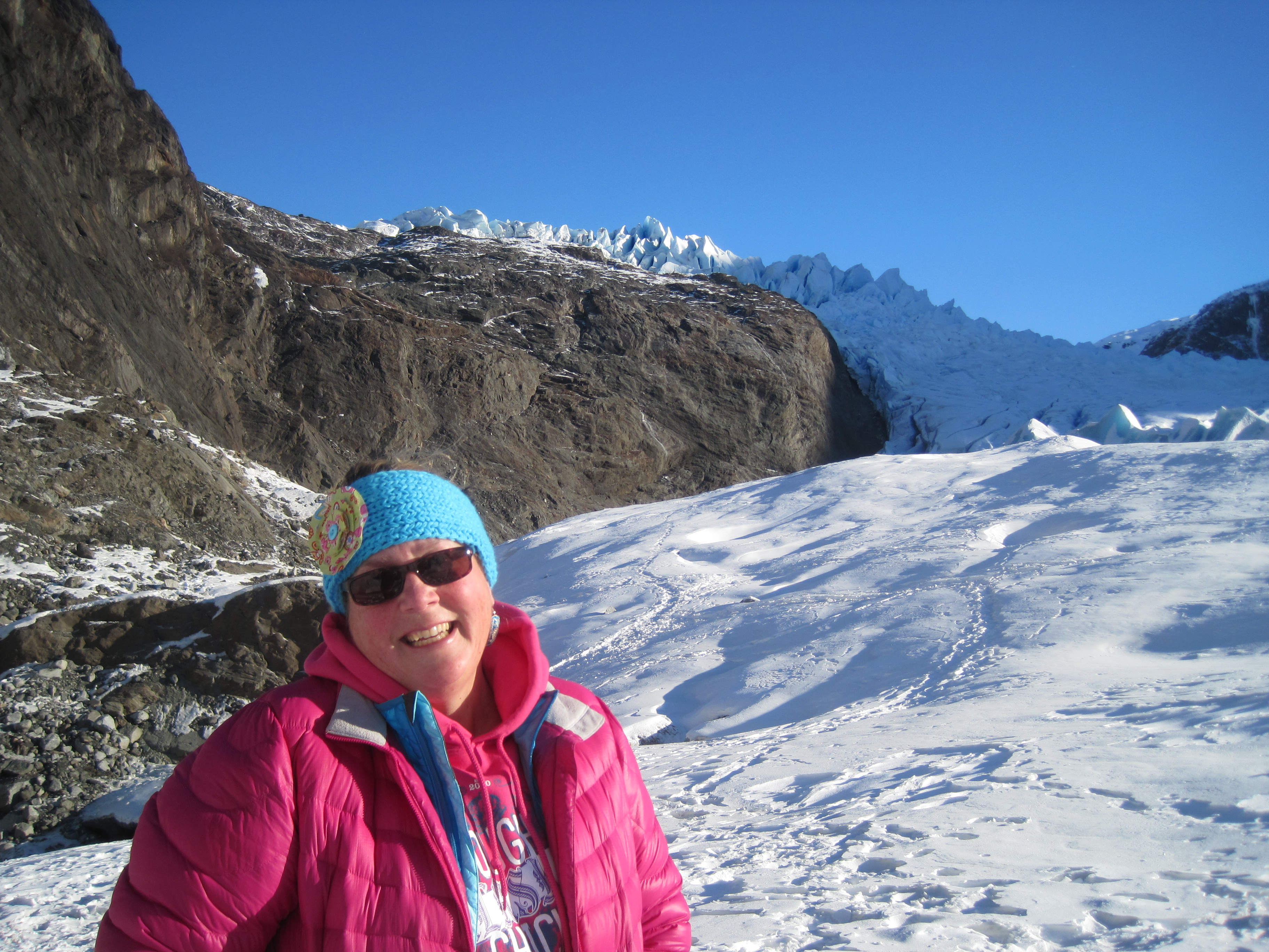
On Sunday we headed up the Bogus Ski Area and went past the ski area up to the trailhead for Mt. Mores.  We hiked about 3.5-4 miles around the rim of the mountain.  It was quite warm, in the high 80’s low 90’s.  Too hot for this Alaskan, but not for Harry.

Hot hike up Bogus Basin outside of Boise

Hot hike up Bogus Basin outside of Boise

IMG_0217

highest point on Morse Mountain

We were then able to hit the brewfest in Nampa before heading to some other friends for the evening in Eagle.

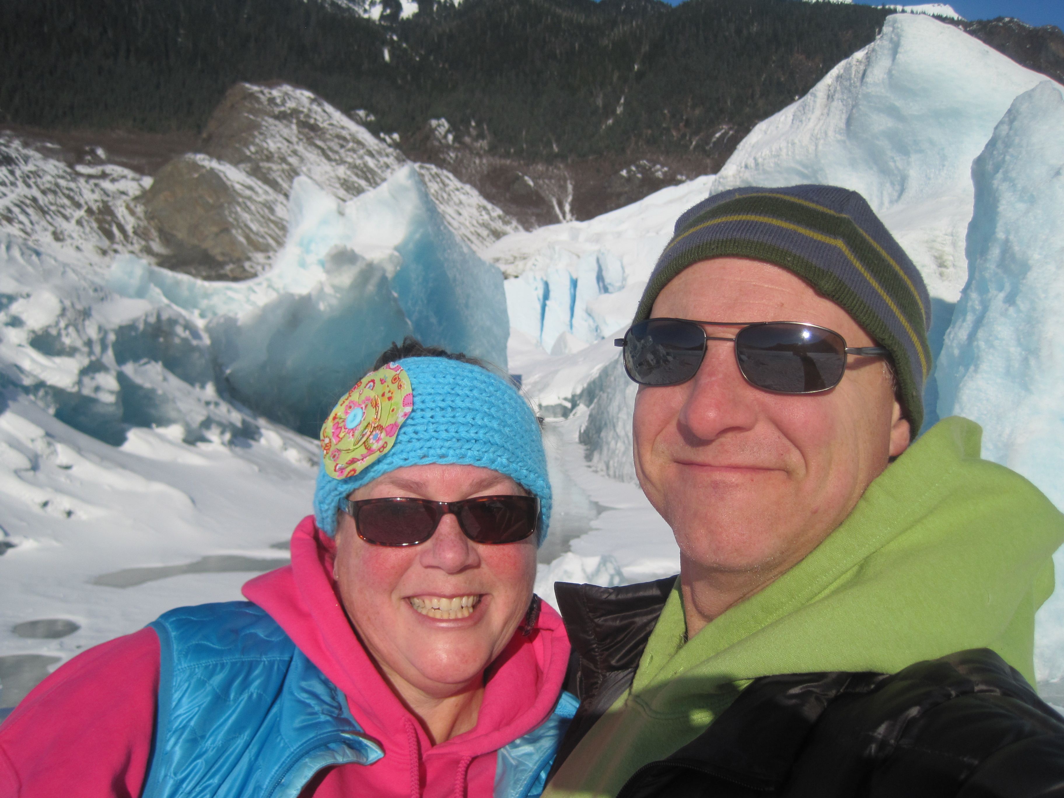
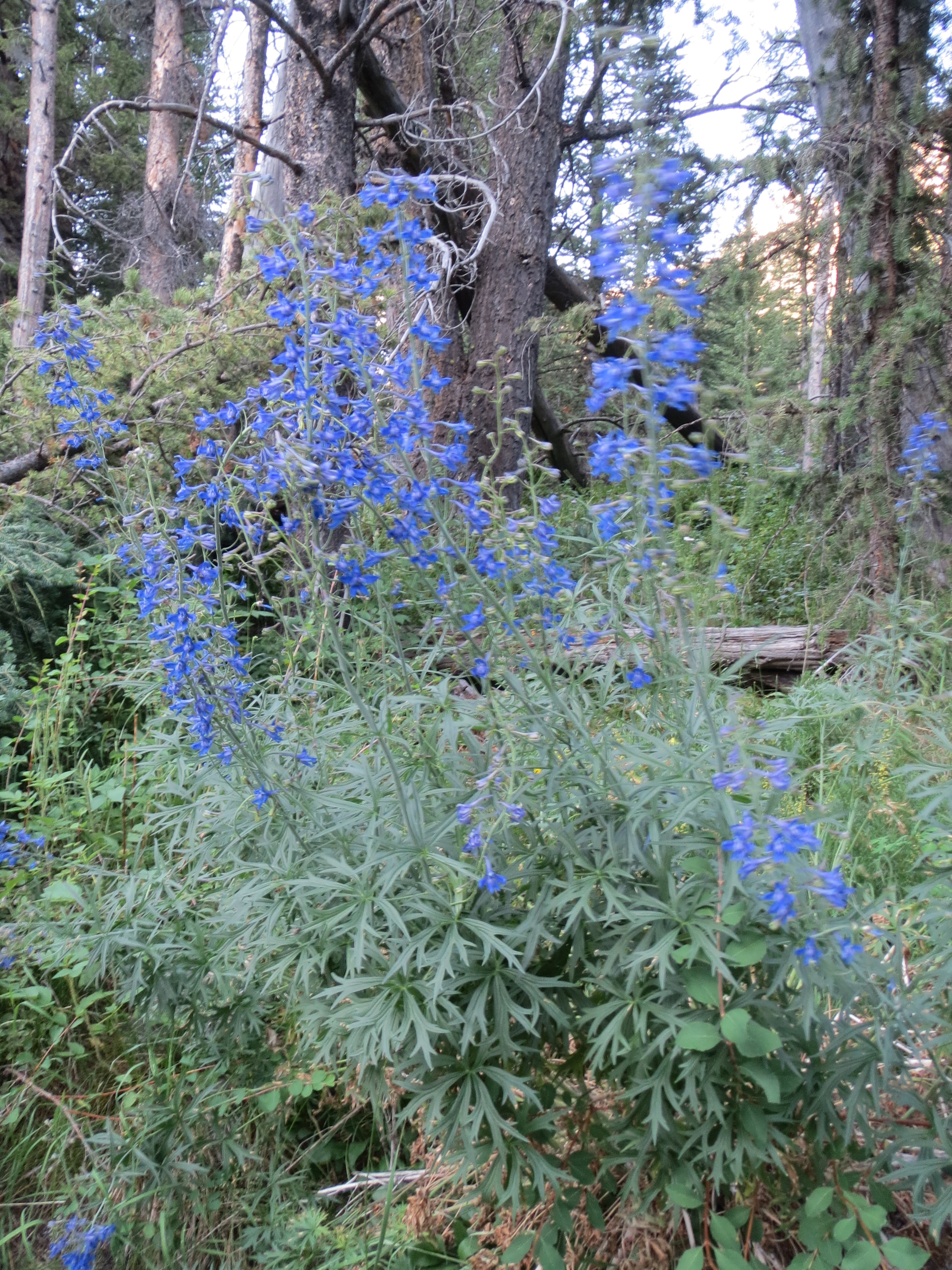
However, the real adventure began on Monday morning when we headed eastward then N up to Haley, Sun Valley and eventually into the Copper Canyon and Wildhorse Basin.

IMG_0247

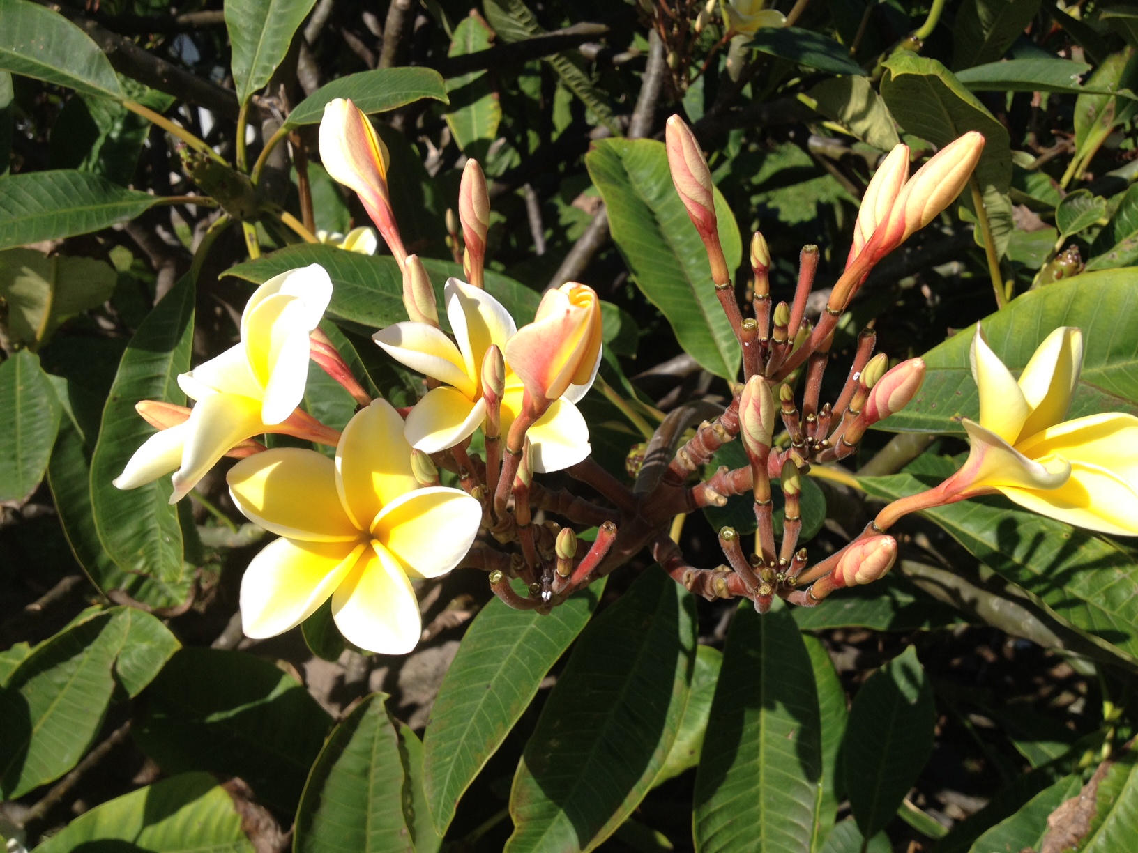
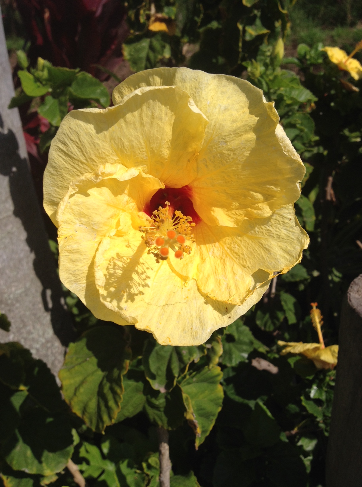
beautiful wildflowers

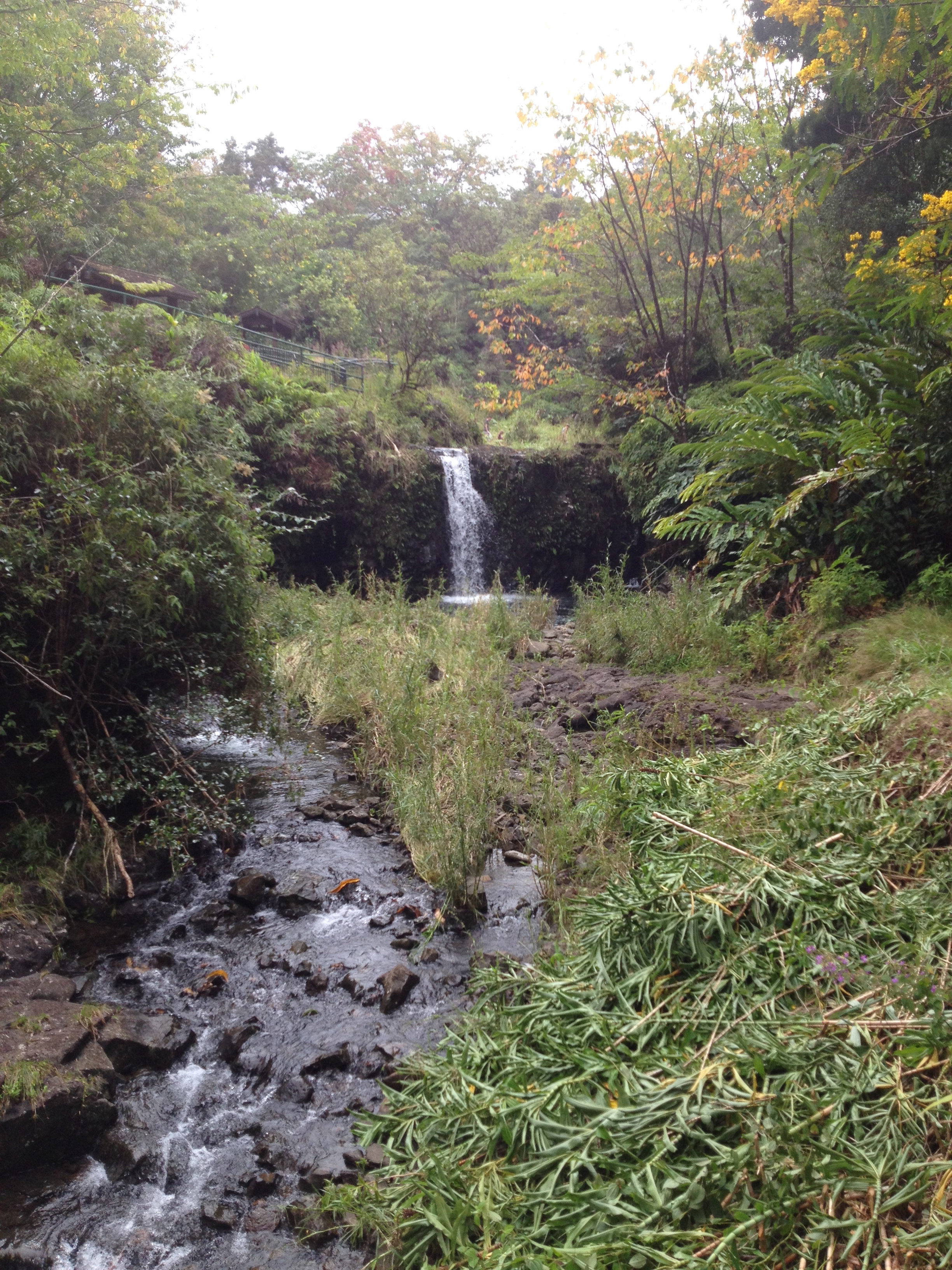
  Once we arrived to the Wildhorse Basin we knew we’d hit the jackpot of Idaho, and the fact that we’d been given an upgrade at our car rental to a Jeep, helped us quickly decide to take the remote road as far as we could.IMG_0229

IMG_0245

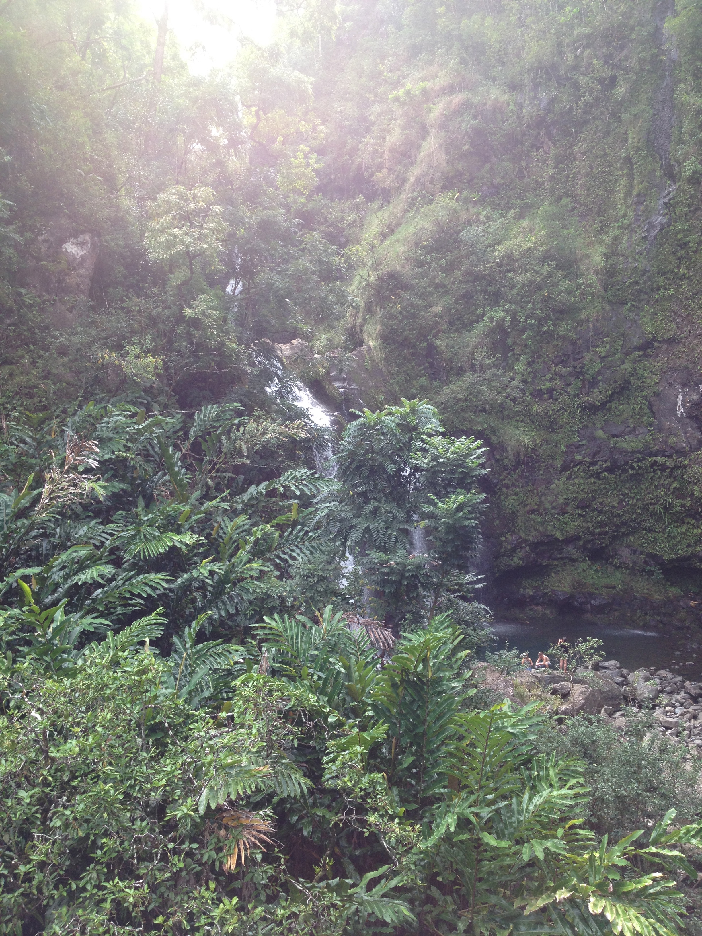
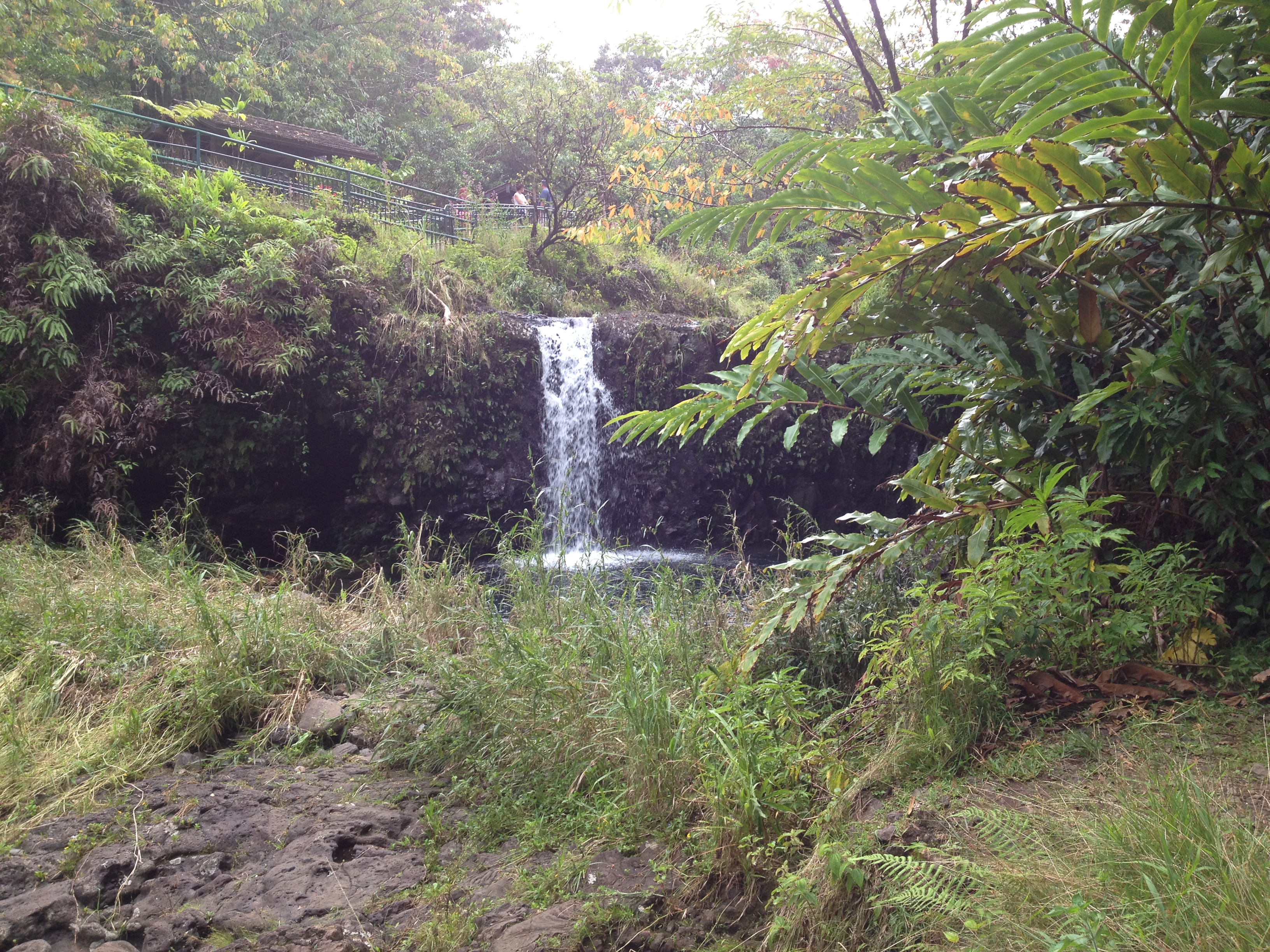
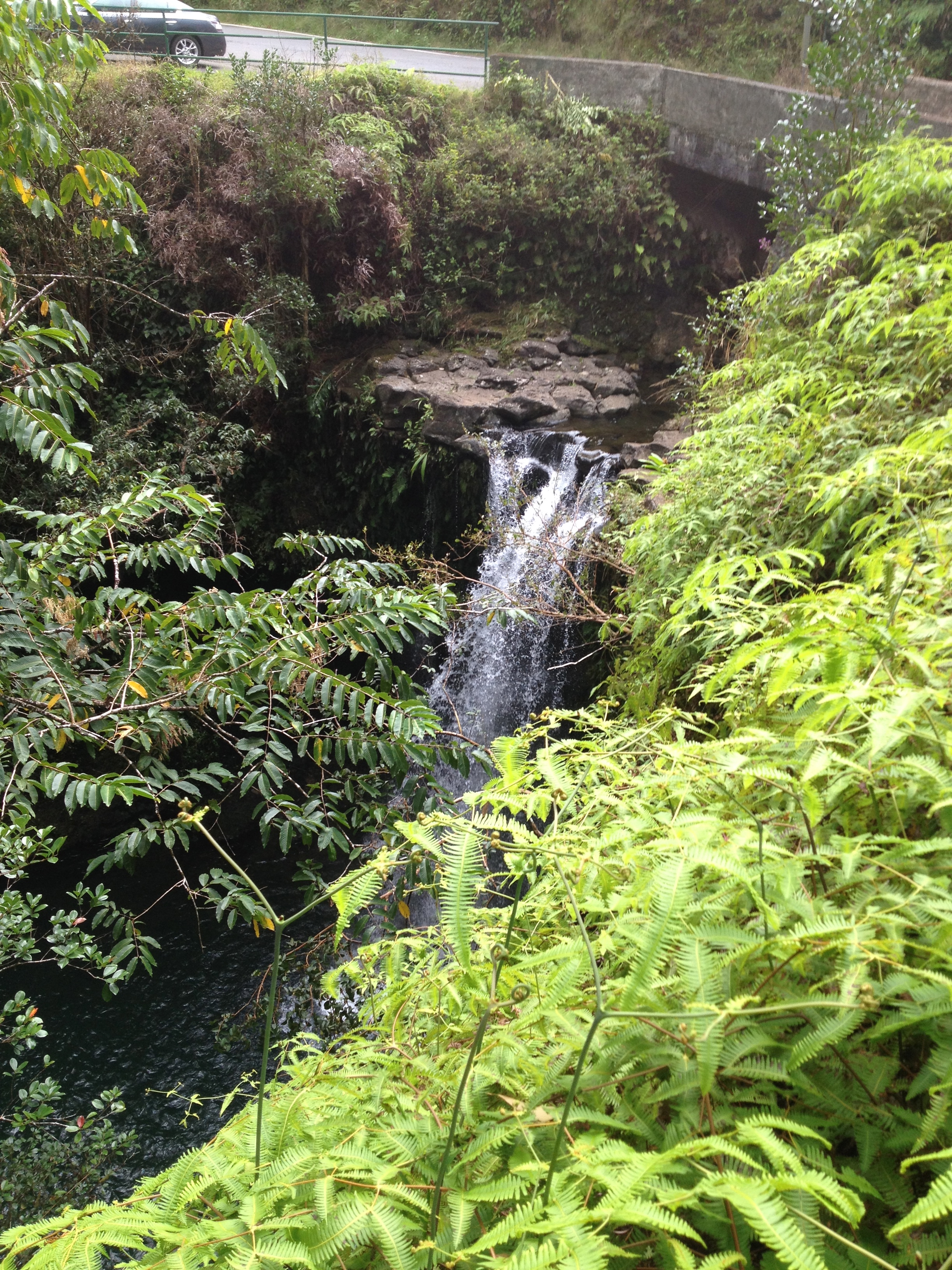
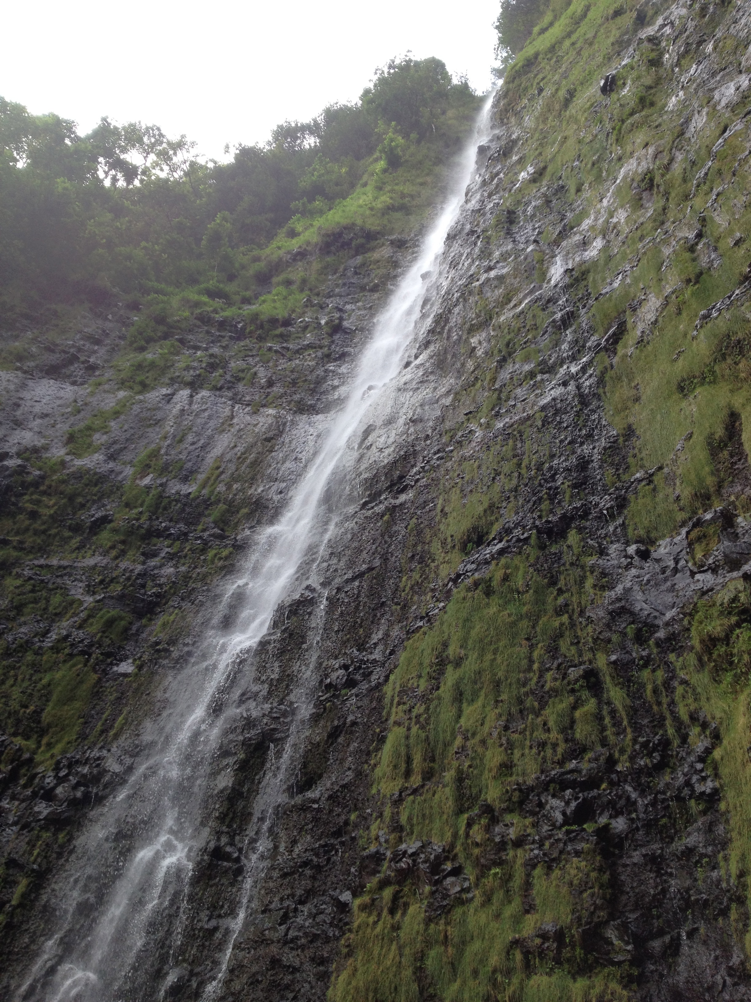
beautiful flowing falls

IMG_0249

need to look up what these were but they were beautiful

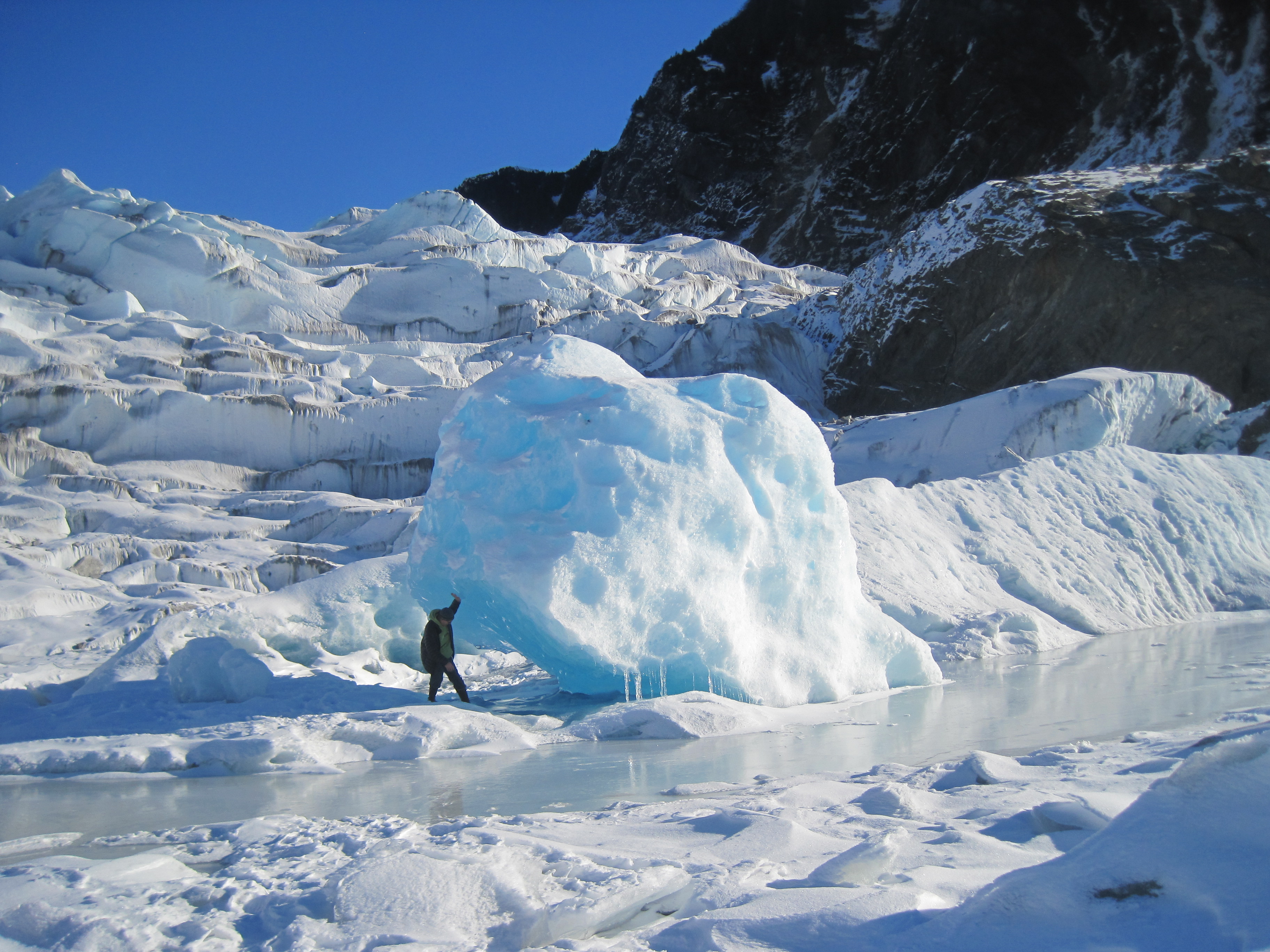
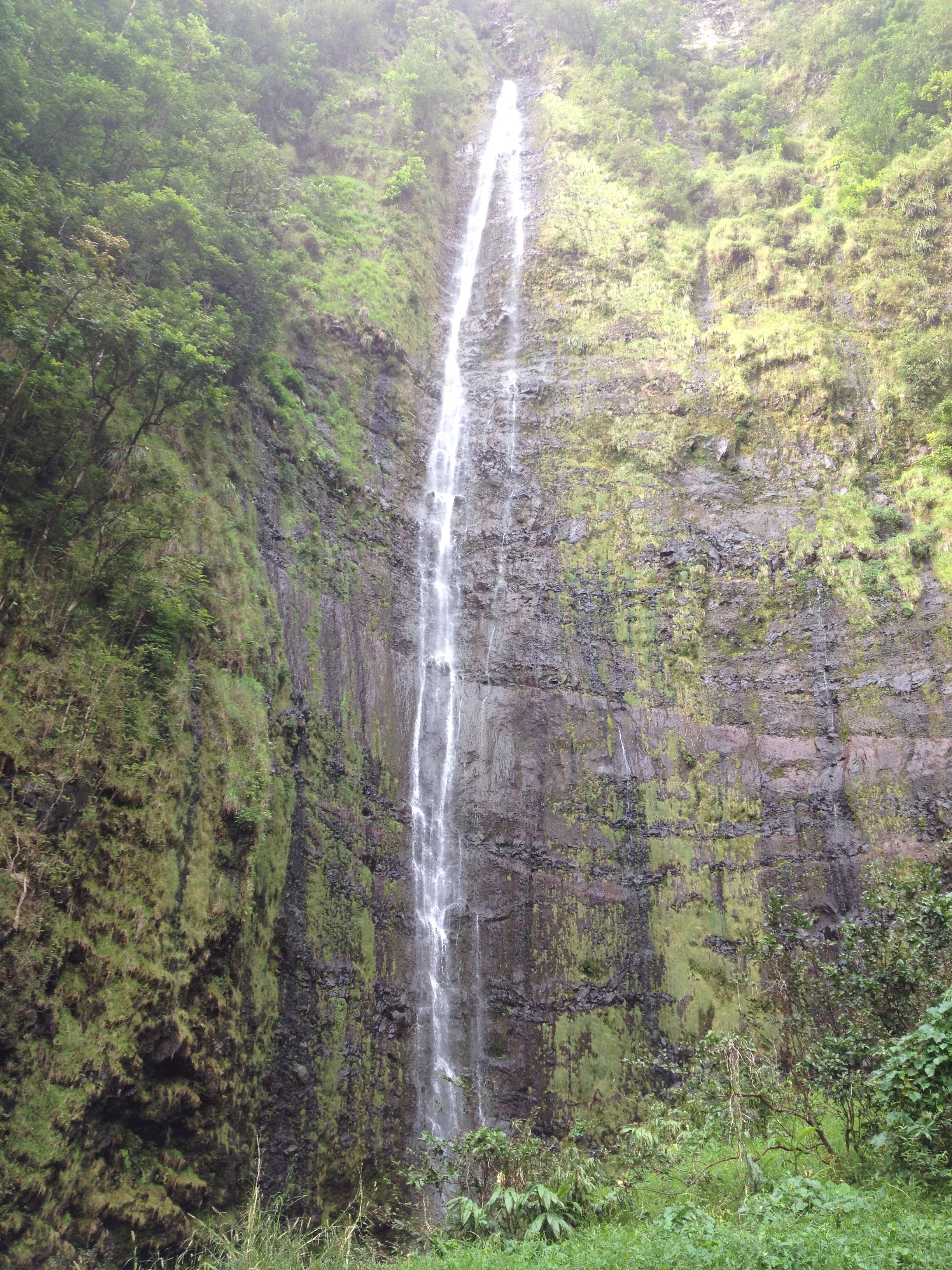
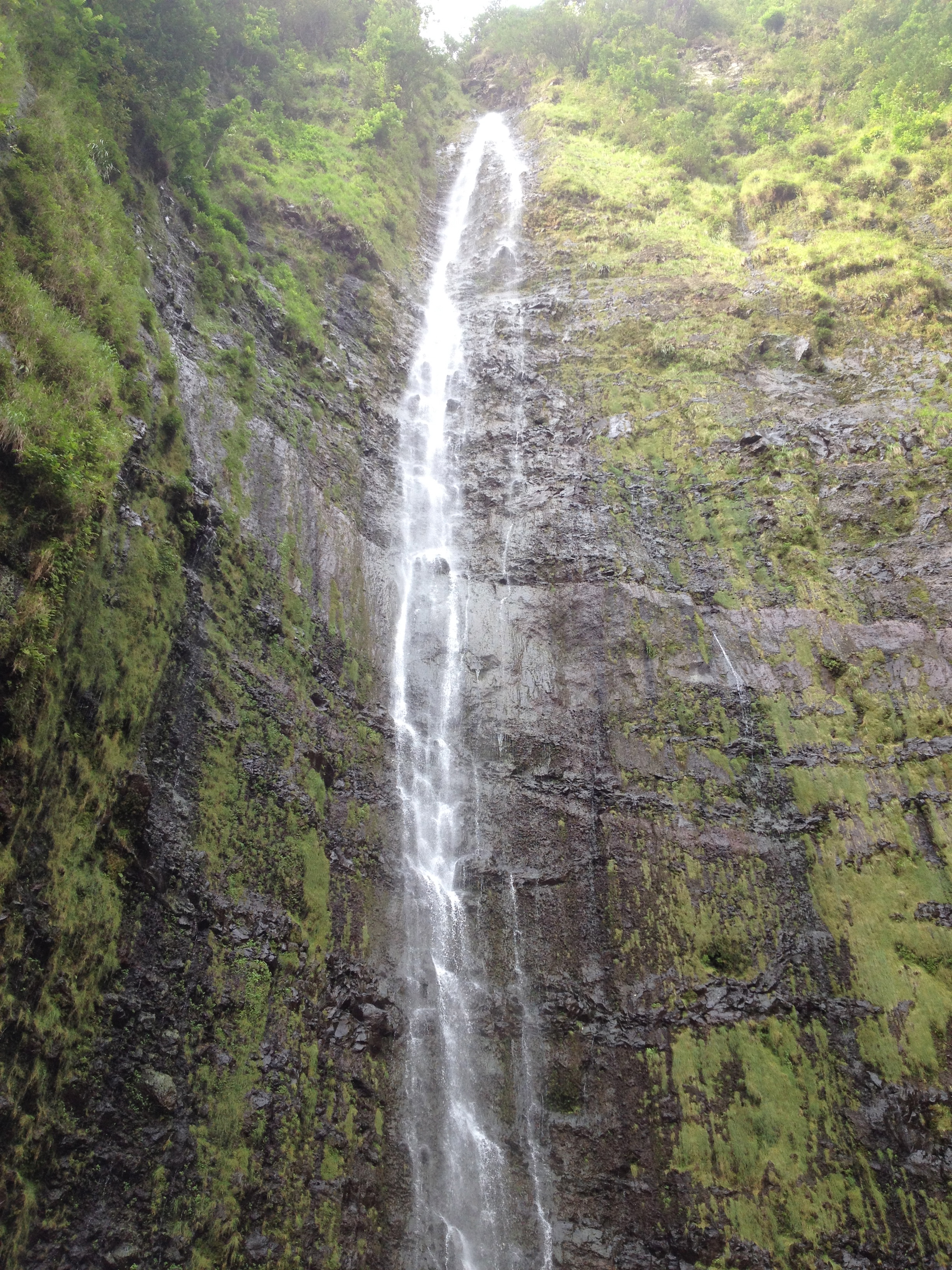
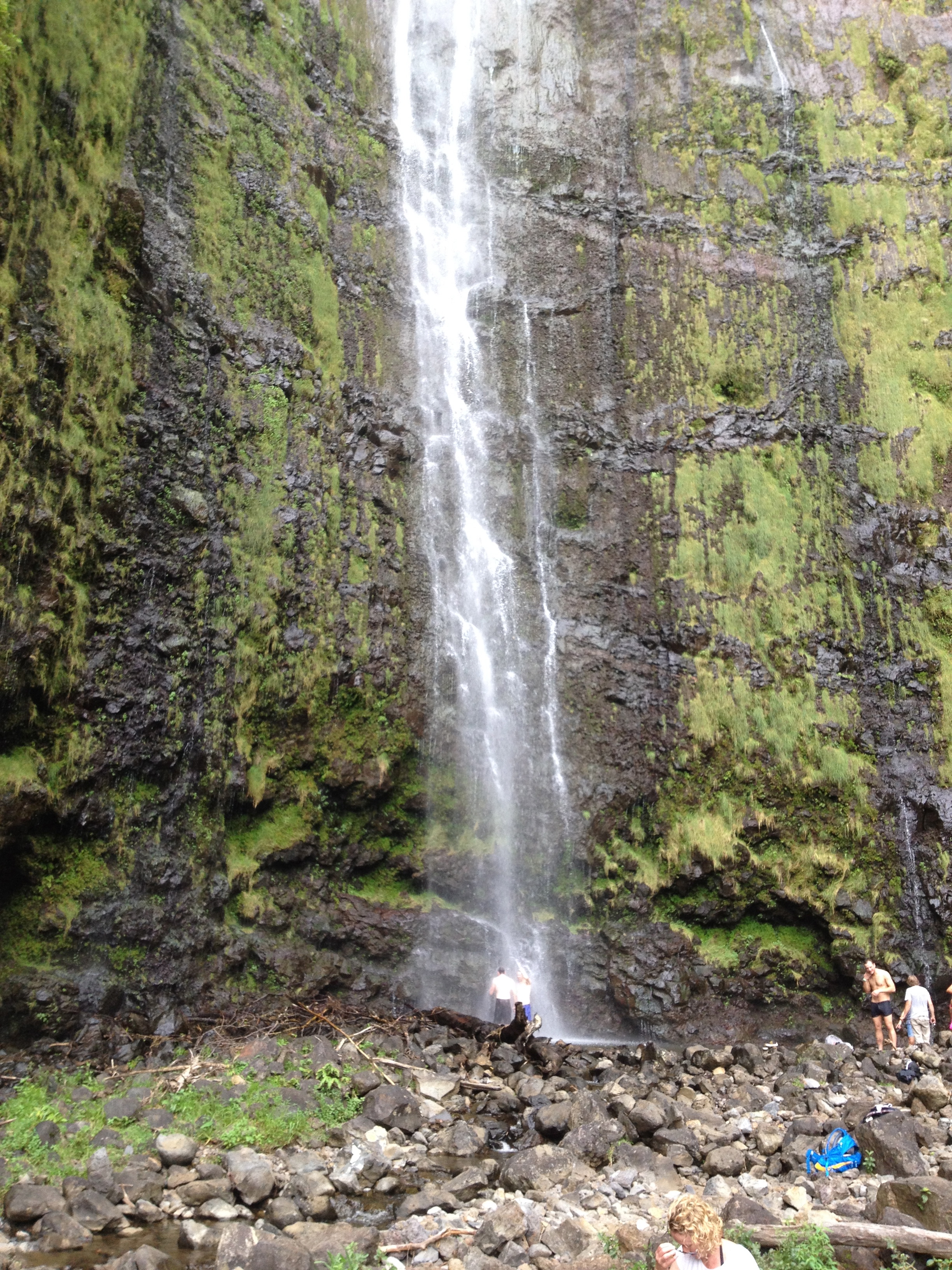
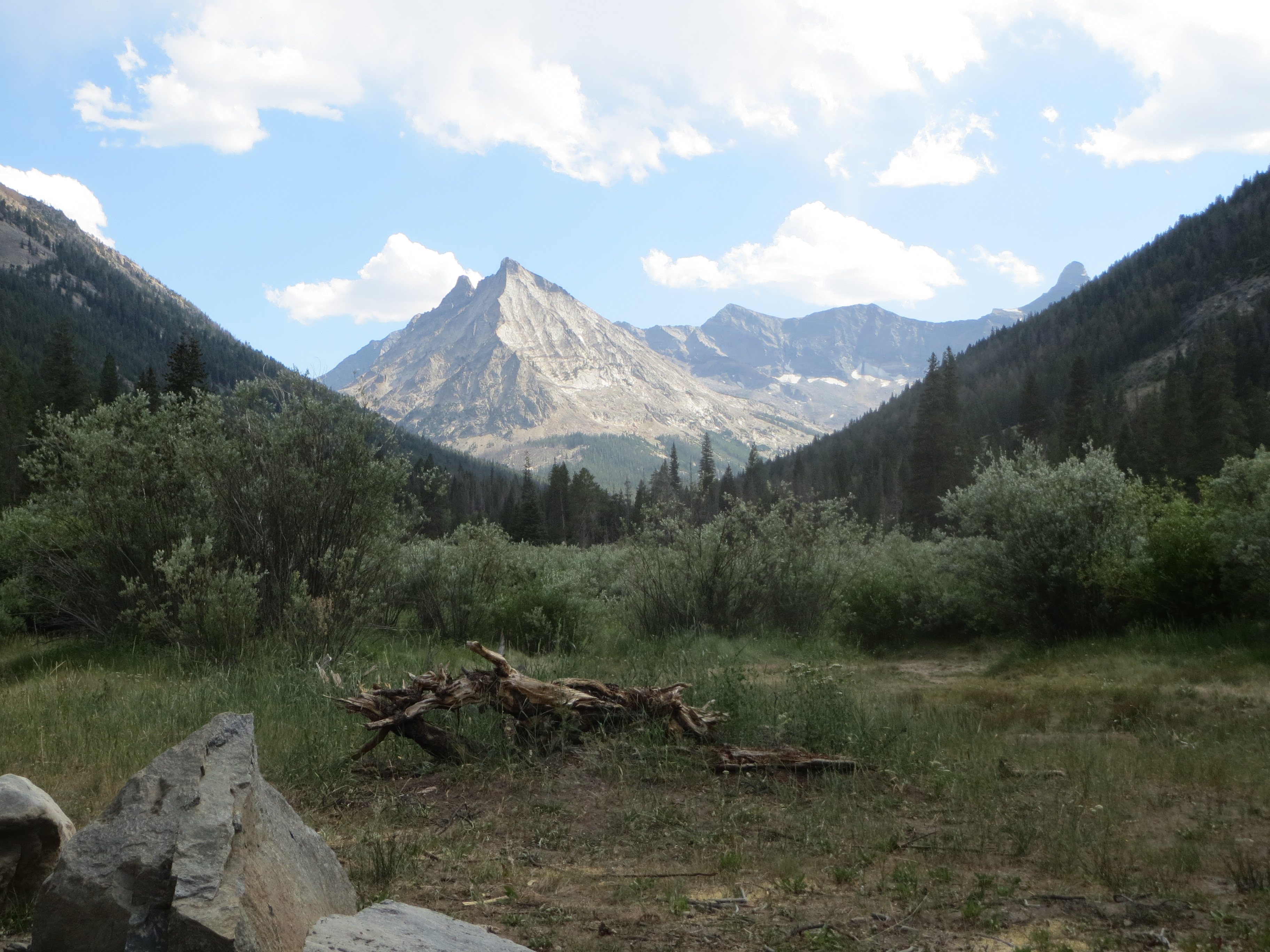
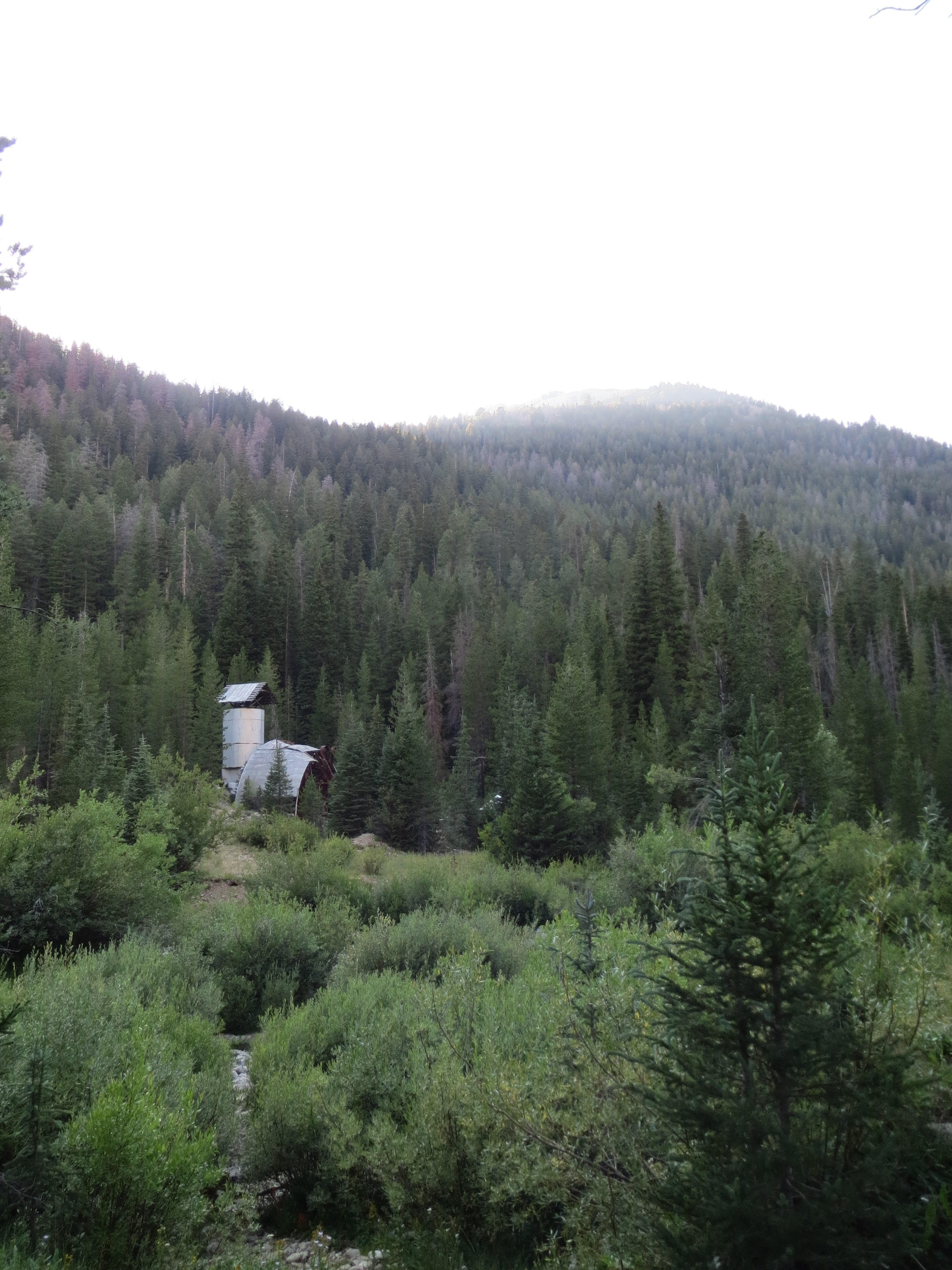
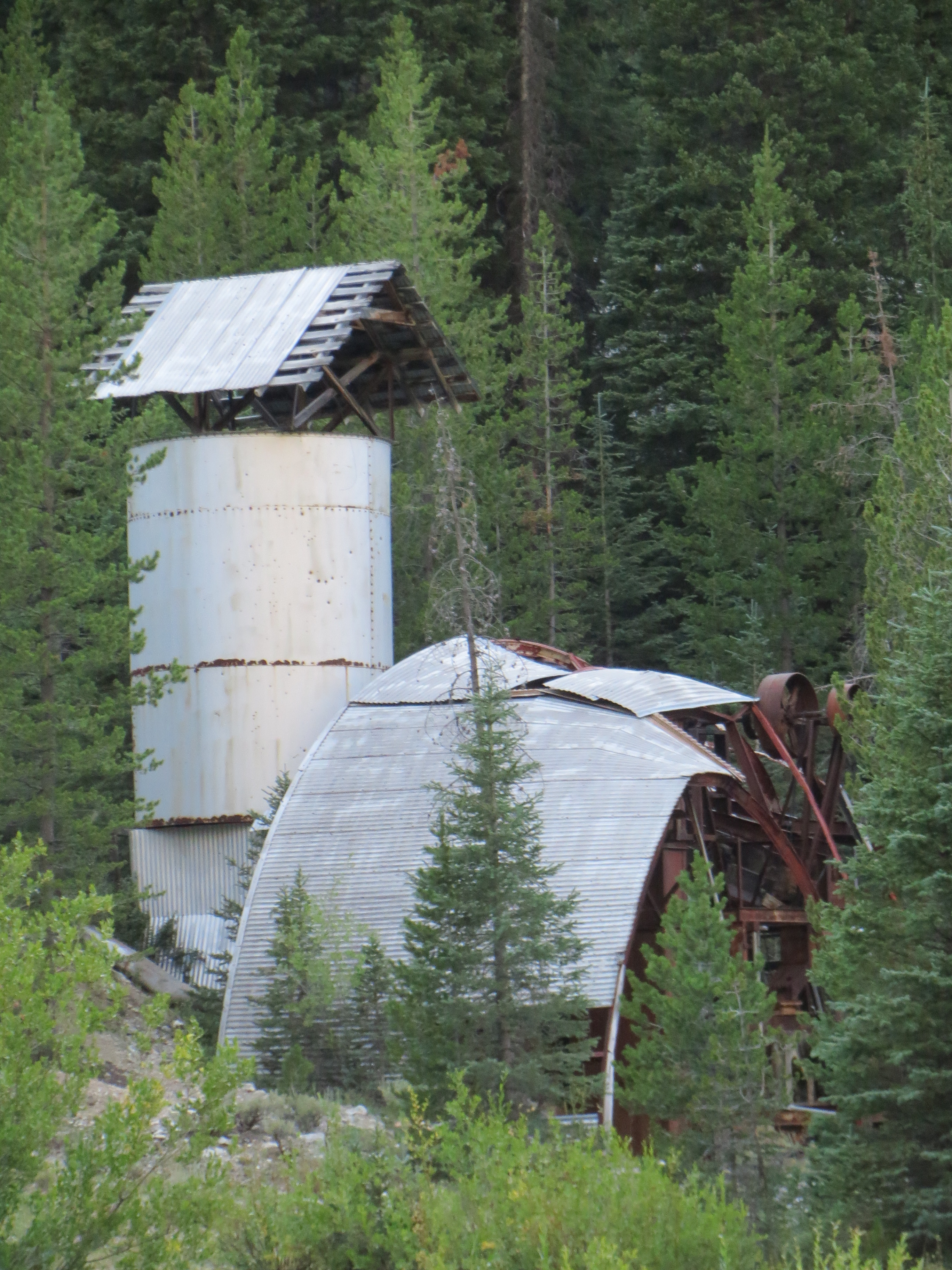
In the end it took us over  an hour to travel 3.5 miles.   The logging road we took seemed to be mostly traveled by ATV’s these days, but we made it in the Jeep!  At the end we hiked in about another mile or so and the valley was just spectacular.    On the way out we stopped and took some photos of the old mine.

IMG_0250IMG_0253IMG_0252IMG_0251

IMG_0238

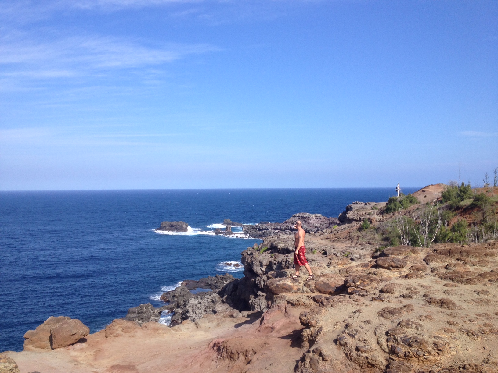
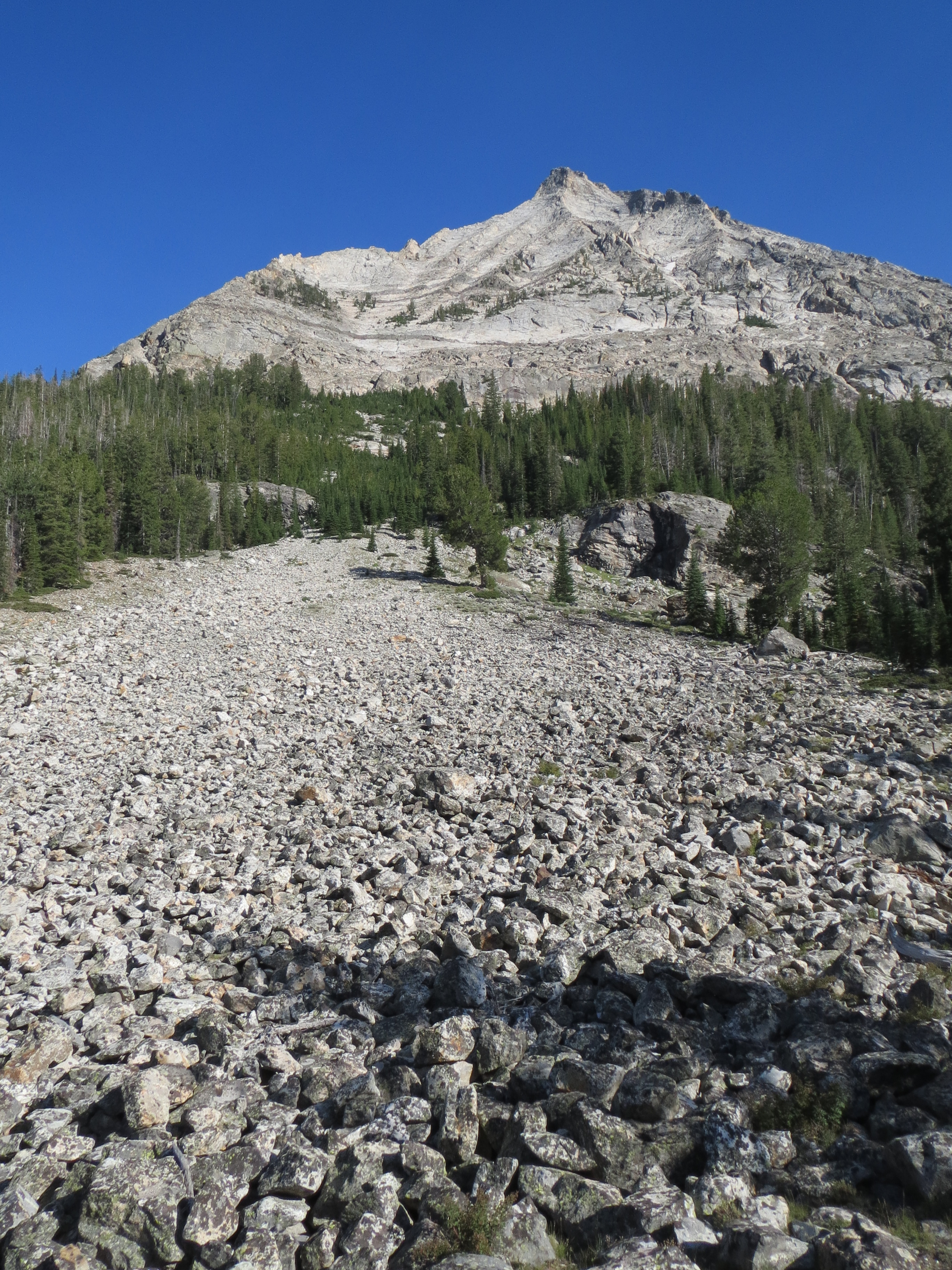
the peak at the end of the trail. Must have been at about 11,500-12,000 feet

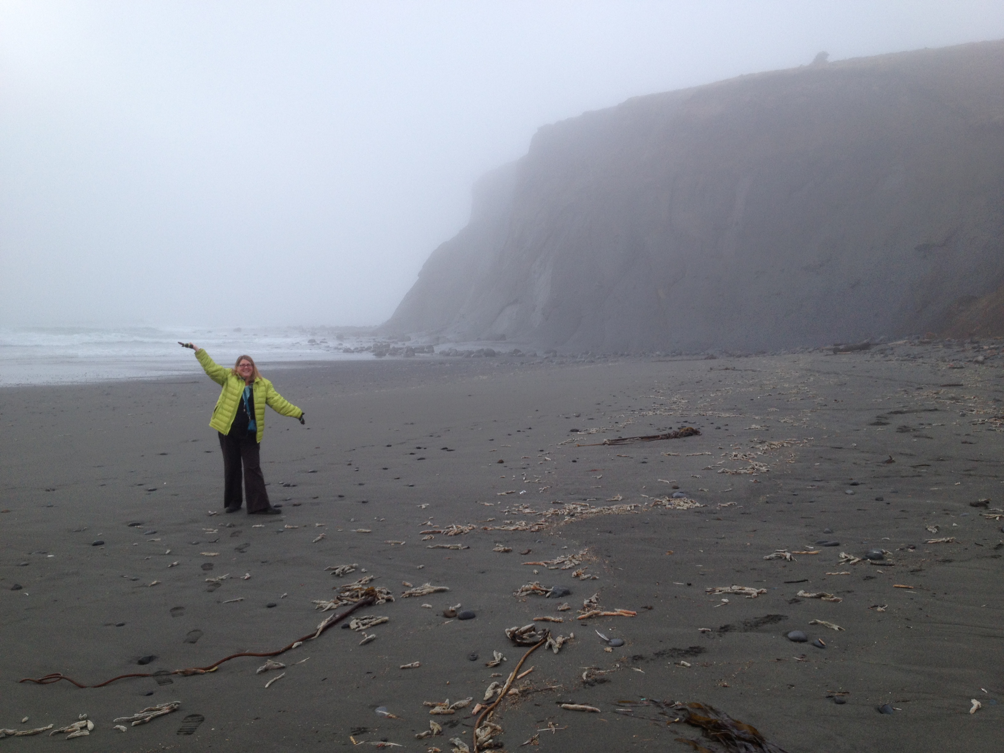
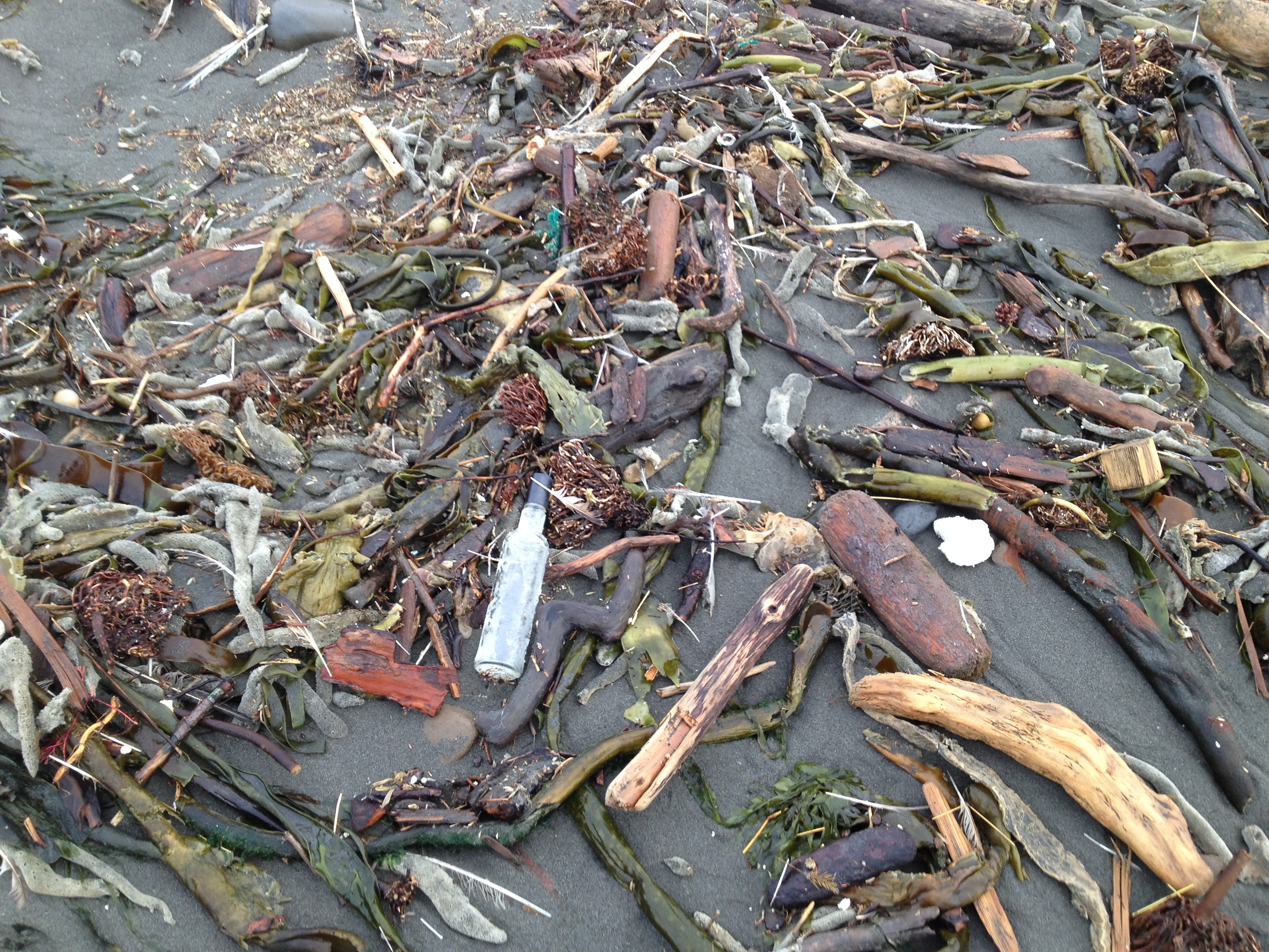
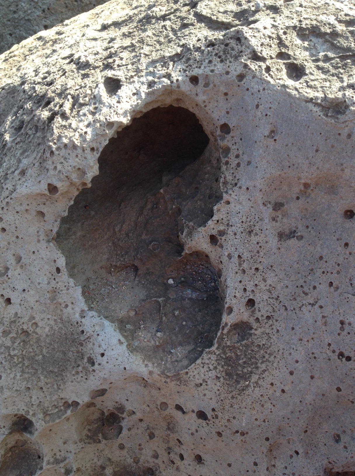
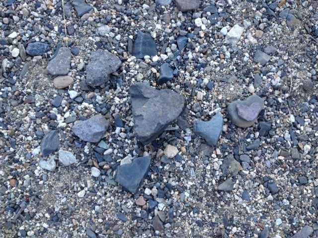
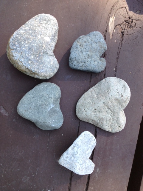
However, what both of us agreed to be the highlight of the trip was where we camped that night.  After coming back off the ATV road we decided to not camp at the campground, (there were only 2 spaces full, but they were the only 2 on the river) but rather to set up our tent on the riverbed.  There were so many “almost heart rocks” that we

heart

almost heart rock beach

decided to call our campsite the ‘almost heart’ site. IMG_0231

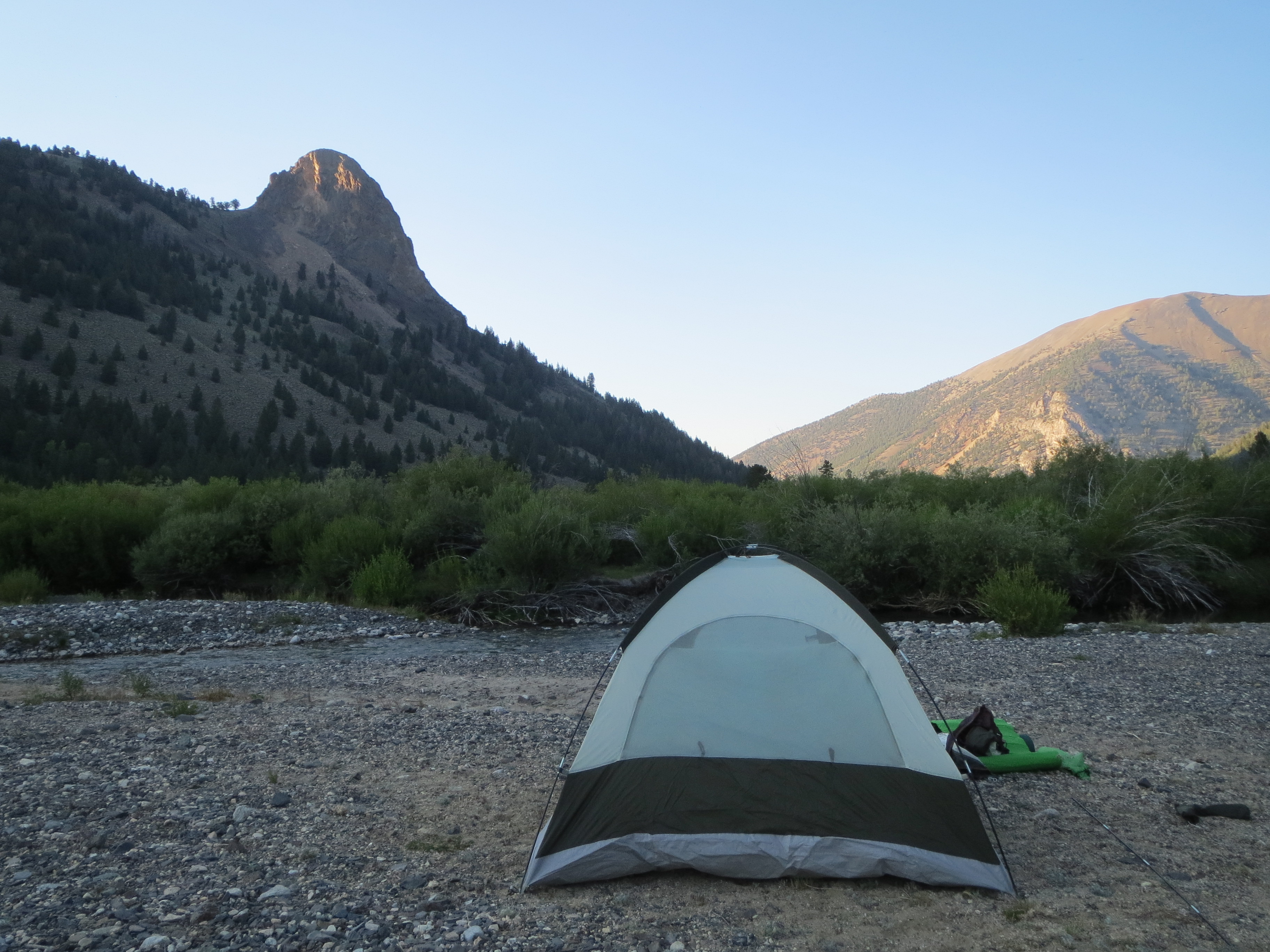
The sky was so clear that we saw more stars that night than we’ve ever seen, even more than on Mauna Kea (13,803 feet) in Hawaii.  It was spectacular.  We saw the Milky Way and many constellations as well satellites passing in the sky.  We could tell that with such a clear sky that it was going to be a cold night, but we never imagined it would get down to freezing but it did.

IMG_0263

the view from our tent

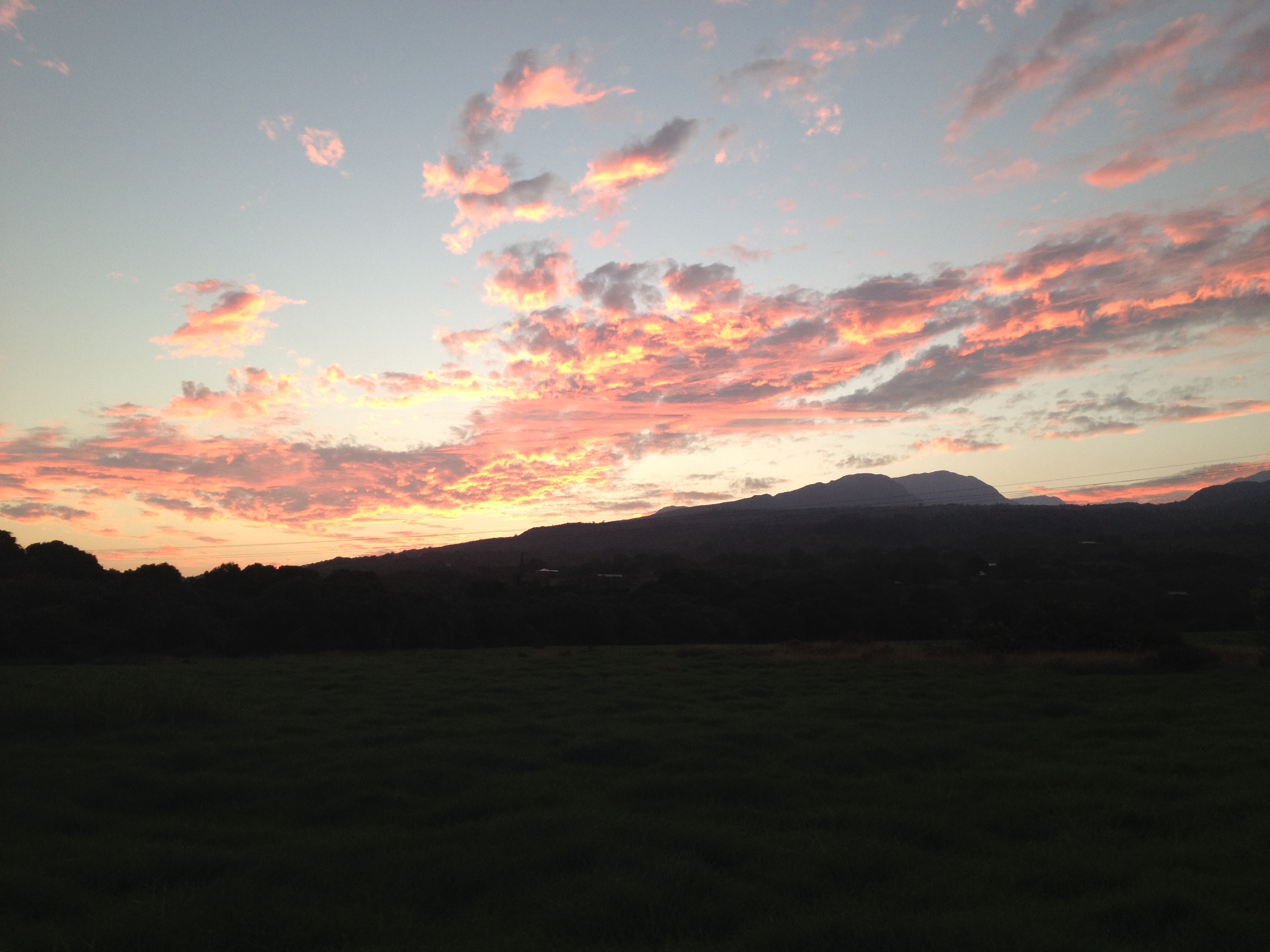
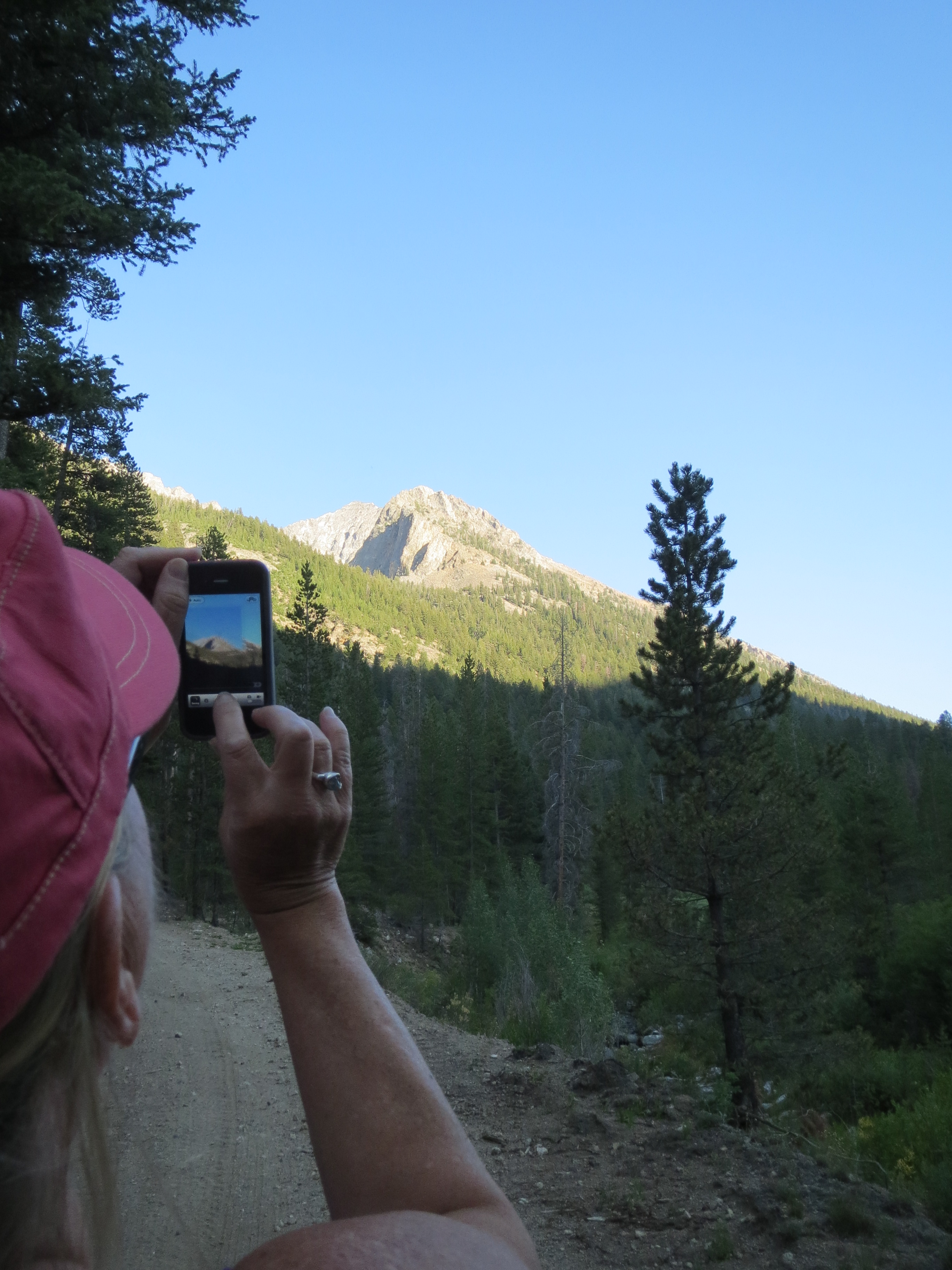
As we awoke in the morning we saw the sun rise over the mountain peak and knew we’d already had THE highlight of the trip.  But we continued onward.  We drove the loop through Copper River Basin, which was also worth the time.  Eventually we made it back to Sun Valley by noon and continued our adventure toward Stanley.  Everyone had told us we’d love it there but neither of us know what to expect.IMG_0256

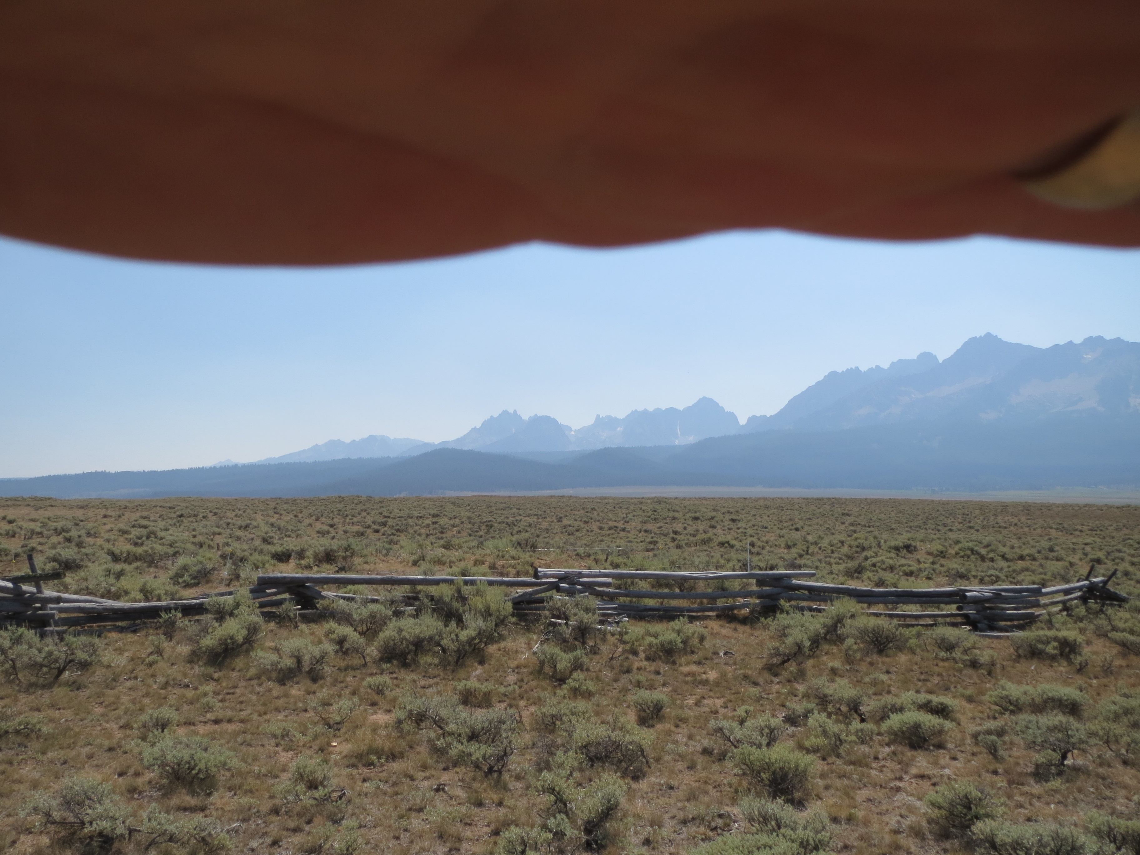
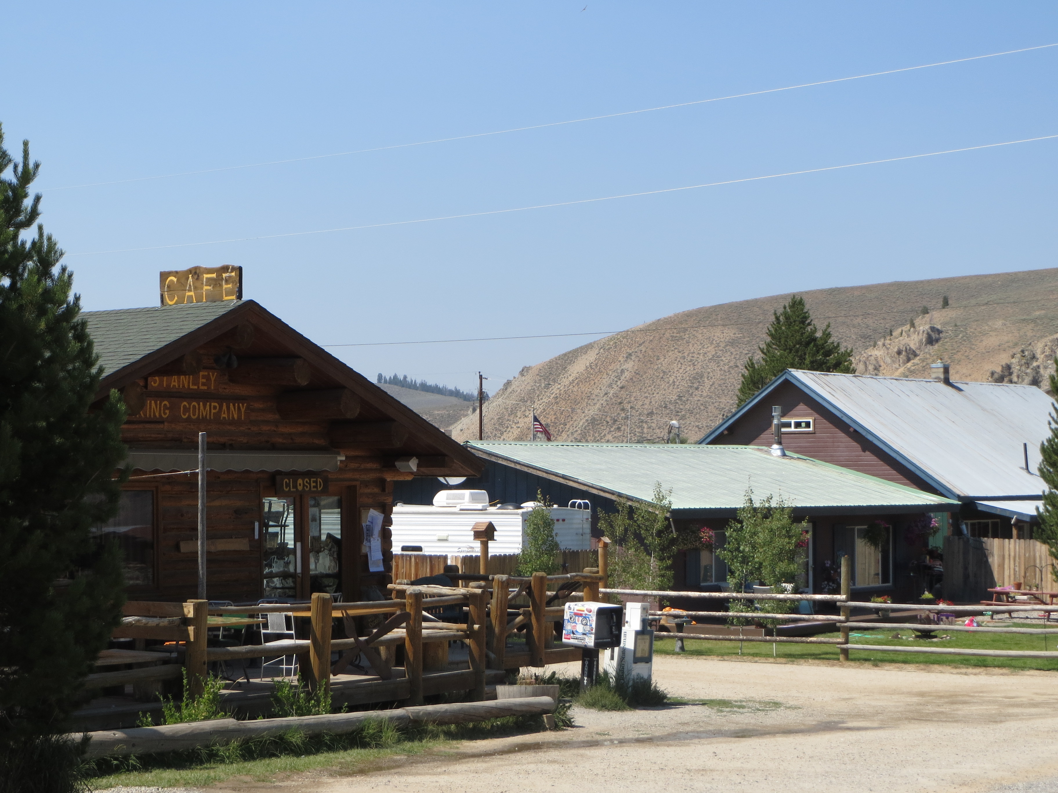
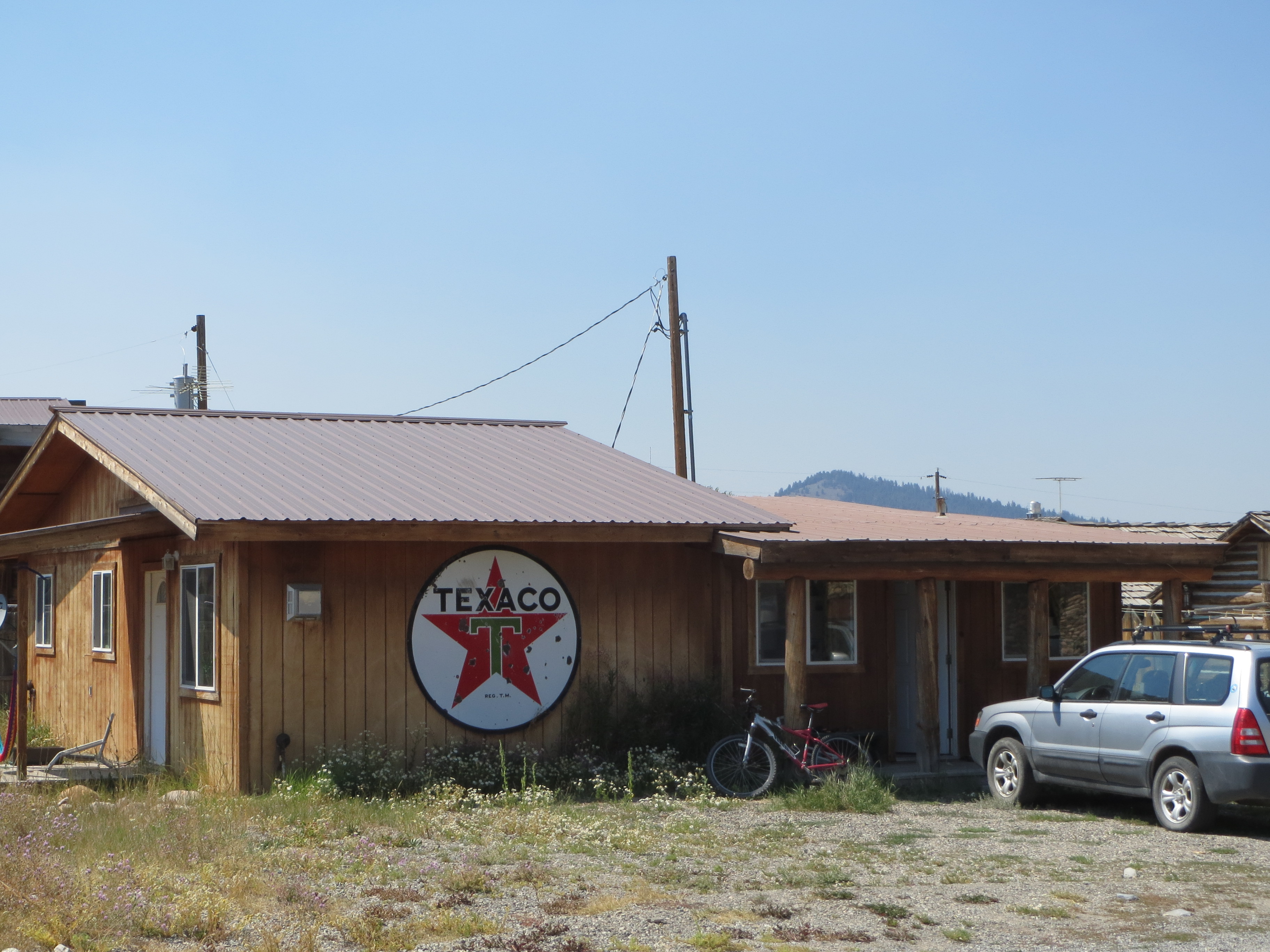
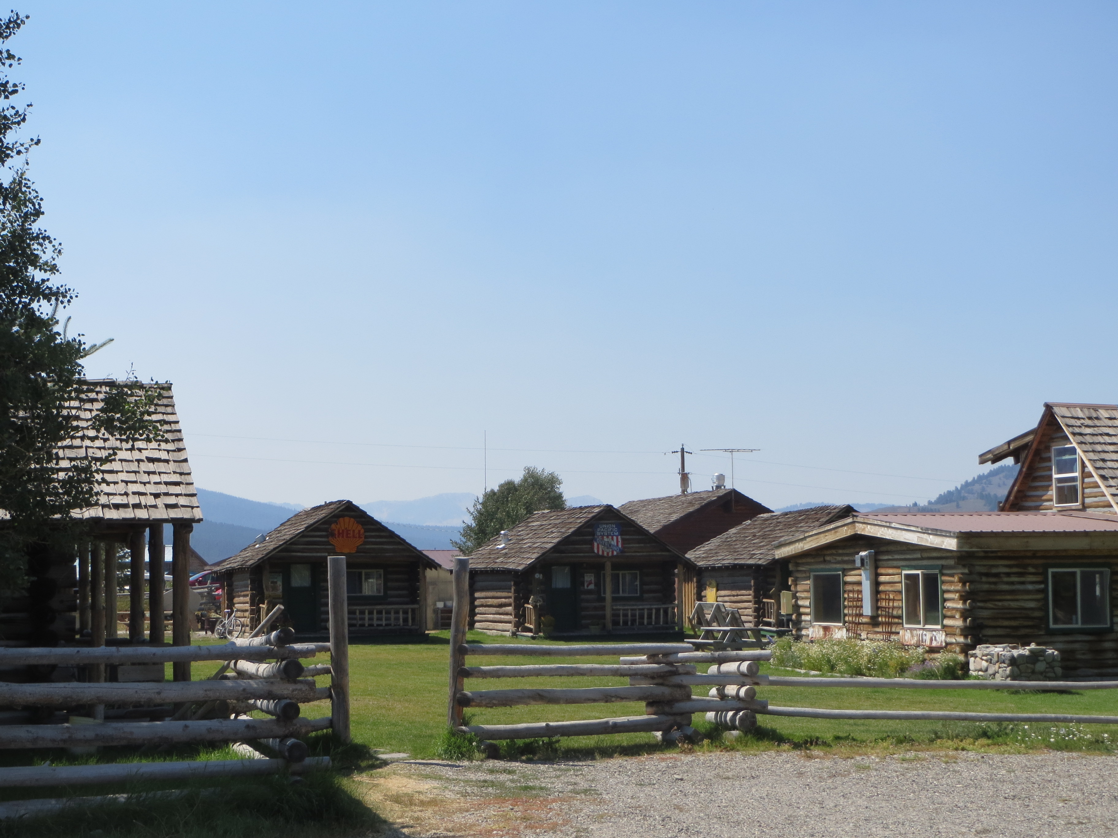
It was a quaint little town, almost like one of the ghost towns in N Arizona.  It also reminded me of Nenana, AK or any smallllll town USA.  There was the main road through town and about 3 turn offs, making it easy to see all of town.  We ate pizza for lunch, filled up with gas and stopped at the visitor center.  The woman told us that the area we wanted to visit had a recent fire and that the ‘scenery’ wasn’t what it used to be.  Hence we continued to another location.IMG_0294 IMG_0305 IMG_0306 IMG_0308 IMG_0309 IMG_0310

heart2

the heart rocks at the hot springs camp site

hot sp

harry enjoying the hot springs.

Eventually we ended up in Bonneville Campgrounds, established in the location most likely because of the natural hot springs that were about ¼ mile from our tent.  We enjoyed them both in the evening and again the next morning.  It was perfect for both of us because Harry could sit in the HOT area and I could lounge where the hot water met the cold river water creating just the right temperature for me!

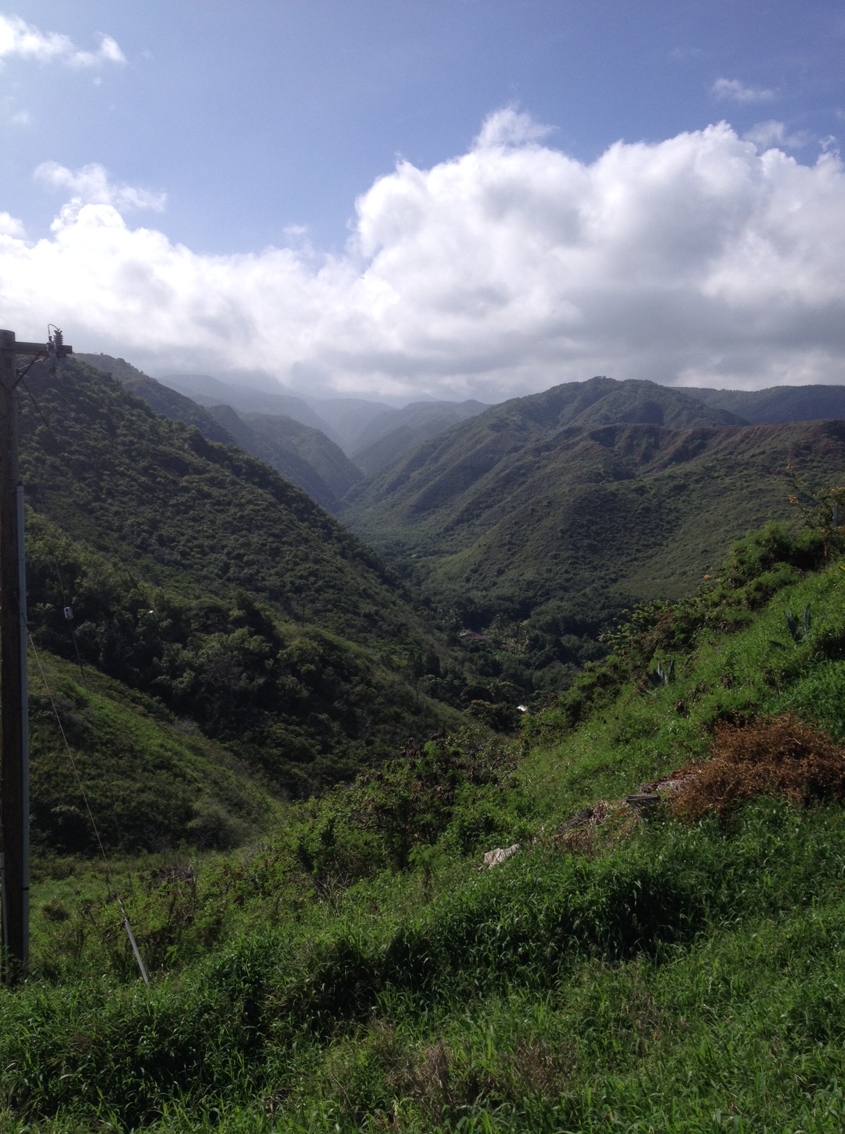
That day we drove a scenic route through a gorge headed towards McCall.  It again was magnificent.  We kept commenting on how nice it would have been to have our motorcycles for this trip.  We followed a river towards the west and then another one North.  The one that was flowing south as we drove north had amazing rapids and turbulent waters, very pretty.

We arrived into McCall right around the time we could check into our condo.  We quickly found the brewery before Marcia came to take us to their house on the lake, the gathering spot for the reunion.

hike mc2

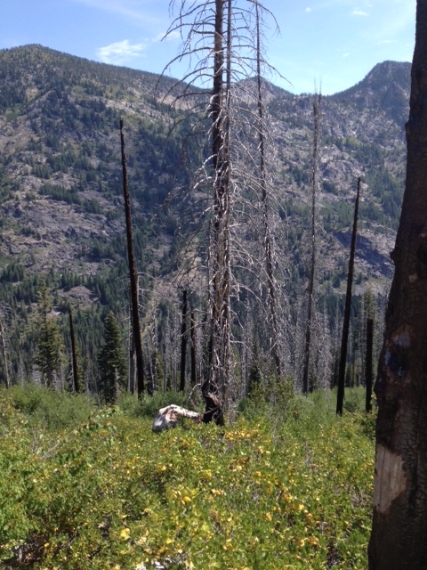
there had been a fire about 18-20 years ago

The next few days were full of family, fun, laughs and memories. hikemc

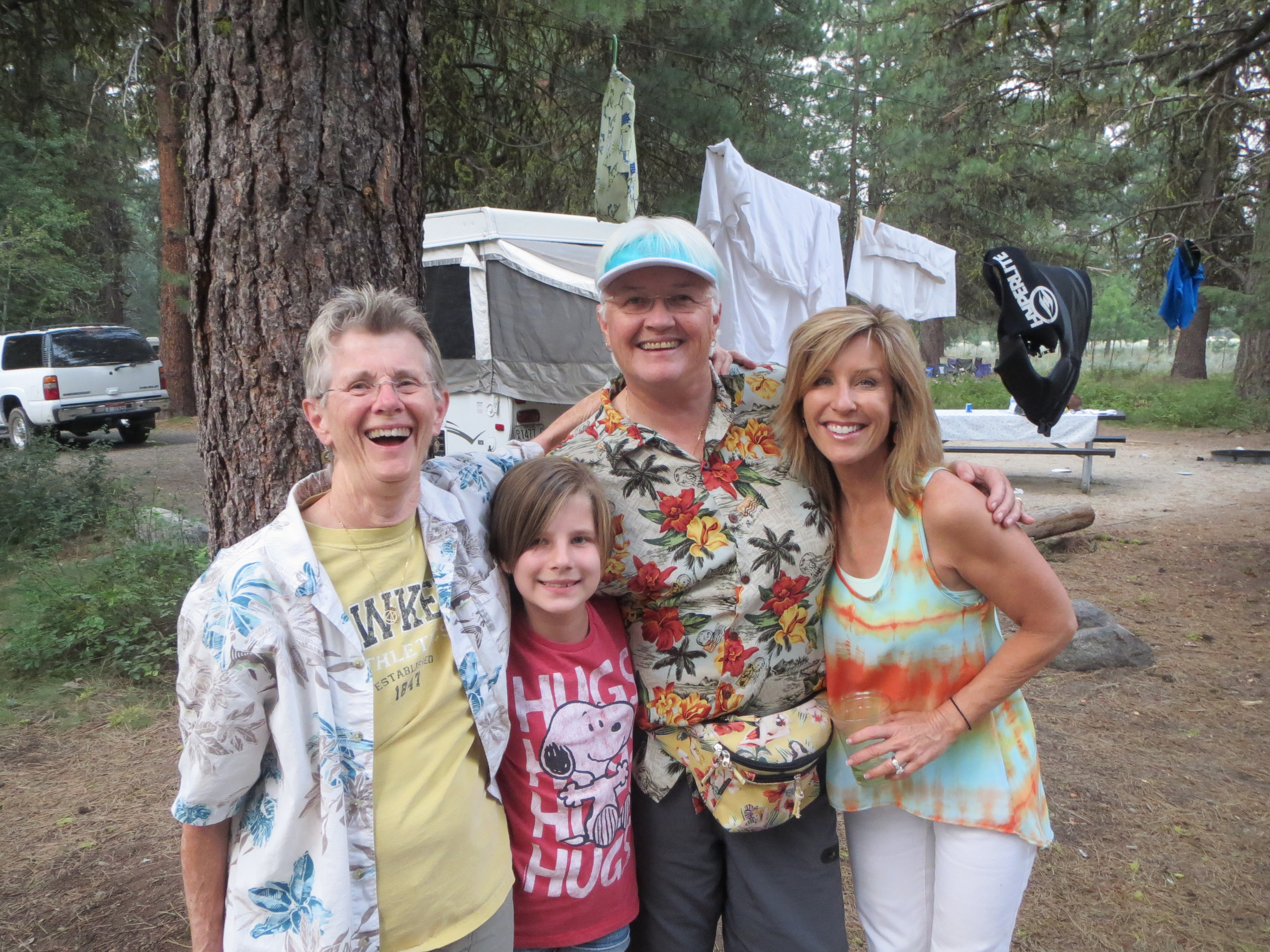
Harry and I hiked up to Canyon Lake, it was steep and it was hot, and combining those elements with the high elevation, I was pooped!  We also canoed with John/Liz and Michael /Debbie down the river for a few hours, another fun adventure.    Sharing the condo with April, Carol and the twins Jason and Morgan was also a blast.

IMG_0339

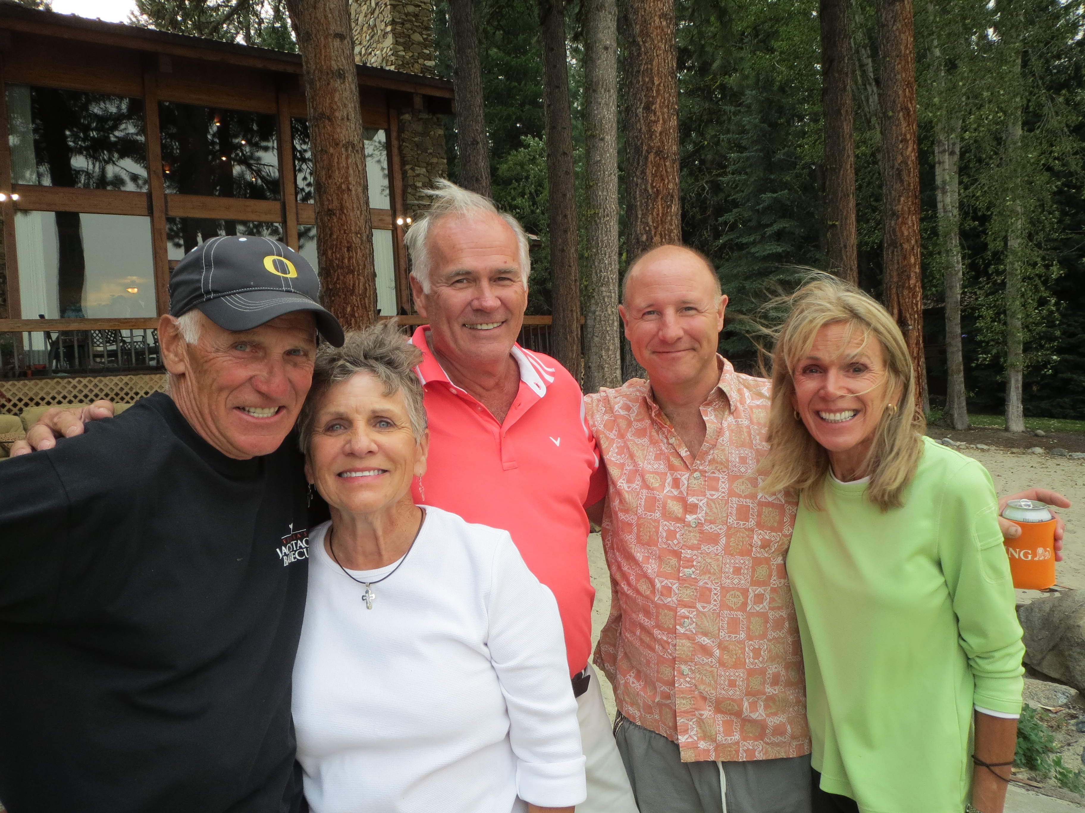
the Tullis kids, Tom, Marcia, John, Harry and Karen, we missed Jim, Kathy and Jack

Thursday night the family had dinner at the pizza place, Friday night everyone brought things to BBQ and we ate at the house on the lake and Saturday night most everyone gathered at Tom and Ann’s (+family_) campsites for more BBQ fun. IMG_0419 IMG_0431

We missed those not there, but hope to see them all at the next gathering.

4 Comments »