timistravels

My job allows me to visit a lot of Alaska on a yearly basis. I wanted to capture the trips in one location!

Iao Needle~ Maui

IMG_1585

it was a beautiful day for viewing the needle

IMG_2709

there are short trails around the park but NO hiking trails

IMG_2704

sunshiny day

Each time we visit Maui we are in awe of the stunning, lush valleys that you can find on the island.  One of our favorites is the one that houses the Iao Needle.  It is easy to get to from any where on the island and only costs $5 / per vehicle to enter the park.  One of the bonuses of going to the needle si that you get to drive through historic Wailuku, one of my favorite communities on Maui.  It is a lush region with a lot of the island’s history.  The Iao Needle is 1,2oo feet tall and is a lush green rock outcropping that rises above a local river to an elevation of 2250 feet.

IMG_1589

this is looking back towards Wailuku and the ocean. You can see how far up the valley we were

Kuka’emoku as it is known in Hawaiian is an “erosional remnant.  It is at the end of a ridge comprised of denser dike stone.  The softer rock around the dike stone was eroded by steams and waterfall” reads one of the informational signs at the site.  IMG_1599   IMG_1598

This area is beautiful and full of history in this area.  In 1790 there was the Battle of Kepaniwai.  The needle was a lookout point for King Kamehameha as he beat the Maui army; changing the course of history on Maui.

Last time we were here, the needle was in a fog/cloud as it gets a lot of weather changes in this area, but this visit was perfect, it helped that we went early.

1 Comment »

Pohaku Park (aka S-turns); Two Turtles Sunning Themselves

On all our visits to Maui we had not stopped at the Pohaku Park before (just down the hill from Maui Brewing Co Restaurant) but someone said I might be able to find some beach glass, so we went to fine it.  During the walk  I only found 3 smallllll pieces of beach glass but we had a better experience!

As we approached one end of the beach (it is broken into 2 parts in a way, divided by big lava rocks) we watched as a turtle walked out of the water and walked to the corner of the cement wall where he decided to nap.  We had to run back to the car for the cameras because we didn’t bring them on the glass search.  IMG_2731

We knew we had to keep a significant distance and we tried not to bother him.  IMG_1619

After pictures we decided to explore the other half of the beach and to our excitement there was another turtle that had beached himself to get some sun and rest.

IMG_2745

this one was asleep quite quickly

Enjoy the pics, I know it was a great experience for us.   IMG_1626 IMG_1628    IMG_2740

Leave a comment »

Maui’s Honolua Bay (snorkeling) and the Blow Hole; Fun plan for a day

no fin

poor turtle had only one front fin, but it didn’t seem to bother him

IMG_1610

this is from above looking down on the cover; this is the view on the way BACK from the blow hole

On our ongoing trips to Maui we have discovered that a drive around the NW end of the island is a must.  We try to snorkel as much as we can while we are here and today’s snorkel was one of the best ever and it occurred in Half Moon Bay.  Turtles, moray eels, and all sorts of fish highlighted the day.  To get to this bay you simply drive NW out of Lahaina and go along the shore line, past the last of the resorts and housing areas.  About 4 miles later you will wind down into the base of a valley and see a parking space for about 10 cars, and typically there is a local selling fruit and drinks.  (We bought a yummy papaya from them)  The trail in is about a 5 minute walk through a beautiful rain forest canopy with chickens and roosters talking to you the entire way!

Getting into the water is more of the challenge here, there is no ‘easy entry’ as there is no sandy beach.  Once you make it in, head towards the right and after about 1/4 mile you will start to see the coral and the beautiful sea life!  Often there are boats with tours on them, and lots of folks snorkeling off these boats.  You can NOT go onto the rocks on the shores as it is a protected area.  They also ask you not to wear sunscreen because it damages the coral.  This is the turtle we saw while snorkeling here, sadly he was missing his front left fin?  Who knows why, but it didn’t seem to bother him!

IMG_1607

blow hole

IMG_1604

starting to blow

Once you are done snorkeling hop back in your car and continue to head away from Lahaina for about 5 more miles.  When you see mile marker 38 you will see a pull out  with about 5 car parking spaces, you DON”T want to stop here, you want to go another 1/2 mile to a bigger parking lot.  Park and head down the trail to see the blow hole.   The trail is rocky and can be slippery (wet or dry) so don’t do it in flip flops, instead wear hiking sandals or tennis shoes.

IMG_0328 - Version 2

my favorite spot on the island!

An added treat to being down at the bottom to view the blow hole is the opportunity to see my favorite site on the island, the natural Heart Shaped Rock that is cut out of the rock.  To find this rock, as you are standing looking at the blow hole, take a share look over your right shoulder and head that way.  You can’t see it from there Blow Hole, but if you head that way you should find it.

IMG_1608

It was a great way to spend the day, and because it was Sunday we also stopped at the Art Under the Tree in Lahaina, which highlights local artists each Sunday.  To end the day we stopped at the Maui Brewing Company for some munchies.  Food was okay but the beer is yummy!

PS during the drive we saw a bunch of tents and such on a point, so we stopped to investigate.  It was a women’s surfing championship sponsored by Target?  Who knew!IMG_1609

Leave a comment »

Guided Trek on Mendenhall Icefield with local company, Northstar Trekking

July 22, 2014

What better way to celebrate our 14th anniversary than to go on a helicopter ride and trek on Mendenhall Glacier Harry and I once again took advantage of a certificate we had gotten during a fundraiser earlier this year. We have gone with Northstar Trekking 3 other times and each time it is a new adventure.

After realizing we were locals AND had gone with NST before our pilot Tracey wanted to know ‘what we wanted to see’, after telling her where we’d been before she headed N almost directly over our house then curved over towards the icefield.

IMG_1232

flying over Herbert Glacier. We ride our bicycles to the face of this a few times a year

IMG_1234

Eagle Glacier is receding quite rapidly.

IMG_1245

looking into Canada, this is probably Camp Peak

IMG_1241

some of the smaller glaciers in the icefield

IMG_1242

the pointed tips were never covered by glaciers, but the more rounded peaks were made rounded by glacier ice smoothing them out.

IMG_1250

other than being on the glacier this is my favorite picture of the day. This is Snow Tower Peaks

First we flew over Mt. Stroller White towards Herbert Glacier and continued N to Eagle Glacier. The amazing part of the flight was that we could begin to see Canadian Peeks. Along the way we also saw so many peaks that it is hard to describe let alone name them all, though Snow Tower Peaks were stunning.

IMG_1256

swinging around to head down to our trekking spot

IMG_1267

we’ve landed and I want to point out the people in this picture, it gives perspective of how large the glacier is.

The Juneau Icefield is the 5th largest icefield in America covering 1500 square miles. It is about 100 miles deep and 50 miles east to west. This icefield is about 3000 years old, so indeed there are pyramids older than this ice! Think about the icefield as one big lake with many rivers flowing out of the lake, these rivers are the glaciers. There are approximately 40 significant glaciers flowing off this field and about 100 smaller ones.

IMG_1278

in front of a ‘cave’ that was not here last week and will probably be gone in a week..

Yes Mendenhall melting and yes it is moving. It takes about 10 feet of snow to create one foot of ice, so each winter a layer is established on the icefield, but it is not growing as fast as it is melting. I have seen significant movement in the glacier in the 19 years I have lived here, it is the sad truth.

IMG_1293

filling water bottle to drink some of the clear, cold water flowing through the glacier.

IMG_1326

just as we were to depart, the tent is there for staff to store things in or to get out of the elements on not so nice days.

IMG_1318

These crevasses are about 150 feed down, you don’t want to fall.

IMG_1306

again for perceptive, this has tent and helicopter as well as people.

This is the same glacier that we were able to hike in the ice caves earlier this year, sadly they have started to collapse and it is very unsafe to return now.  http//timistravels.wordpress.com/2014/03/08/mendenhall-glacier-ice-caves-and-some-northern-lights/


Leave a comment »

Homer, Alaska; The End of the Road (or at least Highway 1)

July 17-20, 2014

IMG_1048

we flew in from Anchorage about a 30 minute flight on RAVN Air

IMG_1047

local airport

Homer, Alaska is one of the places in Alaska that gets the title of “end of the road” as it is the end of Alaska Highway 1. It’s about a 5 hour, 225 mile drive south of Anchorage so driving is an option as well as a quick 30 minute flight.   During the summer is a very popular destination for those visiting Alaska from outside, but we saw just as many, if not more, visitors that were from Alaska. Many people were visiting from as far north as Fairbanks, the Mat Su and Anchorage. People head to Homer for a number of reasons but fishing is the biggest!

IMG_1210

This is a view of the 4.5 mile spit from the air. As you can it feeds right into the bay.

IMG_1197

the change in water color is due to the fact that much of the water comes from the glaciers across the bay and glacial water is full of silt which leaves the water greyish in color and ‘thicker’ looking!

IMG_1196

Homer is known for the surf and individuals travel here so enjoy the waves.

The Spit is where a lot of the ‘tourist’ things occur. This Spit is a 4.5 mile strip of gravel, rock and sand that stretched out into the ocean. The spit was developed by glaciers in the past and most likely is the moraine from that glacier. Since it is surrounded by water on both sides, it is reshaped often. Historically there was a community on the spit from 1896 to 1902 but it was deserted after that. When a road connected Homer to Anchorage in the 1950’s the town grew quickly up into the hills surrounding the water.

IMG_1177

probably the most known establishment on the spit, though it’s menu has shrunk over the years.

IMG_1081

view out of my hotel room at Land’s End Hotel; view rooms are worth it.

IMG_1057

arts and gardening combined.

IMG_1056

11:30 at night, not bad!


IMG_1213

as we were flying out I captured this view of the bay with the Grewingk Glacier flowing into Katcemak Bay

Across from the spit is Kachemak (Catch-a-mack) you can view many glaciers flowing from the Harding Ice Field, named after President Harding. 30 glaciers flow out of this ice field which is about 3oo square miles. The 3 that can be seen from Homer are Grewingk, Portlock and Dixon Glaciers.


IMG_1176

creativity on the spit

IMG_1209

these floats pouring off a businesses porch in Old Town

Homer is an artistic, farming community. There were fresh, local vegetables on every menu in town and each store highlighted local artists. This farming in this area has grown significantly in the past few years. Homer has aspired to be known as THE ART community in Alaska. Many shops carry local art, but the fun place to visit is the Farmer’s Market on Wed and Sat mornings. You can buy not only fresh veggies but a lot of art work.


If you have a change be sure to take the ferry and visit Seldovia while in Homer. It is a quaint town that depicts off the road communities here in Alaska. The Island and Ocean Visitor Center is also a nice stop. It offers a great overview of wildlife in the area and showcases history of the region. s://timistravels.wordpress.com/wp-admin/post.php?post=3478&action=edit&message=6&postpost=v2


IMG_3141

yeppers, Moose running down the road, captured on the iphone of colleague J.Reeves

The thing that was most challenging for me was to view the 100’s and I am not exaggerating when I was 100’s of RV’s that were parked in the RV parks. When a community is on the road system this is an outcome one might expect. It was also odd to see tents set up on the spit as there is NOT one tree on the spit so it is wide open camping, I suppose I prefer camping in the woods !

IMG_1187

this fellow sat outside our meeting room for an hour on Sunday morning.

Alaskamagif300

255 miles South of Anchorage


Leave a comment »

Small town Charm in Seldovia, Alaska

IMG_1172

do you see the face of a bear in these rocks? I do and I love it!!! taken from ferry ride.

IMG_1161

wish I would have caught this, but I just decided to stand by it! It’s about a 90# Halibut.

IMG_1144

locals call this camel rock, I can see why!


July 18, 2014

A day in Seldovia, Alaska

I, for one love quaint little towns that embrace what Alaska is all about and Seldovia is just that kind of town. We were in Homer for work but had the opportunity to take the ferry ride over to Seldovia and spend the afternoon there.

IMG_1087

view from the ferry as we left Homer


IMG_1106

we saw whales breaching during the ferry ride. I almost caught the ‘fluke’ (whales tail)

IMG_1095

sea otters are everywhere in the waters in this area

IMG_1125

little sea otter playing in the harbor


IMG_1120

arriving to Seldovia, can you tell it’s a fishing community


IMG_1132

such beautiful flowers welcoming the ferry


It is a quieter community, as it is not on the road system; you have to try to get there! The community is far removed from the hustle and bustle of life in bigger communities in Alaska. It’s a town full of small town charm including Christmas Light contest, an annual chainsaw competition (with many of the carvings decorating town), and a solstice music festival just to name a few.IMG_1124IMG_1133

berries

a bowl of salmon berries is a summer treat!

We were hosted by a local for lunch and had yummy fresh salmon and halibut! What a treat. We then visited the Susan Early School on our way to the Otterbahn Hike and visit to the beach. I collected a lot of beach glass, (which I love) as well as filling 2 bags with salmon berries!IMG_1138IMG_1134

seldovia map

just in case you were wondering where it is on the map of Alaska

I’ve read a trip advisor reviews where people complained that there was “nothing to do” but I disagree, it is a delightful step into a beautiful community that isn’t full of tourist shops and billboards, it is a quaint Alaska community full of kindness and great old-fashioned hospitality.

Leave a comment »

Mendenhall Glacier Bear Activity

June 1, 2014

This was sent in an email to my by Laurie Craig the Lead Naturalist at the Mendenhall Glacier Visitor Center.  She wrote that “A few of us observed a fascinating bear family interaction. No camera was handy so I recreated the event in a different manner. Enjoy!”  I asked and she gave permission to share these.  cartoon 1 cub climbs tree 2014 june 1 cartoon 2 bears dangle 1june2014 cartoon 3 bear chew branch 1june2014 cartoon 4 munch 1june2014 cub tree2 cub tree

Then, I found some photo’s taken by Janice Gorle that go along with the adorable story.  Thanks Laurie and Janice.


Leave a comment »

Juneau’s road side bears; Mom and 3 cubs

bears playing

3 cubs playing on a log. (Photo by Janet Lopez)

janet year one bears

Mama watching her 3 babies in the spring of 2013. (Photo by Janet Lopez)

Last May (2013) we had a treat almost daily this black bear and her cubs would be eating dandelions on the by-pass near our house.  Several time I’d see them OR at least knew they were there because cars were parked all along the road trying to get photos. NONE of these pics are mine, but I will get credit to my sweet friends who took them. I am usually on my motorcycle this time of year and I am NOT stopping to grab the camera.


This May (2014) I was thrilled to see them early in May and almost every day since. Sometimes they are just playing around and others simply eating. It means that the babies made it through winter and are now one year old! Very fun.

katy bears

May 2014 Mom and 1 year olds return. (Photo by Katy Giorgio)

bears cx

This is a Juneau traffic jam… I drive this road daily and see them all the time. (May 2014 photo by Jennifer Hardy Brown)


So, for the educational part of this blog…. Some maybe wondering, ‘how come 2 cubs are brown and mom and other cub are black?’ Well the answer is actually quite simple. Black Bears, are all one species, but can be black, brown, cinnamon, blonde and yes, even white, which in Alaska and the Pacific NW are called “Spirit Bears” . Scientist speculate that there are many different colors to their coats: 1. to help camouflage them or 2. Because of climate and what they eat.


These brown cubs could lose the brown color and turn to black over time. It usually doesn’t happen until they are a bit older.


One other thing to note is the ‘chest blaze’ that is clearly viewed on the mom and the cubs. It is basically a “V” like marking, and her cubs are more likely to keep theirs throughout their life because she still has hers. It is not uncommon for a cub to lose theirs as they mature.


****These brown coated ‘black’ bears should NOT be confused with the Brown or Grizzly bears that I wrote about in my blog last summer.https://timistravels.wordpress.com/2013/07/ They can inhabit the same areas, but the Brown/Grizzly bears are much larger and have distinct characteristics that label them as such.

see the V marking on chest?  photo by Sue Reishus

Take note of the V marking on chest? photo by Sue Reishus

watched this guy stand up and walk over to car; it is worrysome how comfortable they are around humans. Photo by Sue Reishus

mom crossed the road leaving the cubs on one side. There was an attempt to stop traffic and allow cubs to join mom, here they are reunited again. Photo by Sue Reishus

UPDATE: Last night on ride home stopped and watched them play, my friend Sue Reishus captured these shots.

1 Comment »

Motorcyclin’ Around Michigan including a (Ferry) Ride Across Lake MI

May 4-9, 2014

IMG_2719

leaving Almont on the beginning of our 1100 mile trip

We had hoped for better weather for a ‘spring’ ride in Michigan, however, we didn’t have much choice once we bought tickets.  Left Almont and headed N towards Midland with some light rain.  It actually wasn’t too bad though the hands did begin to get a tad cold on the ride.  Enjoyed a night with family in Midland and dinner at Pizza Sams!

IMG_2724

3 years in business, nice people

On Monday a.m. we started the longest mileage leg of the trip, Midland to Sault St. Marie.  It rained the first hour but got nicer the more N we went.  Decided to try the Cheboygan Brewery and since it was Cinco De Mayo they had a fun little spread of food to accompany the beer!

IMG_0844

if you look really close you can see the Mackinaw Bridge behind us.

We continued on to the Mackinaw Bridge for a photo opt though you can’t see the bridge very well in the distance.  I can’t believe they charge the same for 1 bike or 1 car.  I only have 2 wheels, and weigh a lot less than a car.  Oh well.

IMG_0847

loved the old painting on the side of the building

IMG_2728

Note all the church pews in the background. The “cheese” club was meeting here this night and there were lots of them!

IMG_2734

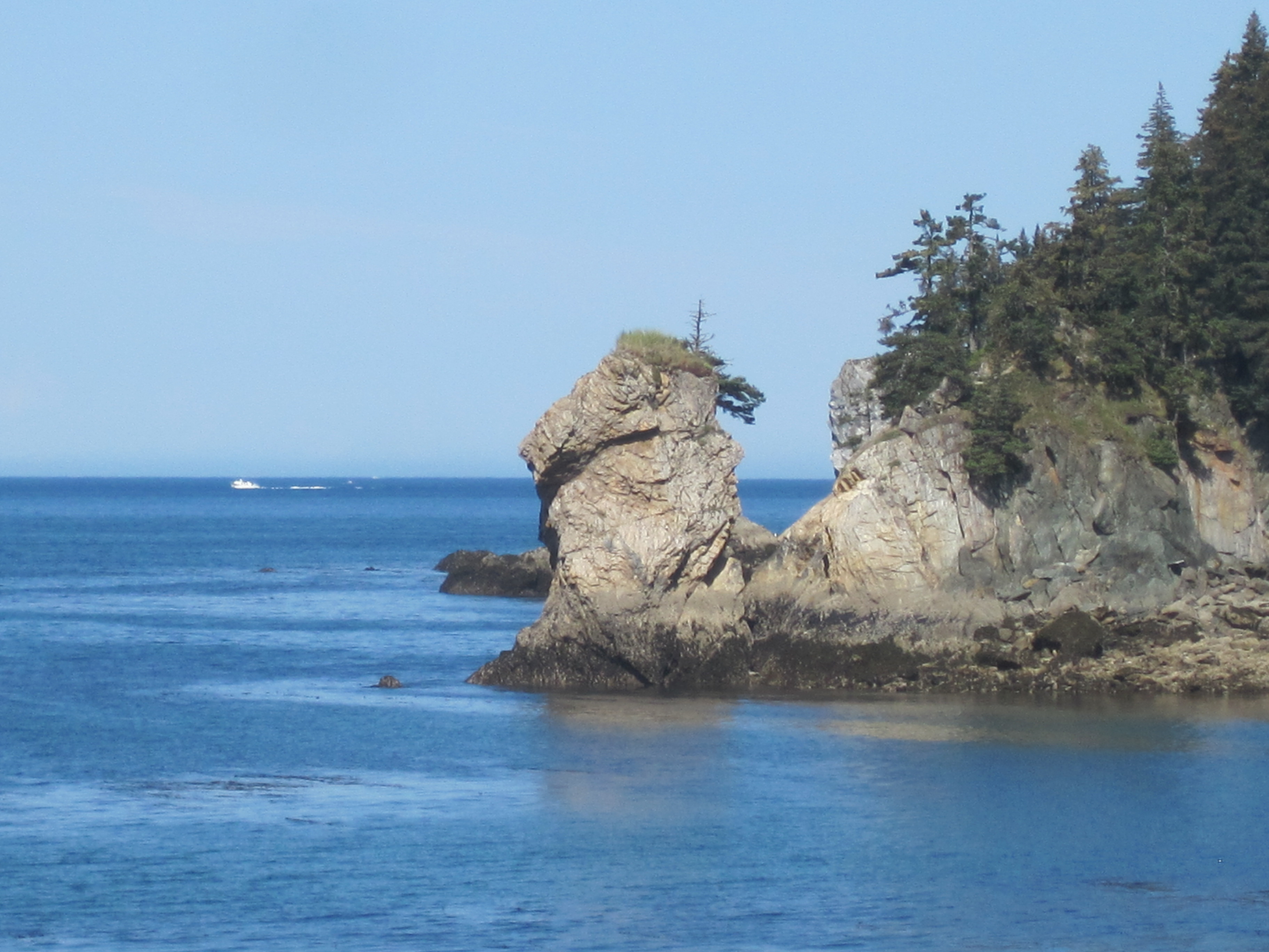
Having ice in the locks this late in the year is not that common. There is was a lot of ice in Lake Superior

IMG_0849

Chippewa County Courthouse was built in 1877. It is an example of the Second Empire style of construction from the late 1800’s. Wall are 2 feet thick, both the bell tower and the main building feature steep sloping roofs once covered in slate now with shingles. The 3rd floor has the “statue of Justice” made of wood.

IMG_0850

out front of the courthouse is the The ‘Wolf of Rome’ it is an exact copy, of the ‘Capitoline Wolf’ which has been housed since 1471 in the Palazzo dei Conservatori on the Campidoglio, Rome, Italy.

After crossing the bridge it was a quick hour into Sault St. Marie.  The first exit has a lot of hotels and shopping options (for the UP that is) but we continued into town to see if we could find the brewery and dinner options.  Ended up staying at a hotel right on the Locks and lucky for Harry the brewery was right across the street.  Interesting evening filled with interesting characters.  Loved the small town feel and time we spent here on a nice spring evening.

Left early on Tues. a.m. to drive to Escanaba.  There was snow along the route but none on the roads.  Went on M-28 through Newberry into Sceeny and then took HWY117 south before heading west on HWY 2.  The day got colder the closer we got to Lake Michigan.  When we arrived into Escanaba I was happy to see http://www.cyclecityinc.com/.  I went inside and bought gloves that were battery operated and could keep my hands warmer!    Enjoyed a night with family and a great dinner at the Stonehouse!


Wed. was by far the worst day of the trip.  We left in rain which subsided a bit after 1/2 hour.  However 15 miles outside of Green Bay I saw lightning, so we pulled under a viaduct and waited, and waited and waited.  After about 45 minutes the rain had let up a bit and we rode into Green Bay. Sadly the place we wanted to stop and eat was only open for dinner, not lunch, so we rode on, in the rain!  AND now I am talking rain, with 20-25 mile an hour sustained winds and 30=40 MPH gusts.    We were freezing, we were drenched and it was horrible.  Stopped to fill up with gas, and warm up and wait to see if rain eventually passed.  It did after about an hour, so we hopped back on for the last hour of the trip into Milwaukee.  By the time we got to our hotel we simply wanted to take hot showers and lay down and rest.

Thursday, awoke to warm weather, first of the trip.  Toured downtown Milwaukee on our bikes then hopped on the ferry.  w.lake-express.com.  Great experience, nice ride and motorcycles free!  Arrived in Muskegon and rode bikes to Grand Rapids for dinner with more family members.


statue in park in downtown Milwaukee, it is in memory of Laurent-Salomon Juneau, founder and first mayor of Milwaukee.

IMG_2747

as we pulled into Muskegon! It was close to 90 degrees!

IMG_2752

Happy to be warm and see the sunshine!


Finally on Friday we rode back to Almont and put the bikes away til next time, when we hope the weather is better!


2 Comments »

Eagle fight; Lena Cove, Juneau, Alaska

April 17, 2014

IMG_2666

the one on top was hurting the weaker one

IMG_2661

While on walk in the neighborhood, my neighbor and I had a National Geographic moment. While walking towards Lena Cove, we had seen 2 eagles flying and chasing each other.  They looked like they were either fighting or flirting (bird style).  

IMG_2671

they eventually laid like this for about 20 minutes while we waited for the professional to arrive

We got to the recreation area and suddenly we heard a crashing sound, I actually thought it was a bear falling out of a tree.  However,  once we focused we saw 2 eagles fall from top of tree to the ground intertwined.  That was about 30-35#’s falling straight down.  It was exceptionally loud and again sounded like a much bigger object.   

We realized that the eagles were attached so at first I thought they were mating until the one on top started pecking at the neck of the other one,  and we realized they were fighting. Because of the pecking, there was blood everywhere and we actually thought the one on the bottom had died.  It was not moving, but the one on top was barely moving.  

We called the “raptor center” http://www.juneauraptorcenter.org to see if they could come and help.  They told us, “oh this is not that uncommon this time of year, if you approach them they will be more scared of you and forget they are mad at each other.”  We walked over to them but there was no movement and they were not letting go of one another.  We still worried about the one on the bottom.  Apparently this time of year it’s all about fighting over females and territory.

IMG_2674

look at the talon grip on the head. That is the more injured one trying to keep the more dominate one awas

Ultimately a member of the Raptor Center arrived and walked right up and tried to pull them apart.  They were not happy and did not let go of each other easily. They had their talons dug into each other. IMG_2672 Finally he tore the two of them apart enough that the top one flew off, followed by the injured one on the bottom, however we could see he had a broken leg and worried he won’t be able to get food.

IMG_2678

he was pulling them apart

IMG_2676

neither one was willing to let go

UPDATE 8 days later a neighbor had a dead eagle in her yard, and it had a broken leg, it looks as though he didn’t make it

1 Comment »