timistravels

My job allows me to visit a lot of Alaska on a yearly basis. I wanted to capture the trips in one location!

Madrid’s Museums Reina Sofia and Prado!

Dec. 20, 2014

What a wonderful day to begin exploration of Madrid. First stop, The Reina Sofía National Art Centre. We came here specifically to see som Picasso’s and Dail’s paintings. There is much work from the Surrealism period and covers artwork from 1930’s through 1980’s. As I expected some of it was just bizarre to me personally. It was as if all these artist friends tried to out wired each other for a certain time period.

/home/wpcom/public_html/wp-content/blogs.dir/99b/31551210/files/2014/12/img_2019.jpg

/home/wpcom/public_html/wp-content/blogs.dir/99b/31551210/files/2014/12/img_2028.jpg

Onto our next stop the Prado Museum which was just blocks from Sofia.
However unlike Sofia this museum is full of European art dating back to the 12th century, stunning oil paintings lined the walls. We viewed much work by Francisco de Goya, Diego Velázquez, El Greco, Titian, Peter Paul Rubens and Hieronymus Bosch are some of the highlights of the collection. No photos are allowed to be taken inside the Prado!

Two pieces that stood out to me were: Las Meninas, as We have statues of it given to us as a gift years ago. To see painting was stunning. We are NOT allowed to take photos so theses both came off the website of the museum.

/home/wpcom/public_html/wp-content/blogs.dir/99b/31551210/files/2014/12/img_0722.png

Second stand out was The Garden of Earthly Delights by Bosch. To me it’s a painting before its time. It was painted sometime between 1490 and 1510. It is a 3 panel painting done with the 2 side ones being shutters. The left shutter is Adam and Eve, the middle has a lot of nudity, animals, fruits, etc and the right shutter then displays hell or what happens after adultery etc. they say it shows what happens with life’s temptations. The reason it stood out to me was because it seems ahead of its time. It is more Salvador Dali like than something done in 1490-1510!

/home/wpcom/public_html/wp-content/blogs.dir/99b/31551210/files/2014/12/img_0721.png

/home/wpcom/public_html/wp-content/blogs.dir/99b/31551210/files/2014/12/img_2038.jpg

/home/wpcom/public_html/wp-content/blogs.dir/99b/31551210/files/2014/12/img_2040.jpg

Leave a comment »

Palace of Versailles in Paris

Dec. 18, 2014.

We were so excited when we bought all day train/bus passes to realize we could go all the way to The Palace of Versailles on the total opposite end of town from where we stayed. We awoke early and headed out arriving about 8 am knowing it did not open until 9, but wanting to avoid lines we’d read about. Let me assure you we were the first in line at 8;45, there were no lines for tickets in Dec!

Originally a cottage or hunting lodge this castle sits in what used to be the country for those living in Paris. Now the area is a suburb for people with money! It is easy to find the castle once you get off the train just go around the corner and head in the direction you are facing when you get off the train.

Louis XIV moved to the castle in the late 1600’s and began the elaborate decorations and expansion of the palace. That is of course until the beginning of the French Revolution when the family was forced out of the castle and back into France due in part to His arrogance and extravagance while many lived in poverty. During the Revolution much of the original furniture was auctioned off or pillaged by Parisians unhappy with the monarchy.

On the tour one of the most stunning room was the Hall of Mirrors. The chandeliers that line this room are stunning. The windows (mostly original glass) help make the room bright and airy. There were rooms/apartments for everyone, the king, his wife and their daughters. Another standout room was the Public Dining Room where common Parisians would come by nightly to watch the royals eat dinner. Such arrogance.

Another beautiful area of the castle are the gardens. Though they were dormant in Dec it is easy to imagine these gardens in the spring/summer. The fountains were off and the statues were all covered for winter. However, from reading posts it sounds like many of the fountains are off all summer as well.

We also ventured to Marie-Antoinette’s estate which is a (poorly signed) 1 mile walk from the castle through the gardens. It was worth the visit but almost a let down after the castle. NOTE: This does not open until noon!

All in all we spent about 4 hours exploring. Thankfully there were not as many tourists as in the summer months though there were many “tour groups” entering vs independent travelers like ourselves.

/home/wpcom/public_html/wp-content/blogs.dir/99b/31551210/files/2014/12/img_1750.jpg

/home/wpcom/public_html/wp-content/blogs.dir/99b/31551210/files/2014/12/img_1776.jpg

/home/wpcom/public_html/wp-content/blogs.dir/99b/31551210/files/2014/12/img_1780.jpgoration

/home/wpcom/public_html/wp-content/blogs.dir/99b/31551210/files/2014/12/img_1786.jpg

/home/wpcom/public_html/wp-content/blogs.dir/99b/31551210/files/2014/12/img_1850.jpg

/home/wpcom/public_html/wp-content/blogs.dir/99b/31551210/files/2014/12/img_1739.jpg

2 Comments »

The Catacombs of Paris

Dec. 17, 2014-Day 1 in Paris, we were so jetlagged but decided to hit the ground running til we dropped. We decided to visit the Catacombs, which was interesting to say the least. 6 million people buried in the limestone caves under Paris.

A bit of how this came to be. For years Parisians buried the deceased near churches and along their neighborhoods. By the late 1700’s these burial areas were very large and growing. Parisians wanted more of the real estate to build homes houses not for burial grounds. King Louis XVI decided to investigate the abandoned underground limestone mines as an option for burial.

In 1776 Graveyards all around Paris were dug up and moved in mass to the abandoned mining area, now called the catacomb. Cemeteries were moved to this location for many years. To this day there is still a lot of space for burials however there are no large buildings in this area because the foundation is so unstable as the tunnels are right below the streets.

The visit left me a bit uneasy but it was intriguing though I’m glad we visited.

/home/wpcom/public_html/wp-content/blogs.dir/99b/31551210/files/2014/12/img_1674-0.jpg

/home/wpcom/public_html/wp-content/blogs.dir/99b/31551210/files/2014/12/img_1684.jpg

/home/wpcom/public_html/wp-content/blogs.dir/99b/31551210/files/2014/12/img_1690-0.jpg

/home/wpcom/public_html/wp-content/blogs.dir/99b/31551210/files/2014/12/img_1694.jpg

/home/wpcom/public_html/wp-content/blogs.dir/99b/31551210/files/2014/12/img_1688-0.jpg

/home/wpcom/public_html/wp-content/blogs.dir/99b/31551210/files/2014/12/img_1686.jpg

/home/wpcom/public_html/wp-content/blogs.dir/99b/31551210/files/2014/12/img_1674-1.jpg

1 Comment »

Iao Needle~ Maui

IMG_1585

it was a beautiful day for viewing the needle

IMG_2709

there are short trails around the park but NO hiking trails

IMG_2704

sunshiny day

Each time we visit Maui we are in awe of the stunning, lush valleys that you can find on the island.  One of our favorites is the one that houses the Iao Needle.  It is easy to get to from any where on the island and only costs $5 / per vehicle to enter the park.  One of the bonuses of going to the needle si that you get to drive through historic Wailuku, one of my favorite communities on Maui.  It is a lush region with a lot of the island’s history.  The Iao Needle is 1,2oo feet tall and is a lush green rock outcropping that rises above a local river to an elevation of 2250 feet.

IMG_1589

this is looking back towards Wailuku and the ocean. You can see how far up the valley we were

Kuka’emoku as it is known in Hawaiian is an “erosional remnant.  It is at the end of a ridge comprised of denser dike stone.  The softer rock around the dike stone was eroded by steams and waterfall” reads one of the informational signs at the site.  IMG_1599   IMG_1598

This area is beautiful and full of history in this area.  In 1790 there was the Battle of Kepaniwai.  The needle was a lookout point for King Kamehameha as he beat the Maui army; changing the course of history on Maui.

Last time we were here, the needle was in a fog/cloud as it gets a lot of weather changes in this area, but this visit was perfect, it helped that we went early.

1 Comment »

Pohaku Park (aka S-turns); Two Turtles Sunning Themselves

On all our visits to Maui we had not stopped at the Pohaku Park before (just down the hill from Maui Brewing Co Restaurant) but someone said I might be able to find some beach glass, so we went to fine it.  During the walk  I only found 3 smallllll pieces of beach glass but we had a better experience!

As we approached one end of the beach (it is broken into 2 parts in a way, divided by big lava rocks) we watched as a turtle walked out of the water and walked to the corner of the cement wall where he decided to nap.  We had to run back to the car for the cameras because we didn’t bring them on the glass search.  IMG_2731

We knew we had to keep a significant distance and we tried not to bother him.  IMG_1619

After pictures we decided to explore the other half of the beach and to our excitement there was another turtle that had beached himself to get some sun and rest.

IMG_2745

this one was asleep quite quickly

Enjoy the pics, I know it was a great experience for us.   IMG_1626 IMG_1628    IMG_2740

Leave a comment »

Guided Trek on Mendenhall Icefield with local company, Northstar Trekking

July 22, 2014

What better way to celebrate our 14th anniversary than to go on a helicopter ride and trek on Mendenhall Glacier Harry and I once again took advantage of a certificate we had gotten during a fundraiser earlier this year. We have gone with Northstar Trekking 3 other times and each time it is a new adventure.

After realizing we were locals AND had gone with NST before our pilot Tracey wanted to know ‘what we wanted to see’, after telling her where we’d been before she headed N almost directly over our house then curved over towards the icefield.

IMG_1232

flying over Herbert Glacier. We ride our bicycles to the face of this a few times a year

IMG_1234

Eagle Glacier is receding quite rapidly.

IMG_1245

looking into Canada, this is probably Camp Peak

IMG_1241

some of the smaller glaciers in the icefield

IMG_1242

the pointed tips were never covered by glaciers, but the more rounded peaks were made rounded by glacier ice smoothing them out.

IMG_1250

other than being on the glacier this is my favorite picture of the day. This is Snow Tower Peaks

First we flew over Mt. Stroller White towards Herbert Glacier and continued N to Eagle Glacier. The amazing part of the flight was that we could begin to see Canadian Peeks. Along the way we also saw so many peaks that it is hard to describe let alone name them all, though Snow Tower Peaks were stunning.

IMG_1256

swinging around to head down to our trekking spot

IMG_1267

we’ve landed and I want to point out the people in this picture, it gives perspective of how large the glacier is.

The Juneau Icefield is the 5th largest icefield in America covering 1500 square miles. It is about 100 miles deep and 50 miles east to west. This icefield is about 3000 years old, so indeed there are pyramids older than this ice! Think about the icefield as one big lake with many rivers flowing out of the lake, these rivers are the glaciers. There are approximately 40 significant glaciers flowing off this field and about 100 smaller ones.

IMG_1278

in front of a ‘cave’ that was not here last week and will probably be gone in a week..

Yes Mendenhall melting and yes it is moving. It takes about 10 feet of snow to create one foot of ice, so each winter a layer is established on the icefield, but it is not growing as fast as it is melting. I have seen significant movement in the glacier in the 19 years I have lived here, it is the sad truth.

IMG_1293

filling water bottle to drink some of the clear, cold water flowing through the glacier.

IMG_1326

just as we were to depart, the tent is there for staff to store things in or to get out of the elements on not so nice days.

IMG_1318

These crevasses are about 150 feed down, you don’t want to fall.

IMG_1306

again for perceptive, this has tent and helicopter as well as people.

This is the same glacier that we were able to hike in the ice caves earlier this year, sadly they have started to collapse and it is very unsafe to return now.  http//timistravels.wordpress.com/2014/03/08/mendenhall-glacier-ice-caves-and-some-northern-lights/


Leave a comment »

Homer, Alaska; The End of the Road (or at least Highway 1)

July 17-20, 2014

IMG_1048

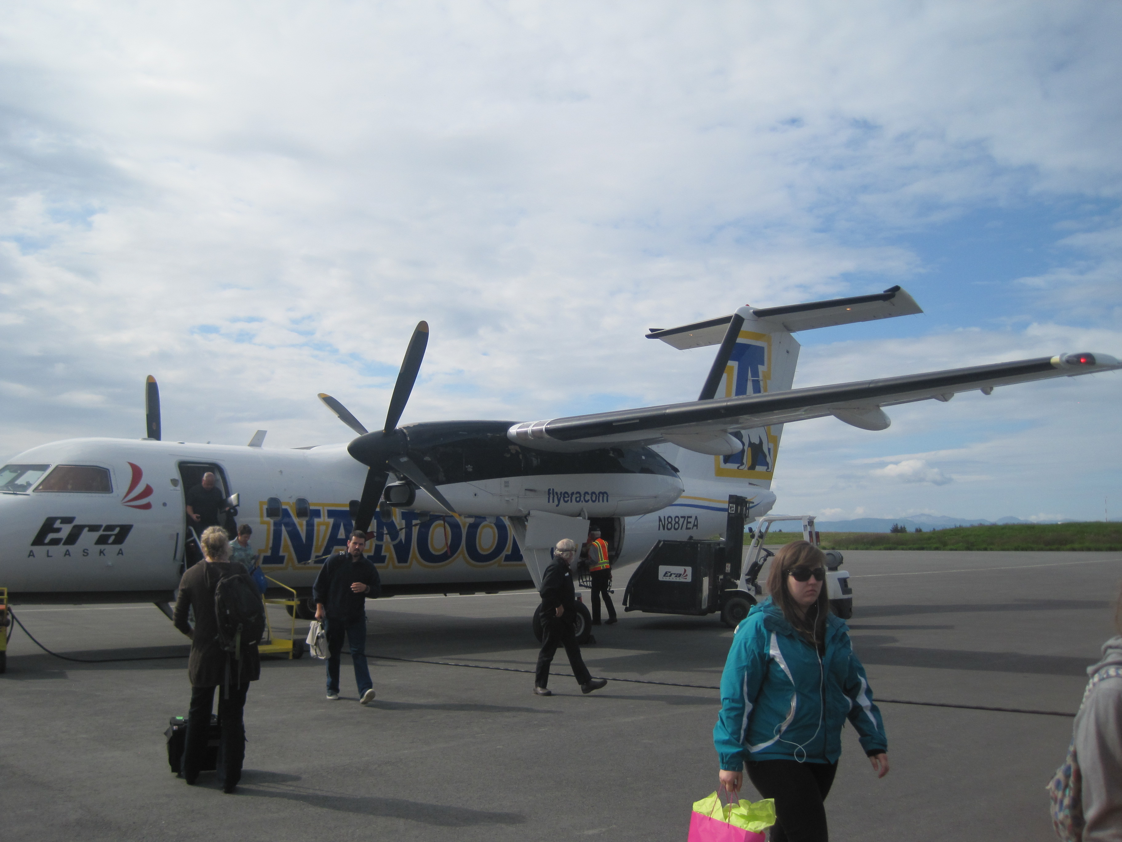
we flew in from Anchorage about a 30 minute flight on RAVN Air
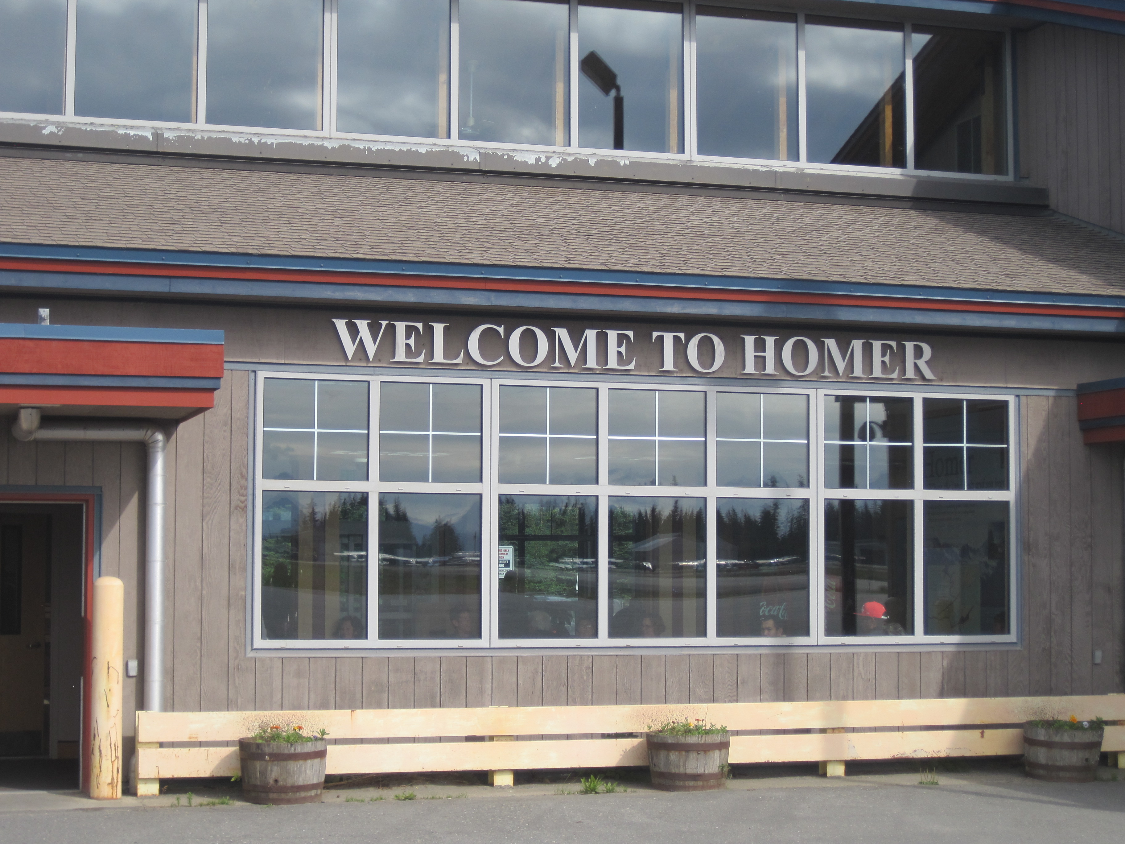
IMG_1047

local airport

Homer, Alaska is one of the places in Alaska that gets the title of “end of the road” as it is the end of Alaska Highway 1. It’s about a 5 hour, 225 mile drive south of Anchorage so driving is an option as well as a quick 30 minute flight.   During the summer is a very popular destination for those visiting Alaska from outside, but we saw just as many, if not more, visitors that were from Alaska. Many people were visiting from as far north as Fairbanks, the Mat Su and Anchorage. People head to Homer for a number of reasons but fishing is the biggest!

IMG_1210

This is a view of the 4.5 mile spit from the air. As you can it feeds right into the bay.

IMG_1197

the change in water color is due to the fact that much of the water comes from the glaciers across the bay and glacial water is full of silt which leaves the water greyish in color and ‘thicker’ looking!

IMG_1196

Homer is known for the surf and individuals travel here so enjoy the waves.

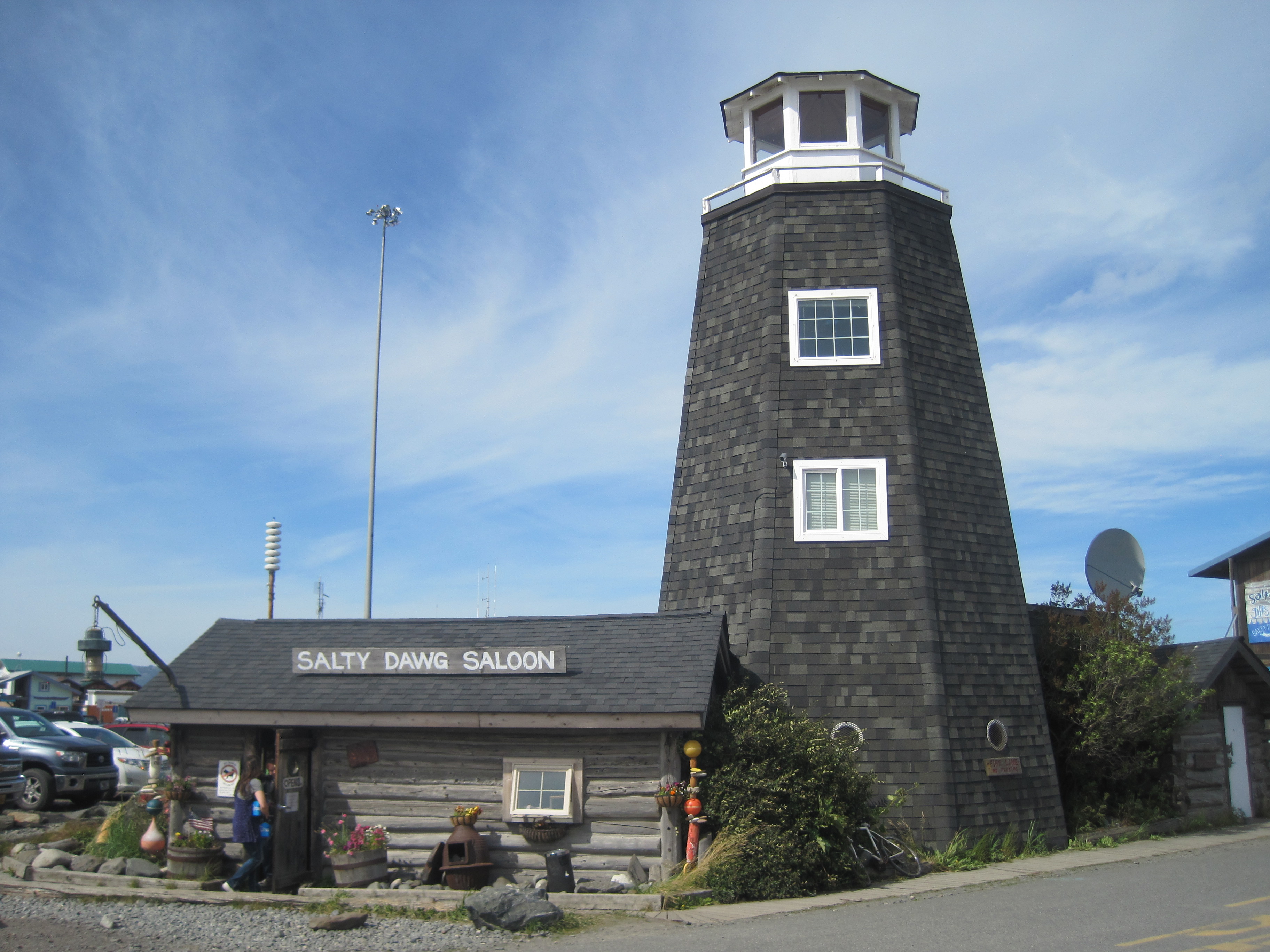
The Spit is where a lot of the ‘tourist’ things occur. This Spit is a 4.5 mile strip of gravel, rock and sand that stretched out into the ocean. The spit was developed by glaciers in the past and most likely is the moraine from that glacier. Since it is surrounded by water on both sides, it is reshaped often. Historically there was a community on the spit from 1896 to 1902 but it was deserted after that. When a road connected Homer to Anchorage in the 1950’s the town grew quickly up into the hills surrounding the water.

IMG_1177

probably the most known establishment on the spit, though it’s menu has shrunk over the years.

IMG_1081

view out of my hotel room at Land’s End Hotel; view rooms are worth it.

IMG_1057

arts and gardening combined.

IMG_1056

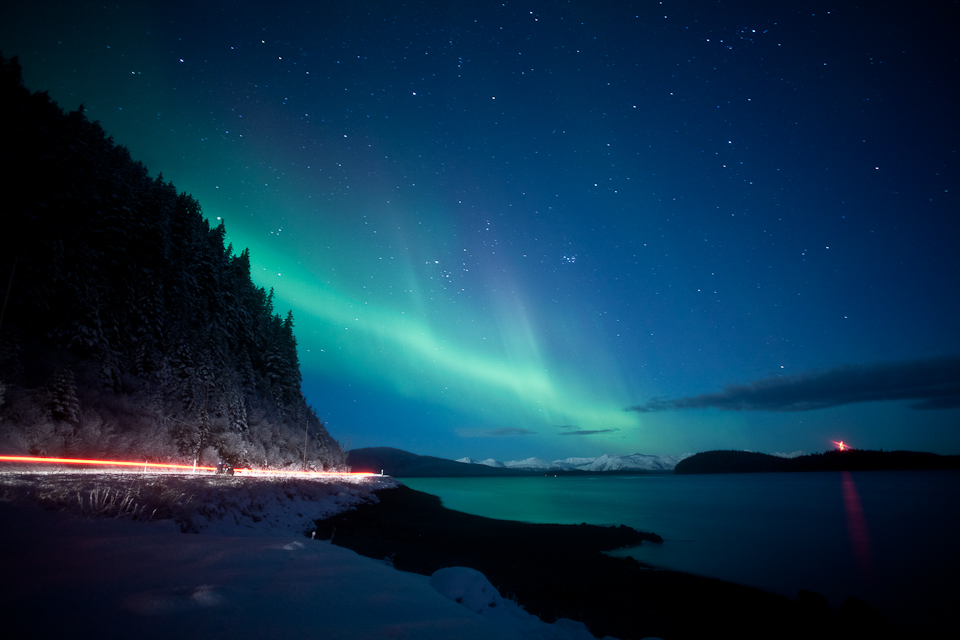
11:30 at night, not bad!


IMG_1213

as we were flying out I captured this view of the bay with the Grewingk Glacier flowing into Katcemak Bay

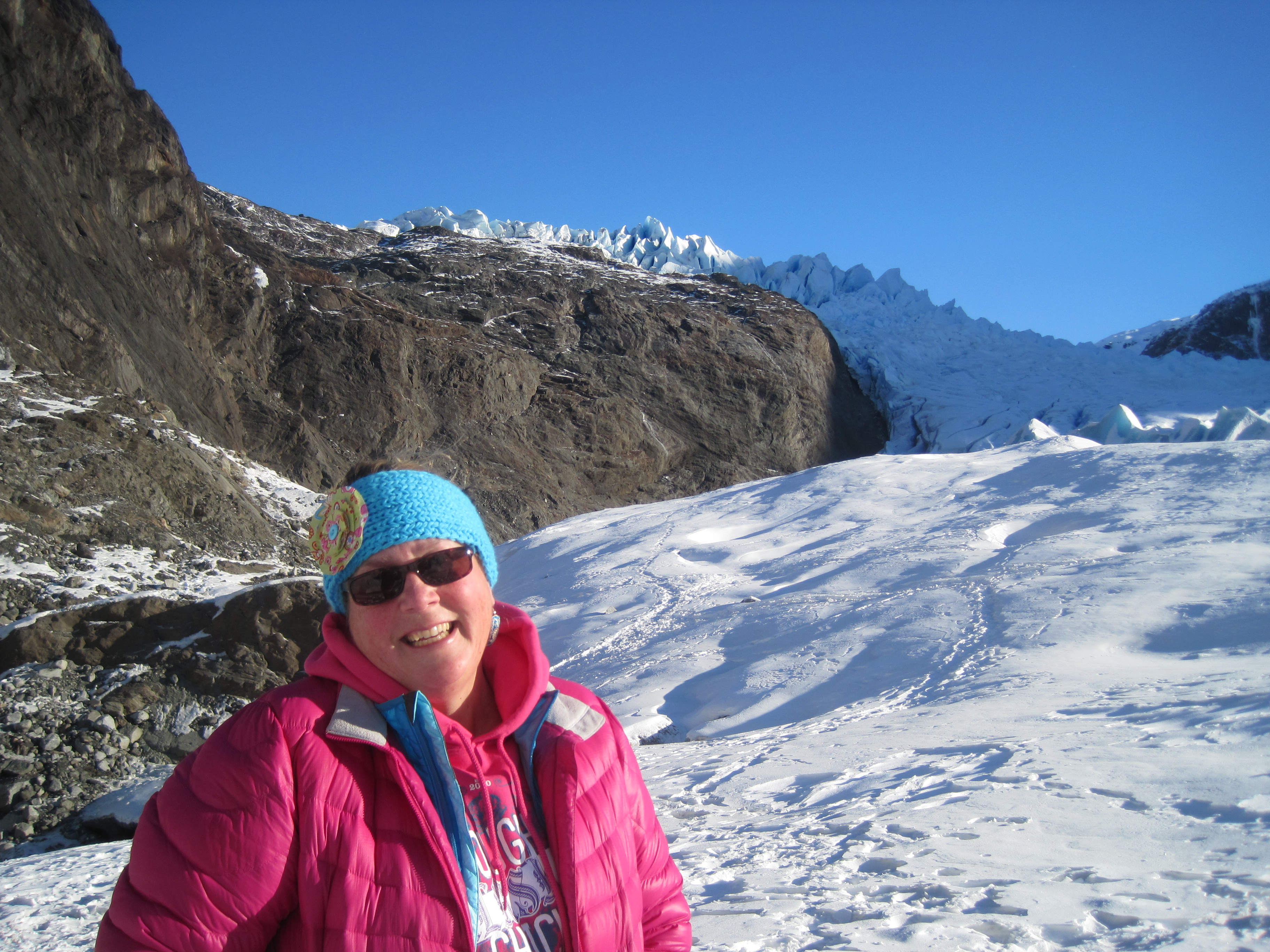
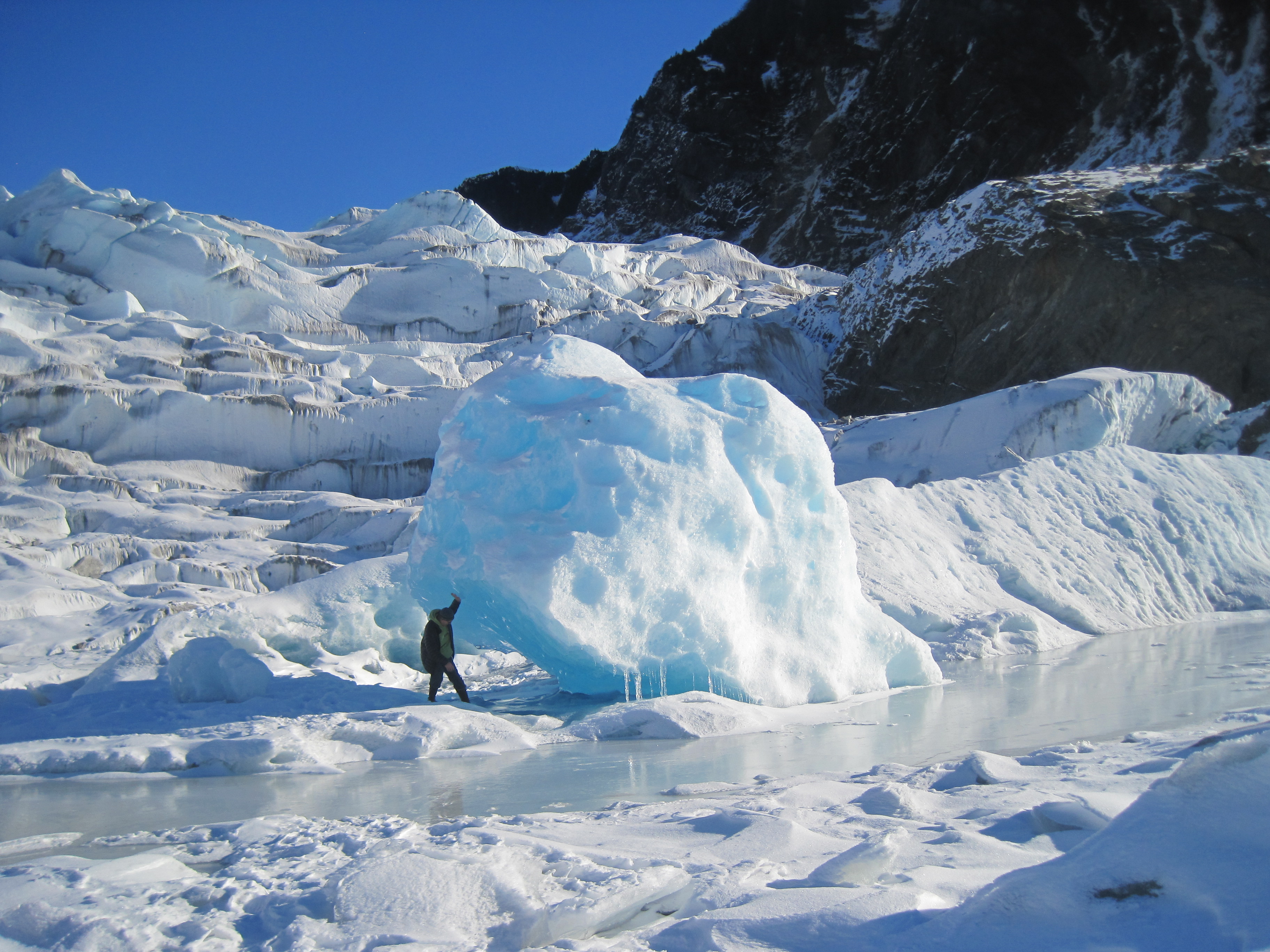
Across from the spit is Kachemak (Catch-a-mack) you can view many glaciers flowing from the Harding Ice Field, named after President Harding. 30 glaciers flow out of this ice field which is about 3oo square miles. The 3 that can be seen from Homer are Grewingk, Portlock and Dixon Glaciers.


IMG_1176

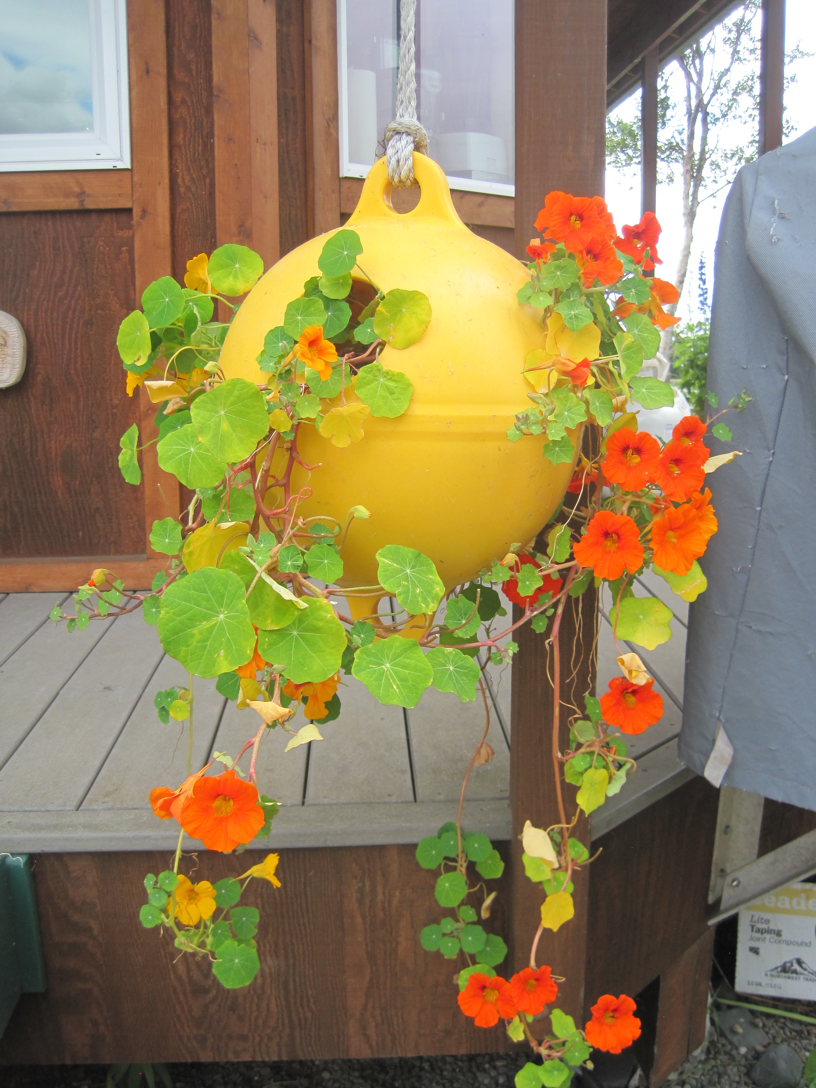
creativity on the spit

IMG_1209

these floats pouring off a businesses porch in Old Town

Homer is an artistic, farming community. There were fresh, local vegetables on every menu in town and each store highlighted local artists. This farming in this area has grown significantly in the past few years. Homer has aspired to be known as THE ART community in Alaska. Many shops carry local art, but the fun place to visit is the Farmer’s Market on Wed and Sat mornings. You can buy not only fresh veggies but a lot of art work.


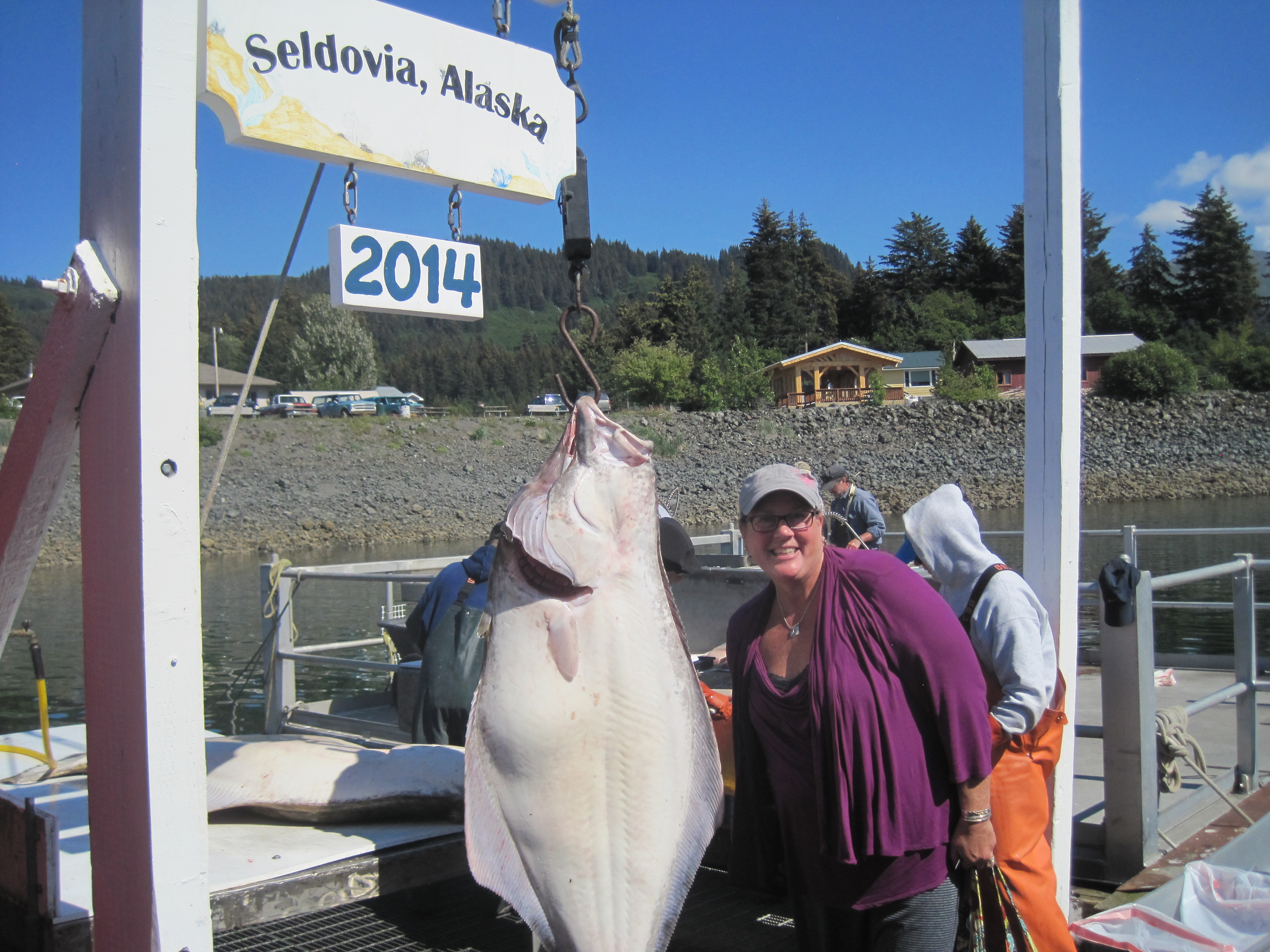
If you have a change be sure to take the ferry and visit Seldovia while in Homer. It is a quaint town that depicts off the road communities here in Alaska. The Island and Ocean Visitor Center is also a nice stop. It offers a great overview of wildlife in the area and showcases history of the region. s://timistravels.wordpress.com/wp-admin/post.php?post=3478&action=edit&message=6&postpost=v2


IMG_3141

yeppers, Moose running down the road, captured on the iphone of colleague J.Reeves

The thing that was most challenging for me was to view the 100’s and I am not exaggerating when I was 100’s of RV’s that were parked in the RV parks. When a community is on the road system this is an outcome one might expect. It was also odd to see tents set up on the spit as there is NOT one tree on the spit so it is wide open camping, I suppose I prefer camping in the woods !

IMG_1187

this fellow sat outside our meeting room for an hour on Sunday morning.

Alaskamagif300

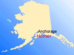
255 miles South of Anchorage


Leave a comment »

Small town Charm in Seldovia, Alaska

IMG_1172

do you see the face of a bear in these rocks? I do and I love it!!! taken from ferry ride.

IMG_1161

wish I would have caught this, but I just decided to stand by it! It’s about a 90# Halibut.

IMG_1144

locals call this camel rock, I can see why!


July 18, 2014

A day in Seldovia, Alaska

I, for one love quaint little towns that embrace what Alaska is all about and Seldovia is just that kind of town. We were in Homer for work but had the opportunity to take the ferry ride over to Seldovia and spend the afternoon there.

IMG_1087

view from the ferry as we left Homer


IMG_1106

we saw whales breaching during the ferry ride. I almost caught the ‘fluke’ (whales tail)

IMG_1095

sea otters are everywhere in the waters in this area

IMG_1125

little sea otter playing in the harbor


IMG_1120

arriving to Seldovia, can you tell it’s a fishing community


IMG_1132

such beautiful flowers welcoming the ferry


It is a quieter community, as it is not on the road system; you have to try to get there! The community is far removed from the hustle and bustle of life in bigger communities in Alaska. It’s a town full of small town charm including Christmas Light contest, an annual chainsaw competition (with many of the carvings decorating town), and a solstice music festival just to name a few.IMG_1124IMG_1133

berries

a bowl of salmon berries is a summer treat!

We were hosted by a local for lunch and had yummy fresh salmon and halibut! What a treat. We then visited the Susan Early School on our way to the Otterbahn Hike and visit to the beach. I collected a lot of beach glass, (which I love) as well as filling 2 bags with salmon berries!IMG_1138IMG_1134

seldovia map

just in case you were wondering where it is on the map of Alaska

I’ve read a trip advisor reviews where people complained that there was “nothing to do” but I disagree, it is a delightful step into a beautiful community that isn’t full of tourist shops and billboards, it is a quaint Alaska community full of kindness and great old-fashioned hospitality.

Leave a comment »

Mendenhall Glacier Bear Activity

June 1, 2014

This was sent in an email to my by Laurie Craig the Lead Naturalist at the Mendenhall Glacier Visitor Center.  She wrote that “A few of us observed a fascinating bear family interaction. No camera was handy so I recreated the event in a different manner. Enjoy!”  I asked and she gave permission to share these.  cartoon 1 cub climbs tree 2014 june 1 cartoon 2 bears dangle 1june2014 cartoon 3 bear chew branch 1june2014 cartoon 4 munch 1june2014 cub tree2 cub tree

Then, I found some photo’s taken by Janice Gorle that go along with the adorable story.  Thanks Laurie and Janice.


Leave a comment »

Mendenhall Glacier Ice Caves (and some Northern Lights)

March 1, 2014

Almost every Feb. or March Juneau has a cold snap where Mendenhall Lake freezes enough that individuals can get out on the lake to cross country ski, or hike etc.  Typically during that time it is also quite sunny and the rain or snow subsides for a few weeks.

These explorations around Mendenhall Glacier are typically astounding, and the photos that come out of the visits make our Christmas Card each year, it is truly part of what makes Juneau such an incredible place to live, these things are in our back yard.

This year the glacial caves are getting a lot of attention from National news outlets but here are a few of my photos from the weekend of March 1 and 2, 2014.  I went on my own Sat. but did not enter the caves.  I made Harry get up early with me on Sunday and get out there when 1) there were not many people there at all and 2) I felt a little more safe with it being colder in the morning.  There is danger doing this but it was worth the risk!

The few Northern Light pictures are NOT taken by me, rather a friend of a friend.  Thought you may enjoy seeing them!

IMG_2496

out near the face of glacier

IMG_0735

harry inside the cave, yes, real colors, not altered at all

IMG_0737

me enjoying being silly

IMG_0761

over my right shoulder is a ice column in the cave, facinating

IMG_0768

just outside the cave with the peaks above my head being higher up on glacier.

IMG_0789

harry at the face being silly himself

IMG_0743

while in the cave we are looking up out of these holes…

IMG_0804

this ice cave I would not venture into, there were sounds coming out of it and that triangular piece above Harry’s left arm looks to scary to me.

IMG_0690

I hiked out to face on Sat. by myself, but did not venture into the caves

IMG_0719

just as you enter the cave

IMG_0732

that ice column that is in the middle of the cave, not quite sure how it formed, possibly a water drip that grew???

IMG_0782

the natural heart cut out I found hiking around the face of glacier

IMG_0785

out near face so much BLUE

IMG_0764

not touched up at all, the colors were simply incredible, almost looks fake doesn’t it?

Dylans house aurora 1

during this same time period we also get great Northern Lights. I did NOT take this photo rather it was taken by David Reed, a friend of a friend of a friend.

North Douglas

again by David Reed, this is taken out on North Douglas. the lights along the bottom are car lights. the light over the hilltop to the right is near our home!

2 Comments »