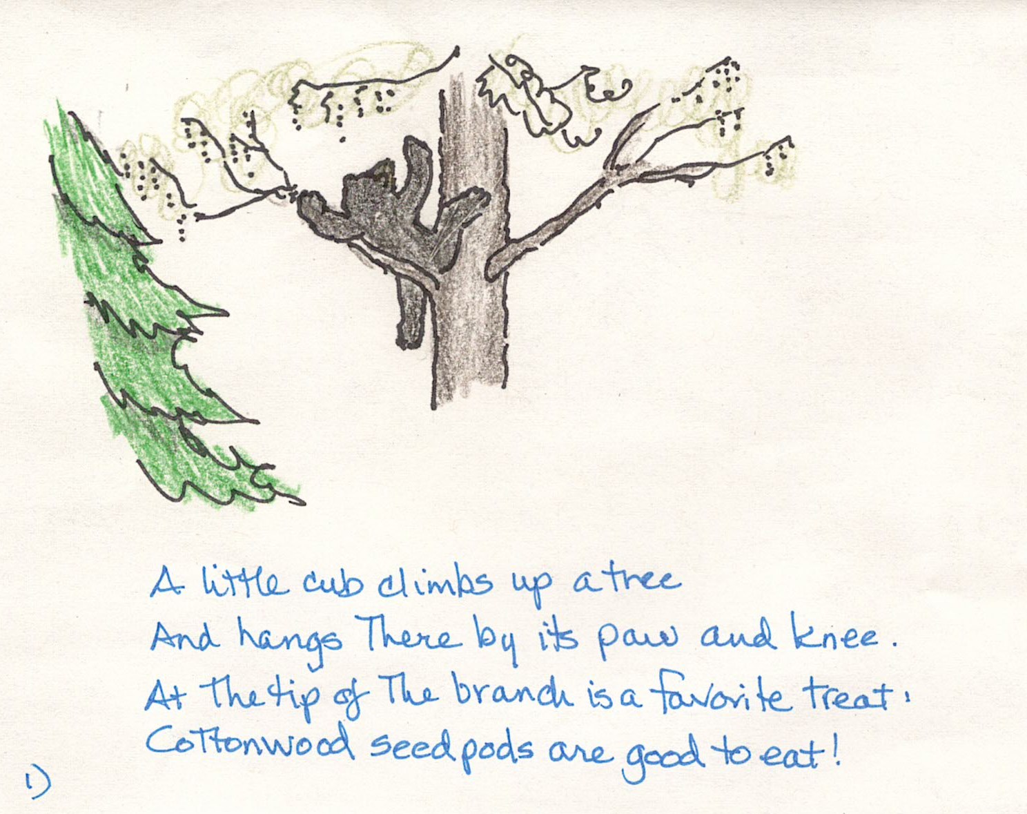
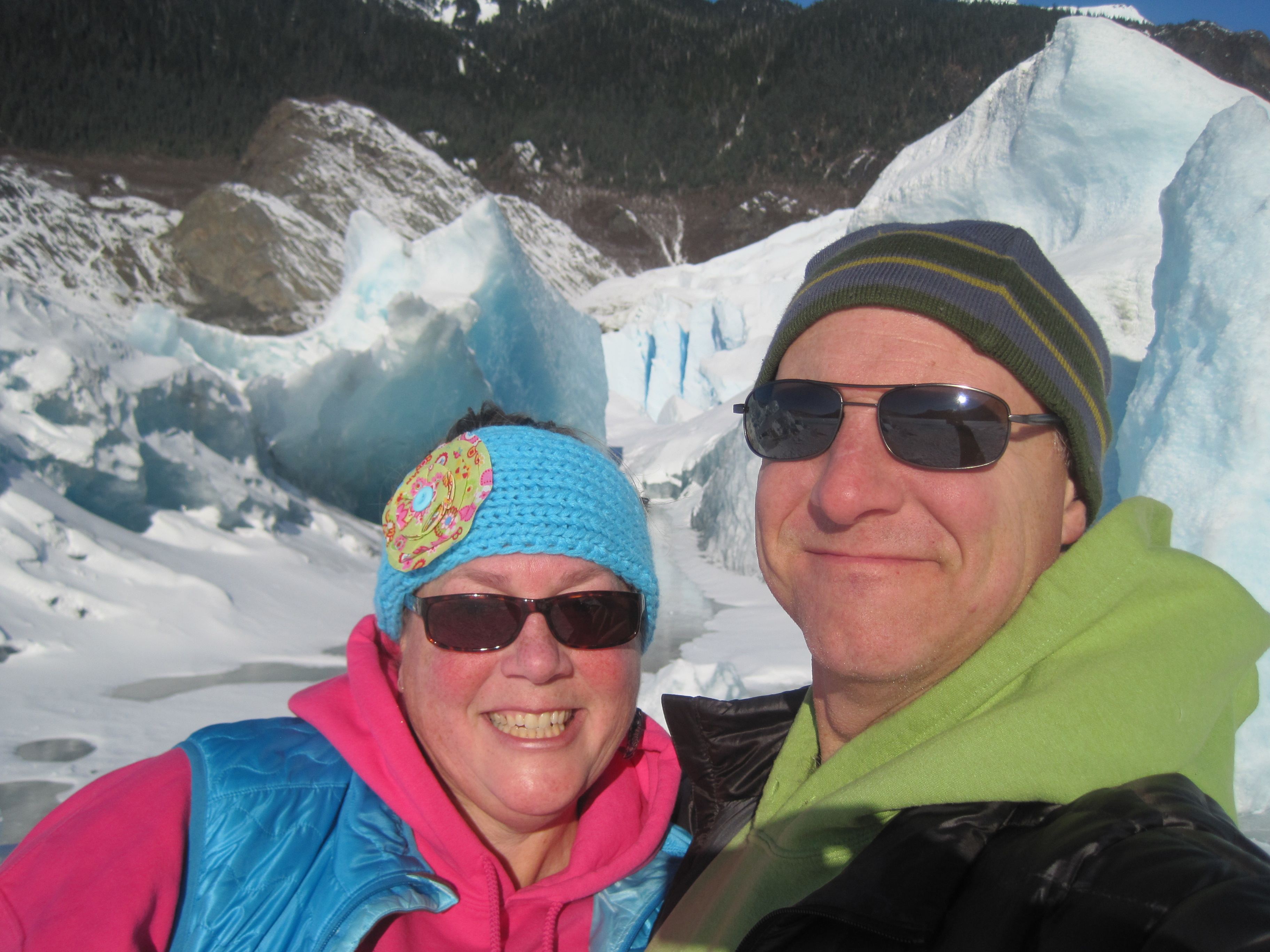
timistravels

My job allows me to visit a lot of Alaska on a yearly basis. I wanted to capture the trips in one location!

Guided Trek on Mendenhall Icefield with local company, Northstar Trekking

July 22, 2014

What better way to celebrate our 14th anniversary than to go on a helicopter ride and trek on Mendenhall Glacier Harry and I once again took advantage of a certificate we had gotten during a fundraiser earlier this year. We have gone with Northstar Trekking 3 other times and each time it is a new adventure.

After realizing we were locals AND had gone with NST before our pilot Tracey wanted to know ‘what we wanted to see’, after telling her where we’d been before she headed N almost directly over our house then curved over towards the icefield.

IMG_1232

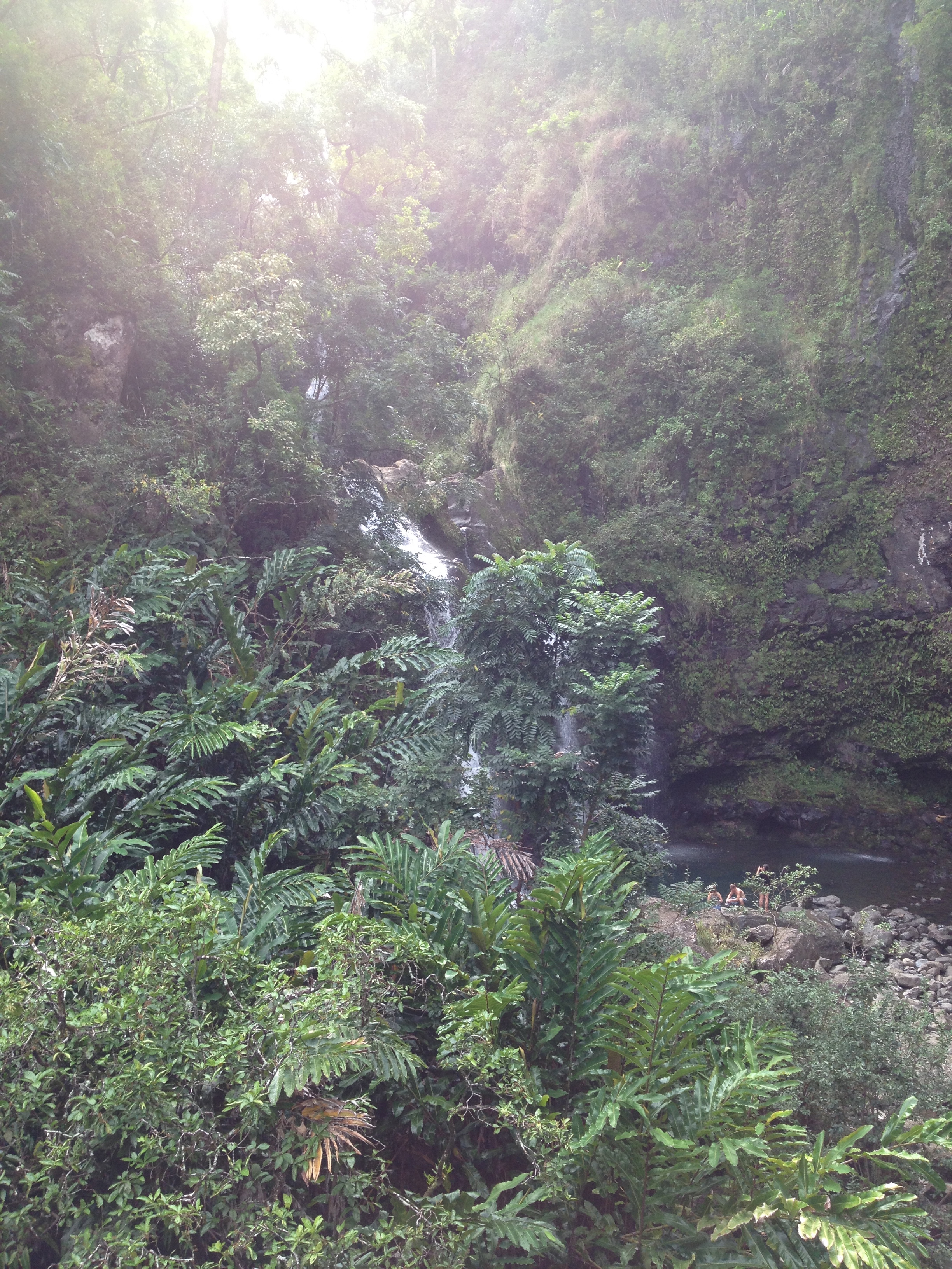
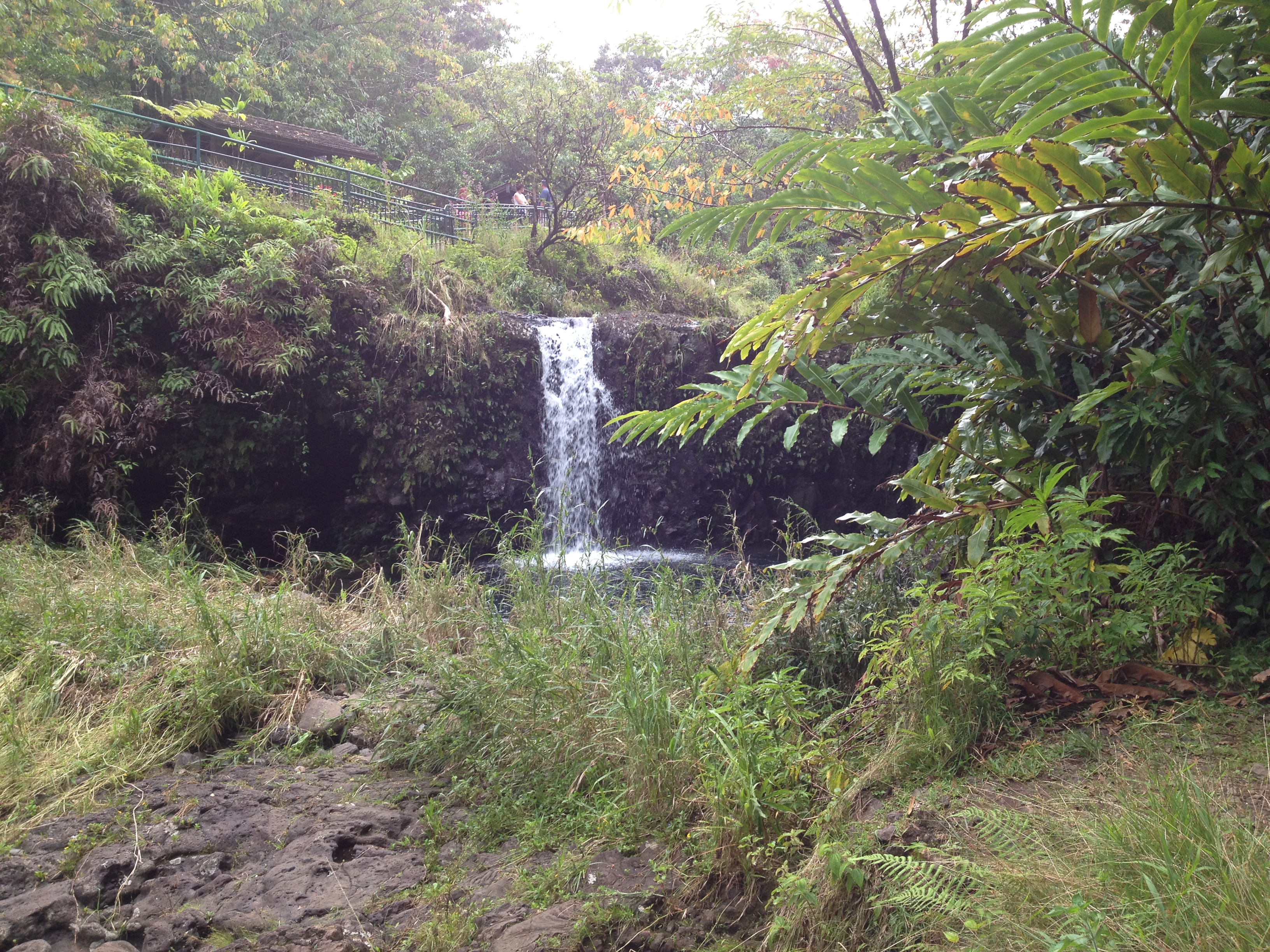
flying over Herbert Glacier. We ride our bicycles to the face of this a few times a year

IMG_1234

Eagle Glacier is receding quite rapidly.

IMG_1245

looking into Canada, this is probably Camp Peak

IMG_1241

some of the smaller glaciers in the icefield

IMG_1242

the pointed tips were never covered by glaciers, but the more rounded peaks were made rounded by glacier ice smoothing them out.

IMG_1250

other than being on the glacier this is my favorite picture of the day. This is Snow Tower Peaks

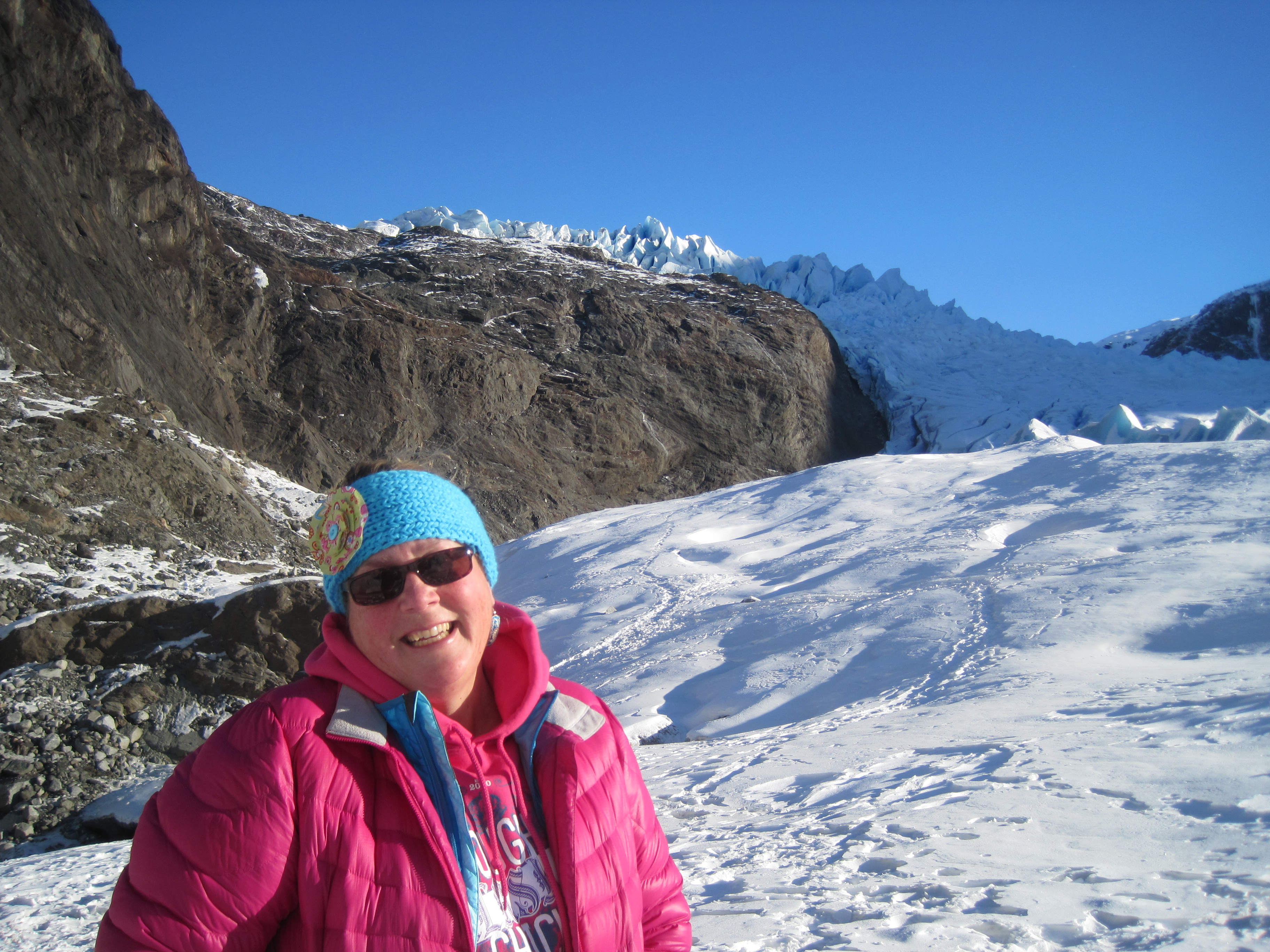
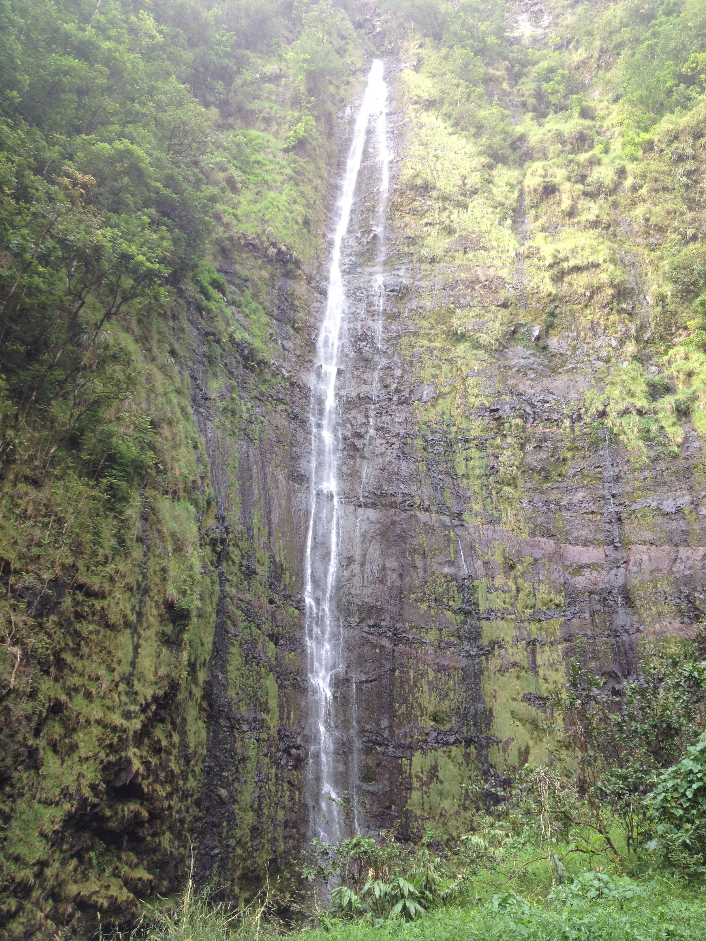
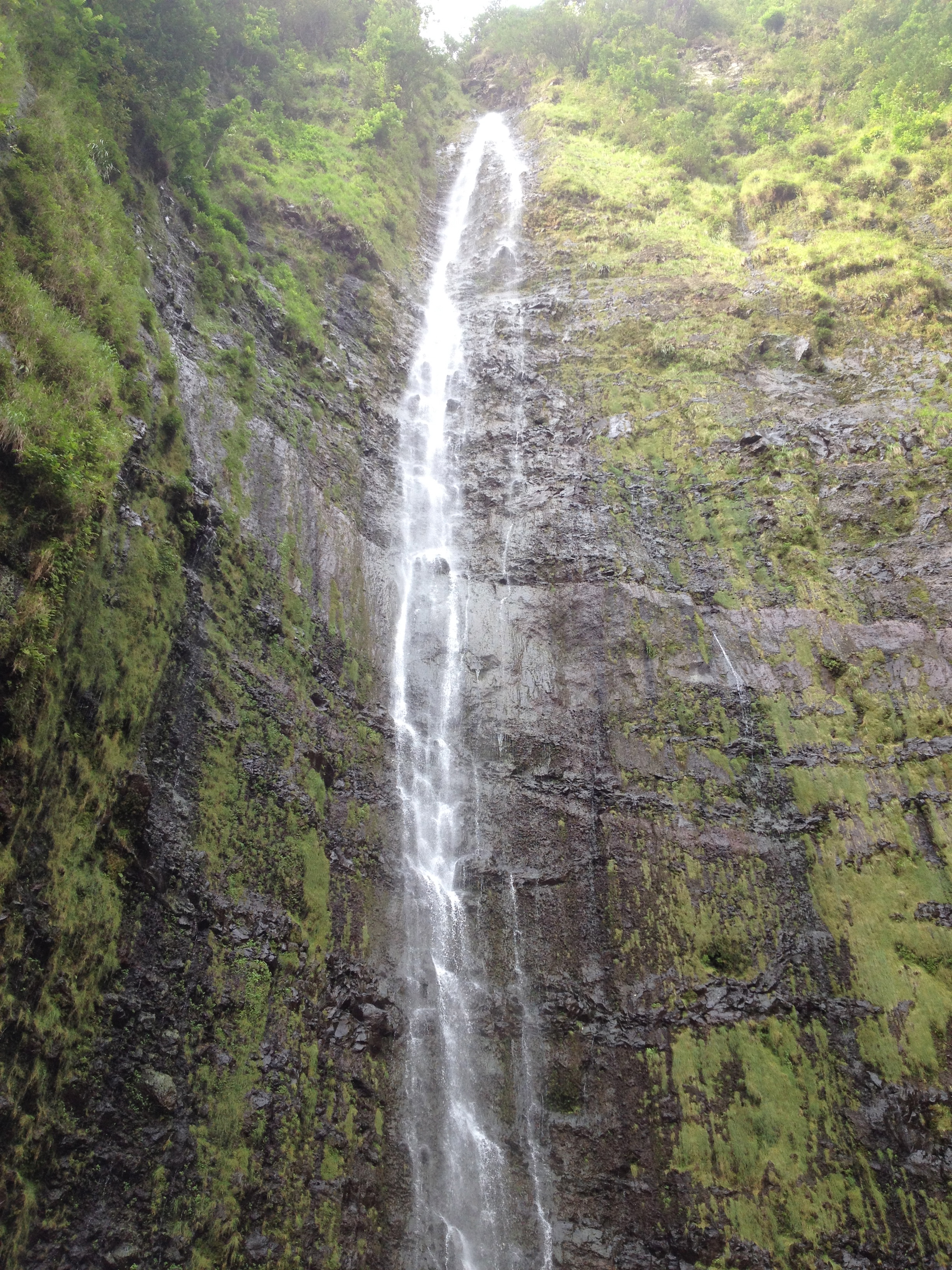
First we flew over Mt. Stroller White towards Herbert Glacier and continued N to Eagle Glacier. The amazing part of the flight was that we could begin to see Canadian Peeks. Along the way we also saw so many peaks that it is hard to describe let alone name them all, though Snow Tower Peaks were stunning.

IMG_1256

swinging around to head down to our trekking spot

IMG_1267

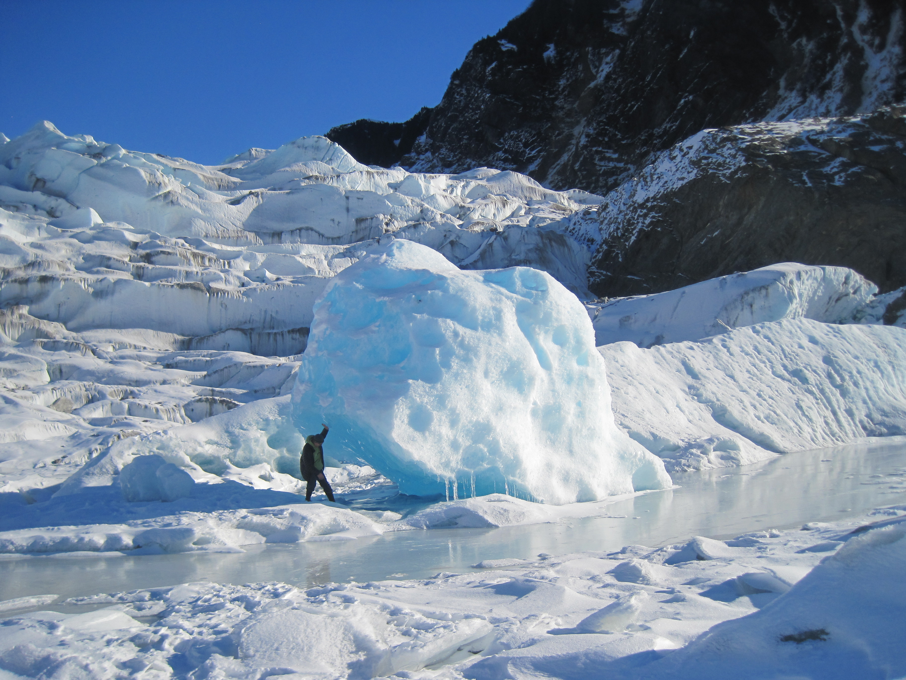
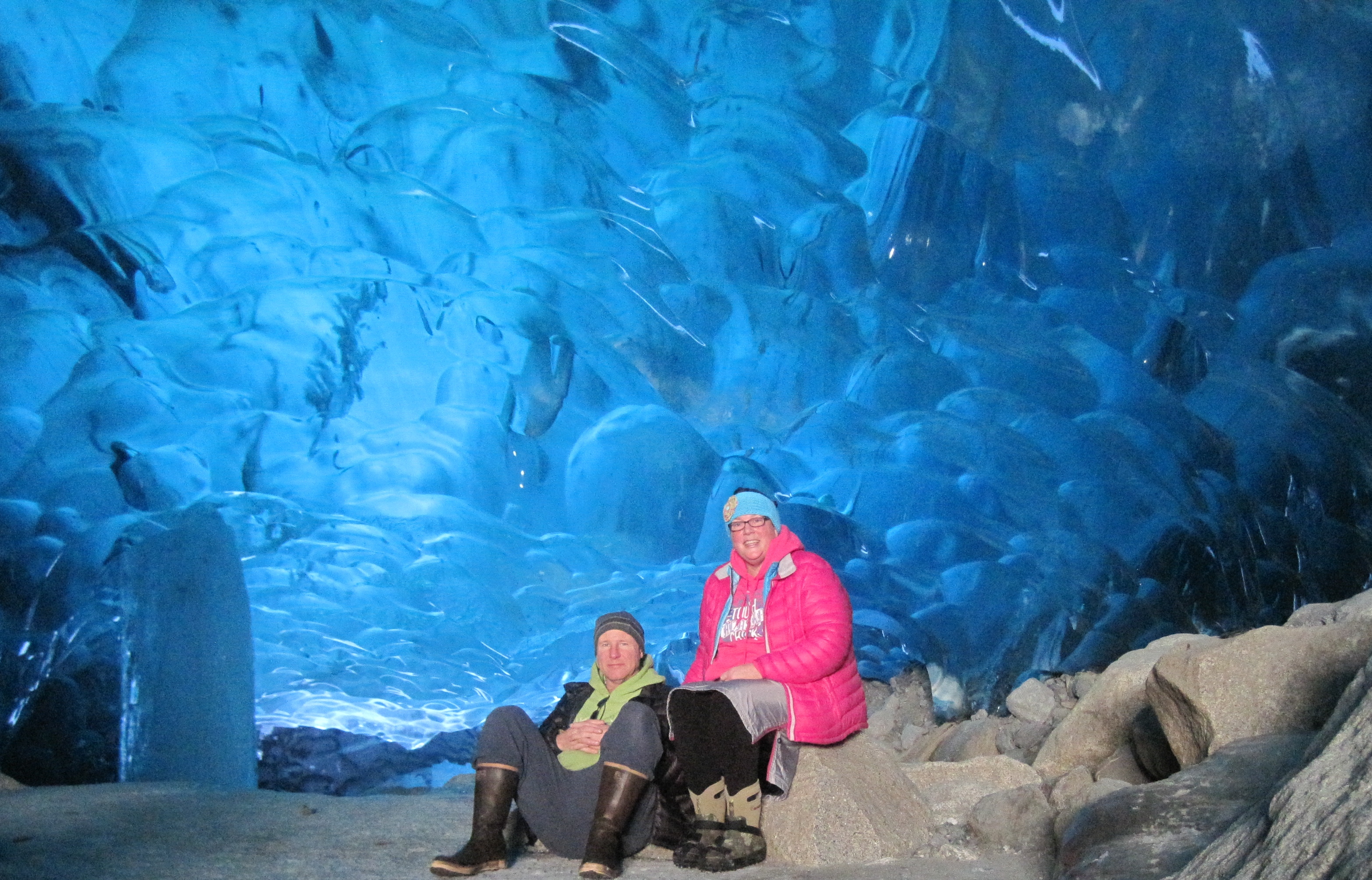
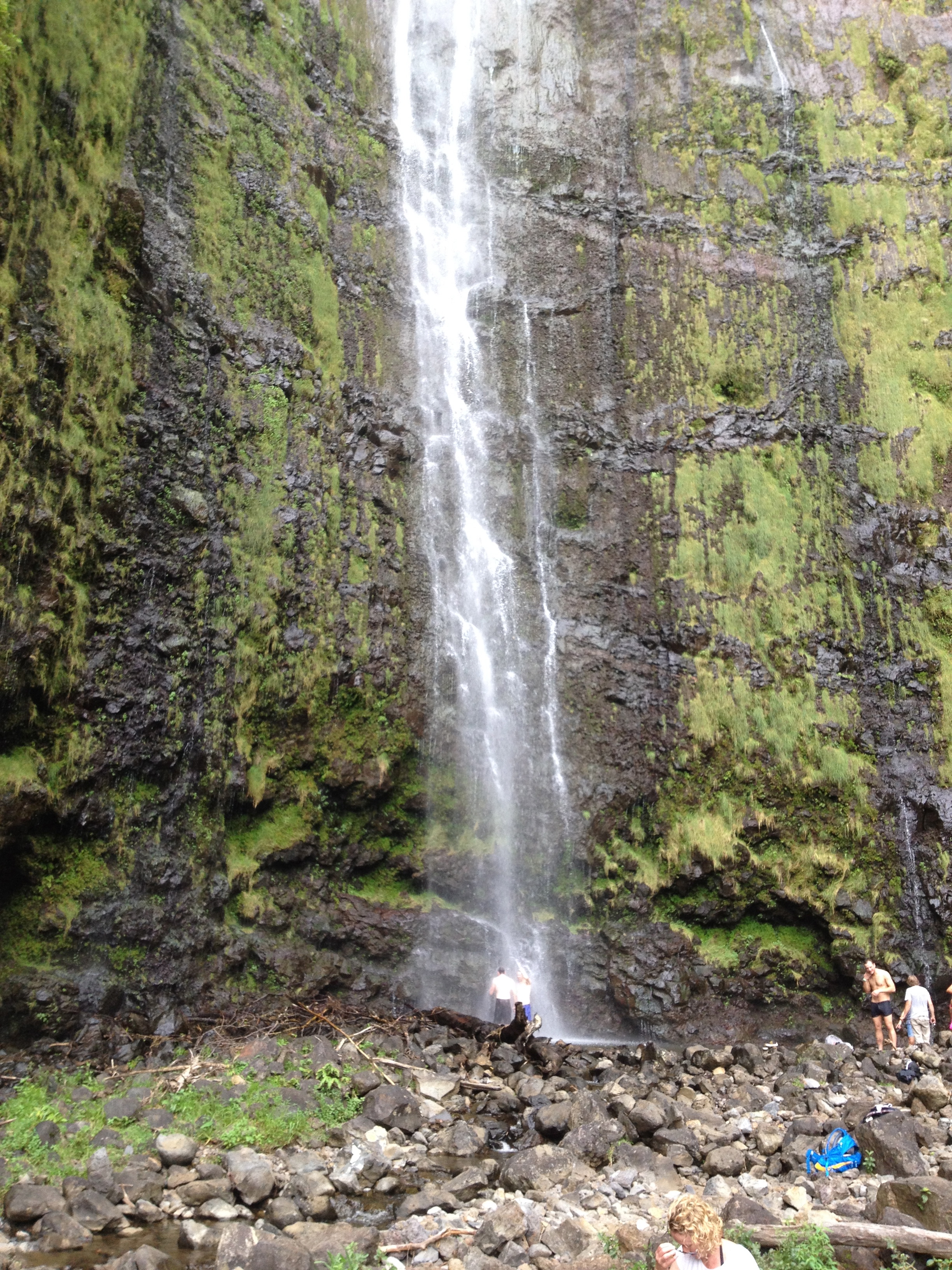
we’ve landed and I want to point out the people in this picture, it gives perspective of how large the glacier is.

The Juneau Icefield is the 5th largest icefield in America covering 1500 square miles. It is about 100 miles deep and 50 miles east to west. This icefield is about 3000 years old, so indeed there are pyramids older than this ice! Think about the icefield as one big lake with many rivers flowing out of the lake, these rivers are the glaciers. There are approximately 40 significant glaciers flowing off this field and about 100 smaller ones.

IMG_1278

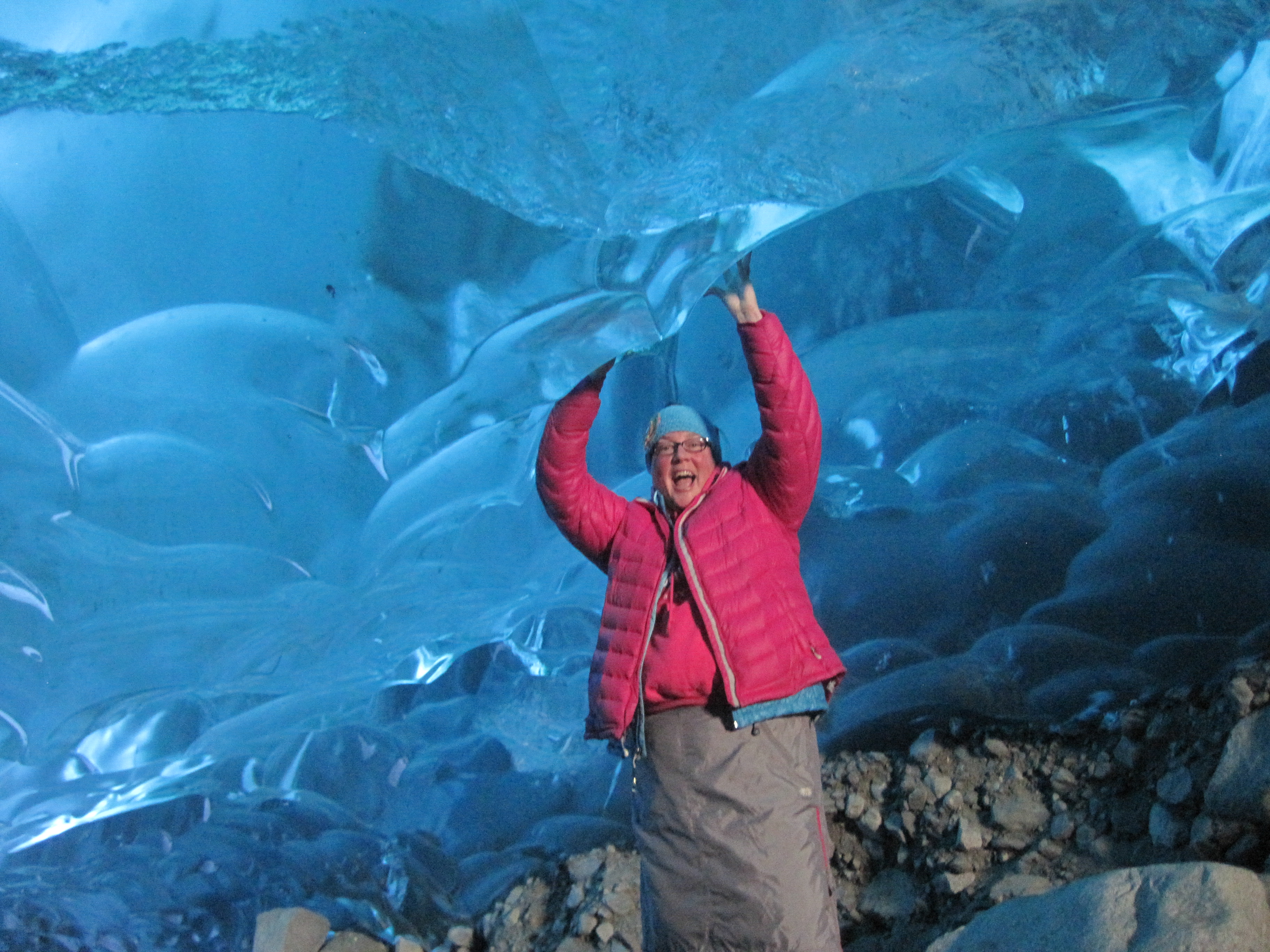
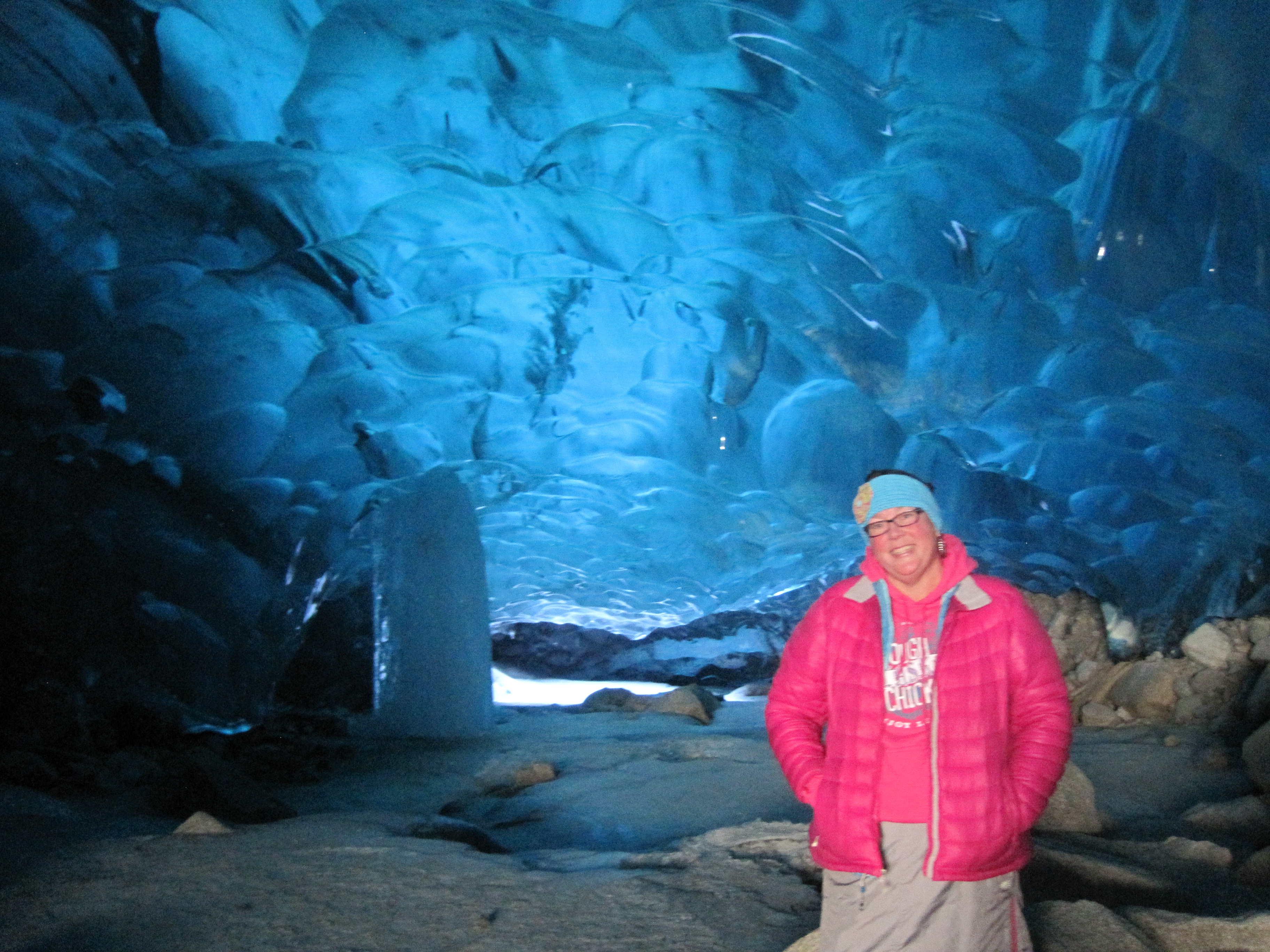
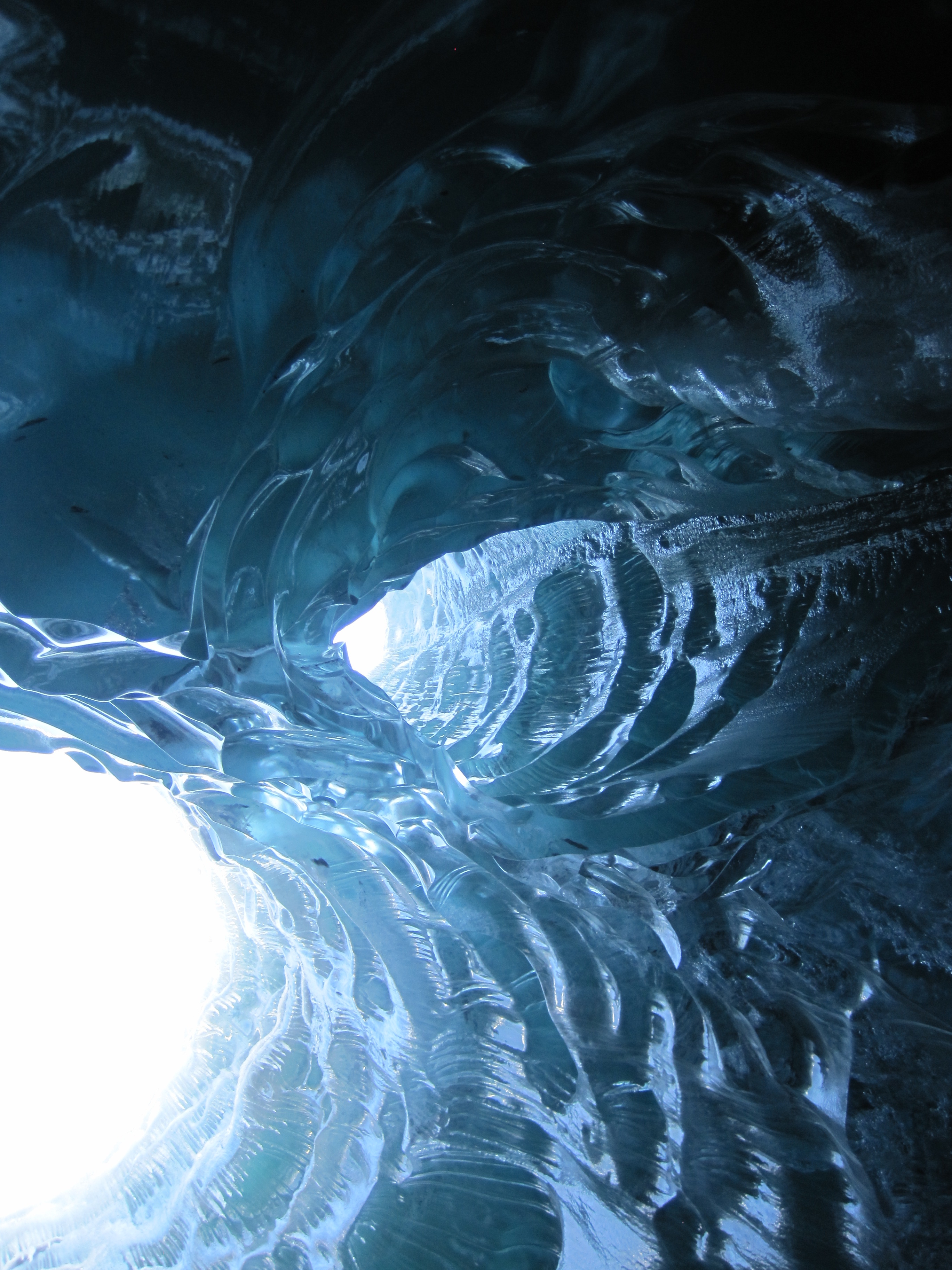
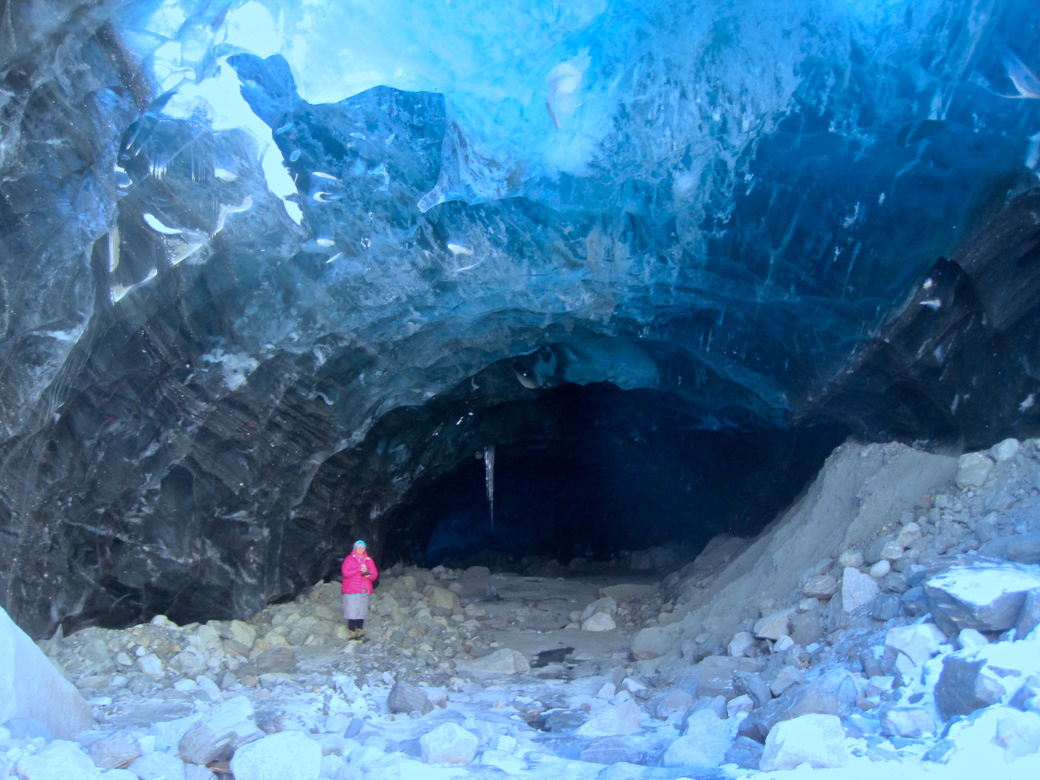
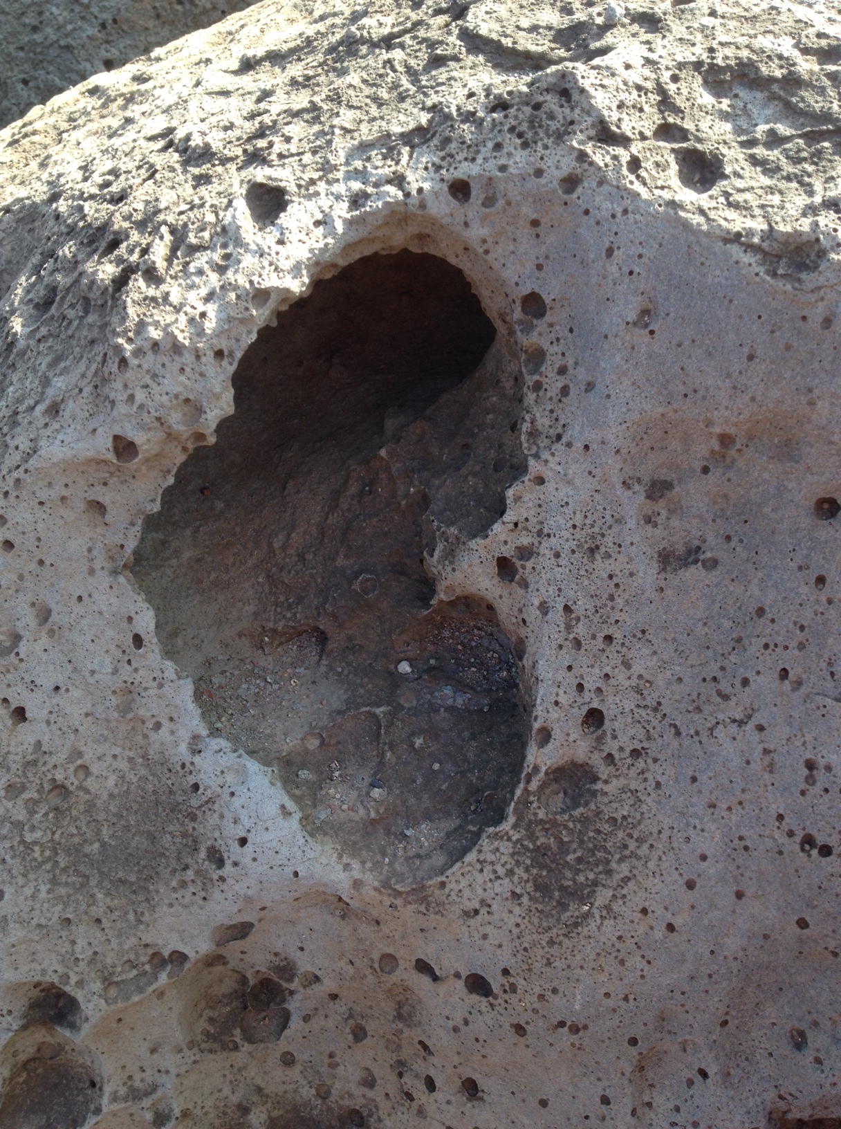
in front of a ‘cave’ that was not here last week and will probably be gone in a week..

Yes Mendenhall melting and yes it is moving. It takes about 10 feet of snow to create one foot of ice, so each winter a layer is established on the icefield, but it is not growing as fast as it is melting. I have seen significant movement in the glacier in the 19 years I have lived here, it is the sad truth.

IMG_1293

filling water bottle to drink some of the clear, cold water flowing through the glacier.

IMG_1326

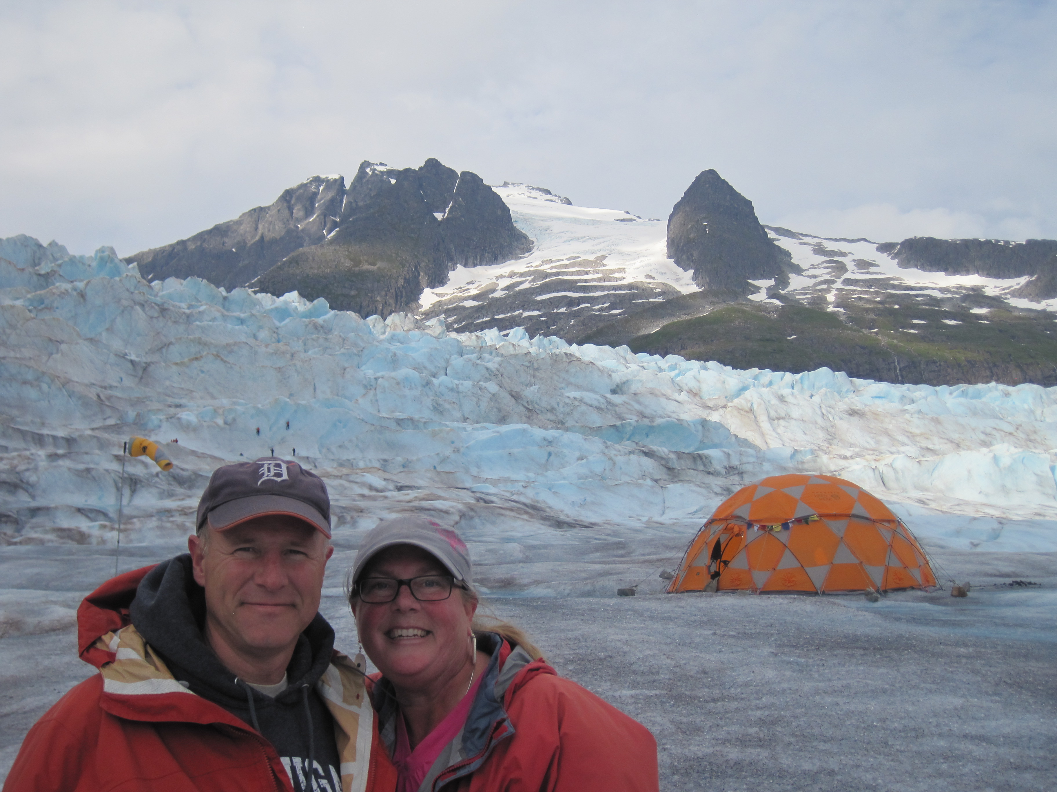
just as we were to depart, the tent is there for staff to store things in or to get out of the elements on not so nice days.

IMG_1318

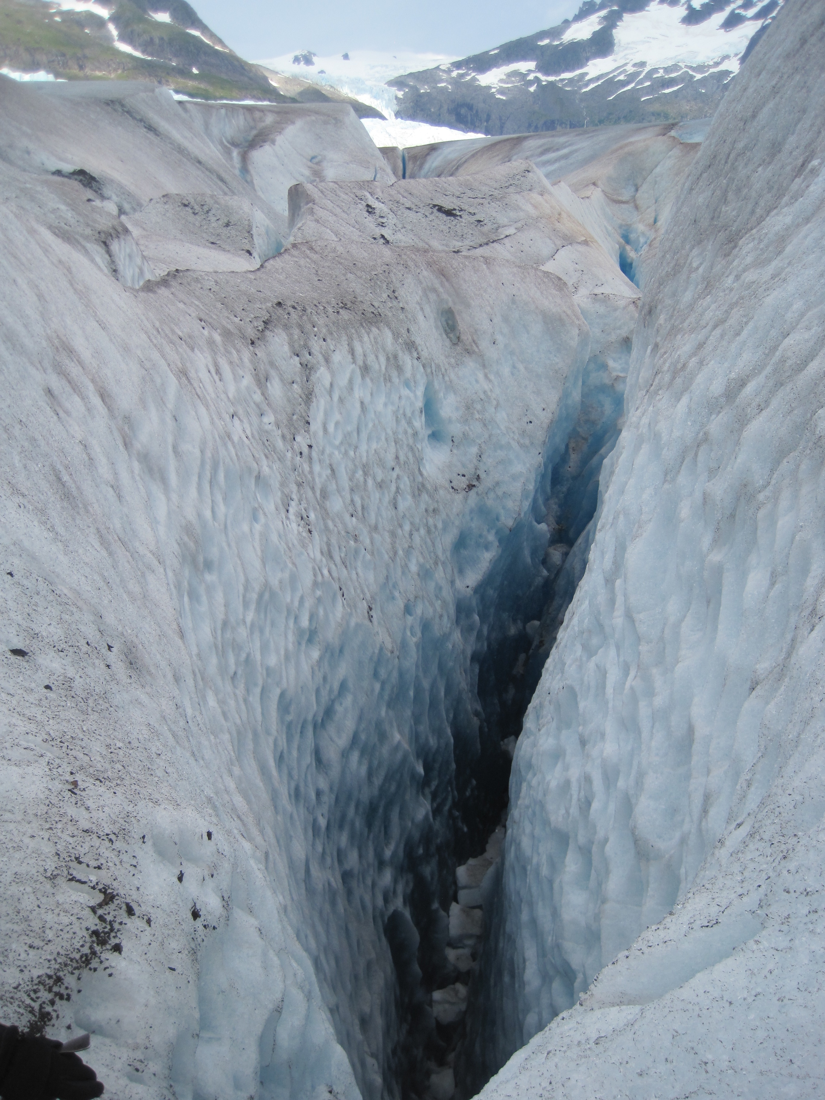
These crevasses are about 150 feed down, you don’t want to fall.

IMG_1306

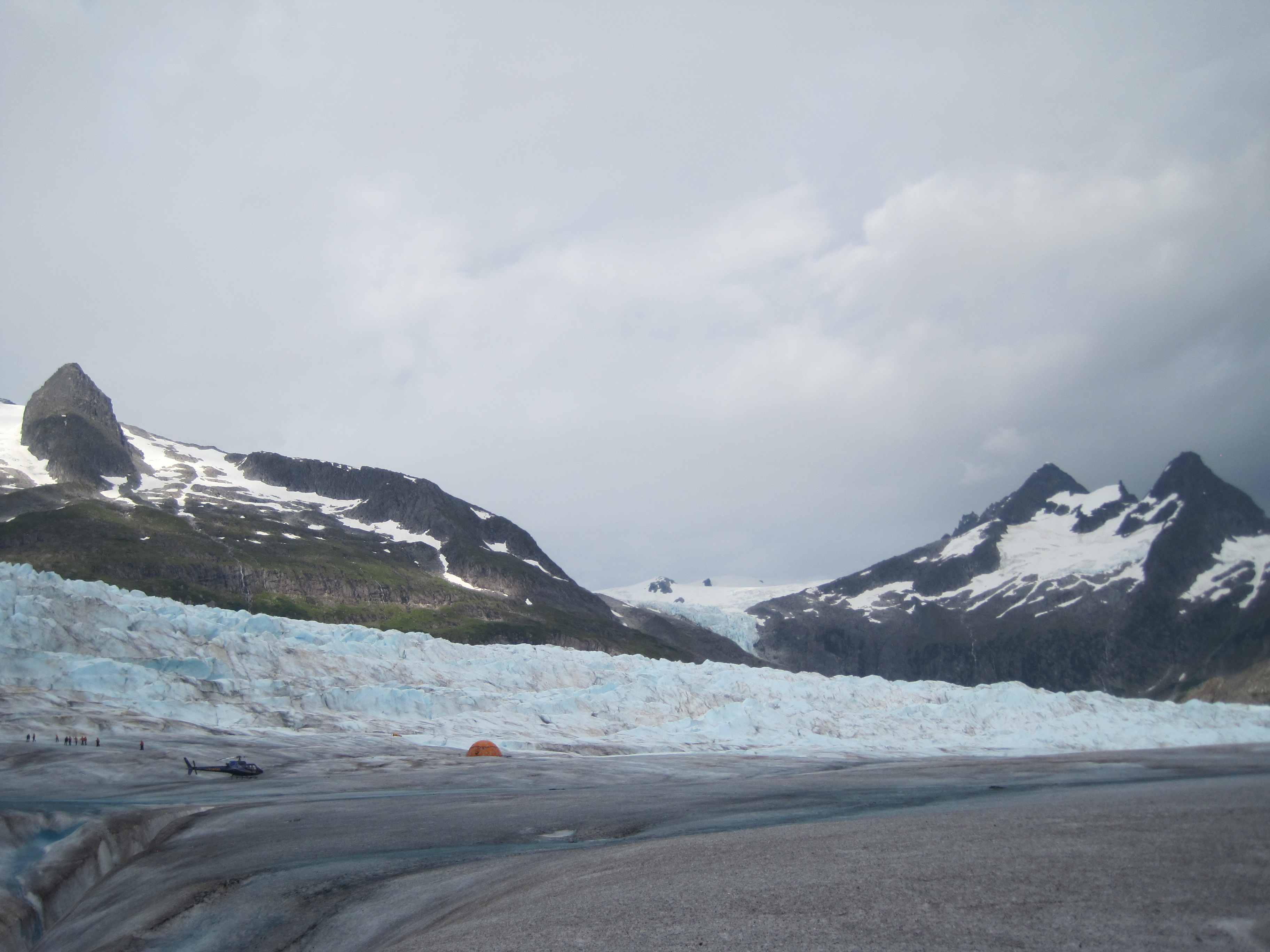
again for perceptive, this has tent and helicopter as well as people.

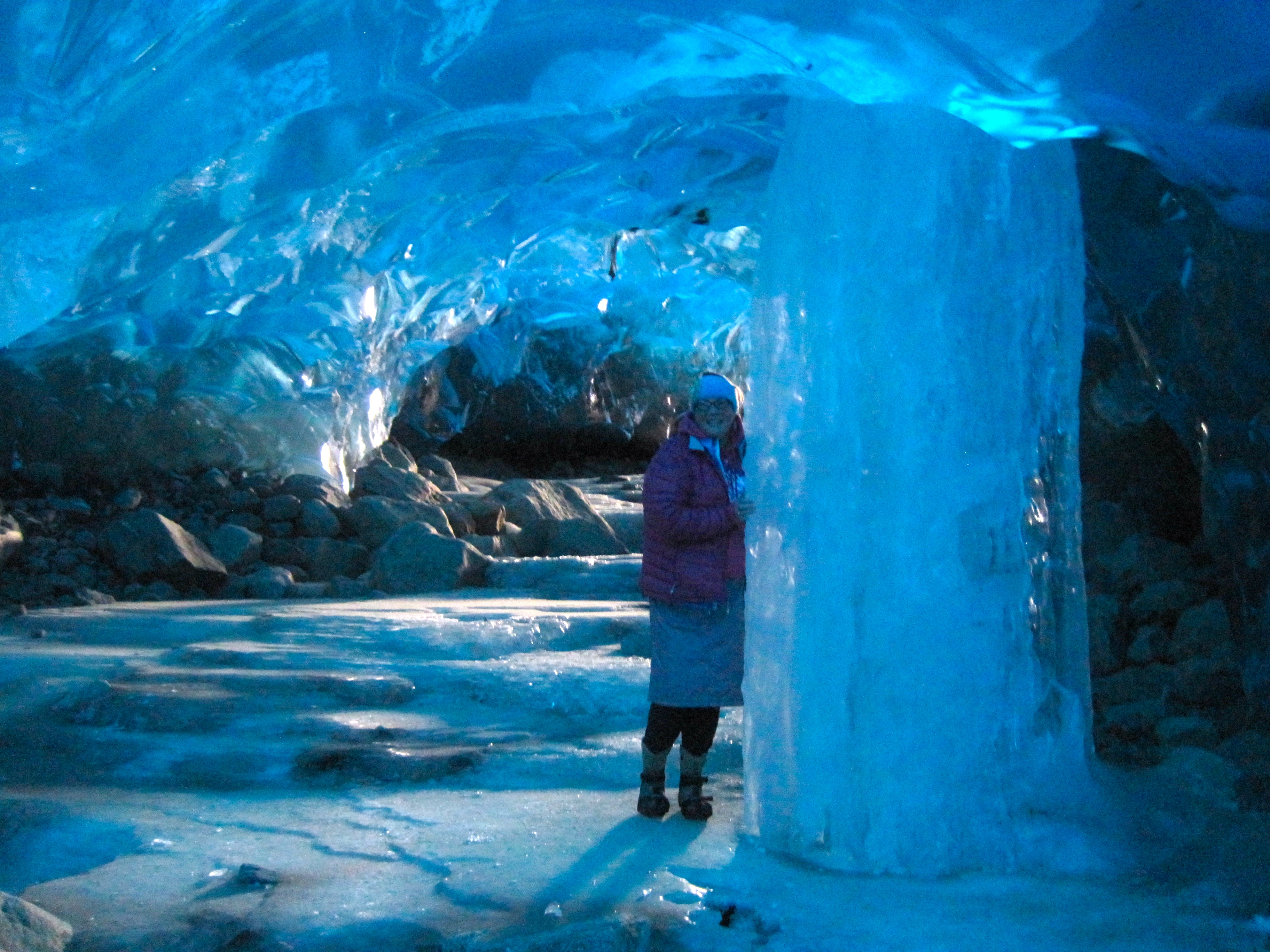
This is the same glacier that we were able to hike in the ice caves earlier this year, sadly they have started to collapse and it is very unsafe to return now.  http//timistravels.wordpress.com/2014/03/08/mendenhall-glacier-ice-caves-and-some-northern-lights/


Leave a comment »

Homer, Alaska; The End of the Road (or at least Highway 1)

July 17-20, 2014

IMG_1048

we flew in from Anchorage about a 30 minute flight on RAVN Air

IMG_1047

local airport

Homer, Alaska is one of the places in Alaska that gets the title of “end of the road” as it is the end of Alaska Highway 1. It’s about a 5 hour, 225 mile drive south of Anchorage so driving is an option as well as a quick 30 minute flight.   During the summer is a very popular destination for those visiting Alaska from outside, but we saw just as many, if not more, visitors that were from Alaska. Many people were visiting from as far north as Fairbanks, the Mat Su and Anchorage. People head to Homer for a number of reasons but fishing is the biggest!

IMG_1210

This is a view of the 4.5 mile spit from the air. As you can it feeds right into the bay.

IMG_1197

the change in water color is due to the fact that much of the water comes from the glaciers across the bay and glacial water is full of silt which leaves the water greyish in color and ‘thicker’ looking!

IMG_1196

Homer is known for the surf and individuals travel here so enjoy the waves.

The Spit is where a lot of the ‘tourist’ things occur. This Spit is a 4.5 mile strip of gravel, rock and sand that stretched out into the ocean. The spit was developed by glaciers in the past and most likely is the moraine from that glacier. Since it is surrounded by water on both sides, it is reshaped often. Historically there was a community on the spit from 1896 to 1902 but it was deserted after that. When a road connected Homer to Anchorage in the 1950’s the town grew quickly up into the hills surrounding the water.

IMG_1177

probably the most known establishment on the spit, though it’s menu has shrunk over the years.

IMG_1081

view out of my hotel room at Land’s End Hotel; view rooms are worth it.

IMG_1057

arts and gardening combined.

IMG_1056

11:30 at night, not bad!


IMG_1213

as we were flying out I captured this view of the bay with the Grewingk Glacier flowing into Katcemak Bay

Across from the spit is Kachemak (Catch-a-mack) you can view many glaciers flowing from the Harding Ice Field, named after President Harding. 30 glaciers flow out of this ice field which is about 3oo square miles. The 3 that can be seen from Homer are Grewingk, Portlock and Dixon Glaciers.


IMG_1176

creativity on the spit

IMG_1209

these floats pouring off a businesses porch in Old Town

Homer is an artistic, farming community. There were fresh, local vegetables on every menu in town and each store highlighted local artists. This farming in this area has grown significantly in the past few years. Homer has aspired to be known as THE ART community in Alaska. Many shops carry local art, but the fun place to visit is the Farmer’s Market on Wed and Sat mornings. You can buy not only fresh veggies but a lot of art work.


If you have a change be sure to take the ferry and visit Seldovia while in Homer. It is a quaint town that depicts off the road communities here in Alaska. The Island and Ocean Visitor Center is also a nice stop. It offers a great overview of wildlife in the area and showcases history of the region. s://timistravels.wordpress.com/wp-admin/post.php?post=3478&action=edit&message=6&postpost=v2


IMG_3141

yeppers, Moose running down the road, captured on the iphone of colleague J.Reeves

The thing that was most challenging for me was to view the 100’s and I am not exaggerating when I was 100’s of RV’s that were parked in the RV parks. When a community is on the road system this is an outcome one might expect. It was also odd to see tents set up on the spit as there is NOT one tree on the spit so it is wide open camping, I suppose I prefer camping in the woods !

IMG_1187

this fellow sat outside our meeting room for an hour on Sunday morning.

Alaskamagif300

255 miles South of Anchorage


Leave a comment »

Small town Charm in Seldovia, Alaska

IMG_1172

do you see the face of a bear in these rocks? I do and I love it!!! taken from ferry ride.

IMG_1161

wish I would have caught this, but I just decided to stand by it! It’s about a 90# Halibut.

IMG_1144

locals call this camel rock, I can see why!


July 18, 2014

A day in Seldovia, Alaska

I, for one love quaint little towns that embrace what Alaska is all about and Seldovia is just that kind of town. We were in Homer for work but had the opportunity to take the ferry ride over to Seldovia and spend the afternoon there.

IMG_1087

view from the ferry as we left Homer


IMG_1106

we saw whales breaching during the ferry ride. I almost caught the ‘fluke’ (whales tail)

IMG_1095

sea otters are everywhere in the waters in this area

IMG_1125

little sea otter playing in the harbor


IMG_1120

arriving to Seldovia, can you tell it’s a fishing community


IMG_1132

such beautiful flowers welcoming the ferry


It is a quieter community, as it is not on the road system; you have to try to get there! The community is far removed from the hustle and bustle of life in bigger communities in Alaska. It’s a town full of small town charm including Christmas Light contest, an annual chainsaw competition (with many of the carvings decorating town), and a solstice music festival just to name a few.IMG_1124IMG_1133

berries

a bowl of salmon berries is a summer treat!

We were hosted by a local for lunch and had yummy fresh salmon and halibut! What a treat. We then visited the Susan Early School on our way to the Otterbahn Hike and visit to the beach. I collected a lot of beach glass, (which I love) as well as filling 2 bags with salmon berries!IMG_1138IMG_1134

seldovia map

just in case you were wondering where it is on the map of Alaska

I’ve read a trip advisor reviews where people complained that there was “nothing to do” but I disagree, it is a delightful step into a beautiful community that isn’t full of tourist shops and billboards, it is a quaint Alaska community full of kindness and great old-fashioned hospitality.

Leave a comment »

Mendenhall Glacier Bear Activity

June 1, 2014

This was sent in an email to my by Laurie Craig the Lead Naturalist at the Mendenhall Glacier Visitor Center.  She wrote that “A few of us observed a fascinating bear family interaction. No camera was handy so I recreated the event in a different manner. Enjoy!”  I asked and she gave permission to share these.  cartoon 1 cub climbs tree 2014 june 1 cartoon 2 bears dangle 1june2014 cartoon 3 bear chew branch 1june2014 cartoon 4 munch 1june2014 cub tree2 cub tree

Then, I found some photo’s taken by Janice Gorle that go along with the adorable story.  Thanks Laurie and Janice.


Leave a comment »

Juneau’s road side bears; Mom and 3 cubs

bears playing

3 cubs playing on a log. (Photo by Janet Lopez)

janet year one bears

Mama watching her 3 babies in the spring of 2013. (Photo by Janet Lopez)

Last May (2013) we had a treat almost daily this black bear and her cubs would be eating dandelions on the by-pass near our house.  Several time I’d see them OR at least knew they were there because cars were parked all along the road trying to get photos. NONE of these pics are mine, but I will get credit to my sweet friends who took them. I am usually on my motorcycle this time of year and I am NOT stopping to grab the camera.


This May (2014) I was thrilled to see them early in May and almost every day since. Sometimes they are just playing around and others simply eating. It means that the babies made it through winter and are now one year old! Very fun.

katy bears

May 2014 Mom and 1 year olds return. (Photo by Katy Giorgio)

bears cx

This is a Juneau traffic jam… I drive this road daily and see them all the time. (May 2014 photo by Jennifer Hardy Brown)


So, for the educational part of this blog…. Some maybe wondering, ‘how come 2 cubs are brown and mom and other cub are black?’ Well the answer is actually quite simple. Black Bears, are all one species, but can be black, brown, cinnamon, blonde and yes, even white, which in Alaska and the Pacific NW are called “Spirit Bears” . Scientist speculate that there are many different colors to their coats: 1. to help camouflage them or 2. Because of climate and what they eat.


These brown cubs could lose the brown color and turn to black over time. It usually doesn’t happen until they are a bit older.


One other thing to note is the ‘chest blaze’ that is clearly viewed on the mom and the cubs. It is basically a “V” like marking, and her cubs are more likely to keep theirs throughout their life because she still has hers. It is not uncommon for a cub to lose theirs as they mature.


****These brown coated ‘black’ bears should NOT be confused with the Brown or Grizzly bears that I wrote about in my blog last summer.https://timistravels.wordpress.com/2013/07/ They can inhabit the same areas, but the Brown/Grizzly bears are much larger and have distinct characteristics that label them as such.

see the V marking on chest?  photo by Sue Reishus

Take note of the V marking on chest? photo by Sue Reishus

watched this guy stand up and walk over to car; it is worrysome how comfortable they are around humans. Photo by Sue Reishus

mom crossed the road leaving the cubs on one side. There was an attempt to stop traffic and allow cubs to join mom, here they are reunited again. Photo by Sue Reishus

UPDATE: Last night on ride home stopped and watched them play, my friend Sue Reishus captured these shots.

1 Comment »

Motorcyclin’ Around Michigan including a (Ferry) Ride Across Lake MI

May 4-9, 2014

IMG_2719

leaving Almont on the beginning of our 1100 mile trip

We had hoped for better weather for a ‘spring’ ride in Michigan, however, we didn’t have much choice once we bought tickets.  Left Almont and headed N towards Midland with some light rain.  It actually wasn’t too bad though the hands did begin to get a tad cold on the ride.  Enjoyed a night with family in Midland and dinner at Pizza Sams!

IMG_2724

3 years in business, nice people

On Monday a.m. we started the longest mileage leg of the trip, Midland to Sault St. Marie.  It rained the first hour but got nicer the more N we went.  Decided to try the Cheboygan Brewery and since it was Cinco De Mayo they had a fun little spread of food to accompany the beer!

IMG_0844

if you look really close you can see the Mackinaw Bridge behind us.

We continued on to the Mackinaw Bridge for a photo opt though you can’t see the bridge very well in the distance.  I can’t believe they charge the same for 1 bike or 1 car.  I only have 2 wheels, and weigh a lot less than a car.  Oh well.

IMG_0847

loved the old painting on the side of the building

IMG_2728

Note all the church pews in the background. The “cheese” club was meeting here this night and there were lots of them!

IMG_2734

Having ice in the locks this late in the year is not that common. There is was a lot of ice in Lake Superior

IMG_0849

Chippewa County Courthouse was built in 1877. It is an example of the Second Empire style of construction from the late 1800’s. Wall are 2 feet thick, both the bell tower and the main building feature steep sloping roofs once covered in slate now with shingles. The 3rd floor has the “statue of Justice” made of wood.

IMG_0850

out front of the courthouse is the The ‘Wolf of Rome’ it is an exact copy, of the ‘Capitoline Wolf’ which has been housed since 1471 in the Palazzo dei Conservatori on the Campidoglio, Rome, Italy.

After crossing the bridge it was a quick hour into Sault St. Marie.  The first exit has a lot of hotels and shopping options (for the UP that is) but we continued into town to see if we could find the brewery and dinner options.  Ended up staying at a hotel right on the Locks and lucky for Harry the brewery was right across the street.  Interesting evening filled with interesting characters.  Loved the small town feel and time we spent here on a nice spring evening.

Left early on Tues. a.m. to drive to Escanaba.  There was snow along the route but none on the roads.  Went on M-28 through Newberry into Sceeny and then took HWY117 south before heading west on HWY 2.  The day got colder the closer we got to Lake Michigan.  When we arrived into Escanaba I was happy to see http://www.cyclecityinc.com/.  I went inside and bought gloves that were battery operated and could keep my hands warmer!    Enjoyed a night with family and a great dinner at the Stonehouse!


Wed. was by far the worst day of the trip.  We left in rain which subsided a bit after 1/2 hour.  However 15 miles outside of Green Bay I saw lightning, so we pulled under a viaduct and waited, and waited and waited.  After about 45 minutes the rain had let up a bit and we rode into Green Bay. Sadly the place we wanted to stop and eat was only open for dinner, not lunch, so we rode on, in the rain!  AND now I am talking rain, with 20-25 mile an hour sustained winds and 30=40 MPH gusts.    We were freezing, we were drenched and it was horrible.  Stopped to fill up with gas, and warm up and wait to see if rain eventually passed.  It did after about an hour, so we hopped back on for the last hour of the trip into Milwaukee.  By the time we got to our hotel we simply wanted to take hot showers and lay down and rest.

Thursday, awoke to warm weather, first of the trip.  Toured downtown Milwaukee on our bikes then hopped on the ferry.  w.lake-express.com.  Great experience, nice ride and motorcycles free!  Arrived in Muskegon and rode bikes to Grand Rapids for dinner with more family members.


statue in park in downtown Milwaukee, it is in memory of Laurent-Salomon Juneau, founder and first mayor of Milwaukee.

IMG_2747

as we pulled into Muskegon! It was close to 90 degrees!

IMG_2752

Happy to be warm and see the sunshine!


Finally on Friday we rode back to Almont and put the bikes away til next time, when we hope the weather is better!


2 Comments »

Mendenhall Glacier Ice Caves (and some Northern Lights)

March 1, 2014

Almost every Feb. or March Juneau has a cold snap where Mendenhall Lake freezes enough that individuals can get out on the lake to cross country ski, or hike etc.  Typically during that time it is also quite sunny and the rain or snow subsides for a few weeks.

These explorations around Mendenhall Glacier are typically astounding, and the photos that come out of the visits make our Christmas Card each year, it is truly part of what makes Juneau such an incredible place to live, these things are in our back yard.

This year the glacial caves are getting a lot of attention from National news outlets but here are a few of my photos from the weekend of March 1 and 2, 2014.  I went on my own Sat. but did not enter the caves.  I made Harry get up early with me on Sunday and get out there when 1) there were not many people there at all and 2) I felt a little more safe with it being colder in the morning.  There is danger doing this but it was worth the risk!

The few Northern Light pictures are NOT taken by me, rather a friend of a friend.  Thought you may enjoy seeing them!

IMG_2496

out near the face of glacier

IMG_0735

harry inside the cave, yes, real colors, not altered at all

IMG_0737

me enjoying being silly

IMG_0761

over my right shoulder is a ice column in the cave, facinating

IMG_0768

just outside the cave with the peaks above my head being higher up on glacier.

IMG_0789

harry at the face being silly himself

IMG_0743

while in the cave we are looking up out of these holes…

IMG_0804

this ice cave I would not venture into, there were sounds coming out of it and that triangular piece above Harry’s left arm looks to scary to me.

IMG_0690

I hiked out to face on Sat. by myself, but did not venture into the caves

IMG_0719

just as you enter the cave

IMG_0732

that ice column that is in the middle of the cave, not quite sure how it formed, possibly a water drip that grew???

IMG_0782

the natural heart cut out I found hiking around the face of glacier

IMG_0785

out near face so much BLUE

IMG_0764

not touched up at all, the colors were simply incredible, almost looks fake doesn’t it?

Dylans house aurora 1

during this same time period we also get great Northern Lights. I did NOT take this photo rather it was taken by David Reed, a friend of a friend of a friend.

North Douglas

again by David Reed, this is taken out on North Douglas. the lights along the bottom are car lights. the light over the hilltop to the right is near our home!

2 Comments »

Not the Iditarod, but a “pre race” in Galena

Galena, Alaska 2003 or 2005

As the Iditarod race is running this year, on VERY LITTLE snow, I am reminded of a trip I took to Galena, Alaska about 10 years ago.  I was in town for work and picked a great weekend to be there for the Spring Festival.

Every other year, the Iditarod Race stops in Galena, this was the off year, so this race was the highlight.  It was cold that day, I’m remembering about -30 to -40 below, though a few days later it was up in the 20’s.  It was a dry cold which makes it better than the wet cold of Southeast, Alaska.

I don’t remember a lot of ‘facts’ from this day, but what I do remember is that those dogs were so pampered and loved by their owners (contrary to what others might think), and those dogs LOVE to run.  The other surprising part is how small the dogs are.I had always thought they were larger dogs but once I saw in person they are much smaller.

All and all a fun time and one of these years I will get to see the actual Iditarod!      Enjoy the pics!

OLYMPUS DIGITAL CAMERA OLYMPUS DIGITAL CAMERA OLYMPUS DIGITAL CAMERA OLYMPUS DIGITAL CAMERA OLYMPUS DIGITAL CAMERA OLYMPUS DIGITAL CAMERA OLYMPUS DIGITAL CAMERA OLYMPUS DIGITAL CAMERA OLYMPUS DIGITAL CAMERA OLYMPUS DIGITAL CAMERA OLYMPUS DIGITAL CAMERA OLYMPUS DIGITAL CAMERA OLYMPUS DIGITAL CAMERA OLYMPUS DIGITAL CAMERA

2 Comments »

Driving the Hana Highway

11/21/13

Some people say this drive is not worth it, we could not DISAGREE more, we LOVE this drive.  I do say however, if you are prone to car sickness simply offer to drive.  I have driven it 2 x’s and would recommend it to anyone visiting Maui.  I am sure this won’t be the last time we drive it.

The beauty starts off almost immediately.  At the 2 mile mark there is the busiest hike of the road, and is certainly a fun easy hike into a waterfall and pool.   At about the 6 mile mark when you see the Rainbow Eucalyptus Forest on your left. IMG_1816 IMG_1825 IMG_1822 IMG_1821 IMG_1820 IMG_1819 IMG_1818 After leaving there, continue along the highway slowing at each bridge to #1 make sure no one is coming the other way and #2 (an most important) to see if there are any waterfalls in these valleys.  Sadly during this trip there had not been much rain in recent history, so a lot of the river beds were dry.IMG_1827

At 19 mile you will see the Three Bear Falls, though again, if there has not been much rain they will not be flowing as much as they will during the wet season.IMG_1826 IMG_1830  Wailuaiki Falls is located near the 21 mile marker, but it can be very hard to find a place to park around here, though we parked up hill and walked back down to view them.  Some of the best falls are up near mile markers 43 an 45.IMG_1832 IMG_1834 IMG_1835 IMG_1836 IMG_1839  However, the highlight of our day was once we arrived to the National Park and decided to hike the 2 miles up and through the Oheo Gulch to the Waimoku Falls.  The 2nd mile of the trail is mostly going through bamboo forests which in itself is interesting.  It is 400 feet tall and the tallest falls on Maui.  We took a dip in the pool in front of it.  IMG_1867 IMG_1868 IMG_1869 IMG_1871 IMG_1873 IMG_1874

Once we were back at the Park Service area we decided to walk towards the ocean (below the main road) to view the  Seven Sacred Pools.  There are many falls along this short walk and of course pools that you can swim in and cool down after hot hikes!

During our day we also did 2 other highlights that are noteworthy.  We stopped at the Lava Tube (caves) which were worth the $12.50 entry fee.  There are a lot of interpretive signs and I feel I learned a lot while walking through the cave.  It is fascinating how it was formed.

Lastly as a highlight to the day we stopped at Nutcharee’s Thai Food in Hana.thai  We have had a lot of Thai food and traveled in Thailand for a month, so we can be a bit picky, let me tell you this was authentic and so worth stopping by to eat.  We had the 2 specials of the day, red curry with chicken and an extra special treat, fresh ahi and green curry.  No words can describe how good the green curry ahi was.  The ahi melted in my mouth.

The only bummer of the day is that we ran out of time.  We ended up driving back on the Hana Highway in the dark missing so much of the beauty that we viewed on the way down to Hana.IMG_1892

1 Comment »

Drive around North end of Maui

11/19/13

1valley

there are a few valley’s like this on the N end

We have driven this before but wanted to highlight a few standouts this time.Though many people go from Lahaina around, we start the other way so that we can end in Lahaina for dinner and drinks at the Maui Brewery.  For all purposes the drive starts in Kahului.  Turn as if you were headed to the college (where the Saturday flea market is held, another must!).  Heard North along the highway 340.  As the road begins to elevate and get curvy be sure to stop at a pull out and look back at Haleakala which towers just over 10,000 feet.

3plumeriaphoto

yellow plumeria, so pretty

2flower

Hibiscus are so dang pretty

Last year we did a great hike along this route that took us a few miles into the rain forest, but this year we had other plans.  If you want to do that hike watch for the telephone pole that has #174 on it and remember that that trail head is at the bottom of that hill.  Hence if you are going the direction we are, you’d have to turn around after you see #174 and go about 1/4 miles back down the hill.  This pull out near pole 174 is also a great one to view back towards the rest of the island.

5 1st blowphoto

this is at the 2nd Mile marker 38 AFTER the blow hole if you come the way we came OR the 1st marker if you come from Lahaina. Don’t start your hike to hole from here.

4churchphoto

the quaint church in Kapalua

We continued around the point stopping for construction near the small town of Kapalua.  Near the town the road is VERY narrow and it is one lane most of the way.  Each time we drive this there seems to be a hold up b/c someone freaks out as they drive this road and stops traffic until a nice Samaritan helps the scared driver pull over far enough so others can pass.  DON”T drive this drive if you are not comfortable with tight spaces.

6 heart rockphoto

found this heart shape in a lava rock as we were climbing down to the blow hole

7 heart cut outphoto

so happy to find the natural formation of this heart in the lava rocks near the blow hole

We got to the mile marker 38  (there are 2, one at each parking lot for the blow hole), and headed out to find the natural heart cut out in the rock formations.  We hiked down the steep, rocky area towards the blow hole, but then veered to our right to find the rock!  Score!

11 snorkelphoto

we snorkeled in this cove and it was so beautiful. You can see people in the water if you look close.

After this hike we headed to our favorite snorkeling area, DT Fleming Beach Park.  After a short walk into the beach we were quick to get on our gear and into the water.  Amazing fish that I will blog about next.

After an hour or so of snorkeling, it was off to Maui Brewery for some IPA’s.  But the real treat of the night was trying a new eatery, Star Noodles.  A new ‘dont miss’ on Maui.

All and all a great day and well worth the trip around the tip!

1 Comment »