timistravels

My job allows me to visit a lot of Alaska on a yearly basis. I wanted to capture the trips in one location!

Iditarod 2015, Nenana the first mandatory stop

First Pit Stop: Nenana, Alaska

Monday, March 9, 2015

IMG_4802

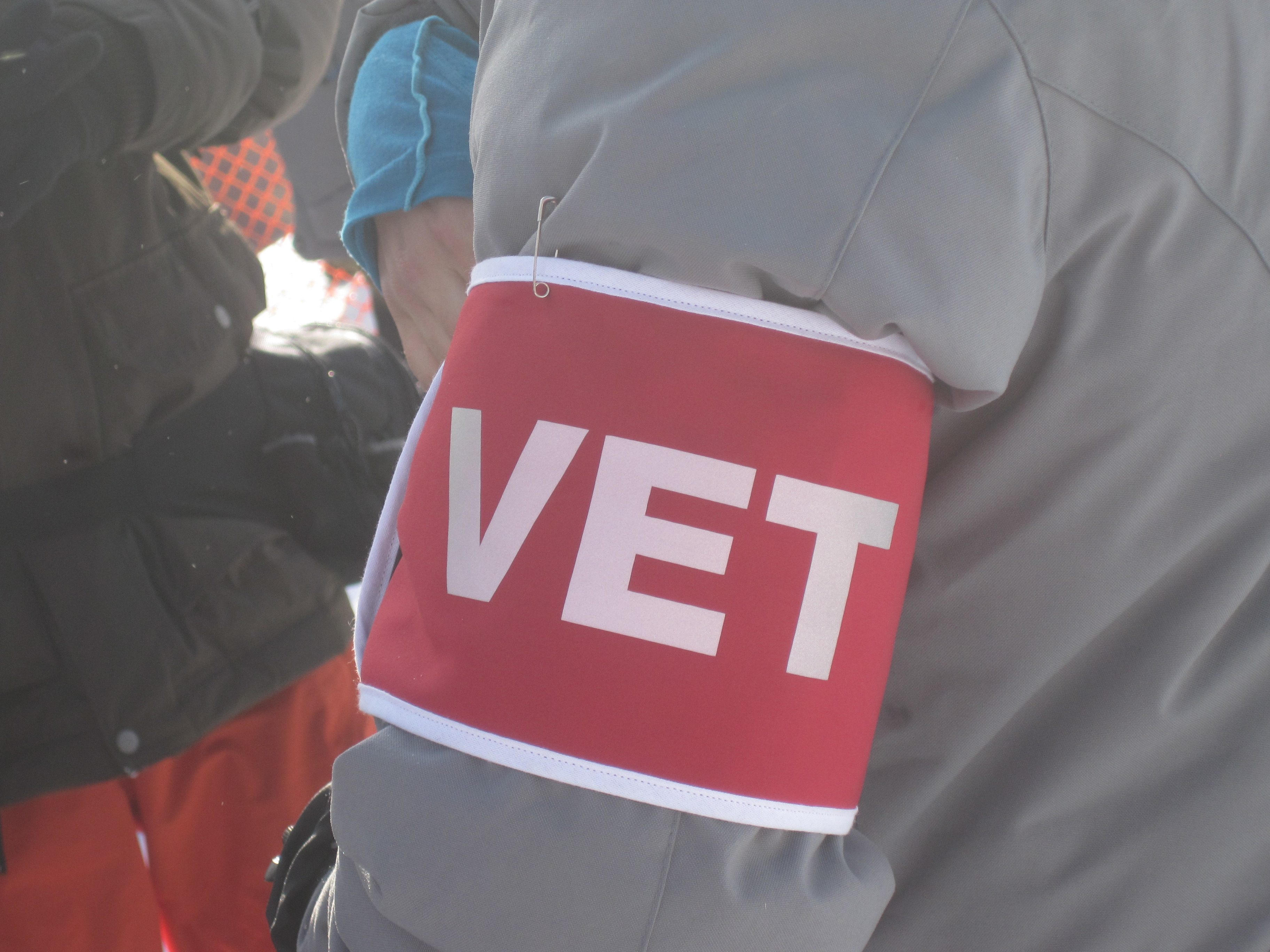
all Vets had these armbands

IMG_4786

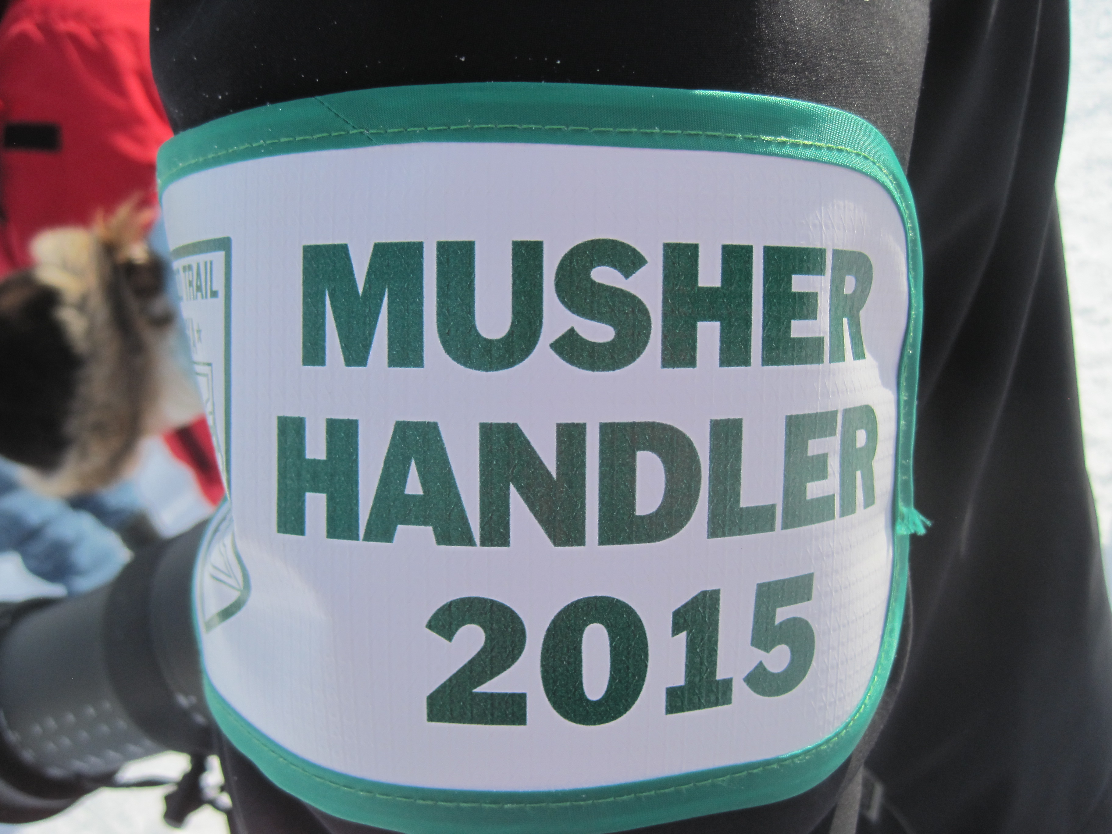
all the helpers/handlers had these arm bands

IMG_4775

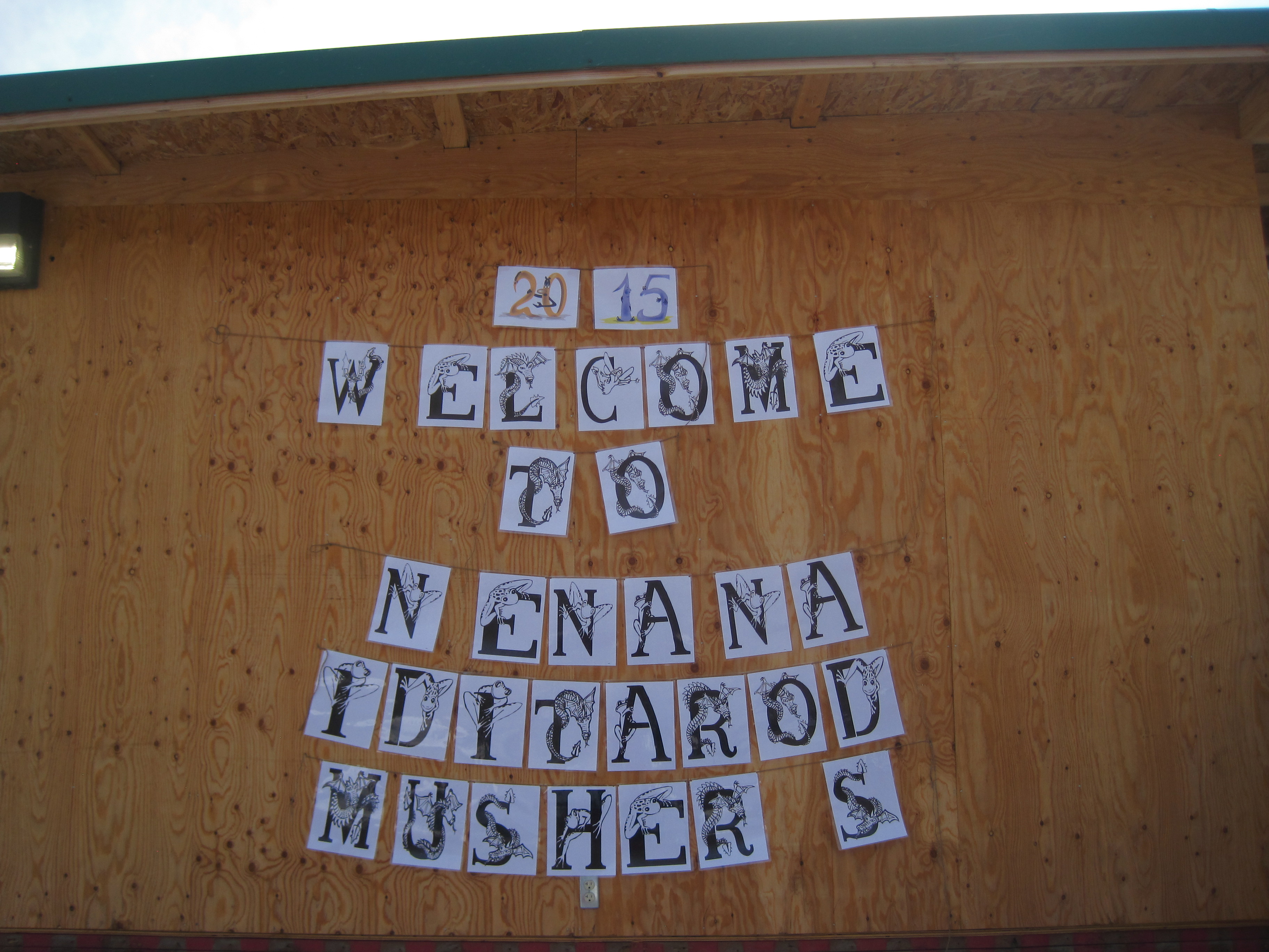
the town of Nenana welcomed the teams!

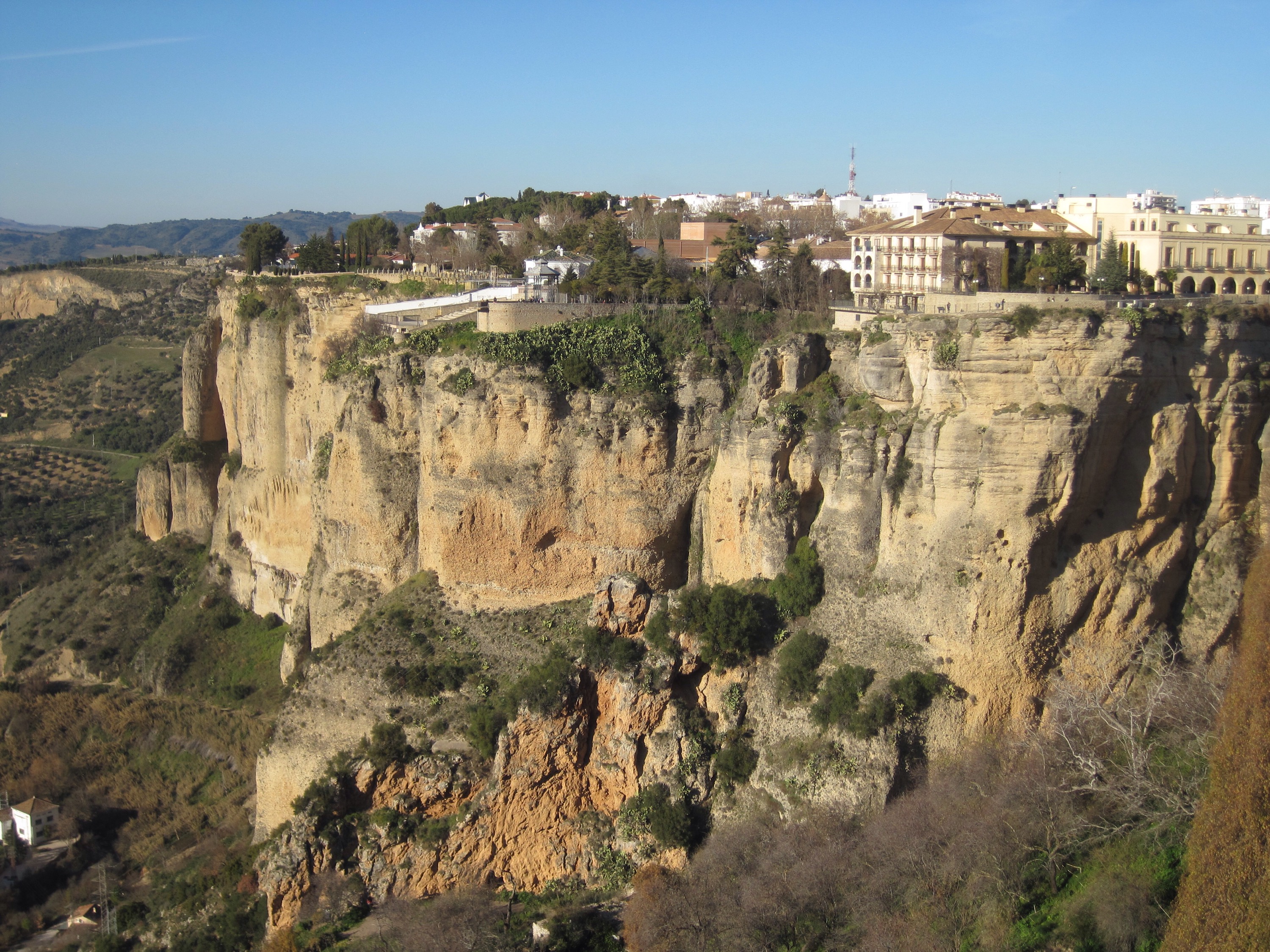
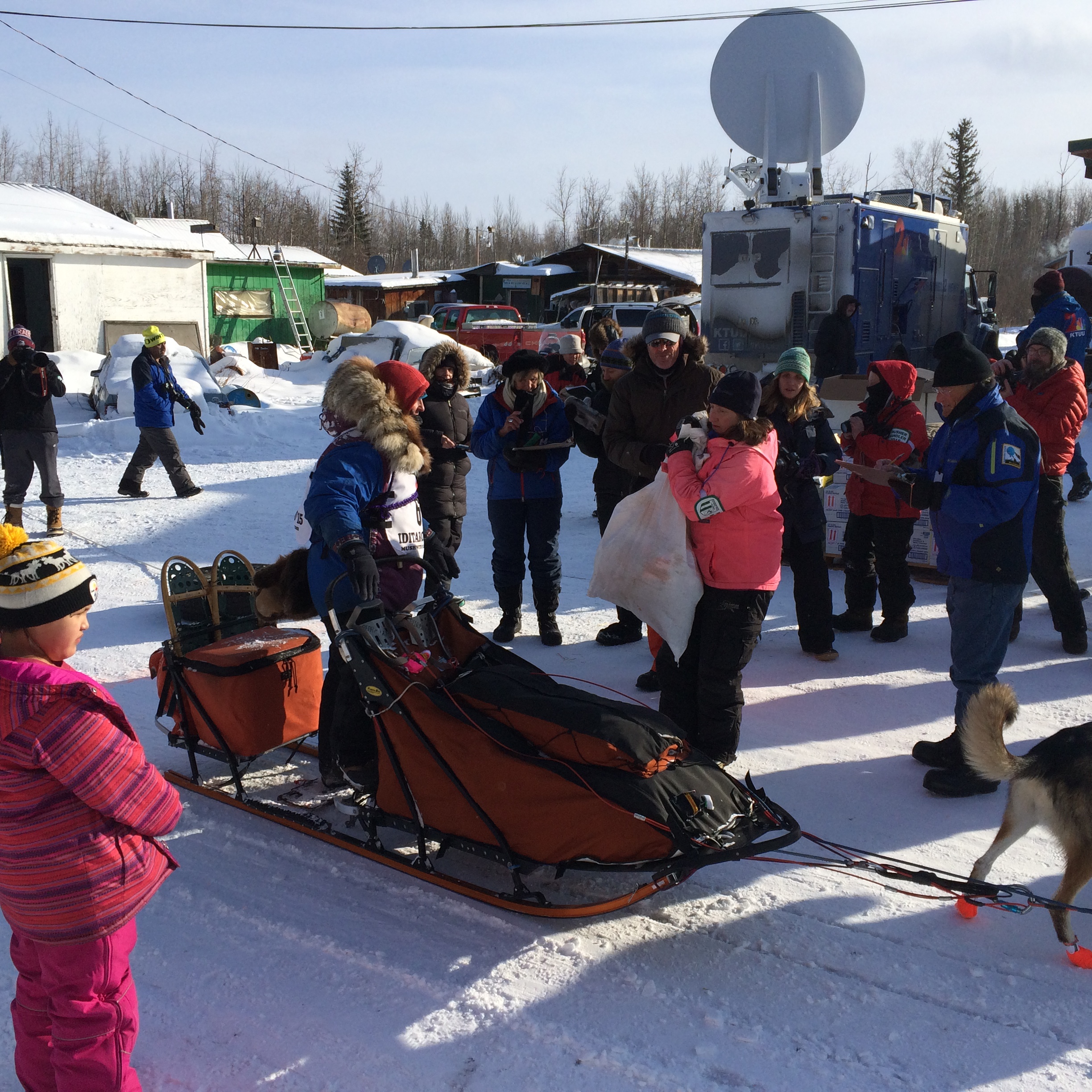
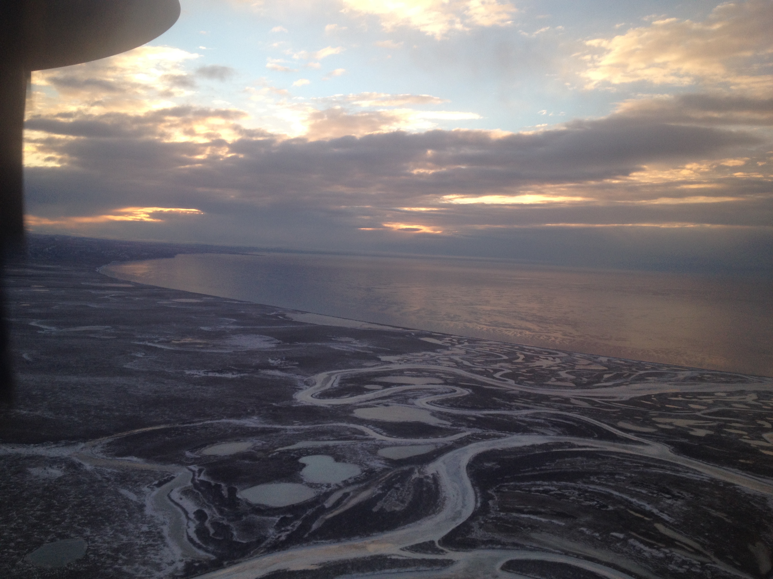
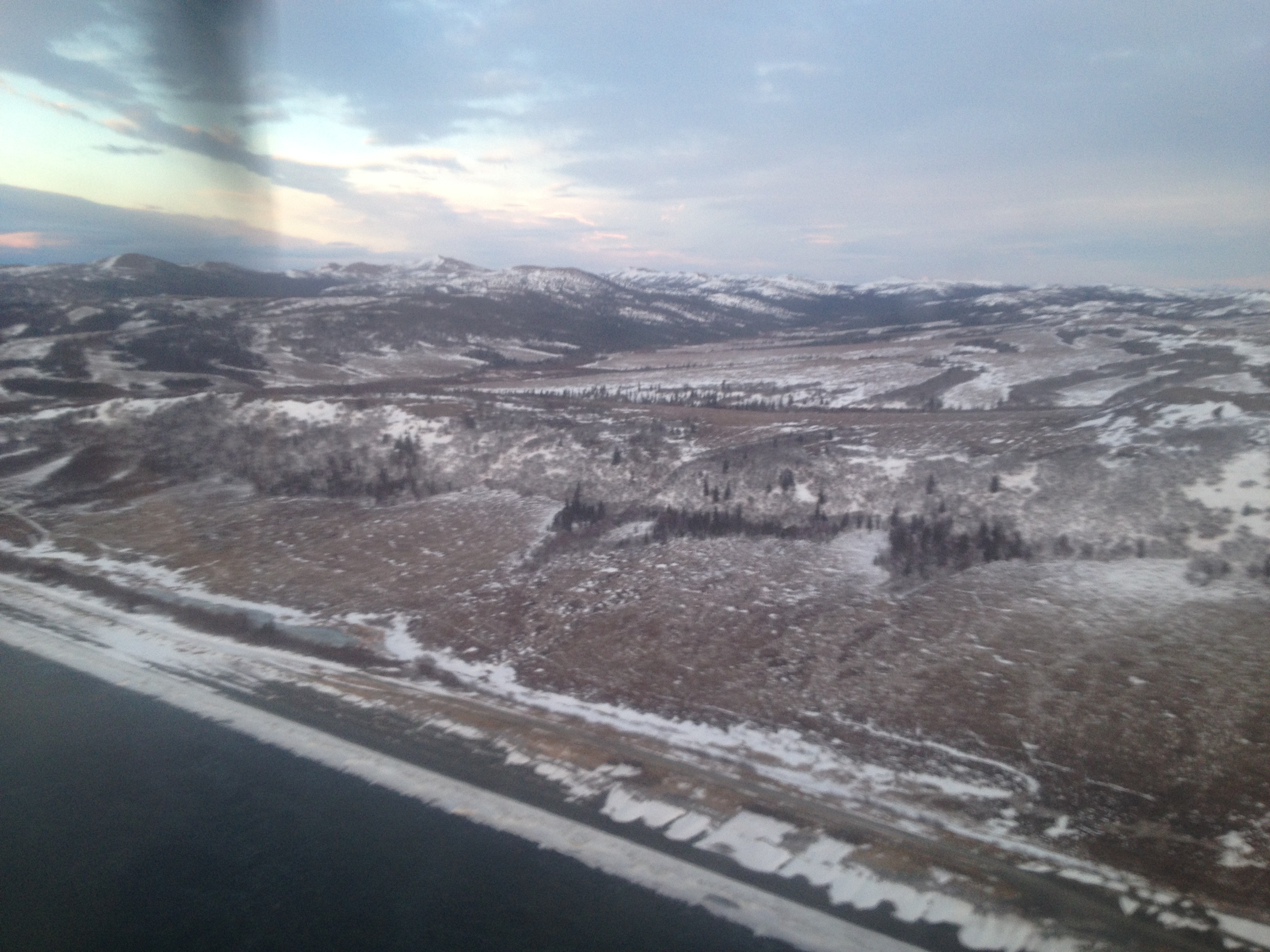
Along the route there are mandatory check in points, mushers have 3 MANDATORY layovers, 2 for 8 hours and 1 for 24 hours. It is up to the musher to decide where to stop for these layovers and the layovers cannot be combined. This year with the alternative route, Nenana was the first stop. Nenana is 58 miles South of Fairbanks along the Tanana River.


Mushers need to stop, sign in, have their dogs checked by vets and gather supplies that were flown (or in this case driven) to these sites ahead of time, typically 1800 pounds is sent out in total. These (mostly mandatory) supplies include:

  • food for both the dogs and their humans,
  • straw for bedding once the teams stop to sleep,
  • back up headlamps and batteries,
  • an ax,
  • sleeping bag,
  • snowshoes,
  • stove and fuel,
  • 2 sets of booties for EACH dog,
  • arctic parka,
  • a vet log where the status of each dog is logged at each stop by a VET,
  • mail to be delivered in Nome,
  • parts to repair the sleds if needed
IMG_4773

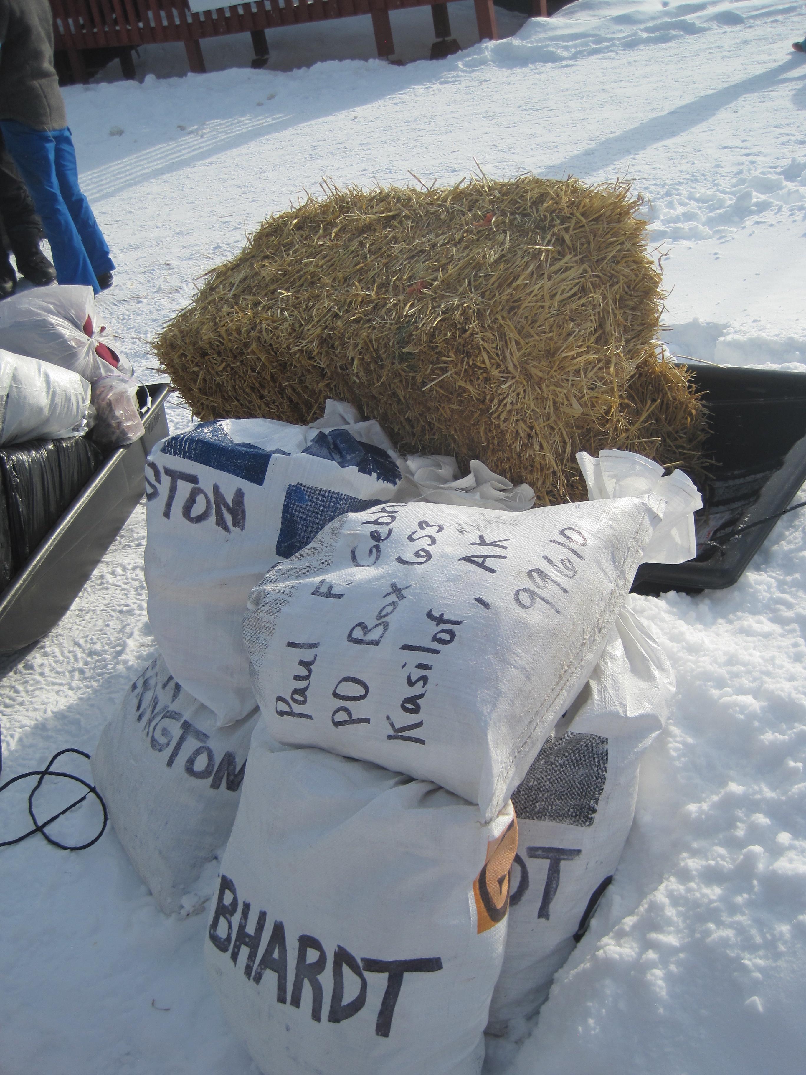
supplies that were sent ahead of time

IMG_4774

food, straws etc all sent ahead of time

IMG_4800

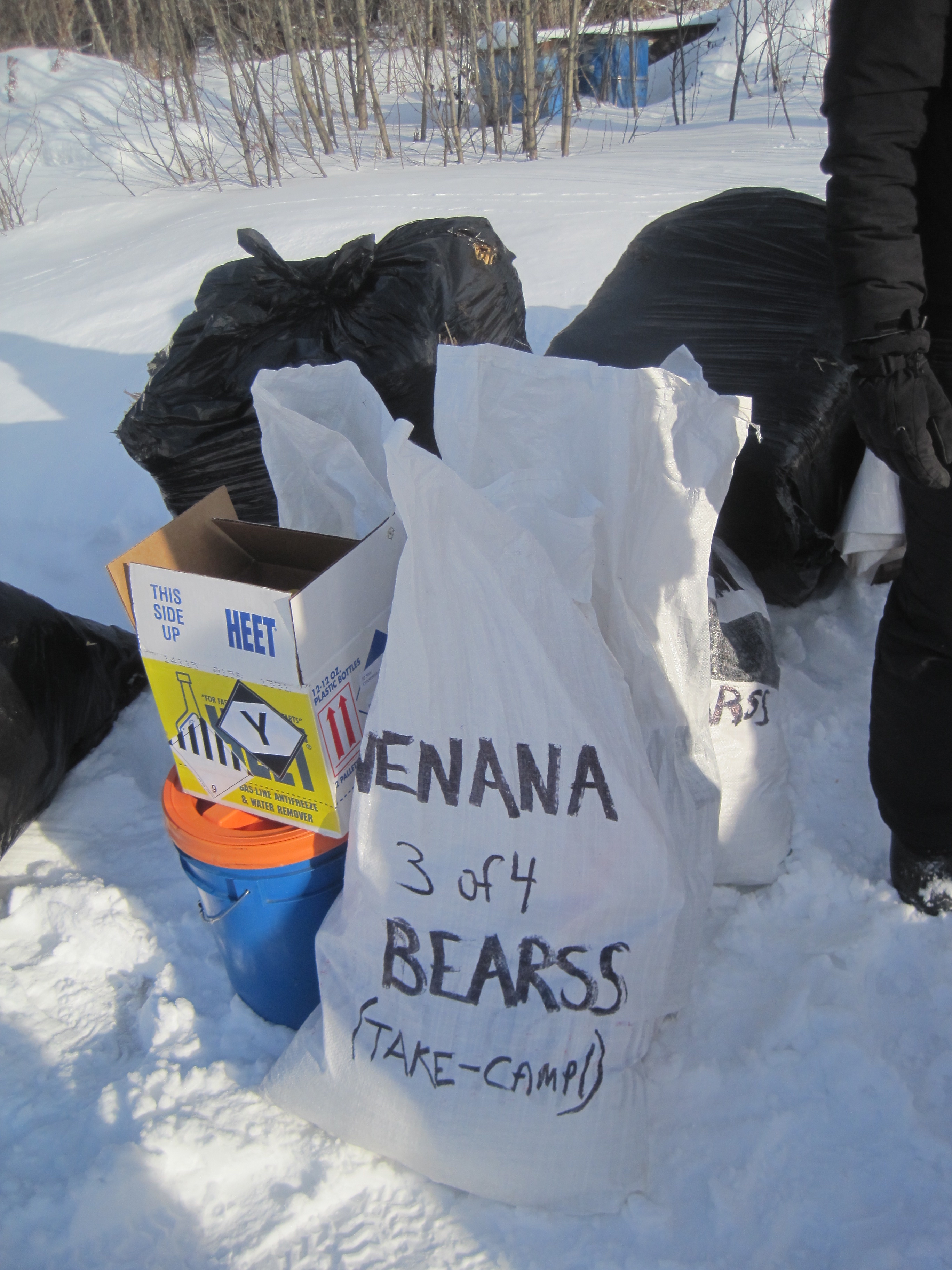
food, supplies, and HEET to cook the food with!


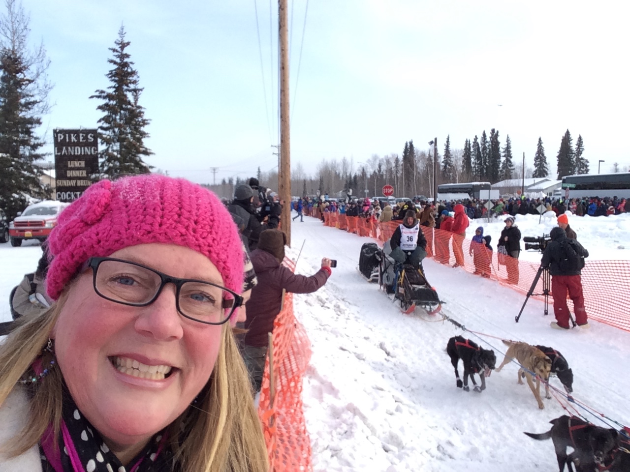
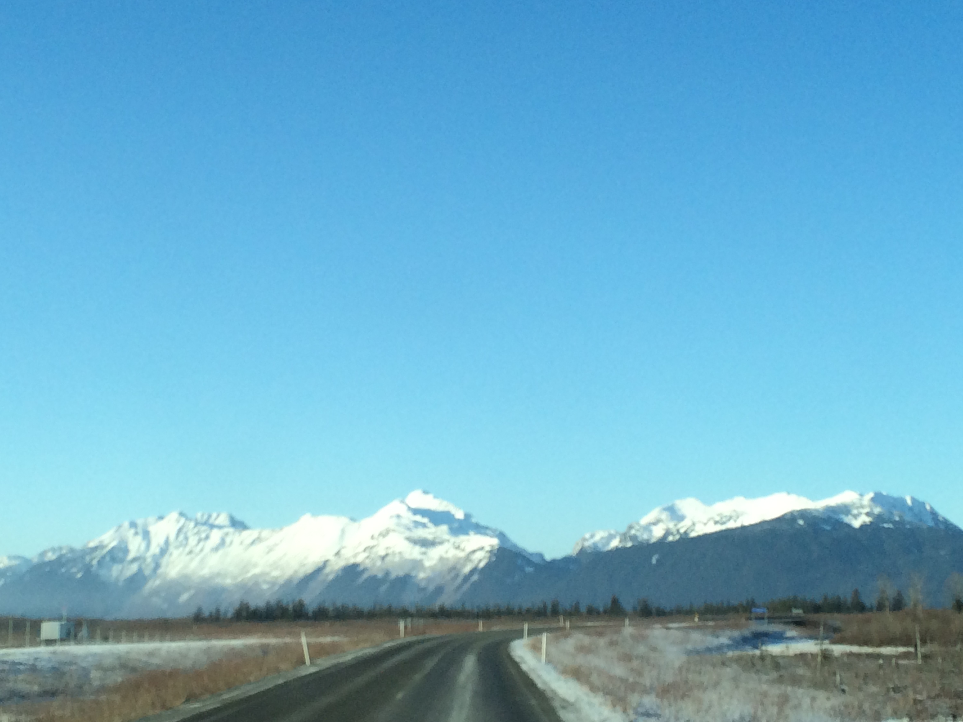
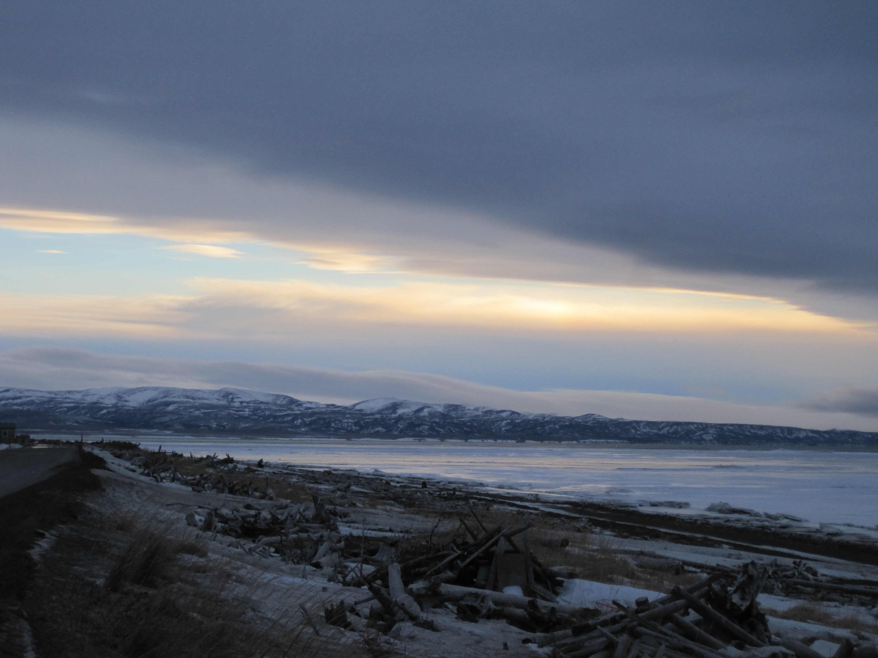
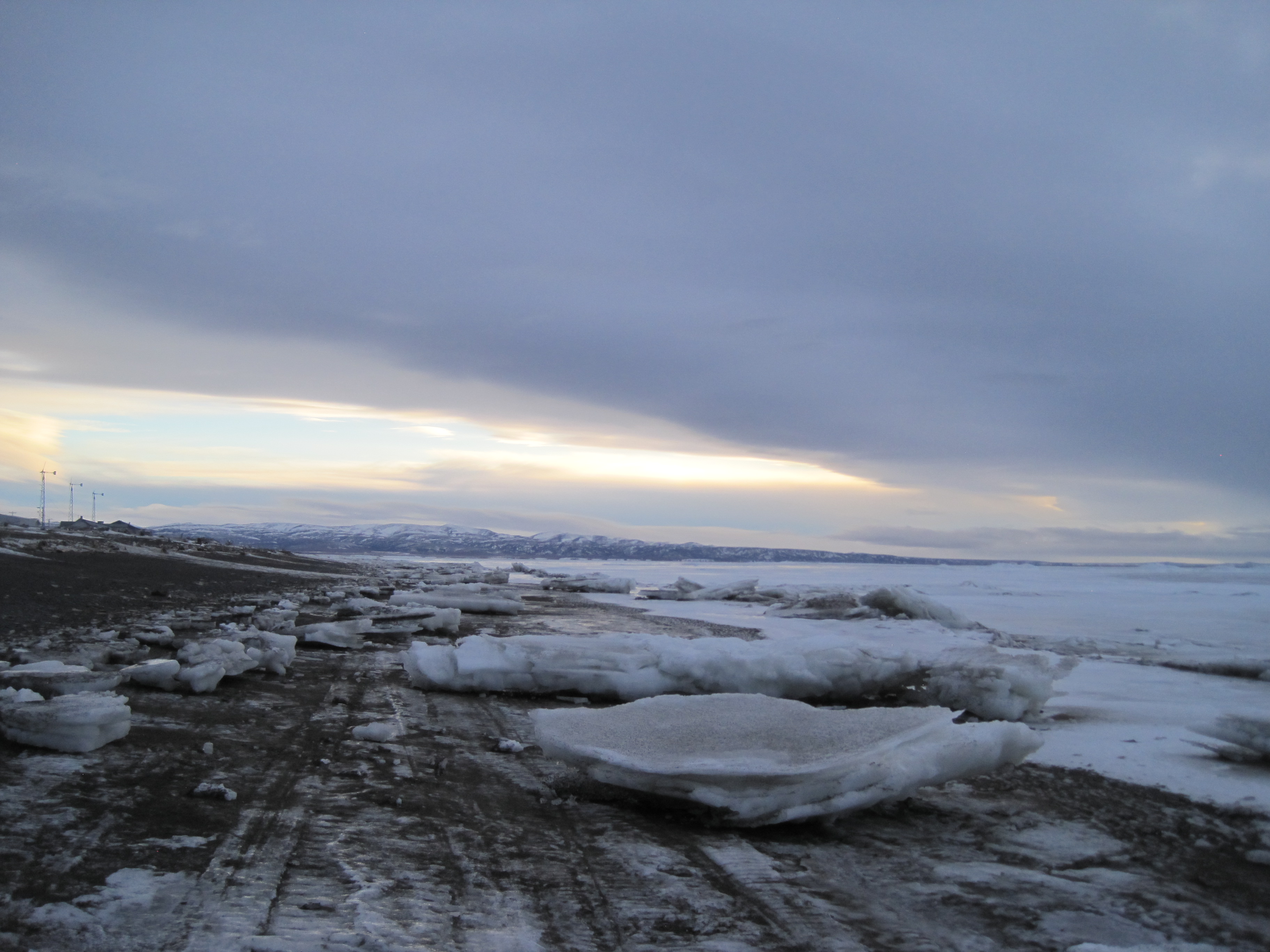
I hopped in the car and drove  58 miles south from Fairbanks to Nenana.  It was fun to see the town of Nenana come out to welcome in the teams. There was food inside the Chief Mitch Demientieff Tribal Hall, and fires going for those visitors to come in and warm up. T-shirts were for sale, and the atmosphere was one of excitement and fun.   Outside each musher had supplies that had been sent /dropped off for them to pick up on their stop in Nenana. I wondered what the pallet of “HEET” was for and asked one of the organizers, they indicated that the Heet was used for cooking along the trail.


The day was cold but full of sunshine so if you waited in the sun it did not feel so cold. Nenana Schools offer a Residential component where students from rural Alaska can come and live in the Living Center and attend the public school. I befriended a few of the girls from the LC and enjoyed chatting with them as we awaited the teams.


IMG_4784

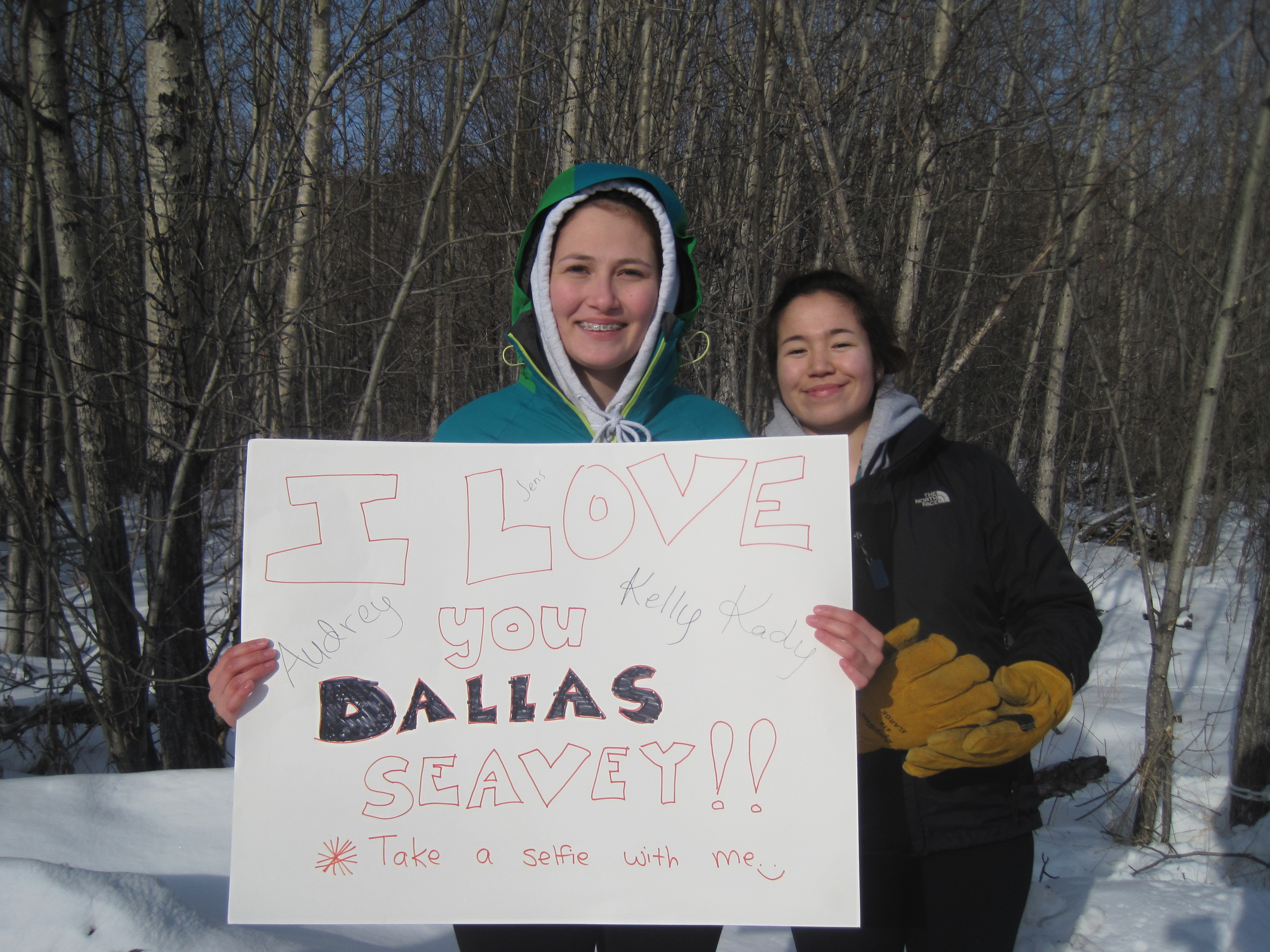
students from Nenana’s Living Center cheering on their favorite racers

IMG_3298

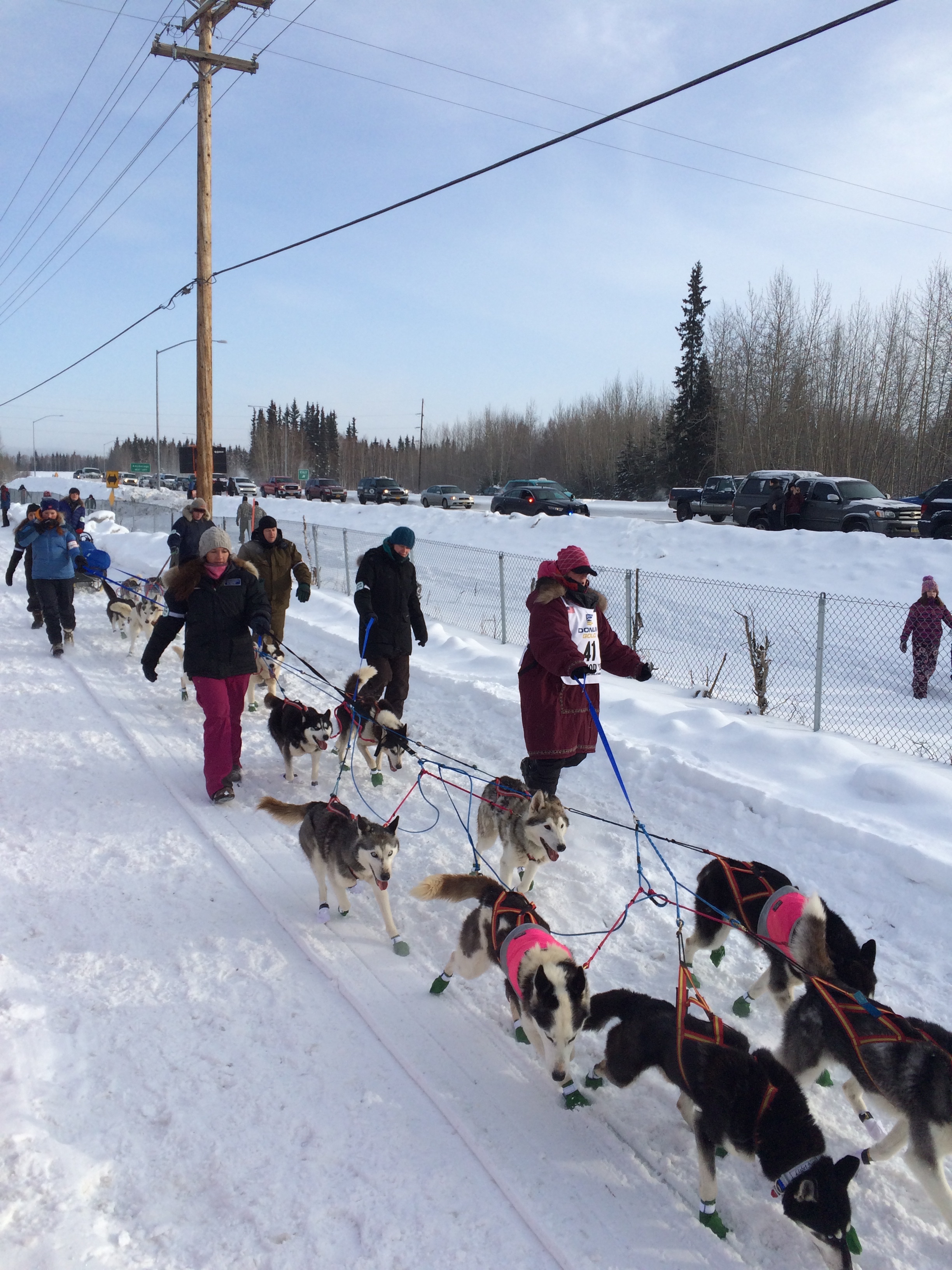
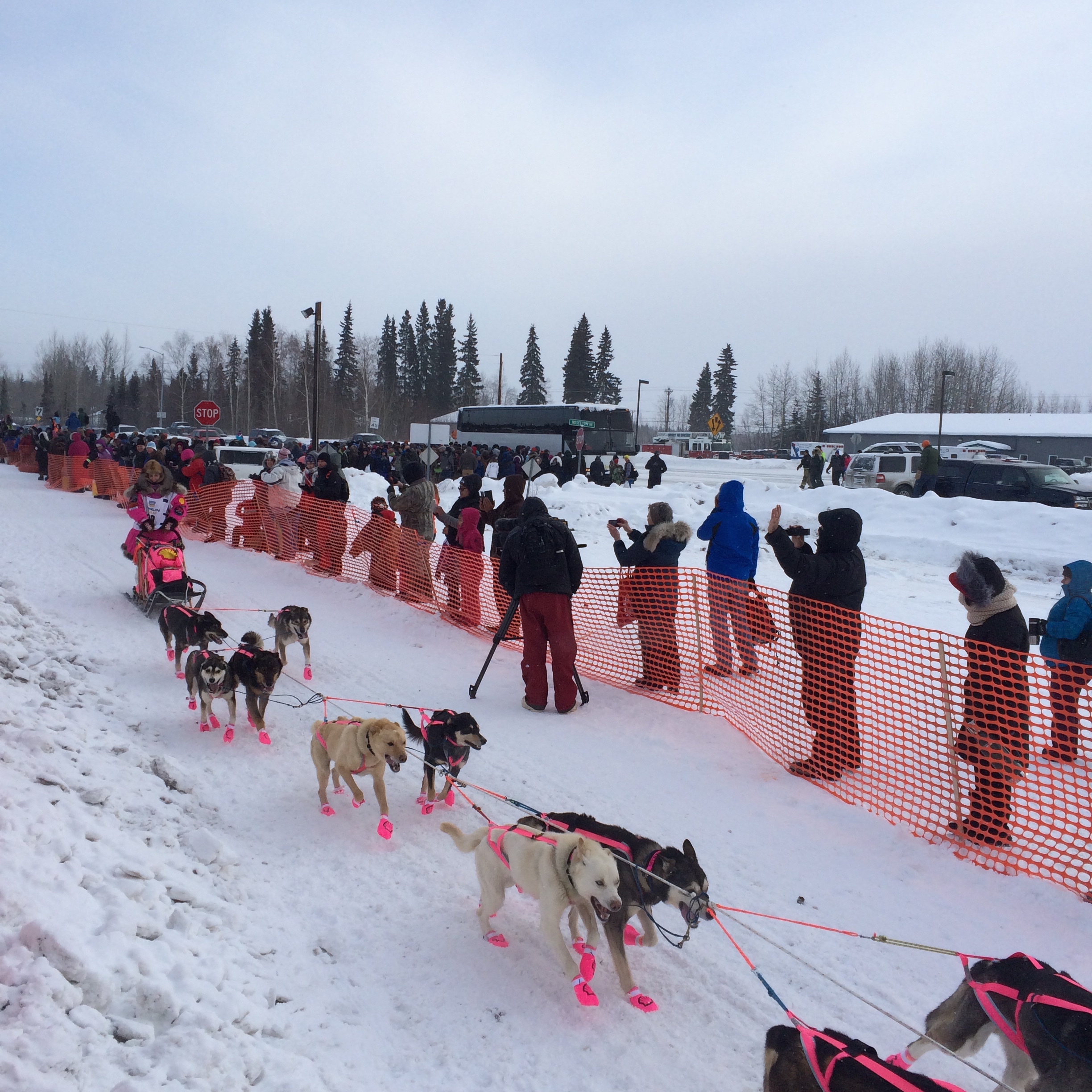
Martin Buser the first to cross the line in Nenana


IMG_4819

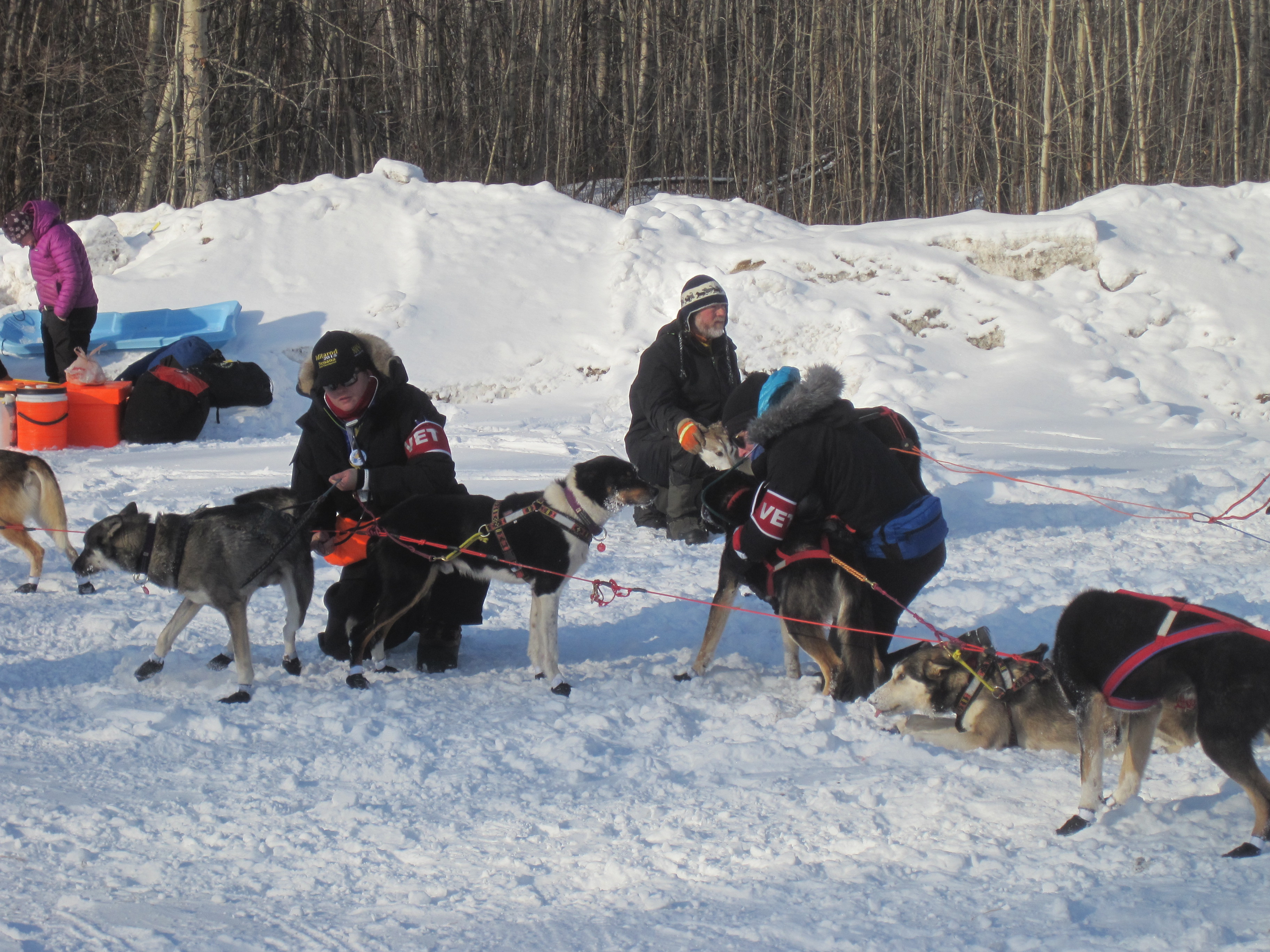
vets doing the mandatory check on each dog

IMG_4824

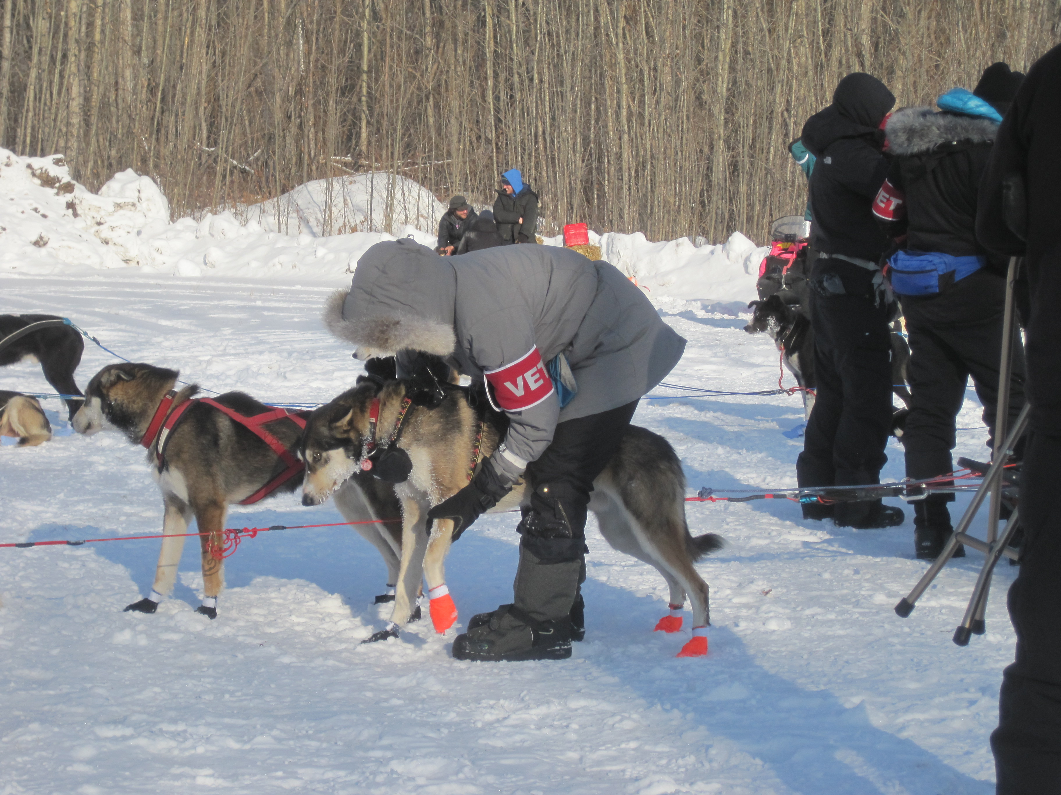
a vet checking one dogs legs, paws etc.

I was so excited to watch about 6 teams cross the check in point line and watch the handlers take care of the dogs, the vets do mandatory checks on each dog and watch the mushers grab the gear they would need for the next legs of the race.  I know some people think it is cruel and ‘animal abuse’ but I also think these dogs are bre d to do this work, with other breeds it might be cruel and abuse but not with these, they are so thrilled to be running.  It reminded me of how our lab was bred to hunt and swim, he loved those more than anything.  AND I have a friend that is a VET on the race this year and she is one of the biggest pet advocates I know, so I trust her opinion.

IMG_hug

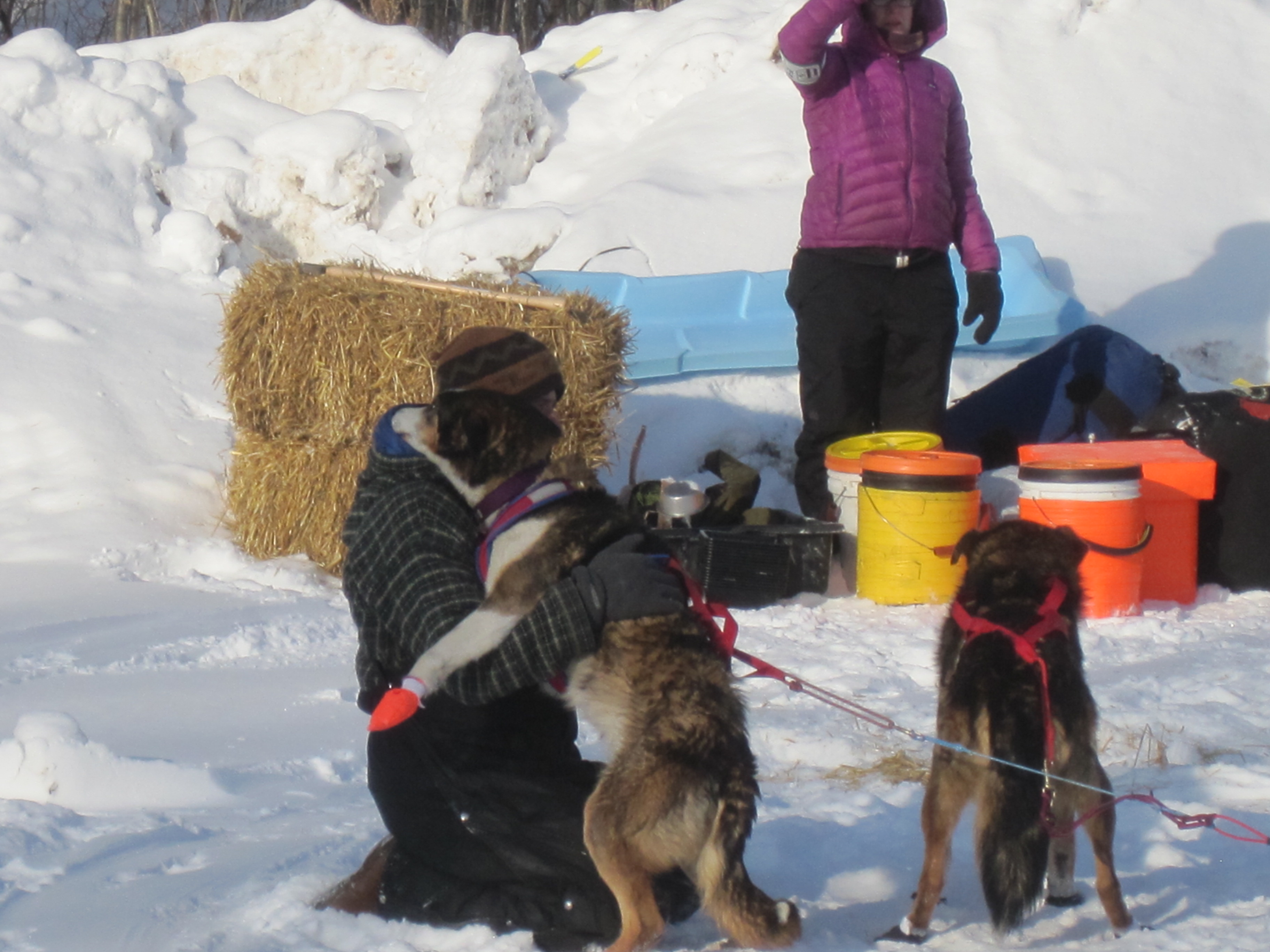
my favorite picture of the race. Look at this handler giving love to the lead dog, this made me teary eyed

IMG_jumpy

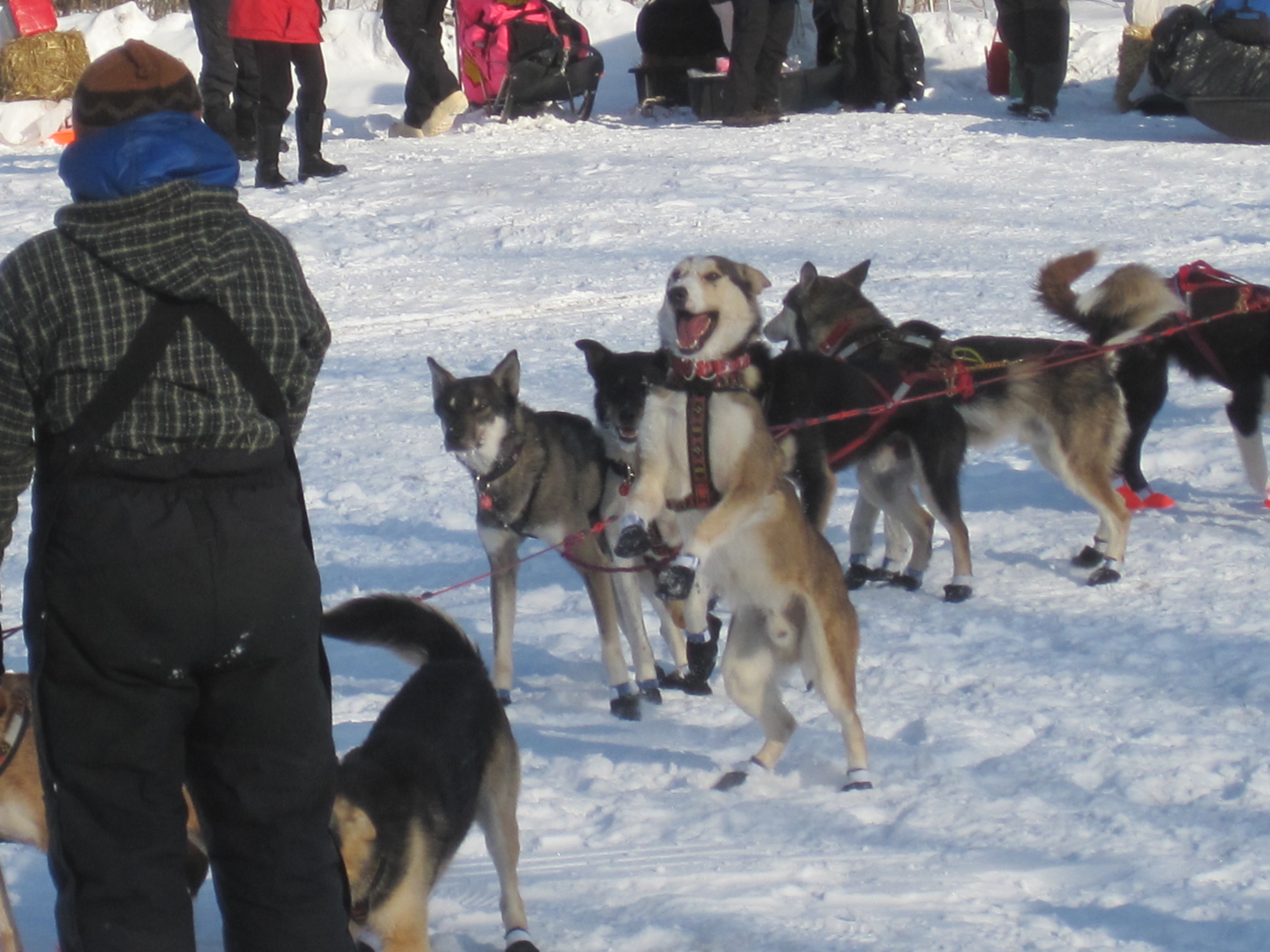
I named this dog” Jumpy” because he was like this for about 15 minutes during the ‘rest’ period. He just wanted to run, run, run


Leave a comment »

Some facts about the Iditarod

Fairbanks, Alaska

Monday, March 9, 2015

Since moving to Alaska I have learned a lot about the Iditarod, and was blessed to get a chance to go to the start and first check point this year! The start was moved to Fairbanks for only the 2nd time in history because there was not enough snow, basically NO snow in Anchorage.  The Iditarod is probably the most famous sporting event in Alaska, though there are many other races each winter, the Iditarod is the ‘grandfather’ of the others.

Some history on the Iditarod:

  • In 1925 the residents of Nome, Alaska were in need of some medicine as there were many residents infected with diphtheria.
  • There were 1400 residents at that time and the only Dr. in town was worried the entire population may die off if medicine did not come to Nome quickly.
  • Anchorage was the only place in Alaska that had the medicine but because it was winter getting the medicine to Nome would be challenging, no boats, no trains etc. could get to Nome.
  • Dog teams became the best solution to save the citizens of Nome by delivering the medicine, as dog teams were the way that mail was taken to rural Alaska.
  • On Jan. 27, 1925 a musher named Wild Bill Shannon wrapped 20 #’s of medicine and took off with the help of his nine dogs.
  • They traveled 674 miles to get the package to Nome.
  • The weather was very nasty and cold getting lower the -60 degrees during the run. (ironically a lot like the bitter cold this winter is proving to be for the racers).
  • Wild Bill became hypothermic along the way and passed the medicine onto another musher and team of dogs.
  • The cold weather continued and the musher Seppala left Shaktoolik but decided to take a short cut over Norton Sound where the winds were so strong it reached -85 degrees, and the dogs had trouble because the trail was icy.
  • The next leg was run by musher Olson and finally passed to Gunnar Kaasen who left in a blizzard.
  • His lead dog was actually from Seppala’s kennel but was a great leader and famous with Alaskan’s “Blato” .
  • An 80 MPH gust of wind tossed the sleigh over and the medicine became buried in the snow, Kaasen was eventually able to retrieve it
  • Blato as the team leader pulled into Nome on Feb. 2nd at 5:30 a.m.
  • It took these teams 5 ½ days to get the serum to Nome, and sadly 5 dogs lost their lives in the attempt to save humans.
  • Over 150 dogs and 20 mushers helped get the meds to Nome saving the lives of the residents of the town.
  • In 1973 the Iditarod Trail Sled Dog Sled Race was started.
  • The race was started in part to commemorate history BUT also to save the ‘sled dog’ culture that was being overtaken by snow machines.
  • The first winner was Dick Wilmarth and it took him 3 weeks to arrive in Nome
  • This years race will stop in 18 communities (not counting the day in Anchorage) include 77 racers and over 1000 dogs!
  • Dogs drop 6,000-10,000 calories a day so it is important for them to eat about 4-5 #’s of food each day. Usually it is dry food mixed with some meat.
  • Teams can start with no more than 16 dogs, but no fewer than 12, the MUST end the race with at least 5 dogs as some dogs drop out along the race and are flown back to anchorage, typically because of an injury of some sort or simply exhaustion.
  • Teams  this year will travel over 968 miles.
    IMG_handlers

    handlers bring the teams to the start line. Every 2 minutes a new team leaves from the start line.

    IMG_me

    watched about 25 teams take off from this spot…. freezing, freezing, freezing…

    IMG_deedee

    DeeDee Janrowe is racing for the 33rd time in the Iditarod. She is known as the PINK team in support of breast cancer awareness. She is a survivor and ran the race just weeks after chemo one year.

    IMG_me sign

    being that Fairbanks is the Ice Sculpting Capital it was only appropriate that there was one of a dog team!

Leave a comment »

Cordova Alaska, 2012 Record snow, 2015 NO snow!

Feb. 3/4, 2015

I have visited Cordova a lot over the last few years, but it is stunning how different a few years can make.  3 years ago they were buried in snow and today there is NONE… the white stuff on the ground is frost. Here is the post from 2012 and some photos from today!  They made national news in 2012 because of the snow and the National Guard was called in to help shovel the snow off of roofs.

https://timistravels.wordpress.com/2012/01/16/cordova-alaska-during-snowpocyolypse-2012/

IMG_2960 IMG_2958

Much like my last blog I am here help the board hire a superintendent, this is the information they put in their ad.  Enjoy

“Cordova is located at the southeastern end of Prince William Sound in the Gulf of Alaska. The community was built on Orca Inlet, at the base of Eyak Mountain. It lies 52 air miles southeast of Valdez and 150 miles southeast of Anchorage.  Winter temperatures are mild with average snowfall of 80 inches though this winter they have made national news with their record snowfall! Cordova has become home to those that enjoy the natural beauty of the area and for those that love the out-of-doors. Fishing, hiking, hunting, and most outdoor activities make Cordova’s unique surroundings desirable for many. Summer temperatures average from 50 to 63. Cordova is accessed by plane or boat. It is linked directly to the North Pacific Ocean shipping lanes through the Gulf of Alaska. It receives year-round barge services and State Ferry service.


The area has historically been home to the Alutiiq, with the addition of migrating Athabascan and Tlingit natives. Orca Inlet was originally named “Puerto Cordova” by Don Salvador Fidalgo in 1790. The town of Cordova was named in 1906 and the City was formed in 1909. Cordova became the railroad terminus and ocean shipping port for copper ore from the Kennecott Mine up the Copper River.


Cordova supports a large fishing fleet for Prince William Sound and several fish processing plants. Over 300 of the 2100 year-round residents hold commercial fishing permits, and nearly half of all households have someone working in commercial harvesting or processing. In the summers, Cordova doubles in population as fishermen and others flock to town for involvement with the fishing industry. Copper River red salmon, pink salmon, herring, halibut, bottom fish and other fisheries are harvested. The largest employers are Trident Processors, Cordova School District, Cordova Hospital, the City, and the Department of Transportation. The U.S. Forest Service and the U.S. Coast Guard maintain personnel in Cordova.”

Leave a comment »

Petersburg, Alaska’s “Little Norway”

Jan. 28-29, 2015

This will be the first of 3 visits to Petersburg, Alaska for the year 2015.  I am assisting them as they hire a new superintendent of schools.  This is a short blog which highlights the community of Petersburg in the words outlined in job description for the superintendency!  map

Petersburg is an island home to approximately 3,000 residents, where small town life influences the social and work environments. The town, located on the north end of Mitkof Island, is nestled among the forested islands and mountains of Southeast Alaska’s Inside Passage.  Nearby Frederick Sound is a summer feeding grounds for hundreds of humpback whales. The Stikine-LeConte Wilderness Area, with its beautiful LeConte Glacier calving off tons of bright blue icebergs, is a short boat ride away.

Mitkof Island was once home to Tlingit fish camps. Present-day Petersburg was settled in the 1890’s by Norwegian fishermen and families. To this day, Petersburg reflects the cultural and artistic influences of its early roots.

Petersburg is surrounded by the Tongass National Forest, the world’s largest temperate rainforest. In 2014 Petersburg had record rainfall receiving over 115”, though this rain helps the lush environment. Its maritime climate means that summers are cool and winters are mild. Average precipitation is approximately 110 inches, which mostly arrives in the form of rain. Recreational opportunities abound in this area of natural beauty including boating, hiking, camping, fishing, hunting, sea kayaking and whale-watching.

Homeport to one of the most productive commercial fishing fleets in the state, Petersburg has three busy fish processing plants operating in the summer. Both the Forest Service and Coast Guard have a presence in Petersburg helping add to the diversity of the community.

There is twice-daily Alaska Airlines jet service to either Juneau/Anchorage or Seattle, and the Alaska’s Marine Highway System ferries dock in Petersburg. Excellent medical services include a hospital with a clinic and long-term care unit, four doctors, two dentists and a full-service pharmacy. Attractive senior citizen housing is also available. Many families are second and third generation residents who have grown up in Petersburg and graduated from the schools their own children and grandchildren now attend. The stability of the community and educational environment contributes to a longstanding reputation for high student expectations and achievement.photo (14)

Leave a comment »

Unalakleet, Alaska~ Jan. 15-16, 2015 and NO SNOW!

Jan. 15/16

Last year I was unable to fly into Unalakleet because they had so much snow, this year, NONE.  Unalakleet is on the NW coast of the Bering Sea, just under the community of Nome.  It was a beautiful day as I flew in and the sun was setting over the community.  It was in the high 20’s low 30’s while I was there and I enjoyed a quick walk to the beach and the ability to beach comb a bit!    The Elders are worried about the continued warming of the region.  There were locals that had just gone out on a seal hunt, not normal for this time of year.

If you want to know more about Unalakleet, check out my blogs from Jan. 2012 and 2013!  Here are some pics!  The photo of me is with Donald Masters, Donald originally from Unalakleet is a former student of mine (at UAS).  He’d gone south for college but has moved back home~ and I got to see him, what a treat!

IMG_3551

landing in Unalakleet! Sun starting to set about 4:30!

IMG_3558

swinging around to the airport

IMG_4439

Sunset on the day I left, this is a beautiful community.

IMG_4441

drift wood on the beach, locals use it for fire wood

IMG_4442

another view looking down the beach

IMG_3561

long lost friends… last saw each other over 15 years ago! JOY

1 Comment »

Little Diomede, you CAN see Russia from this Alaska town!

Jan. 15-16, 2015

opik crabbing_10201918398510867_6874398955344371888_n Opik and her scoop to help grab the crabs with! (photo courtsey of Opik Ahkinga)
little with big distance224_10202162234806622_8244573605986660090_n this photo was taken on Little Diomede but you can see how close Big Diomede is. Big is part of Russia! (photo courtesy of Opik Ahkinga)
little-diomede Little Diomede sits in the Bering Sea just off the coast of AK near Nome.
the town201832445082085_6403267181590825491_n This is Little Diomede (photo by Opik Ahkinga)
helicopter land big background201063887468625_996764091_n There is one helicopter flight in/out of Little Diomede each week, there are no planes as there is no place for a runway. This is a remote community.(photo by Opik Ahkinga)

Okay, NO I did not get to go to Little Diomede, but there was a woman at my training ( which was held at the regional office in Unalakleet https://timistravels.wordpress.com/2012/01/24/flying-wild-alaska-unalakleet-adventure-jan-16-18-2012/?preview=true&preview_id=34&preview_nonce=6a772c9321 ) that grew up there.  I felt like a reporter asking her questions about her home town!  Her name is Opik Ahkinga, Opik is her Eskimo name and the name she has always gone by.  Opik translates to “snow owl”!

opik and crab0179335674_269752413_n Happy Crabber Opik Ahkinga! So blessed to meet this woman! (photo courtesy of Opik Ahkinga)
hole1918323989004_4710106530687486734_n the hole made in the ice to get crab! (photo by Opik Ahkinga)

Opik spends much of her time helping her village become aware of humans environmental impact.  She shared many stories of growing up there and how for years there were ‘disposable’ items such as water bottles.  They had never seen such a thing, but once ‘western ways’ moved to Little Diomede there was a need to educate on how to remove unwanted material.

pile oh crab4702046678404_1030976808_n a days catch! (photo by Opik Ahkinga)
crab hole253503_413916261_n one by one! (photo by Opik Ahkinga)

Another interesting discussion I had with Opik was her talking about subsistence living.   She is a crabber.  She crabs by digging a hole through the ice of the Bering Sea and dropping a line with bait.  She prefers smelt, but any fish is acceptable.  She drops down about 60-80 feet but can go down as deep as 100 feet.  Opik talked about 2 main kinds of crab that she gets; Blue King which is very tasty, Blue King is fished where there is a rocky bottom.  The other is Red King, not as good as good as Blue but still yummy.  Red King is caught in more mucky bottom areas.  In the winter these crab come ‘in’ to spawn where in the fall and summer they are further off shore.

And though Blue King is so sweet and tasty, the Spiny King is the best!  Historically  these Spiny Kings were found Japan and eastern Russia.  The first time they were found in AK were off of Little Diomede in 2003.  However, by 2010 they were really showing up in the waters around St. Lawrence Island and other communities in the Bering Sea.

Opik shared other interesting stories with me including the fact that she remembers going with her Grandpa to the international date line to trade with the Russians. Big Diomede is part of Russia, though it is just miles from Little Diomede and can been seen across the Bering Sea.  The international date line separated them and they are less than 2 miles apart.  Big Diomede is actually only a Russian military base.  Both Big and Little Diomded ‘communities’ are on the west side of the islands.  She shared that her father used to go to school on Big Diomede.  Another story was that  in 1952 her uncle (mom’s brother) went out to hunt and  was found and taken by the Russians.  He was kept captive for 50 days before he was released and sent home.

There is so much history in this part of our great state and so few know anything about it.  I feel blessed to have met Opik and look forward to more conversations in the years ahead.

side note that made me smile; the mascot for Little Diomede; the “dateliners”  isn’t that cute?

Leave a comment »

Visited 5 countries in 27 days; the numbers! (Mostly Spain and Paris)

DAYS
20 days in Spain
4 days in Paris
A day each in Andorra, Portugal, and Gibraltar

TOURED
Toured 5 palaces
Drove 4178 k’s or 2611 miles
According to the Fitbit we walked 137 miles
Toured 12 Cathedrals (and saw 1000’s of churches)
Explored 17 cities
Rode countless metro’s, busses, trains, and even 1 taxi ride
Toured 3 art museums
Took a boat ride on the Mediterranean
Toured a park (yes we paid to enter a city park)
Climbed to the top of 2 towers
Went to 1 flamenco show
Attended the ballet
11 hotels ( + stays with friends a few nights)
2 gigs of data: one in iphone one in iPad mini.
9 flights (Juneau, Seattle, San Francisco, Paris, Madrid, Paris, Houston, Seattle, Juneau)
Countless liters of sangria
3 pairs of Spanish shoes purchased

MONEY
These numbers are pretty accurate
Hotels $700 (the nights in Paris Hilton were free with points)
Tours $400
Driving $1250 (car, tolls, gas, parking AND public transportation, Paris was $150 of this because we stayed out by airport)
Phone/data $30
Flight Paris to/from Madrid $500 (increased because we checked luggage)
Air mileage ticket from Juneau to Paris (free)


Other things we noticed!

It’s hot once you are in the subways!
Spanish language is VERY different from the language spoken in the Catalonia region,
There was NO country check in at Andorra or Portugal border but we had to show passports to enter Gibraltar,
Harry called intermission of the ballet “1/2 time” ,
Saw storks everywhere in southern Spain, also saw hawks, blue herons and several other unidentified birds,
Spaniards LOVE taking their children everywhere, there were 1000’s of baby strollers in all public areas regardless of how crowded it was; all children are also dressed to perfection! ,
There is no such thing as a Kleenex (tissue) or wash clothes in Spain,
Towels in most of our hotels were embroidered with the hotel names,
We enjoyed listening to Podcasts during the road trips,
and, we CAN spend 27 days together AND walk away smiling!

We are SOOOOOO VERY BLESSED!

6 Comments »

Stop into Consuegra to see the Windmills and castle

Our last car trip in Spain was driving from Granada to Madrid. Along this route is the town of Consuegra, about 40 miles from Toledo. It’s a small town that specifically grows saffron, we saw a tractor rolling down Main Street! Small town USA-like!

We followed the signs to the castle as the windmills are right beside it.
These windmills were made famous in the adventures of Don Quixote. We easily drove up the hill to the top an had breathtaking views of the farmland surrounding the town.

The only slow up was the farmer and his sheet crossing the road!

2015/01/img_1272.jpg

just above the town of Consuegra

2015/01/img_1284.jpg

2015/01/img_1287.jpg

2015/01/img_1291.jpg

farmer walking his sheep on the hillside, slowed our drive down a bit!

Read the rest of this entry »

1 Comment »

The Alhambra, Granada, Spain

Jan. 6, 2015

The beauty of Alhambra in part is its gardens and fountains, of which we did not see on a sunny, but cool January day. This was the fifth palace we had explored during this month long vacation in Spain. We had heard so much about it and know that it’s one of Spain’s major attractions yet it left us a little in awe of this ranking.

Don’t get me wrong, the entire facility is interesting AND we loved the Morrish influence, the tiles and the plaster designs are breathtaking. The palace is filled with decorative walls, doorways and ceilings! They destiny are worth seeing it’s just that other palaces on this trip have been breathtaking too, including the Alcázar in both Segovia and Sevilla. The gardens were also beautiful (or we knew it would be with flowers etc ).

Originally built in 889 it was abandoned until around 1059 when the Morrish rebuilt it and made it a royal palace in 1333. During his time of power Napoleon tried to destroy the palace and succeeded in blowing up two towers. This began another round of abandonment. Finally in 1870 it was declared a national monument. There is constant renovation occurring and we witness many aspects of that on our tour. It took about 4 hours to visit everything.

We had not seen so much Moorish influence elsewhere in Spain, there was much more here. Gift shops and street vendors had items for sale we’d seen in Istanbul rather than in Spain. It brought back good memories from former trips.

/home/wpcom/public_html/wp-content/blogs.dir/99b/31551210/files/2015/01/img_1124-0.jpg

there was ice in this fountain

/home/wpcom/public_html/wp-content/blogs.dir/99b/31551210/files/2015/01/img_1143-0.jpg

/home/wpcom/public_html/wp-content/blogs.dir/99b/31551210/files/2015/01/img_1081-0.jpg

/home/wpcom/public_html/wp-content/blogs.dir/99b/31551210/files/2015/01/img_1177-0.jpg

the gardens are beautiful. The groundskeepers are doing a lot of work on them to try to bring them back to their original style.

/home/wpcom/public_html/wp-content/blogs.dir/99b/31551210/files/2015/01/img_1127-0.jpg

/home/wpcom/public_html/wp-content/blogs.dir/99b/31551210/files/2015/01/img_1134-0.jpg

/home/wpcom/public_html/wp-content/blogs.dir/99b/31551210/files/2015/01/img_1105-0.jpg

/home/wpcom/public_html/wp-content/blogs.dir/99b/31551210/files/2015/01/img_1104.jpg

/home/wpcom/public_html/wp-content/blogs.dir/99b/31551210/files/2015/01/img_1130-0.jpg

Leave a comment »

Ronda, a must see while in Spain.

Jan 5, 2015

During the months of planning for this trip one photo kept standing on my mind and that was was one I’d seen of the bridges and cliffs of Ronda. I was very happy that we were able to add a stop in Ronda to our itinerary. We arrived in town midafternoon and got settled into our little cottage housing.

We were advised from Carmen our host at the hotel where to park as we went into town. Being that it was three Kings Day many of the Spaniards were into celebrating and having parades and such, contesting downtown. After parking we headed out to see the sights.

I read that this is one of the most photographed sites in the world. I have nothing to prove that but…the “New Bridge” connects the old city the newer art of town and the outlying communities. It took 42 years to build this bridge which was started in 1751. It hovers above the stunning El Tajo canyon.

We viewed it from above then hiked down the trail to view it from afar. From the top I could also see a “road” that allowed an even better view from further back. We went in circles trying to find that road and as we were just about to give up, we saw it! It was about 2 miles along a cobble stoned road but we did it!

We also saw the “old bridge” to the east of the “new bridge”. Cars drive and people walk across the new bridge daily. What an architectural masterpiece. All and all a great day and worth the trip!

PS. Ronda is know for its bull fighting too, though we didn’t see anything other than the building.

/home/wpcom/public_html/wp-content/blogs.dir/99b/31551210/files/2015/01/img_4325.jpgst

/home/wpcom/public_html/wp-content/blogs.dir/99b/31551210/files/2015/01/img_4360.jpg</a

/home/wpcom/public_html/wp-content/blogs.dir/99b/31551210/files/2015/01/img_4312.jpg

/home/wpcom/public_html/wp-content/blogs.dir/99b/31551210/files/2015/01/img_4316.jpg

/home/wpcom/public_html/wp-content/blogs.dir/99b/31551210/files/2015/01/img_4378.jpg

/home/wpcom/public_html/wp-content/blogs.dir/99b/31551210/files/2015/01/img_4295.jpg

1 Comment »